Browse All

1856 Maine. World Atlas Maine. Published by J.H. Colton & Co. 17 … |

1889 Maine. World Atlas Railroad and County Map of Maine. Geo. F … |

1886 Maine. World Atlas Colton's Maine. Published by G. W & C. B … |

1832 Lower-Canada, N.B., N.Y., Vt., Maine. World Atlas North America sheet II. Lower-Canada and … |

1874 Maine. World Atlas Colton's Maine. Published by G. W & C. B … |

1866 Maine. World Atlas Colton's Maine. Published by G.W. & C.B. … |

1865 Maine. Vermont and New Hampshire. World Atlas Maine. Vermont and New Hampshire. |

1901 Maine. World Atlas Maine. |

1853 A New Map of the Maine World Atlas A New Map of the Maine. Published by Tho … |

1864 Maine World Atlas Johnson's Maine By Johnson and Ward. |

1855 A new map of Maine World Atlas A new map of Maine. Published by Thomas, … |

1873 Maine, New Hampshire, Vermont, Massachus … World Atlas Map of Maine, New Hampshire, Vermont, Ma … |

1953 Maine. World Atlas Maine. U.S. State. |

1816 Maine World Atlas Maine. Engraved by A. Doolittle, New Hav … |

1870 Maine. World Atlas Johnson's Maine. Entered ... 1866. |

1845 Maine. World Atlas Neueste Karte von Maine. Nach den besste … |

1841 Maine. World Atlas Maine. Engraved by G.W. Boynton. Entered … |

1874 Maine. World Atlas Johnson's Maine. Published by A. J. John … |

1833 States of Maine, New Hampshire, Vermont, … World Atlas Map of the States of Maine, New Hampshir … |

1848 Maine. World Atlas A New Map of Maine. Published By S. Augu … |

1816 Maine. World Atlas Maine. 12. H.S. Tanner, sc. (1816) |

1845 Maine. World Atlas Maine. (Written and engraved by Jos. Per … |

1848 Maine. World Atlas Maine. |

1822 Maine. World Atlas Maine. Drawn & Published by F. Lucas Jr. … |

1835 Maine. World Atlas Maine. Entered ... 1835 By Thomas Illman … |

1906 Maine. World Atlas United States (Maine). |

1848 New Map of Maine World Atlas A New Map of Maine. Published By S. Augu … |
1865 County map of the State of Maine World Atlas County map of the State of Maine. Entere … |

1874 County map of the State of Maine World Atlas County map of the State of Maine. (with … |

1877 County map of the State of Maine World Atlas County map of the State of Maine. (with … |

1850 Maine. World Atlas A New Map of Maine. |

1865 North America Sheet II. World Atlas North America Sheet II. East Canada and … |

1857 A New Map of Maine World Atlas A New Map of Maine. Published by Charles … |

1860 Maine. World Atlas Johnson's Maine By Johnson & Browning. N … |

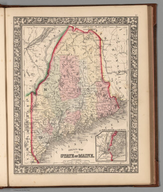
1868 County map of the State of Maine World Atlas County map of the State of Maine. (inset … |

1804 Maine. World Atlas Maine. Drawn by S. Lewis. Engd. by Hooke … |

1812 Maine. World Atlas Maine. (Boston: Published by Thomas & An … |

1831 Maine; Costumes. World Atlas Maine. G. Boynton Sc. Entered ... by S.G … |

1929 129. Maine, Nova Scotia, New Brunswick, … World Atlas Stati Uniti, United States of America. M … |

1929 Legend: 129-31. Maine, Ohio, Penn., N.Y. … World Atlas (Legend to) Stati Uniti, United States o … |

1890 Maine. World Atlas County and township map of the state of … |

1840 Maine. World Atlas Maine. |

1870 Maine. [State Atlas, World Atlas] County map of the state of Maine. (with) … |

1880 Maine. World Atlas County map of the state of Maine. (with) … |

1794 Province of Maine. World Atlas The Province of Maine, From the best Aut … |

1796 Province of Maine. World Atlas The Province of Maine, From the best Aut … |

1860 Maine. World Atlas A New Map of Maine. Philadelphia, Publis … |

1811 Maine. World Atlas The Province of Maine, From the best Aut … |

1883 Maine. World Atlas Maine. |

1838 Maine World Atlas Maine. (to accompany) A Comprehensive At … |