Who What Where WhenREMOVE |
REFINE
Browse All : World Atlas of U.S. North East
1-44 of 44
Author
Cary, John, ca. 1754-1835
Full Title
A new map of part of the United States of North America, containing those of New York, Vermont, New Hampshire, Massachusets (sic), Connecticut, Rhode Island, Pennsylvania, New Jersey, Delaware, Maryland and Virginia. From the latest authorities. By John Cary, engraver. 1806. London: Published by J. Cary, Engraver & Map-seller, No. 181, Strand, Sept. 1, 1806.
Publisher
John Cary
Author
Vandermaelen, Philippe, 1795-1869
Full Title
(Composite of) Amer. Sep. no. 34, 35, 36, 41, 42, 43, 44, 49, 50, 51, 56, 57, 57bis, 61, 62. (Dresse par Ph. Vandermaelen, lithographie par H. Ode. Quatrieme partie. - Amer. sept. Bruxelles. 1827)
Publisher
Ph. Vandermaelen
Author
Vandermaelen, Philippe, 1795-1869
Full Title
Partie des Etats-Unis. Amer. Sep. no. 43. Dressee et dessinee par Ph. Vandermaelen. Desee. sur pierre et Lith. par H. Ode et Ph. Lippens, mars 1825. (Quatrieme partie. - Amer. sept. Bruxelles. 1827)
Publisher
Ph. Vandermaelen
Author
Vandermaelen, Philippe, 1795-1869
Full Title
Partie des Etats-Unis. Amer. Sep. no. 51. Dressee et dessinee par Ph. Vandermaelen. La lettre par Ph. Lippens. Desinee sur pierre et Lithoge. par H. Ode, Mai 1825. (Quatrieme partie. - Amer. sept. Bruxelles. 1827)
Publisher
Ph. Vandermaelen
Author
Society for the Diffusion of Useful Knowledge (Great Britain)
Full Title
North America sheet VI. New-York, Vermont, Maine, New-Hampshire, Massachusetts, Connecticut, Rhode-Island, and New-Jersey. J. & C. Walker sculpt. Published by the Society for the Diffusion of Useful Knowledge. Published Sept. 1st. 1832 by Baldwin & Cradock, 47 Paternoster Row, London. (London: Chapman & Hall, 1844)
Publisher
Chapman and Hall
Author
Society for the Diffusion of Useful Knowledge (Great Britain)
Full Title
North America sheet VII. Pennsylvania, New Jersey, Maryland, Delaware, Columbia and part of Virginia. Published under the superintendence of the Society for the Diffusion of Useful Knowledge. J. & C. Walker sculpt. Published July 15th. 1833 by Baldwin & Cradock, 47 Paternoster Row, London. Printed by J. & C. Walker. (London: Chapman & Hall, 1844)
Publisher
Chapman and Hall
Author
Johnston, Alexander Keith, 1804-1871
Full Title
United States of North America, eastern states, by Keith Johnston, F.R.S.E. Engraved & printed by W. & A.K. Johnston, Edinburgh. William Blackwood & Sons, Edinburgh & London, (1861)
Publisher
William Blackwood & Sons
Author
Mitchell, Samuel Augustus
Full Title
Canada West. Formerly Upper Canada. Published by Thomas, Cowperthwait & Co. No. 253 Market Street. Philadelphia. Entered ... 1850 by Thomas, Cowperthwait & Co. ... Pennsylvania. (inset map) Vicinity of the Falls of Niagara, and the City of Toranto and its Environs.
Publisher
Cowperthwait, Desilver & Butler
Author
Bartholomew, John
Full Title
(Index to) U.S.A. North-East. Lambert Conformal Conic Projection, Standard Parallels 33 (degrees) and 45 (degrees) N. 1:2,500,000.
Publisher
[Houghton Mifflin Co., John Bartholomew & Son LTD.]
Author
Bartholomew, John
Full Title
U.S.A. North-East. The Geographical Institute Edinburgh. Edited by John Bartholomew, M.C. LL. D. Copyright - John Bartholomew & Son, LTD.
Publisher
[Houghton Mifflin Co., John Bartholomew & Son LTD.]
Author
[Carey, Mathew, Warner, Benjamin]
Full Title
The Eastern States with Part Of Canada. Philadelphia: Published By M. Carey, And B. Warner. 1816.
Publisher
M. Carey and B. Warner
Author
Fullarton, A. & Co.
Full Title
United States North America According to Calvin, Smith & Tanner. By G.H. Swanston Edinr. The North Eastern States Comprising Maine, New Hampshire, Vermont, New York, Massachusetts, Rhode Id., Connecticut, New Jersey, Delaware, Pennsylvania, Maryland, Ohio, and part of Virginia & Michigan. LVI. Engraved by G.H. Swanston Edinburgh. A. Fullarton & Co. Edinburgh, London & Dublin.
Publisher
A. Fullarton & Co.
Full Title
American Atlantic ports--north sheet. George Philip & Son, Ltd. The London Geographical Institute. (1922)
Publisher
[C.S. Hammond & Company. London: George Philip & Son, Ltd. The London Geographical Institute, Philip, Son & Nephew, Ltd.]
Author
Arrowsmith, John
Full Title
Upper Canada &c., by J. Arrowsmith. London, pubd. 15 Feby. 1837 by J. Arrowsmith, 35 Essex Street, Strand.
Publisher
John Arrowsmith
Author
Arrowsmith, John
Full Title
Lower Canada, New Brunswick, Nova Scotia, Prince Edwards Id., Newfoundland, and a large portion of the United States. By J. Arrowsmith. London, pubd. 15 Feby. 1837 by J. Arrowsmith, 35 Essex Street, Strand.
Publisher
John Arrowsmith
Author
Tanner, Henry S.
Full Title
Map Of The States Of Maine, New Hampshire, Vermont, Massachusetts, Connecticut & Rhode Island By H.S. Tanner. (with) North Part of Maine. Engraved & Published by H.S. Tanner, Philadelphia. Entered ... 14th day of Novr. 1820 by H.S. Tanner ... Pennsylvania. American Atlas.
Publisher
Henry Tanner
Author
Mitchell, Samuel Augustus Jr.
Full Title
County map of the State of New York, New Hampshire, Vermont. Massachusetts, Rhode Id. and Connecticut. Drawn & Engraved by W. Williams Philadelphia. Entered ... 1860 by S. Augustus Mitchell, Jr. ... Pennsylvania. (inset maps)17. Harbor and Vicinity of New York, and 18. Harbor and Vicinity of Boston.
Publisher
S.A. Mitchell Jr.
Author
[Raynal, G.T., Bonne, R.]
Full Title
Carte de la partie nord, Des Etats Unis, de l'Amerique Septentrionale. Par M. Bonne, Ingenieur-Hydrographe de la Marine. (on upper margin) Liv. XVII et XVIII.: No. 47. (on lower margin) 48. (to accompany) Histoire Philosophique et Politique Des Establissements et Du Commerce Des Europeens Dans Les Deux Indes.
Publisher
Jean-Leonard Pellet
Author
Johnson, A.J.
Full Title
Johnson's New England And Lower Canada By Johnson & Browning. No. 13-14.
Publisher
Johnson and Browning
Author
Arrowsmith, John
Full Title
Lower Canada, New Brunswick, Nova Scotia, Prince Edwards Id., Newfoundland, and a large portion of the United States. By J. Arrowsmith. (with) inset map of Newfoundland. (Map) 42. London, Pubd. 15 Feby. 1842, by J. Arrowsmith, 10 Soho Square.
Publisher
John Arrowsmith
Author
Thomson, John
Full Title
Northern provinces of the United States. (with view) The Great Falls of Niagara. Hewitt sc., Grafton Str. E(a)st, Tottenham Ct. Rd. Drawn & engraved for Thomson's New general atlas, 1817.
Publisher
[Baldwin, Cradock, and Joy, John Cumming, John Thomson]
Author
Letts, Son & Co.
Full Title
Eastern United States. No. 2. Letts's popular atlas. Letts, Son & Co. Limited, London. (1883)
Publisher
Letts, Son & Co.
Author
Robert Laurie & James Whittle
Full Title
A new and correct map of the British colonies in North America. Comprehending Eastern Canada with the province of Quebec, New Brunswick, Nova Scotia, and the government of Newfoundland; with the adjacent states of New England, Vermont, New York, Pennsylvania and New Jersey. London, Publish'd by Laurie & Whittle, 53 Fleet Street, 12th May, 1794.
Publisher
Laurie & Whittle
Author
Robert Laurie & James Whittle
Full Title
A new and general map of the middle dominions belonging to the United States of America, viz. Virginia, Maryland, the Delaware-Counties, Pennsylvania, New Jersey &c., with the addition of New York, & of the greatest part of New England &c., as also of the bordering parts of the British possessions in Canada. (with) A sketch of the upper parts to shown the remainder of the lakes. London, Published by Laurie & Whittle, No. 53, Fleet Street, as the act directs 12th May, 1794.
Publisher
Laurie & Whittle
Author
Goodrich, S.G.
Full Title
Connecticut. New-England. G. Boynton Sc. Entered ... by S.G. Goodrich of Massachusetts. (Boston: Gray & Bowen ... 1831)
Publisher
Gray & Bowen
Author
Goodrich, S.G.
Full Title
Middle States. Southern States. G. Boynton Sc. Entered ... by S.G. Goodrich of Massachusetts. (Boston: Gray & Bowen ... 1831)
Publisher
Gray & Bowen
Author
Touring club italiano
Full Title
(Legend to) Stati Uniti, United States of America, Maine ... Ohio, Pennsylvania, New York, Vermont, New Hampshire, West Virginia, Virginia, North Carolina. Propr. Artistico-letteraria del T.C.I. Ufficio cartografico del T.C.I. (1929)
Publisher
Touring club italiano
Author
Touring club italiano
Full Title
Stati Uniti, United States of America. Ohio, Pennsylvania, New York, Vermont, New Hampshire, West Virginia, Virginia, North Carolina. Propr. Artistico-letteraria del T.C.I. Ufficio cartografico del T.C.I. (1929)
Publisher
Touring club italiano
Author
Touring club italiano
Full Title
(Legend to) Stati Uniti, United States of America, Massachusetts, Connecticut, Rhode Island, New Jersey, Delaware, Maryland, con parte di Pennsylvania, New York, Vermont, New Hampshire. Propr. Artistico-letteraria del T.C.I. Ufficio cartografico del T.C.I. (1929)
Publisher
Touring club italiano
Author
Touring club italiano
Full Title
Stati Uniti, United States of America, Massachusetts, Connecticut, Rhode Island, New Jersey, Delaware, Maryland, con parte di Pennsylvania, New York, Vermont, New Hampshire. Propr. Artistico-letteraria del T.C.I. Ufficio cartografico del T.C.I. (1929)
Publisher
Touring club italiano
Author
[Bartholomew, J. G. (John George), 1860-1920, John Bartholomew and Son]
Full Title
(Composite of) Section maps of Canada on scale of 1:2,500,000. The Edinburgh Geographical Institute, John Bartholomew & Son, Ltd. "The Times" atlas. (London: The Times, 1922)
Publisher
The Times
Author
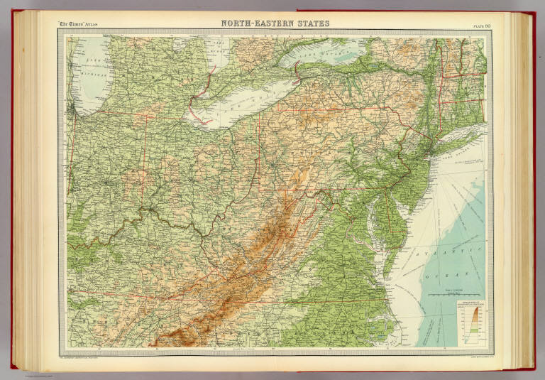
[Bartholomew, J. G. (John George), 1860-1920, John Bartholomew & Co.]
Full Title
North-eastern states. The Edinburgh Geographical Institute, John Bartholomew & Co. "The Times" atlas. (London: The Times, 1922)
Publisher
The Times
Full Title
United States, western. United States, north-eastern. (with Environs of New York City. Published at the office of "The Times," London, 1895)
Publisher
The Times
Full Title
Die Nordost-Staaten der Union. (Richard Andree. Herausgegeben von der Geographischen Anstalt von Velhagen & Klasing in Leipzig. 1881)
Publisher
Velhagen & Klasing
Author
Tanner, Henry S.
Full Title
Map Of The States Of Maine, New Hampshire, Vermont, Massachusetts, Connecticut & Rhode Island By H.S. Tanner. (with) North Part of Maine. Engraved & Published by H.S. Tanner, Philadelphia. Entered ... 14th day of Novr. 1820 by H.S. Tanner ... Pennsylvania. American Atlas.
Publisher
Henry Tanner
Author
Stieler, Adolf
Full Title
Vereinigte Staaten Von Nord-Amerika In 6 Blattern, Bl. 3. Petermann. Bearbeitet v. H. Habenicht. Gest v. Eberhardt, Kuhn, Metzeroth & Weiler. Gotha: Justus Perthes. 1873.
Publisher
Justus Perthes
Author
Tanner, Henry S.
Full Title
Map Of The States Of Maine, New Hampshire, Vermont, Massachusetts, Connecticut & Rhode Island By H.S. Tanner. Improved To 1825. (with) North Part of Maine. American Atlas. Engraved & Published by H.S. Tanner, Philadelphia. Entered ... 14th day of Novr. 1820 by H.S. Tanner ... Pennsylvania.
Publisher
Henry Tanner
Author
Bradford, Thomas G.
Full Title
Michigan and the Great Lakes. G.W. Boynton & Co. Sc. (to accompany) A Comprehensive Atlas, Geographical, Historical & Commercial. By T.G. Bradford. William D. Ticknor, Boston. Wiley & Long, New-York. Entered ... 1835, by Thos. G. Bradford ... Massachusetts.
Publisher
[William D. Ticknor, Wiley & Long]
Author
Tanner, Henry S.
Full Title
Map Of The States Of Maine, New Hampshire, Vermont, Massachusetts, Connecticut & Rhode Island By H.S. Tanner. (with) North Part of Maine. Engraved & Published by H.S. Tanner, Philadelphia. Entered ... 14th day of Novr. 1820 by H.S. Tanner ... Pennsylvania. American Atlas.
Publisher
Henry Tanner
Author
Mitchell, Samuel Augustus
Full Title
County Map Of The States Of New York, New Hampshire, Vermont. Massachusetts, Rhode Id. And Connecticut. 13. Constructed & Engraved by W. Williams Philadelphia. (with) two inset maps: Harbor And Vicinity Of New York. 14. Harbor And Vicinity Of Boston. 15. Entered ... 1860, by S. Augustus Mitchell, Jr. ... Pennsylvania.
Publisher
S.A. Mitchell, Jr.
Author
Moll, Herman, d. 1732
Full Title
New England, New York, New Jersey and Pensilvania. By H. Moll, Geographer. (Printed and sold by Tho: Bowles next ye Chapter House in St. Pauls Church Yard, & Ino: Bowles at ye Black Horse in Cornhill, 1736?)
Publisher
Thos. Bowles and John Bowles
Author
Pinkerton, John, 1758-1826
Full Title
United States of America, northern part. Drawn under the direction of Mr. Pinkerton by L. Hebert. Neele sculpt. 352 Strand. London: published 2d. April 1810 by Cadell & Davies, Strand & Longman, Hurst, Rees, Orme, & Brown, Pater Noster Row.
Publisher
[Cadell and Davies, Longman, Hurst, Rees, Orme, and Brown]
Author
[Robert de Vaugondy, Didier, 1723-1786, Robert de Vaugondy, Gilles, 1688-1766]
Full Title
Partie de l'Amerique Septentrionale, qui comprend le Cours de l'Ohio, la Nlle. Angleterre, la Nlle. York, le New Jersey, la Pensylvanie, le Maryland, la Virginie, la Caroline. Par le Sr. Robert de Vaugondy Geographe ordinaire du Roi. Avec Privilege 1755. M.C. Haussard fecit. (with) Supplement pour la Caroline.
Publisher
[Boudet, Les Auteurs]
1-44 of 44
|