Browse All

1846 Himmelskugel, nordliche. World Atlas Nordliche Himmelskugel 1846. Gezeichnet … |

1846 Himmelskugel, suedliche. World Atlas Suedliche Himmelskugel 1846. Gezeichnet … |

1860 Sonnen-System. World Atlas Sonnen-System. Stahlstich, Direction v. … |

1847 Mond-Karte. World Atlas Mond-Karte. Nach den besten Quellen entw … |

1844 Welt-Karte, Mercators Proj. World Atlas Welt-Karte in Mercators Projektion. Nach … |

1860 Welt-Karte, Globular-Proj. World Atlas Erd-Karte in der Globular-Projektion. Zu … |

1844 Lissabon. World Atlas Lissabon, Lisboa, 1844. (with view) Liss … |

1847 Spanien west. World Atlas Spanien, westliche Halfte. Nach den best … |

1847 Spanien oest. World Atlas (Spanien, oestliche Halfte. Nach den bes … |

1847 Composite: Spanien. World Atlas (Composite of) Spanien ... Nach den best … |

1844 Madrid. World Atlas Plan von Madrid, 1844. Verlag des Biblio … |

1845 Frankreich. World Atlas Frankreich, 1845. Entw. u. gez. v. Haupt … |

1860 Paris. World Atlas Westliche Halfte von Paris ... Ostliche … |

1844 Grossbritannien, Ireland. World Atlas Neueste Karte von Grossbritannien und Ir … |

1844 England. World Atlas Neueste Karte von England. Nach den bess … |

1844 Schotland. World Atlas Neueste Karte von Schotland. Nach den be … |

1844 Ireland. World Atlas Neueste Karte von Ireland. Nach den best … |

1845 London. World Atlas London, 1845, nach den besten Materialie … |

1844 Edinburgh. World Atlas Plan von Edinburgh, 1844. (with view) Ed … |

1844 Italien. World Atlas Neueste Karte von Italien. Nach den bess … |

1845 Neapel, Napoli. World Atlas Neapel, Napoli, 1845. (with view) Castel … |

1844 Griechenland. World Atlas Neueste Karte von Griechenland. (with) A … |

1816 Covers: Maps Of The World And Quarters World Atlas (Covers to) A General Atlas, Being A Col … |

1848 Deutschland. World Atlas Karte von Deutschland. Nach den besten Q … |
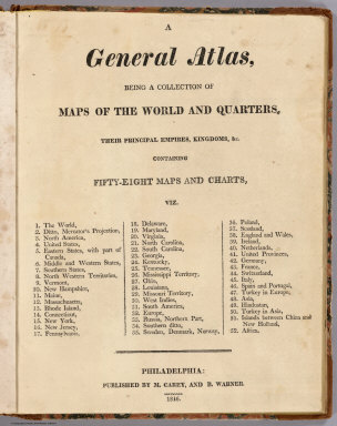
1816 Title Page: Maps Of The World And Quarte … World Atlas (Title Page to) A General Atlas, Being A … |

1847 Bayern, Wurtemberg, Baden, Hohenzollern. World Atlas Neueste Karte von Bayern, Wurtemberg, Ba … |

1816 The World World Atlas The World. From Arrowsmith's Map of the … |

1816 Chart Of The World On Mercators Projecti … World Atlas Chart Of The World On Mercators Projecti … |

1816 North America World Atlas North America. From Arrowsmiths Large Ma … |

1816 United States and Part of Louisiana World Atlas A Map Of The United States and Part of L … |

1816 Eastern States with Part Of Canada World Atlas The Eastern States with Part Of Canada. … |

1858 Bayern I. World Atlas Konigreich Bayern Ites Blatt. Entw. u. g … |

1816 Middle States and Western Territories of … World Atlas The Middle States and Western Territorie … |

1816 The Southern States and Mississippi Terr … World Atlas The Southern States and Mississippi Terr … |

1816 The Northwestern Territories of the Unit … World Atlas The Northwestern Territories of the Unit … |

1816 Vermont World Atlas Vermont, From Actual Survey. Philadelphi … |

1858 Bayern III. World Atlas Konigreich Bayern IIItes Blatt. Entw. u. … |

1816 The State Of New Hampshire World Atlas The State Of New Hampshire, By Samuel Le … |

1816 Maine World Atlas Maine. Engraved by A. Doolittle, New Hav … |

1816 Massachusetts World Atlas Massachusetts. (Engraved by) W. Barker, … |

1816 Rhode Island World Atlas Rhode Island. (Engraved by) W. Barker, s … |

1858 Bayern II. World Atlas Das Konigreich Bayern desseitz des Rhein … |

1816 Connecticut World Atlas Connecticut. (Engraved by) W. Barker, sc … |

1816 New York World Atlas New York. (Engraved by) W. Barker, sculp … |

1816 New Jersey World Atlas New Jersey. (Engraved by) W. Barker, scu … |

1816 Pennsylvania World Atlas Pennsylvania. (Engraved by) W. Barker, s … |

1816 Delaware World Atlas Delaware. Engraved by A. Doolittle. |

1860 Bayern IV. World Atlas Das Konigreich Bayern IVtes Blatt, entw. … |

1816 Maryland World Atlas Maryland. (Engraved by) W. Barker, sculp … |

1816 Virginia World Atlas Virginia. |