Browse All

1794 (South America north) World Atlas (A map of South America containing Tierr … |

1794 South America (south) World Atlas A map of South America containing Tierra … |

1794 Composite: South America. World Atlas (Composite of) A map of South America co … |

1804 No. 5. Tivoli, Velletri, Sora Regional Atlas No. 5. (Tivoli, Velletri, Sora). Gius. G … |

1804 No. 9. Terracina, Fondi, Gaeta Regional Atlas No. 9. (Terracina, Fondi, Gaeta). Gius. … |

1787 Statistical Table: Tableau du commerce d … Geography Book (Statistical Table to) Tableau du commer … |

1789 Statistical Table: Tableau general des e … Geography Book (Statistical Table to) Tableau general d … |

1787 Statistical Table: Tableau de la navigat … Geography Book (Statistical Table to) Tableau de la nav … |

1792 Statistical Table: Tableau de la navigat … Geography Book (Statistical Table to) Tableau estimatif … |

1792 Statistical Table: Resultats generaux du … Geography Book (Statistical Table to) Resultats generau … |

1787 Statistical Table: Tableau des importati … Geography Book (Statistical Table to) Tableau des impor … |

1788 Statistical Table: Denrees coloniales, p … Geography Book (Statistical Table to) Denrees coloniale … |

1788 Statistical Table: Denrees coloniales, p … Geography Book (Statistical Table to) Commerce des colo … |

1803 Carte des iles Antilles. Par J.B. Poirso … Geography Book Carte des iles Antilles. Par J.B. Poirso … |

1803 Carte de St. Domingue Geography Book Carte de St. Domingue ... Par J.B. Poirs … |

1803 Carte de St. Domingue Geography Book Carte de la Guiane Francaise et Hollanda … |

1803 Carte d'Afrique Geography Book Carte d'Afrique ; Par J.B. Poirson, inge … |

1803 Carte de la Inde Geography Book Carte de la Inde, par J. B. Poirson, ing … |
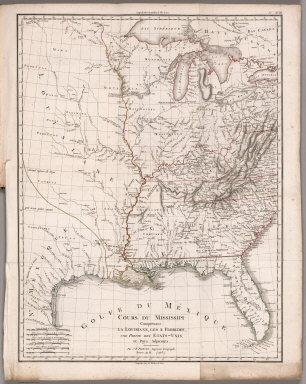
1803 Cours du Mississippi comprenant la Louis … Geography Book Cours du Mississippi comprenant la Louis … |

1789 Statistical Table: Etat general de la po … Geography Book (Statistical Table to) Etat general de l … |

1791 Statistical Table: Tableau general ; des … Geography Book (Statistical Table to) Tableau general ; … |

1804 Plate 28. Facsimile Cartography 1492-186 … [Historical Atlas, National Atlas] Plate 28. Cartography 1492-1867. Lewis M … |

1804 Holstein. World Atlas A map of the Dutchy of Holstein, with th … |

1804 West Indies. World Atlas The West Indies and Coast Adjacent (Redu … |