Browse All

1807 Virginia, North Carolina, South Carolina … Historical Atlas A Map of those parts of Virginia, North … |

1807 Investment and Attack of York in Virgini … Historical Atlas Plan of the Investment and Attack of Yor … |

1807 Siege of Charleston in S. Carolina. Historical Atlas Plan of the Siege of Charleston in S. Ca … |

1807 Covers: South America. Case Map (Covers to) Colombia Prima or South Amer … |

1807 Sheet 1. South America. Case Map Sheet 1. South America. |

1807 Sheet 2. South America. Case Map Sheet 2. South America. |

1807 Sheet 3. South America. Case Map Sheet 3. South America. |

1807 Sheet 4. South America. Case Map Sheet 4. South America. |

1807 Sheet 5. South America. Case Map Sheet 5. South America. |

1807 Sheet 6. South America. Case Map Sheet 6. South America. |

1807 Sheet 7. South America. Case Map Sheet 7. South America. |

1807 Sheet 8. South America. Case Map Sheet 8. South America. |

1807 Sheets 1-8. South America. Case Map Sheets 1-8. South America. |

1807 Map of Upper Egypt, drawn from various d … Separate Map Map of Upper Egypt, drawn from various d … |

1807 Upper Sheet: A Map of Lower Egypt from V … Separate Map (Upper Sheet to) A Map of Lower Egypt fr … |

1807 Lower Sheet: A Map of Lower Egypt from V … Separate Map (Lower Sheet to) A Map of Lower Egypt fr … |

1807 Composite: A Map of Lower Egypt from Var … Separate Map (Composite map of) A Map of Lower Egypt … |

1807 Chart of Shetland Isles and Orkney Islan … Chart Map (Chart of Shetland Isles and Orkney Isla … |

1807 Covers: Untitled Atlas of 12 Outline and … School Atlas (Covers to) (Untitled Atlas of 12 Outlin … |

1807 A: Untitled landform map School Atlas A: (Untitled landform map). |

1807 B: Untitled outline map of the world School Atlas B: (Untitled outline map of the World). |

1807 C: Untitled outline map of North America School Atlas C: (Untitled outline map of North Americ … |

1807 D: Untitled outline map of the United St … School Atlas D: (Untitled outline map of the United S … |

1807 E: Untitled outline map of South America School Atlas E: (Untitled outline map of South Americ … |

1807 F: Untitled outline map of Europe School Atlas F: (Untitled outline map of Europe). |

1807 G: Untitled outline map of England School Atlas G: (Untitled outline map of England). |

1807 H: Untitled outline map of Scotland School Atlas H: (Untitled outline map of Scotland). ( … |

1807 I: Untitled outline map of Ireland School Atlas I: (Untitled outline map of Ireland). |

1807 K: Untitled outline map of Asia School Atlas K: (Untitled outline map of Asia). |

1807 L: Untitled outline map of Africa School Atlas L: (Untitled outline map of Africa). |

1807 M: Untitled outline map of Pennsylvania School Atlas M: (Untitled outline map of Pennsylvania … |
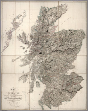
1807 Scotland Case Map Map of Scotland Constructed from Origina … |

1807 (Northwest Section) Map of South Italy a … Case Map (Northwest Section) Map of South Italy a … |

1807 (Northeast Section) Map of South Italy a … Case Map (Northeast Section) Map of South Italy a … |

1807 (Southwest Section) Map of South Italy a … Case Map (Southwest Section) Map of South Italy a … |

1807 (Southeast Section) Map of South Italy a … Case Map (Southeast Section) Map of South Italy a … |

1807 Composite Map: Map of South Italy and Ad … Case Map (Composite Map) Map of South Italy and A … |

1807 Route d' Acapulco a Mexico. National Atlas Carte Reduite de la Route d' Acapulco a … |

1807 Carte de la Route qui mene depuis la Cap … National Atlas Carte de la Route qui mene depuis la Cap … |

1807 Plateau de la Ville de Mexico jusqu'au P … National Atlas Carte reduite de la Partie oreintale de … |

1807 Plan du Port de Veracruz. National Atlas Plan du Port de Veracruz, Dresse par Don … |

1807 Tableau physique de la pente Orientale d … National Atlas Tableau physique de la pente Orientale d … |

1807 Tableau physique de la pente Occidental … National Atlas Tableau physique de la pente Occidental … |

1807 Tableau du Plateau central des Montagnes … National Atlas Tableau du Plateau central des Montagnes … |

1807 Volcans de la Puebla. National Atlas Volcans de la Puebla, vus depuis la Vill … |

1807 Pic d' Orizaba. National Atlas Pic d' Orizaba vu depuis la Foret de Xal … |

1807 British Isles. World Atlas A new map of the British Isles, from the … |

1807 England. World Atlas A new map of England, from the latest au … |

1807 Nova Scotia, Newfoundland, &c. World Atlas A new map of Nova Scotia, Newfoundland & … |

1807 Upper & Lower Canada. World Atlas A new map of Upper & Lower Canada, from … |