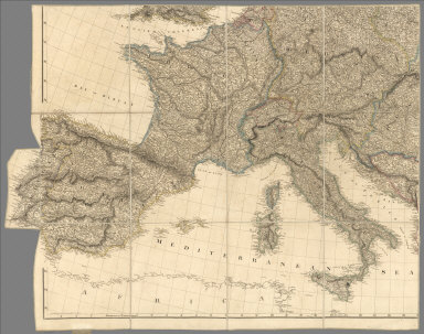
1810
Asia.
Manuscript Map
Asia. (By Frances Bowen. 1810)
|

1810
Hindostan.
Manuscript Map
Hindostan. (By Frances Bowen. 1810)
|

1810
South America.
Manuscript Map
South America. (By Frances Bowen. 1810)
|

1810
China, Corea.
Manuscript Map
China. Contains 15 subject provinces inc
…
|

1810
Islands: China-New Holland.
Manuscript Map
A map of the islands and channels betwee
…
|

1810
Africa, Mediterranean.
Manuscript Map
Africa including the Mediterranean. (By
…
|

1810
Covers: Map Exhibiting the Great Post Ro
…
Case Map
(Covers to) Map Exhibiting the Great Pos
…
|

1810
(Northwest Section) Map Exhibiting the G
…
Case Map
(Northwest Section) Map Exhibiting the G
…
|

1810
(Northeast Section) Map Exhibiting the G
…
Case Map
(Northeast Section) Map Exhibiting the G
…
|

1810
(Southwest Section) Map Exhibiting the G
…
Case Map
(Southwest Section) Map Exhibiting the G
…
|

1810
(Southeast Section) Map Exhibiting the G
…
Case Map
(Southeast Section) Map Exhibiting the G
…
|

1810
Composite Map: Map Exhibiting the Great
…
Case Map
(Composite Map) Map Exhibiting the Great
…
|

1810
Title Page: Account of expeditions to th
…
Exploration Book
(Title Page to) An Account of Expedition
…
|

1810
Falls of St. Anthony.
Exploration Book
Falls of St. Anthony.
|

1810
First Part of Captn. Pike's Chart of the
…
Exploration Book
The First Part of Captn. Pike's Chart of
…
|

1810
Chart of the Internal Part of Louisiana.
Exploration Book
A Chart of the Internal Part of Louisian
…
|

1810
Map of The Internal Provinces of New Spa
…
Exploration Book
A Map of The Internal Provinces of New S
…
|

1810
Sketch of the ... Internal Provinces of
…
Exploration Book
A Sketch of the Vice Royalty Exhibiting
…
|

1810
Map of the Mississippi River from its So
…
Exploration Book
Map of the Mississippi River from its So
…
|

1810
Cover: Mexico, adjacent provinces.
Case Map
(Covers to) A New Map of Mexico and Adja
…
|

1810
Mexico and Adjacent Provinces.
Case Map
A New Map of Mexico and Adjacent Provinc
…
|

1810
No. 6. Campobasso, Trivento, Agnone
Regional Atlas
No. 6. (Campobasso, Trivento, Agnone). G
…
|

1810
No. 17. Bari, Monopoli, Martinafranca
Regional Atlas
No. 17. (Bari, Monopoli, Martinafranca).
…
|

1810
Mexico 1.
Regional Atlas
A new map of Mexico and adjacent provinc
…
|

1810
Mexico 2.
Regional Atlas
(A new map of Mexico and adjacent provin
…
|

1810
Mexico 3.
Regional Atlas
(A new map of Mexico and adjacent provin
…
|

1810
Mexico 4.
Regional Atlas
(A new map of Mexico and adjacent provin
…
|

1810
Composite: Mexico.
Regional Atlas
(Composite of) A new map of Mexico and a
…
|

1810
West Indies 1.
Regional Atlas
Chart of the West Indies and Spanish Dom
…
|

1810
West Indies 2.
Regional Atlas
(Chart of the West Indies and Spanish Do
…
|

1810
Composite: West Indies.
Regional Atlas
(Composite of) Chart of the West Indies
…
|

1810
Austrian Dominions.
World Atlas
Austrian Dominions. Drawn under the dire
…
|

1810
Prussian Dominions.
World Atlas
Prussian Dominions. Drawn under the dire
…
|

1810
Spain and Portugal.
World Atlas
Spain and Portugal. Drawn under the dire
…
|

1810
The Netherlands and the countries to the
…
World Atlas
The Netherlands and the countries to the
…
|

1810
Germany north of the Mayn.
World Atlas
Germany north of the Mayn. Drawn under t
…
|

1810
United States of America, northern part.
World Atlas
United States of America, northern part.
…
|

1810
Peru.
World Atlas
Peru. Drawn under the direction of Mr. P
…
|

1810
The Caracas.
World Atlas
The Caracas. Drawn under the direction o
…
|