Browse All

1816 Head of Oriental Woman (after Giovanni B … |

1816 [Sea Cave Near Margate With A Nude Man S Henry Fuseli |

1816 [PA-F07261-0225, PA-F07261-0225: PA-F072 John Constable |

1816 [The Meeting Of The Duke Of Wellington A Constantin Fidèle Coene |

1816 [Longleat in Wiltshire, the Seat of the John Warwick Smith |

1816 [Upwell Rectory, PA-F06287-0101: Upwell John Sell Cotman |

1816 [A Tiger's Den, PA-F05095-0027: A Tiger' James Northcote |

1816 [Lady Crofton, PA-F05533-0045: Lady Crof George Henry Harlow |

1816 [From Bethay - Ambleside, PA-F06489-0011 John Sell Cotman |

1816 [Two Children Reading, PA-F07089-0025: T Joshua Cristall |

1816 [A Pulpit In South Burlingham Church, PA John Sell Cotman |

1816 [Cliffs in Osmington Bay, with Weymouth John Constable |

1816 [Osmington Bay–Weymouth, Dorset, PA-F072 John Constable |

1816 [Landscape, PA-F07300-0011: Landscape] Benjamin Barker |

1816 [Aylmerton Church, Norfolk - From The So John Sell Cotman |

1816 [Moonlight On The Yare, PA-F07433-0063: John Crome |

1816 [Study Of Boats, Fishermen's Huts, Etc, Joshua Cristall |

1816 [Osmington Bay, PA-F07261-0287: Osmingto John Constable |

1816 Comparative View Of The Heights Of The P … Wall Map Comparative View Of The Heights Of The P … |

1816 Covers: Maps Of The World And Quarters World Atlas (Covers to) A General Atlas, Being A Col … |
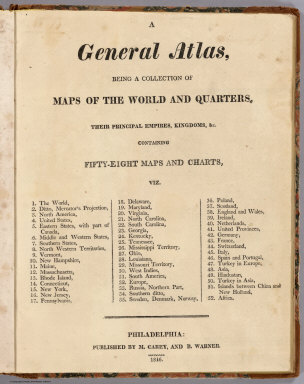
1816 Title Page: Maps Of The World And Quarte … World Atlas (Title Page to) A General Atlas, Being A … |

1816 The World World Atlas The World. From Arrowsmith's Map of the … |

1816 Chart Of The World On Mercators Projecti … World Atlas Chart Of The World On Mercators Projecti … |

1816 North America World Atlas North America. From Arrowsmiths Large Ma … |

1816 United States and Part of Louisiana World Atlas A Map Of The United States and Part of L … |

1816 Eastern States with Part Of Canada World Atlas The Eastern States with Part Of Canada. … |

1816 Middle States and Western Territories of … World Atlas The Middle States and Western Territorie … |

1816 The Southern States and Mississippi Terr … World Atlas The Southern States and Mississippi Terr … |

1816 The Northwestern Territories of the Unit … World Atlas The Northwestern Territories of the Unit … |

1816 Vermont World Atlas Vermont, From Actual Survey. Philadelphi … |

1816 The State Of New Hampshire World Atlas The State Of New Hampshire, By Samuel Le … |

1816 Maine World Atlas Maine. Engraved by A. Doolittle, New Hav … |

1816 Massachusetts World Atlas Massachusetts. (Engraved by) W. Barker, … |

1816 Rhode Island World Atlas Rhode Island. (Engraved by) W. Barker, s … |

1816 Connecticut World Atlas Connecticut. (Engraved by) W. Barker, sc … |

1816 New York World Atlas New York. (Engraved by) W. Barker, sculp … |

1816 New Jersey World Atlas New Jersey. (Engraved by) W. Barker, scu … |

1816 Pennsylvania World Atlas Pennsylvania. (Engraved by) W. Barker, s … |

1816 Delaware World Atlas Delaware. Engraved by A. Doolittle. |

1816 Maryland World Atlas Maryland. (Engraved by) W. Barker, sculp … |

1816 Virginia World Atlas Virginia. |

1816 North Carolina World Atlas North Carolina. (Engraved by) J. Bower. … |

1816 South Carolina World Atlas South Carolina. Engraved by Doolittle, N … |

1816 Georgia World Atlas Georgia. |

1816 Kentucky World Atlas Kentuckey. (Engraved by) W. Barker, scul … |

1816 Tennessee World Atlas Tennessee. |

1816 Mississippi Territory World Atlas Mississippi Territory. |

1816 Ohio World Atlas Ohio. |

1816 Louisiana World Atlas Louisiana. |

1816 Missouri Territory. Formerly Louisiana World Atlas Missouri Territory. Formerly Louisiana. |