Browse All

1816 West Indies World Atlas West Indies. From Various Authorities. |

1816 South America World Atlas South America. Engravecd by W. Kneafs. F … |

1816 Europe World Atlas Europe. From Arrowsmiths 4 Sheet Map Of … |

1816 Northern Part Of Russia Or Muscovy In Eu … World Atlas Northern Part Of Russia Or Muscovy In Eu … |

1816 Southern Part Of Russia Or Muscovy In Eu … World Atlas Southern Part Of Russia Or Muscovy In Eu … |

1816 Sweden, Denmark, and Finland From The Be … World Atlas Sweden, Denmark, and Finland. From The B … |

1816 Poland From The Best Authorities World Atlas Poland From The Best Authorities. Includ … |

1816 Scotland From The Best Authorities World Atlas Scotland From The Best Authorities. Incl … |

1816 England And Wales From The Best Authorit … World Atlas England And Wales From The Best Authorit … |

1816 Ireland From The Best Authorities World Atlas Ireland From The Best Authorities. |

1816 Netherlands From The Best Authorities World Atlas Netherlands From The Best Authorities. |

1816 The Seven United provinces World Atlas The Seven United provinces From The Best … |

1816 Germany From the Best Authorities World Atlas Germany From The Best Authorities. John … |

1816 France World Atlas France &c. From Belleymes 4 Sheet Map Of … |

1816 Switzerland With Its Subjects & Allies World Atlas Switzerland With Its Subjects & Allies F … |

1816 Italy From The Best Authorities World Atlas Italy From The Best Authorities. |

1816 Spain And Portugal From The Best Authori … World Atlas Spain And Portugal From The Best Authori … |

1816 Turkey In Europe and Hungary World Atlas Turkey In Europe and Hungary. |

1816 Asia World Atlas Asia. From Arrowsmiths Maps. (Engraved b … |

1816 Hindostan Or India World Atlas Hindostan Or India. From The Best Author … |

1816 Turkey In Asia World Atlas Turkey In Asia. Drawn From The Most Resp … |

1816 The Islands Of The East Indies World Atlas The Islands Of The East Indies, With The … |

1816 Africa World Atlas Africa. From Arrowsmiths Map Of Africa. |

1816 East End of L. Ontario Manuscript Map East End of Lake Ontario |

1816 Vermont Manuscript Map Vermont |

1816 Zanesville Manuscript Map Zanesville |

1816 New Hampshire Manuscript Map New Hampshire |
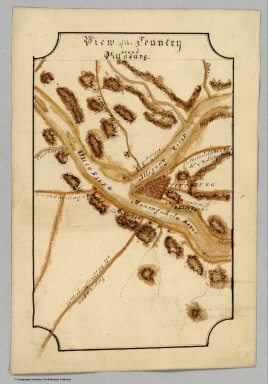
1816 Pittsburg Manuscript Map Pittsburg |

1816 Delaware Manuscript Map Delaware |

1816 New York, Manuscript Map New York, |

1816 Connecticut Manuscript Map Connecticut |

1816 Covers: General Atlas of the United Stat … World Atlas (Covers to) A New and Elegant General At … |

1816 (Title Page) General Atlas of the United … World Atlas (Title Page to) A New and Elegant Genera … |

1816 Contents: General Atlas of the United St … World Atlas (Contents to) A New and Elegant General … |

1816 Eastern Hemisphere. World Atlas Eastern Hemisphere. No. 1. H.S. Tanner, … |

1816 Western Hemisphere. World Atlas Western Hemisphere. 2. H.S. Tanner, sc. … |

1816 Europe. World Atlas Europe. 3. H.S. Tanner, Sc. (1816) |

1816 Asia. World Atlas Asia. 4. H.S. Tanner, sc. (1816) |

1816 Africa. World Atlas Africa. 5. H.S. Tanner, sc. (1816) |

1816 North America. World Atlas N. America. 6. H.S. Tanner, sc. (1816) |

1816 South America. World Atlas S. America. 7. H.S. Tanner, sc. (1816) |

1816 Canada. World Atlas Canada, &c. 8. H.S. Tanner, sc. (1816) |

1816 United States. World Atlas United States. 9. H.S. Tanner, sc. (1816 … |

1816 New Hampshire. World Atlas New Hampshire. 10. H.S. Tanner, sc. (181 … |

1816 Massachusetts. World Atlas Massachusetts. 11. H.S. Tanner, sc. (181 … |

1816 Maine. World Atlas Maine. 12. H.S. Tanner, sc. (1816) |

1816 Vermont. World Atlas Vermont. 13. H.S. Tanner, sc. (1816) |

1816 Rhode Island. World Atlas Rhode Island. 14. H.S. Tanner, sc. (1816 … |

1816 Connecticut. World Atlas Connecticut. 15. H.S. Tanner, sc. (1816) |

1816 New York. World Atlas New York. 16. H.S. Tanner, sc. (1816) |