Browse All
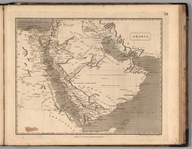
1817 Arabia. World Atlas Arabia. |

1817 China. World Atlas China. |

1817 Japan. World Atlas Japan. |

1817 Hindoostan. World Atlas Hindoostan. |

1817 East India Islands. World Atlas East India Islands. |

1817 New Holland (Australia). World Atlas New Holland. |

1817 West Africa. World Atlas West Africa. |

1817 East Africa. World Atlas East Africa. |

1817 Egypt. World Atlas Egypt. |

1817 Colony of the Cape of Good Hope. World Atlas Colony of the Cape of Good Hope. |

1817 United States. World Atlas United States in North America. |

1817 British Possessions in North America. World Atlas British Possessions in North America. |

1817 Spanish Dominions in North America. World Atlas Spanish Dominions in North America. |

1817 West Indies. World Atlas West Indies. |
1817 Comparative View of the Lengths of the P … [Separate Map, View] Comparative View of the Lengths of the P … |

1817 Covers: Map of Asia Minor Armenia and Ko … Case Map (Covers to) Map of Asia Minor Armenia an … |

1817 Map of Asia Minor Armenia and Koordistan Case Map Map of Asia Minor Armenia and Koordistan … |

1817 Shelton & Kensett's Map Of The State Of … Separate Map Shelton & Kensett's Map Of The State Of … |

1817 Map Of The State Of New York. Case Map Map of the State of New York with part o … |

1817 Cover: United States correct map. Case Map (Covers to) A Correct Map of the United … |

1817 A Correct Map of the United States. Case Map A Correct Map of the United States, With … |

1817 Map of the United States. Case Map Map of the United States Partly From New … |

1817 Louisiana. World Atlas Louisiana. Baltimore _ Published by F. L … |

1817 Indiana. World Atlas Indiana. Drawn and Published by F. Lucas … |

1817 Illinois. World Atlas Illinois. Drawn and Published by F. Luca … |

1817 Missouri. World Atlas Missouri. Drawn and Published by F. Luca … |

1817 Arkansa Ter. World Atlas Arkansa Ter. Drawn and Published by F. L … |

1817 North Western and MichiganTerritories. World Atlas North Western and MichiganTerritories. D … |

1817 Florida. World Atlas Florida. Drawn and Published by F. Lucas … |

1817 Mexico. World Atlas Mexico. Drawn and Published by F. Lucas … |

1817 West Indies. World Atlas West Indies. Drawn and Published by F. L … |

1817 South America. World Atlas South America. Drawn and Published by F. … |

1817 Colombia. World Atlas Colombia. Drawn and Published by F. Luca … |

1817 Brazil. World Atlas Brazil. Drawn and Published by F. Lucas … |

1817 Peru. World Atlas Peru. Drawn and Published by F. Lucas Jr … |

1817 United Provinces. World Atlas United Provinces. Drawn and Published by … |

1817 Chili. World Atlas Chili. Drawn and Published by F. Lucas J … |

1814 Hydrographical chart of the World. World Atlas Hydrographical chart of the World on Wri … |

1814 N. Hemisphere. World Atlas Northern Hemisphere. Kirkwood sculp. Dra … |

1814 S. Hemisphere. World Atlas Southern Hemisphere. Kirkwood sculp. Dra … |

1815 E. Hemisphere. World Atlas Eastern Hemisphere. Drawn & engraved for … |

1815 W. Hemisphere. World Atlas Western Hemisphere. Drawn & engraved for … |

1816 N. Hemisphere, plane of London. World Atlas Northern Hemisphere projected on the pla … |

1816 S. Hemisphere, plane of London. World Atlas Southern Hemisphere projected on the pla … |

1815 British Isles. World Atlas British Isles. Drawn & engraved by Hewit … |

1815 Ireland. World Atlas Ireland. Neale (i.e. Neele) sculpt., Str … |

1815 Scotland. World Atlas Scotland. Drawn & engraved by Hewitt, Br … |

1814 England. World Atlas England. Neele sculpt., Strand, London. … |

1814 British Channel. World Atlas The British Channel. J. & G. Menzies scu … |

1816 North, Baltic seas. World Atlas Chart of the North and Baltic seas, &c. … |