Browse All

1835 Cover: (Michigan-Indiana Border Survey 1 … Manuscript Map (Covers to) (Michigan and Indiana Border … |

1835 Index: (Michigan-Indiana Border Survey 1 … Manuscript Map (Index to) (Michigan and Indiana Border … |

1835 Text Page: (Michigan-Indiana Border Surv … Manuscript Map (Text Page to) (Michigan and Indiana Bor … |

1835 Schaffhausen National Atlas Schaffhausen. Entworfen und bearbeitet v … |

1835 Fussen National Atlas Fussen. Entworfen und bearbeitet von Woe … |

1835 Besancon National Atlas Besancon. Entworfen und bearbeitet von W … |

1835 Waldenstadt National Atlas Waldenstadt. Entworfen und bearbeitet vo … |

1835 Meran National Atlas Meran. Entworfen und bearbeitet von Woer … |

1835 Lausanne National Atlas Lausanne. Entworfen und bearbeitet von W … |

1835 Freyburg in der Schweiz National Atlas Freyburg in der Schweiz. Entworfen und b … |

1835 Locarno National Atlas Locarno. Entworfen und bearbeitet von Wo … |

1835 Chiavenna National Atlas Chiavenna. Entworfen und bearbeitet von … |

1835 Trient National Atlas Trient. Entworfen und bearbeitet von Woe … |

1835 Geneve National Atlas Geneve. Entworfen und bearbeitet von Woe … |

1835 Aosta National Atlas Aosta. Entworfen und bearbeitet von Woer … |

1835 Biella National Atlas Biella. Entworfen und bearbeitet von Woe … |

1835 Milano National Atlas Milano. Entworfen und bearbeitet von Woe … |

1835 Verona National Atlas Verona. Entworfen und bearbeitet von Woe … |

1835 Composite: Sheets 1 - 20, Karte der Schw … National Atlas (Composite of) Sheets 1 - 20 of Karte de … |
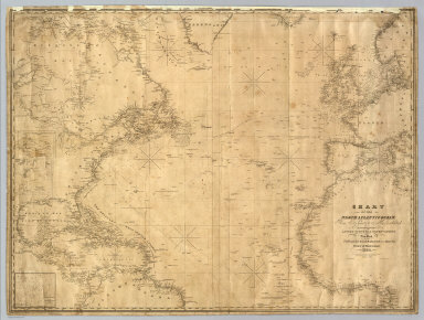
1835 North Atlantic Ocean. Chart Map Chart Of The North Atlantic Ocean, From … |

1835 Mitchell's Reference & Distance Map Of T … Case Map Mitchell's Reference & Distance Map Of T … |

1835 Map of the United States of America. Separate Map Map Of The United States Of America With … |

1835 Covers: Atlas Universel. School Atlas (Covers to) Atlas Universel d'Histoire e … |

1835 Title Page: Atlas Universel. School Atlas (Title Page to) Atlas Universel d'Histoi … |

1835 Table of Contents: Atlas Universel. School Atlas (Table of Contents to) Atlas Universel d … |

1835 Mitchell's map of the United States. Fabric Map Mitchell's map of the United States; Sho … |

1835 Japan, Nagasaki. World Atlas Empire of Japan. (with) Nagasaki Harbour … |

1835 The Antilles or West-India Islands. World Atlas The Antilles or West-India Islands. (Pub … |

1835 The British islands in the West Indies. World Atlas The British islands in the West Indies. … |

1835 Amsterdam. World Atlas Amsterdam. Published under the superinte … |

1835 Florence. Firenze. World Atlas Florence. Firenze. Published under the s … |

1835 Naples. Napoli. World Atlas Naples. Napoli. Published under the supe … |

1835 America. World Atlas America, by J. Arrowsmith. London, pubd. … |

1829 T. 8 S., R. 19-20 W. Manuscript Map Town 8 South, Range 20 West, Town 8 Sout … |

1829 T. 7 S., R. 19 W. Manuscript Map Town 7 South, Rang[e] 19 West. Surveyed … |

1829 T. 8 S., R. 19 W. Manuscript Map Town 8 South, Range 19 West. (Surveyed i … |

1861 T. 7 S., R. 20 W. Manuscript Map Town 7 South, Range 20 West. (Surveyed i … |

1829 T. 8 S., R. 20 W. Manuscript Map Town 8 South, Range 20 West. (Surveyed i … |

1829 T. 8 S., R. 21 W. Manuscript Map T. 8 South, Range 21 West. (Surveyed in … |

1829 T. 7 S., R. 21 W., T. 8 S., R. 22 W. Manuscript Map T. 7 South, R. 21 West. T. 8 S., Range 2 … |

1831 Covers: Woerl Atlas der Schweiz National Atlas (Covers to)Karte der Schweiz, von Dr. I. … |

1831 Title Page: Karte der Schweiz, von Dr. I … National Atlas (Title Page to) Karte der Schweiz, von D … |

1831 Index Page: Titel der Karte National Atlas (Index Page to) Titel der Karte. (on upp … |

1831 Freiburg National Atlas Freiburg. Entworfen und bearbeitet von W … |

1834 Constanz - Lindau National Atlas Constanz - Lindau. Entworfen und bearbei … |

1834 Bern National Atlas Bern. Entworfen und bearbeitet von Woerl … |

1834 Zurich National Atlas Zurich. Entworfen und bearbeitet von Woe … |

1835 Der Atlantische Ocean 1835 World Atlas Der Atlantische Ocean : entw. u. gez. v … |

1835 Ubersicht der neuern Erforschungen in Mi … World Atlas Ubersicht der neuern Erforschungen in Mi … |

1835 Spanien und Portugal. (Spain and Portuga … World Atlas No. XII. Stieler's Hand-Atlas No. 13. Sp … |