Browse All

1836 Connecticut. School Atlas Connecticut. Entered ... 1836, by Eleaze … |

1836 Middle States. School Atlas Middle States and part of the Southern. … |

1836 Western States. School Atlas Western States. Entered ... 1836, by Ele … |

1836 South America. School Atlas South America. Entered ... 1836, by Elea … |

1836 Europe. School Atlas Europe. Entered ... 1836, by Eleazer Hun … |

1836 Great Britain, Ireland. School Atlas Great Britain and Ireland. Entered ... 1 … |

1836 Asia. School Atlas Asia. Entered ... 1836, by Eleazer Hunti … |

1836 Africa, Atlantic. School Atlas Africa and the Atlantic Ocean. Entered . … |

1836 Oceanica. School Atlas Oceanica and comparative N. America & As … |

1836 Cover: Atlas to accompany System of univ … Historical Atlas (Covers to) Atlas to accompany a System … |

1836 Picture of nations. Historical Atlas Picture of nations or perspective sketch … |

1836 BC 1921-Christian era. Historical Atlas B.C. 1921. B.C. 1491. B.C. 980. B.C. 752 … |

1836 AD 395-1492. Historical Atlas A.D. 395. A.D. 1100. A.D. 1492. Entered … |

1836 (World) Historical Atlas (The World). Entered ... 1835, by F.J. H … |
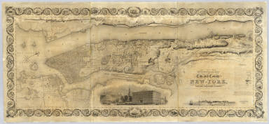
1836 City and County Of New - York. Wall Map Topographical Map Of The City and County … |

1836 A New Chart of The Pacific Ocean (Northe … Chart Map A New Chart of The Pacific Ocean, Exhibi … |

1836 A New Chart of The Pacific Ocean (Southe … Chart Map A New Chart of The Pacific Ocean, Exhibi … |

1836 Composite: A New Chart of The Pacific Oc … Chart Map (Composite of) A New Chart of The Pacifi … |

1836 A Comparative Picture of the Principal W … View A Comparative Picture of the Principal W … |

1836 Map of the State of New Jersey. Separate Map Squire's Map Of The State Of New Jersey. … |

1836 Carte des Tribus Indiennnes de l'Ameriqu … Separate Map Carte des Tribus Indiennnes de l'Ameriqu … |

1836 Anthracite Coal Field, Pottsville, Penns … Case Map Map Of The First And Second Anthracite C … |

1836 Mitchell's Reference & Distance Map Of T … Case Map Mitchell's Reference & Distance Map Of T … |

1836 (Covers to ) Mitchell's Reference & Dist … Case Map Mitchell's Reference & Distance Map Of T … |

1836 Map of the World. [Manuscript Map, Wall Map] Map of the World. Executed by Anna M. Bu … |

1836 Des Principales Montagnes et des Princip … World Atlas Tableau Comparatif et Figure de La Haute … |

1836 The World. [Manuscript Map, Wall Map] The World. By M. Anslin. Western Hemisph … |

1836 Wilson's New American Thirteen Inch Terr … Globe Wilson's New American Thirteen Inch Terr … |

1836 Cover: New universal atlas. World Atlas (Covers to) A New Universal Atlas Contai … |

1836 Title Page: New universal atlas. World Atlas (Title Page to) A New Universal Atlas Co … |

1836 Contents: New universal atlas. World Atlas (Contents to) A New Universal Atlas Cont … |

1836 (Author's Notice to) A New Universal Atl … World Atlas (Author's Notice to) A New Universal Atl … |

1836 Index: New universal atlas. World Atlas (Index to) A New Universal Atlas Contain … |

1836 Map Of The World on the Globular Project … World Atlas A New Map Of The World on the Globular P … |

1836 North America. World Atlas North America. Entered ... 1836 by H.S. … |

1836 Lower Canada. World Atlas Lower Canada. J. Knight Sc. Published by … |

1836 Upper Canada. World Atlas Upper Canada. Published by H.S. Tanner, … |

1836 United States. World Atlas United States. Published by H.S. Tanner, … |

1836 New Map of Maine. World Atlas A New Map of Maine By H.S. Tanner. Enter … |

1836 New Hampshire & Vermont. World Atlas New Hampshire & Vermont By H.S. Tanner. … |

1836 Massachusetts And Rhode Island. World Atlas Massachusetts And Rhode Island: By H.S. … |

1836 Connecticut. World Atlas Connecticut By H.S. Tanner. Engraved by … |

1836 New Map Of New York. World Atlas A New Map Of New York with its Canals, R … |

1836 New Jersey. World Atlas New Jersey Reduced From T. Gordon's Map … |

1836 New Map Of Pennsylvania. World Atlas A New Map Of Pennsylvania with its Canal … |

1836 New Map Of Maryland and Delaware. World Atlas A New Map Of Maryland and Delaware with … |

1836 New Map Of Virginia. World Atlas A New Map Of Virginia With Its Canals, R … |

1836 New Map Of Nth Carolina. World Atlas A New Map Of Nth. Carolina With Its Cana … |

1836 New Map Of South Carolina. World Atlas A New Map Of South Carolina With Its Can … |

1836 New Map Of Georgia. World Atlas A New Map Of Georgia With Its Roads & Di … |