Who What Where WhenREMOVEWHERE
|
REFINE
Browse All : National Atlas of Oregon and California and Utah and NevadaAuthor
Mitchell, Samuel Augustus
Full Title
Map of North America. Entered ... 1839, by S. Augustus Mitchell ... Pennsylvania.
Publisher
Thomas, Cowperthwait & Co.
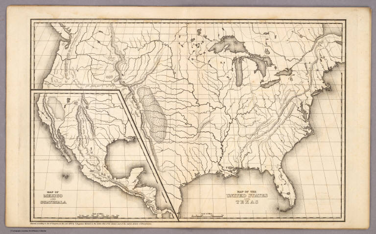
Author
Mitchell, Samuel Augustus
Full Title
Map of the United States and Texas. (with) Map of Mexico and Guatimala. Entered ... 1839, by S. Augustus Mitchell ... Pennsylvania.
Publisher
Thomas, Cowperthwait & Co.
Author
Mitchell, Samuel Augustus
Full Title
Map of South America. Entered ... 1839, by S. Augustus Mitchell ... Pennsylvania.
Publisher
Thomas, Cowperthwait & Co.
Author
Mitchell, Samuel Augustus
Full Title
Map of Europe. Entered ... 1839, by S. Augustus Mitchell ... Pennsylvania.
Publisher
Thomas, Cowperthwait & Co.
Author
Mitchell, Samuel Augustus
Full Title
Map of Asia (with) Map of Palestine or the Holy Land. Entered ... 1839, by S. Augustus Mitchell ... Pennsylvania.
Publisher
Thomas, Cowperthwait & Co.
Author
Mitchell, Samuel Augustus
Full Title
Map of Africa (with) Map of Liberia. Entered ... 1839, by S. Augustus Mitchell ... Pennsylvania.
Publisher
Thomas, Cowperthwait & Co.
Author
Mitchell, Samuel Augustus
Full Title
Map of Oceanica. Entered ... 1839, by S. Augustus Mitchell ... Pennsylvania.
Publisher
Thomas, Cowperthwait & Co.
Author
Mitchell, Samuel Augustus
Full Title
Map of Oceanica. Engraved to Illustrate Mitchell's School and Family Geography. No. 16. Engraved by J.H. Young. Entered ... 1839, by S. Augustus Mitchell ... Connecticut.
Publisher
Thomas, Cowperthwait & Co.
Author
[Bodmer, Karl, Maximilian of Wied, Thorn, William]
Full Title
Carte itineraire de Prince Maximilian de Wied dans l'interieur de l'Amerique Septentrionale de Boston a Missouri superieur &c. en 1832, 33 et 34. Reise Charte des Prinzen Maximilian zu Wied ... Map to illustrate the route of Prince Maximilian of Wied in the interior of North America from Boston to the Upper Missouri &c. in 1832, 33, & 34 ... (Printed from the original plate in 1993). (with) Great Falls of the Missouri. (with) Itaska Lake or Lac Labiche: the source of the, Der Ursprung des, Mississippi.
Publisher
Editions Alecto (Bodmer) Limited
Author
Tanner, Henry S.
Full Title
(Covers and Title Page to) United States of America: by H.S. Tanner, 1839. Philadelphia, Published by Henry S. Tanner. Entered ... 1838, by H.S. Tanner ... Pennsylvania. Engraved by H.S. Tanner, assisted by E.B. Dawson, W. Allen & J. Knight. (title by) J.W. Steel Sc. (with 17 inset maps and 1 profile). (with index) An alphabetical index to the four sheet map of the United States by H. S. Tanner. Philadelphia: Rackliff and Jones, Printers, South-West Corner of George and Swanwick streets.
Publisher
H.S. Tanner
Author
Tanner, Henry S.
Full Title
United States of America: by H.S. Tanner, 1839. Philadelphia, Published by Henry S. Tanner. Entered ... 1838, by H.S. Tanner ... Pennsylvania. Engraved by H.S. Tanner, assisted by E.B. Dawson, W. Allen & J. Knight. (title) J.W. Steel Sc. (with 17 inset maps and 1 profile). (with index) An Alphabetical Index To The Four Sheet Map Of The United States, By H. S. Tanner. Philadelphia: Rackliff And Jones, Printers, South-West corner of Geogre and Swanwick streets.
Publisher
H.S. Tanner
Author
Berghaus, Heinrich
Full Title
Ubersicht der bekannteren Gabeltheilungen des Stromenden Wassers. 2te Abtheilung: Hydrographie, No. 9. Potsdam, bearbeitet in der geographischen Kunstschule. Gotha, J. Perthes. 1839.
Publisher
Justus Perthes
Author
Berghaus, Heinrich
Full Title
Erdkarte zur Ubersicht Der Vertheilung des Starren und Flussigen, der Verschiedenheit der Oberflachen Gestaltung. Nebst Andeutungen zu Einer Arithmetisch-Geographischen Entwickelung der Wagerechten und Senkrechten Ausdehnungen. 3te Abtheilung: Geologie, No. 1. Gezeichnet v. F. Schelle. Gestochen v. Wilh. Jattnig in Berlin. Gotha, J. Perthes, 1839. Bearbeitet in der Geographischen Kunstschule zu Potsdam.
Publisher
Justus Perthes
Author
Berghaus, Heinrich
Full Title
Die Vulkanischen Erscheinungen Der Atlen Welt, In Und Um Den Atlantischen Ocean. 3te Abtheilung: Geologie, No. 7. Potsdam, gestochen in der geographischen Kunstschule. Gotha, bei J. Perthes, 1839.
Publisher
Justus Perthes
Author
Berghaus, Heinrich
Full Title
Specialia vom Vulkan Gurtel des Atlantischen Oceans. 3te Abtheilung: Geologie, No. 8. Gezeichnet von F. Schelle. Gestochen von Joh. Carl Ausfeld. Gotha, J. Perthes, 1839.
Publisher
Justus Perthes
Author
Berghaus, Heinrich
Full Title
Darstellung Der Isodynamischen Linien. 4te Abtheilung: Magnetismus No. 4. Gestochen von Carl Poppey. Gotha, Justus Perthes, 1839.
Publisher
Justus Perthes
Author
Berghaus, Heinrich
Full Title
Verbreitungsbezirke Der Wichtigsten Kulturgewachse; Nebst Andeutungen Uber Den Lauf Der Isotheren Und Isochimenen. 5te Abtheilung: Pflanzengeographie, No. 2. Potsdam, in der geograph. Kunstschule. Gestochen von Joh. Carl Ausfeld. Gotha, J. Perthes, 1839.
Publisher
Justus Perthes
Author
Berghaus, Heinrich
Full Title
Tabellarische Darstellung Der Statistik Des Gewachsreich's In Europa. 5te Abtheilung: Pflanzengeographie, No. 3. Gotha, bei J. Perthes; 1839. Gedruckt im Decker'schen Geheimen Ober-Hofbuchdruckerei-Etablissement in Potsdam.
Publisher
Justus Perthes
Author
Berghaus, Heinrich
Full Title
J. Schouw's Ubersicht Der Verbreitung Der Wichtigsten Kultur, - Baum - Und Strauchgewachse In Europa; Mit Angabe Der Isotheren Und Isochimenen. 5te Abtheilung: Pflanzengeographie, No. 5. Gez. v. F. Schelle. Gest. v. Madel II. Gotha, J. Perthes. 1839.
Publisher
Justus Perthes
Author
Society for the Diffusion of Useful Knowledge (Great Britain)
Full Title
Africa. Published under the superintendence of the Society for the Diffusion of Useful Knowledge. Engraved by J. & C. Walker. London, published by Chapman & Hall 186 Strand, Septr. 1st 1839. (1844)
Publisher
Chapman and Hall
Author
Society for the Diffusion of Useful Knowledge (Great Britain)
Full Title
West Africa I. Published under the superintendence of the Society for the Diffusion of Useful Knowledge. Engraved by J. & C. Walker. London, published by Chapman & Hall, 186, Strand, April 1st. 1839 (1844)
Publisher
Chapman and Hall
Author
Society for the Diffusion of Useful Knowledge (Great Britain)
Full Title
West Africa II. Published under the superintendence of the Society for the Diffusion of Useful Knowledge. Engraved by J. & C. Walker. London, published by Chapman & Hall, 186, Strand, April 15th. 1839 (1844)
Publisher
Chapman and Hall
Author
Society for the Diffusion of Useful Knowledge (Great Britain)
Full Title
Birmingham. Engraved & printed by J. Henshall, no. 1, Cloudesley Terrace, Islington. London, published by the Society for the Diffusion of Useful Knowledge, May 15th, 1839. (London: Chapman & Hall, 1844)
Publisher
Chapman and Hall
Author
Society for the Diffusion of Useful Knowledge (Great Britain)
Full Title
Syracuse with the remaining vestiges of its five cities. Published under the superintendence of the Society for the Diffusion of Useful Knowledge. B.R. Davies sculpt., 16 George Str., Euston Squr. London, published by Chapman & Hall, 186, Strand, Jany. 1838. (1844)
Publisher
Chapman and Hall
Author
[Brue, Adrien Hubert, 1786-1832, Picquet, C.]
Full Title
Carte generale de l'Empire Romain sous Theodose, par A.H. Brue, Geographe du Roi. (with) Carte routiere de l'Empire Romain dite de Peutinger. (with) Etat politique de l'Europe Meridionle. et de l'Afrique Sept. au comt. de la 2a Guerre Punique (119) et limites de la Rep. Romaine au moment de la 1re. revolte des esclaves (133 au J.C.). (with) Conquetes de Romains ... (with) Invasions et etablissements des Barbares ... (with Thebis et Aethiopia Supra Aegyptum). Revue, completee et augmentee de cartes particulieres par Ch. Picquet, Geographe du Roi et de Mgr. le Duc d'Orleans. Paris, 1839. Chez Chles. Picquet, Quai Conti No. 17, pres du Pont des Arts.
Publisher
C. Picquet
Author
[Brue, Adrien Hubert, 1786-1832, Picquet, C.]
Full Title
Carte physique et routiere des vingt-deux cantons de la Suisse, par A. Brue, Geographe du Roi. Revue et augmentee par Ch. Picquet, Geographe du Roi &a. Paris, 1839. Chez Chles. Picquet, Quai Conti No. 17, pres du Pont des Arts.
Publisher
C. Picquet
Author
[Brue, Adrien Hubert, 1786-1832, Picquet, C.]
Full Title
Carte generale de l'Amerique Meridionale et des iles qui en dependent. (with) Iles Galapagos. (with isles Pierre I and Alexandre I). (with) Iles Shetland et Orcades Meridionale, d'apres le Capne. Weddell en 1825. (with) Archipel de Sandwich. (with Isle St. Paul). (with Isle de la Trinite). Dressee par A. Brue, Geographe du Roi. Augmentee et rectifiee pour des limites par Ch. Picquet, Geographe du Roi et du Duc d'Orleans. Paris, 1839. Chez Ch. Picquet, Quai Conti No. 17, pres du Pont des Arts.
Publisher
C. Picquet
Author
[Brue, Adrien Hubert, 1786-1832, Picquet, C.]
Full Title
Carte generale de l'Asie-Mineure, de l'Armenie, de la Syrie, de la Mesopotamie, du Caucase &a. par A. Brue, Geographe du Roi. (with) Etat de l'Asie avant Cyrus et limites de l'Empire des Perses a la mort de ce Prince (560 et 579 av. J.C.). (with) Marche de Cyrus le Jeune et des Grecs ses allies, retraite des dix-mille Grecs sous Xenophon. (with) Colonies de Pheniciens de 20e . au 5e. siecles avant J.C. Revue, completee et augmentee de cartes particulieres par Ch. Picquet , Geographe du Roi et de Mgr. le Duc d'Orleans. Paris, 1839. Chez Chles. Picquet, Quai Conti No. 17, pres du Pont des Arts.
Publisher
C. Picquet
Author
[Brue, Adrien Hubert, 1786-1832, Picquet, C.]
Full Title
Carte generale de l'Italie ancienne par A. Brue, Geographe du Roi, 1829. (with) Conquetes des Romains jusqu'au commencement de la 2e. Guerre Punique (219 av. J.C.). (with) Italie a l'epoque de la fondation de Rome (755 av. J.C.). Revue, completee et augmentee de cartes particulieres par Ch. Picquet, Geographe du Roi et de Mgr. le Duc d'Orleans. Paris, 1839. Chez Ch. Picquet, Quai Conti No. 17.
Publisher
C. Picquet
Author
[Brue, Adrien Hubert, 1786-1832, Picquet, C.]
Full Title
Carte generale de la Gaule, par A. Brue, Geographe du Roi, 1821. (with) Campagnes de Jes. Cesar dans la Gaule. (with) Divisions etablies successivement dans la Gaule jusq'ua la fin de IVe. siecles de l'ere vulgaire. (with) Conquetes successives dans la Gaule par les Visigots, les Bourguignons, et les Francs ... (with) Expeditions et etablissemens des Galois. (with) Lutece au tems des Romains et au commencement du regne de Clovis. Revue, completee et augmentee de cartes particulieres par Ch. Picquet , Geographe du Roi et de Mgr. le Duc d'Orleans. Paris, 1839. Chez Chles. Picquet, Quai Conti No. 17, pres du Pont des Arts.
Publisher
C. Picquet
Author
[Brue, Adrien Hubert, 1786-1832, Picquet, C.]
Full Title
Carte de l'Espagne ancienne, par A. Brue, Geographe du Roi, 1827. (with) Guerres des Romains en Espagne ... Revue, corrigee d'une carte particuliere par Ch. Picquet, Geographe du Roi et de Mgr. le Duc d'Orleans. Paris, 1839. Chez Chles. Picquet, Quai Conti No. 17, pres du Pont des Arts.
Publisher
C. Picquet
Author
[Brue, Adrien Hubert, 1786-1832, Picquet, C.]
Full Title
Carte des Iles Britanniques ancienne ... (with) Connaissances geographiques des ancien sur les Iles Britanniques jusq'ua Ptolomee ... Carte de la Germanie, de la Rhetie, du Norique, etc., par A. Brue, Geographe du Roi (1827). (with) Guerres des Romains en Germanie ... Revue, completee et augmentee d'une carte particuliere par Ch. Picquet, Geographe du Roi et de Mgr. le Duc d'Orleans &a. Paris, 1839. Chez Chles. Picquet, Quai Conti No. 17, pres du Pont des Arts.
Publisher
C. Picquet
Author
Disturnell, John
Full Title
Hudson River & Vicinity. Drawn By David H. Burr. Published By H.S. Tanner, Agt. 237 Broadway, New-York, 1845. Entered ... 1834, by J. Disturnell ... New York. S. Stiles & Co. N.Y. (to accompany) The Hudson River Guide, And Tour To The Springs...Accompanied By A Correct Map. New York: Published By Colton & Disturnell, No. 124 Broadway. MDCCCXXXIX.
Publisher
Colton & Disturnell
Author
Berghaus, Henry
Full Title
West Coast of South America. Peru and Bolivia ... Quilca to Cobija. Observations made on Board of H.M.S. Princess Louisa, Royal Prussian Mercantile Navy, 1827, and various Authorities by Henry Berghaus L.L.D. F.R.G.S. Regius Professor, and Principal of the geographical Institute. Potsdam, 1839. Published at the office of geogr. Institute, Potsdam, June 1, 1847. (inset) Plan of the Port of Yquique (Iquique) and principal Mines of Guantajaya; with the roads from the Port.
Publisher
Office of Geographic Institute
Author
[Wilkes, Charles, United States Exploring Expedition]
Full Title
Apolima, Samoan Group. Harbour of Oafonu (Afono), Isld. of Tutuila, North Side. Harbour of Aur, Isld. of Tutuila, North Side by U.S.Ex.Ex. 1839. Harbour of Fungasar, North Side, Island of Tutuila by the Ex.Ex. 1839.
Publisher
C. Sherman
Author
[Wilkes, Charles, United States Exploring Expedition]
Full Title
Harbour of Mataatu, Island of Savaii, (Samoa), Harbour of Apia, Island of Upolu. Roadstead between Laulii and Latonca, North Side, Island of Upolu, U.S.Ex.Ex. 1839 &1841. Harbour of Falealili, South Side, Island of Upolu, U.S.Ex.Ex. 1839 &1841.
Publisher
C. Sherman
Author
[Wilkes, Charles, United States Exploring Expedition]
Full Title
Bay of Massefao, Island of Tutuila, by the U.S.Ex.Ex. 1839. Bay of Fagitua, Island of Tutuila, by the U.S.Ex.Ex. 1839. Sketch of Aluau Bay. 1839. Sketch of Anuu Island. 1839.
Publisher
C. Sherman
Author
[Wilkes, Charles, United States Exploring Expedition]
Full Title
Islands of Manua (Manu'a), Ofoo (Ofu) & Oloosinga (Olosega), Samoan Group, U.S.Ex.Ex. 1839. Island of Tutuila (American Samoa), Samoan Group, U.S.Ex.Ex. 1839.
Publisher
C. Sherman
Author
[Wilkes, Charles, United States Exploring Expedition]
Full Title
Island of Upolu, Samoan Group by the U.S. Ex.Ex. 1839.
Publisher
C. Sherman
Author
[Stieler, Adolf, Stulpnagel, F.v.]
Full Title
Stieler's Hand-Atlas No. 13b. Spanien und Portugal in IV Blattern.
Publisher
Justus Perthes
Author
[Grimm, J.L., Mahlmann, H.]
Full Title
Uebersichts-Karte von Oest-Hoch-Asien ... Berlin. 1839. (Survey Map of East-High-Asia ... Berlin, 1839.)
Publisher
G. Reimer
Author
[Grimm, J.L., Mahlmann, H.]
Full Title
Karte vom Russischen Altai ... Berlin, 1839. (Map of Russian Altai ... Berlin, 1839).
Publisher
G. Reimer
Author
[Grimm, J.L., Mahlmann, H.]
Full Title
(Geologic Cross-Section) (Profiles of Asian Mountains).
Publisher
G. Reimer
Author
Monin, C.V.
Full Title
Espagne Ancienne ou Iberie par C.V. Monin, 1837.
Publisher
Librairie Classique
Author
Berghaus, Heinrich
Full Title
Ubersicht Der Mittleren Barometerstande Am Meere Und Der Oscillationen Des Luftdrucks. 1ste. Abtheilung: Meteorologie No. 6. Gest. v. W. Barns. Gotha, Justus Perthes. 1839.
Publisher
Justus Perthes
Author
Berghaus, Heinrich
Full Title
Windkarte der Erde. 1ste. Abtheilung: Meteorologie No. 7. Gezeichnet in der geographischen Kunstschule zu Potsdam. Gestochen von Edler. Gotha, Justus Perthes. 1840.
Publisher
Justus Perthes
Author
[Alaskan Boundary Tribunal, Tanner, H.S.]
Full Title
(Facsimile) A Map of North America Constructed According to the Latest Information by H.S. Tanner (portion). 1839. Alaskan Boundary Tribunal, 1903. 14. Photo. Lith. by A. Hoen & Co. Baltimore, MD.
Publisher
Government Printing Office
Author
Society for the Diffusion of Useful Knowledge (Great Britain)
Full Title
The Panjab with part of Afghanistan, Kashmeer, Sinde &c. Engraved by J. & C. Walker. Published for the Society for the Diffusion of Useful Knowledge by Chapman & Hall, 186 Strand, 1st. Septr. 1839 (1844)
Publisher
Chapman and Hall
|