Browse All

1840 Turquie d'Europe. World Atlas Carte generale de la Turquie d'Europe, d … |

1840 Grece moderne, Archipel, Albanie, Macedo … World Atlas Carte generale de la Grece moderne, de l … |

1840 Amerique Septentrionale. World Atlas Carte generale de l'Amerique Septentrion … |

1840 Etats-Unis, Haut et Bas-Canada, Nouvle. … World Atlas Carte generale des Etats-Unis, des Haut … |

1840 Etats-Unis Mexicains, Texas, Amerique Ce … World Atlas Carte generale des Etats-Unis Mexicains, … |

1840 Empire d'Alexandre. World Atlas Carte generale de l'Empire d'Alexandre, … |

1840 Grece Ancienne, Macedoine, Thrace, &a. World Atlas Carte generale de la Grece Ancienne, de … |

1856 Covers: D.B. Cooke & Co's Railway Map Gr … Pocket Map (Covers to) D.B. Cooke & Co.'s Great Wes … |

1856 D.B. Cooke & Co.'s Great Western Railway … Pocket Map D.B. Cooke & Co.'s Great Western Railway … |

1840 Spain and Portugal World Atlas Spain and Portugal. Re- Published by G.F … |

1840 Switzerland World Atlas Switzerland. Re- Published, Jany st. 184 … |

1840 Der nordliche gestirnte Himmel. (The Nor … World Atlas No. III. Stieler's Hand-Atlas No. 5a. De … |

1840 Island of Natrai, Island of Angau (Gau o … Chart Map Island of Natrai, Feejee (Fiji) Group, b … |

1840 Island of (Keteira), Island of Totoia (T … Chart Map Island of Moala (Keteira), Feejee (Fiji) … |

1840 Harbours of Mbenga, Rewa-Roads, South Si … Chart Map Island and Harbours of Mbenga, South Sid … |

1840 Eastern Group, Fiji. Chart Map Eastern Group, Feejee (Fiji) Islands, by … |

1840 Western End of Viti Levu, with the Ship … Chart Map Western End of Viti Levu, with the Ship … |

1840 Admiralty Inlet, Washington. Chart Map Ports Orchard and Madison including the … |
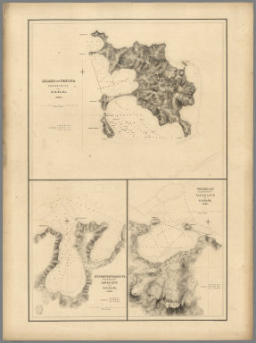
1840 Island of Yendua, Nucumurry Harbour, Wai … Chart Map Island of Yendua, Feejee (Fiji) Group, b … |

1840 Channel on the South Western Side of Van … Chart Map Channel on the South Western Side of Van … |

1840 Chart of the Antarctic Continent. Exploration Book Chart of the Antarctic Continent Shewing … |

1840 Chart of the Viti Group or Feejee Island … Exploration Book Chart of the Viti Group or Feejee Island … |

1840 Der nordliche gestirnte Himmel. (The Nor … World Atlas No. III. Stieler's Hand-Atlas No. 5a. De … |

1840 Plate 31. Facsimile Cartography 1492-186 … [Historical Atlas, National Atlas] Plate 31. Cartography 1492-1867. Bonnevi … |

1833 Map of High Asia. Regional Atlas Karte von Hoch-Asien zu C. Ritter's Erdk … |

1833 Map of High Asia. Regional Atlas Karte von Hoch-Asien zu C. Ritter's Erdk … |

1833 China. Regional Atlas China. |

1833 West Siberia. Regional Atlas West Siberien. (West Siberia). |

1833 West Siberia. Regional Atlas West Siberien. (West Siberia). |

1833 East Siberia. Mongolia. Manchuria. Regional Atlas Ost Siberien. Mongolei. Mandschire. (Eas … |

1933 Himalayan mountains in Bissahir, Gherwal … Regional Atlas Das Himalaja Gebirg in Bissahir, Gherwal … |

1839 Survey Map of East-High-Asia ... Berlin, … Regional Atlas Uebersichts-Karte von Oest-Hoch-Asien .. … |

1839 Map of Russian Altai ... Berlin, 1839. Regional Atlas Karte vom Russischen Altai ... Berlin, 1 … |

1839 Geologic Cross-Section: Profiles of Asia … Regional Atlas (Geologic Cross-Section) (Profiles of As … |

1841 Sheet I. Inner Asia. Regional Atlas (Sheet I) Karte Inner-Asiens ... Berlin … |

1841 Sheet II. Inner Asia. Regional Atlas (Sheet II) Karte Inner-Asiens ... Berlin … |

1841 Sheet III. Inner Asia. Regional Atlas (Sheet III) Karte Inner-Asiens ... Berli … |

1841 Sheet IV. Inner Asia. Regional Atlas (Sheet IV) Karte Inner-Asiens ... Berlin … |

1841 Composite Map: Inner-Asia. Regional Atlas (Composite Map) Karte Inner-Asiens ... B … |

1850 South Iran. Regional Atlas Versuch einer Darsellung von Sued Iran. … |

1850 Index Map and Sectional Title Page: Atla … Regional Atlas (Index Map and Sectional Title Page) Atl … |

1850 Sect. I. Beirut. Atlas of Palestine and … Regional Atlas Sect. I. Beirut. (Atlas von Palaestina u … |

1850 Sect. II. Damascus. Atlas of Palestine a … Regional Atlas Sect. II. Damascus. (Atlas von Palaestin … |

1850 Sect. III. Tiberias. Atlas of Palestine … Regional Atlas Sect. III. Tiberias. (Atlas von Palaesti … |

1850 Sect. IV. El Mezareib. Atlas of Palestin … Regional Atlas Sect. IV. El Mezareib. (Atlas von Palaes … |

1850 Sect. V. Jerusalem. Atlas of Palestine a … Regional Atlas Sect. V. Jerusalem. (Atlas von Palaestin … |

1850 Sect. VI. Kulat Zerka. Atlas of Palestin … Regional Atlas Sect. VI. Kulat Zerka. (Atlas von Palaes … |

1850 Sect. VII. El Khulil (Hebron). Atlas of … Regional Atlas Sect. VII. El Khulil (Hebron). (Atlas vo … |

1850 Sect. VIII. Todtes Meer. Atlas of Palest … Regional Atlas Sect. VIII. Todtes Meer. (Atlas von Pala … |

1850 Sect. IX. Mayha. Atlas of Palestine and … Regional Atlas Sect. IX. Mayha. (Atlas von Palaestina u … |