Browse All

1849 Vicinity of Boston. World Atlas Map of the Vicinity of Boston. |

1849 Vol 2. Plate: Battersea Survey Book Battersea. (to accompany) Ordnance Surve … |

1849 Vol 2. Plate: Deptford Survey Book Deptford. (to accompany) Ordnance Survey … |

1849 Vol 2. Plate: London Bridge Survey Book London Bridge. (to accompany) Ordnance S … |

1849 Das Mittellaendische und Schwarze Meer. … World Atlas No. XLIV. Stieler's Hand-Atlas (No. 42a) … |

1849 West-Polynesien. (Western Polynesia). World Atlas Stieler's Hand-Atlas (No. 51). West-Poly … |

1849 Ost-Polynesien. (Eastern Polynesia). World Atlas Stieler's Hand-Atlas (No. 52). Ost-Polyn … |

1849 Advertisement - back liner: Atlanten im … World Atlas (Advertisement - back liner). Atlanten i … |

1849 Das Mittellaendische und Schwarze Meer. … World Atlas No. XLIV. Stieler's Hand-Atlas (No. 42a) … |

1849 Ost-Polynesien. (Eastern Polynesia). World Atlas Stieler's Hand-Atlas (No. 52). Ost-Polyn … |

1849 Oest. Hoch-Africa. World Atlas Oestliches Hoch-Africa mit Madagascar un … |

1849 Vereinigten Staaten v. N. America. World Atlas Die Vereinigten Staaten von Nord America … |

1849 Die Europaeische Turkei .... (Turkey in … World Atlas No. XLII. Stieler's Hand-Atlas (No. 38b) … |

1849 Allemagne occidentale. World Atlas (Carte generale de l'Allemagne comprenan … |

1849 Allemagne orientale. World Atlas Carte generale de l'Allemagne comprenant … |

1849 Composite: Allemagne. World Atlas (Composite of) Carte generale de l'Allem … |

1849 Amerique du Nord. World Atlas Carte de l'Amerique du Nord. (with) Comp … |

1849 16. Britannia, Caledonia et Hibernia. World Atlas 16. Britannia, Caledonia et Hibernia. |

1849 17. Germania. World Atlas 17. Germania. |

1849 22. Empire d'Alexandre. World Atlas 22. Empire d'Alexandre. |
1849 24. Carte de L'Empire Romain sous August … World Atlas 24. Carte de L'Empire Romain sous August … |

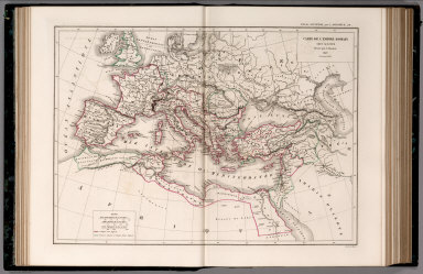
1849 25. Carte de L'Empire Romain et du Monde … World Atlas 25. Carte de L'Empire Romain et du Monde … |

1849 Terre, Mercator proj. World Atlas Terre suivant la projection de Mercator, … |

1849 Mappemonde. World Atlas Mappemonde en deux hemispheres. Publiee … |

1849 L'Angleterre, Galles. World Atlas Carte particuliere de l'Angleterre et de … |

1849 France physique, politique. World Atlas Carte physique et politique de la France … |

1838 Die Isothermkurven Der Nordlichen Halbku … World Atlas Die Isothermkurven Der Nordlichen Halbku … |

1837 Karte Von Europa. World Atlas Karte Von Europa. Zur Ubersicht der Warm … |

1839 Ubersicht Der Mittleren Barometerstande … World Atlas Ubersicht Der Mittleren Barometerstande … |

1839 Windkarte der Erde. World Atlas Windkarte der Erde. 1ste. Abtheilung: Me … |

1841 Hyetographische Karte der Erde. World Atlas Hyetographische Karte der Erde. 1ste. Ab … |

1849 Facsimile: Russian Chart. Historical Atlas (Facsimile) Translation of Title: Part o … |

1849 Text Page: Preface. Physical Atlas (Text Page) Preface. |

1847 Western Hemisphere. World Atlas Western Hemisphere. The World in Equal Q … |

1847 Eastern Hemisphere. World Atlas Eastern Hemisphere. The World in Equal Q … |

1847 World in Mercador's Projection. World Atlas The World in Mercador's Projection. Engr … |

1847 Europe. World Atlas Sharpe's Corresponding Maps. Europe. Eng … |

1847 Great Britain and Ireland. . World Atlas Sharpe's Corresponding Maps. Great Brita … |

1847 England and Wales Railway Map (northern … World Atlas Sharpe's Corresponding Maps. England and … |

1847 England and Wales Railway Map (southern … World Atlas Sharpe's Corresponding Maps. England and … |

1847 Composite: England and Wales Railway Map … World Atlas (Composite of) Sharpe's Corresponding Ma … |

1847 Scotland. World Atlas Sharpe's Corresponding Maps. Scotland. L … |

1847 Ireland. World Atlas Sharpe's Corresponding Maps. Ireland. Lo … |

1847 Holland And Belgium. World Atlas Sharpe's Corresponding Maps. Holland and … |

1847 Prussia - Holland and the German States. World Atlas Sharpe's Corresponding Maps. Prussia - H … |

1847 Switzerland. World Atlas Sharpe's Corresponding Maps. Swtizerland … |

1847 Turkey and Greece. World Atlas Sharpe's Corresponding Maps. Turkey and … |

1847 Greece and the Ionian Islands. World Atlas Sharpe's Corresponding Maps. Greece and … |

1847 Italy. World Atlas Sharpe's Corresponding Maps. Italy. Lond … |

1847 Spain and Portugal. World Atlas Sharpe's Corresponding Maps. Spain and P … |