Browse All

1850 60. Montgomery, SE Quad. Geologic Atlas 60. Montgomery, SE Quad. |

1850 60. Llanidloes, Montgomery, SW Quad. Geologic Atlas 60. Llanidloes, Montgomery, SW Quad. |

1850 76. Bardsey Island, N Quad. Geologic Atlas 76. Bardsey Island, N Quad. |

1850 76. Bardsey Island, S Quad. Geologic Atlas 76. Bardsey Island, S Quad. |

1850 79. Denbigh, SE Quad. Geologic Atlas 79. Denbigh, SE Quad. |

1850 79. Denbigh, SW Quad. Geologic Atlas 79. Denbigh, SW Quad. |

1850 Polar-Karte. (Arctic). World Atlas No. VIII. Stieler's Hand-Atlas (No. 41b) … |

1850 Der Atlantische Ocean. (Atlantic). World Atlas Stieler's Hand-Atlas (No. 41c). Der Atla … |

1850 Iran und Turan (Kazakhstan), Persien (Pe … World Atlas No. XLVI. Stieler's Hand-Atlas (No. 43b) … |

1850 China und Japan. (China and Japan). World Atlas No. XLVII. Stieler's Hand-Atlas (No. 43c … |

1850 Ost-Indien Mit Den Inseln. (East Indies) … World Atlas No. XLVIII. Stieler's Hand-Atlas (No. 44 … |

1850 Vorder-Indien oder das Indo-Britische Re … World Atlas No. XLIX. Stieler's Hand-Atlas (No. 44b) … |

1850 Sud-Africa (Southern Africa) mit Madagas … World Atlas No. LIII. Stieler's Hand-Atlas (No. 45c) … |

1850 West-Indien Centro-Amerika. (West Indies … World Atlas No. LIX. Stieler's Hand-Atlas (No. 48). … |

1850 Sud-Amerika. (South America). World Atlas No. LX. Stieler's Hand-Atlas (No. 49b). … |

1850 Sud-Amerika. (South America). World Atlas No. LXI. Stieler's Hand-Atlas (No. 49c). … |

1850 Australien und Polynesien (Australia and … World Atlas No. LXII. Stieler's Hand-Atlas (No. 50a) … |

1850 Festland von Australien und benachbarte … World Atlas No. LXIII. Stieler's Hand-Atlas (No. 50b … |

1850 Sud-Ostlichen Australien. (Southeastern … World Atlas No. LXIII. Stieler's Hand-Atlas (No. 50c … |

1850 Composite: Spanien und Portugal in IV Bl … World Atlas (Composite of) Stieler's Hand-Atlas No. … |

1850 Composite: Frankreich. World Atlas (Composite of) No. XIV, XV, XVI. Stieler … |

1850 Composite: England und Wales, Schotland, … World Atlas (Composite of) No. XVII, XIX, XX. Stiele … |

1850 Composite: Deutschland World Atlas (Composite of) Nos. XXI, XXVII, XXIX, XX … |

1850 Spanien und Portugal in IV Blattern. (Sp … World Atlas Stieler's Hand-Atlas No. 13b. Spanien un … |

1850 Spanien und Portugal in IV Blattern. (Sp … World Atlas Stieler's Hand-Atlas No. 13c. Spanien un … |

1850 Spanien und Portugal in IV Blattern. (Sp … World Atlas Stieler's Hand-Atlas No. 13d. Spanien un … |

1850 Spanien und Portugal in IV Blattern. (Sp … World Atlas Stieler's Hand-Atlas No. 13e. Spanien un … |

1850 Schweden und Norwegen, Danemark, Island … World Atlas No. XX. Stieler's Hand-Atlas (No. 16a.) … |

1850 Sachsen, Thuringen und Benachbarte Laend … World Atlas Stieler's Hand-Atlas (No. 27 u. 28). Sac … |

1850 Amerika (America). World Atlas Stieler's Hand-Atlas (No. 41a). Amerika. |

1850 China und Japan. (China and Japan). World Atlas No. XLVII. Stieler's Hand-Atlas (No. 43c … |

1850 Ost-Indien Mit Den Inseln. (East Indies) … World Atlas No. XLVIII. Stieler's Hand-Atlas (No. 44 … |

1850 Festland von Australien und benachbarte … World Atlas No. LXIII. Stieler's Hand-Atlas (No. 50b … |

1850 Sud-Ostlichen Australien. (Southeastern … World Atlas No. LXIII. Stieler's Hand-Atlas (No. 50c … |

1850 Composite: Africa World Atlas (Composite of) No. LII, No. LIINo. LIIIb … |

1850 Composite: Sud-Amerika. (South America). World Atlas (Composite of) No. LXI, No. LX. Stieler' … |

1841 Harbours in Admiralty Inlet, Washington. Chart Map Harbours in Admiralty Inlet, Oregon Terr … |

1839 Apolima, Samoan Group. Harbour of Oafonu … Chart Map Apolima, Samoan Group. Harbour of Oafonu … |

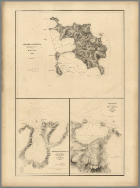
1840 Island of Natrai, Island of Angau (Gau o … Chart Map Island of Natrai, Feejee (Fiji) Group, b … |

1839 Harbour of Mataatu, Island of Savaii. Ha … Chart Map Harbour of Mataatu, Island of Savaii, (S … |

1841 (Tabiteuea) Island, Peacock's Anchorage, … Chart Map Taputeoiea (Tabiteuea) or Drummond's Isl … |

1840 Island of (Keteira), Island of Totoia (T … Chart Map Island of Moala (Keteira), Feejee (Fiji) … |

1840 Harbours of Mbenga, Rewa-Roads, South Si … Chart Map Island and Harbours of Mbenga, South Sid … |

1840 Eastern Group, Fiji. Chart Map Eastern Group, Feejee (Fiji) Islands, by … |

1840 Western End of Viti Levu, with the Ship … Chart Map Western End of Viti Levu, with the Ship … |

1840 Admiralty Inlet, Washington. Chart Map Ports Orchard and Madison including the … |

1839 Bay of Massefao, Bay of Fagitua, Island … Chart Map Bay of Massefao, Island of Tutuila, by t … |

1841 (Nanumanga), Maraki Island, Maiana Islan … Chart Map Hudson's Island (Nanumanga), by the U.S. … |
1840 Island of Yendua, Nucumurry Harbour, Wai … Chart Map Island of Yendua, Feejee (Fiji) Group, b … |

1841 (Nonouti) Island, Makin Island, (Butarit … Chart Map Nanouti Bishop or Sydenhams Island (Nono … |