Browse All

1851 Natal And Kaffraria. World Atlas Natal And Kaffraria. The Illustrations b … |

1851 Western Africa. World Atlas Western Africa. The Illustrations by H. … |

1851 Northern Africa. World Atlas Northern Africa. The Illustrations by H. … |

1851 Egypt, And Arabia Petraea. World Atlas Egypt, And Arabia Petraea. The Illustrat … |

1851 North America. World Atlas North America. The Illustrations by J. M … |

1851 South America. World Atlas South America. The Illustrations by J. M … |

1851 British America. World Atlas British America. The Illustrations by H. … |

1851 West Canada. World Atlas West Canada. The Illustrations by H. War … |

1851 East Canada And New Brunswick. World Atlas East Canada And New Brunswick. The Illus … |

1851 Nova Scotia And Newfoundland. World Atlas Nova Scotia And Newfoundland. The Illust … |

1851 United States. World Atlas United States. The Illustrations by J. M … |

1851 Mexico, California and Texas. World Atlas Mexico, California and Texas. The Illust … |

1851 Central America. World Atlas Central America. The Illustrations by H. … |

1851 Isthmus of Panama. World Atlas Isthmus of Panama. The Illustrations by … |

1851 Venezuela, New Granada, Equador, and the … World Atlas Venezuela, New Granada, Equador, and the … |

1851 Peru & Bolivia. World Atlas Peru & Bolivia. The Illustrations by H. … |

1851 Chili And La Plata. World Atlas Chili And La Plata. The Illustrations by … |

1851 Falkland Islands And Patagonia. World Atlas Falkland Islands And Patagonia. The Illu … |

1851 Brazil. World Atlas Brazil. The Illustrations by H. Winkles … |

1851 British Guayana. World Atlas British Guayana. The Illustrations Drawn … |

1851 West India Islands. World Atlas West India Islands. The Illustrations by … |

1851 Jamaica. World Atlas Jamaica. The Illustrations by H. Winkles … |

1855 Covers: Township Map Of The State Of Iow … Pocket Map (Covers to) A Township Map Of The State … |

1855 Township Map Of The State Of Iowa Pocket Map A Township Map Of The State Of Iowa. Com … |

1851 Nuova California ; Baie di Monterey e di … World Atlas Nuova California, Stati Uniti dell'Ameri … |

1851 Nassau, Hessen Homburg, Frankfurt a/M. World Atlas Herzogthum Nassau, Landgrafschaft Hessen … |

1851 Hannover. World Atlas Hannover entw. u. gez. vom Major Radefel … |

1851 Oldenburg Grossherzogthum. World Atlas Grossherzogthum Oldenburg und Gebiet der … |

1851 Oesterreich. World Atlas Der Kaiserstaat Oesterreich. Nach den be … |

1851 Gallia Transalpina e le sue successive d … World Atlas Gallia Transalpina e le sue successive d … |

1851 Richmond's I. Harbor. Chart Atlas Richmond's Island Harbor (Harbor of Refu … |

1851 Hart & City Island, Sachem's Head Harbor … Chart Atlas Hart & City Island. From a trigonometric … |

1851 Hell Gate & approaches. Chart Atlas Hell Gate and its approaches. From a tri … |

1851 Savannah River. Chart Atlas Savannah River. Reconnaissance of the ap … |

1851 Cedar Keys, Fla. Chart Atlas Reconnoissance of vicinity of Cedar Keys … |

1851 Entrance Mobile Bay. Chart Atlas Entrance to Mobile Bay. From a trigonome … |

1851 Mare Island Straits, Calif. Chart Atlas Mare Island Straits, California. U.S. Co … |

1851 Trinidad Bay, Calif. Chart Atlas Reconnaissance of Trinidad Bay, Californ … |

1851 Beaufort Harbor, N.C. Chart Atlas Preliminary sketch of Beaufort Harbor, N … |

1851 Frying-Pan Shoals, Cape Fear River Chart Atlas Sketch of Frying-Pan Shoals and Cape Fea … |

1851 75. Harlech, SW Quad. Geologic Atlas 75. Harlech, SW Quad. |

1851 No.2. Plan of that part of the Isthmus o … Separate Map Plan of that part of the Isthmus of Tehu … |
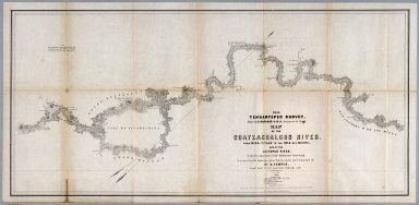
1851 No.5. Map of the Coatzacoalcos River fro … Separate Map 1851 Tehuantepec Survey, Major J.G. Barn … |

1851 No.6. Map of the River Uspanapa to the P … Separate Map Tehuantepec Survey, Maj. J.G. Barnard. U … |

1850 Polar-Karte. (Arctic). World Atlas No. VIII. Stieler's Hand-Atlas (No. 41b) … |

1850 Der Atlantische Ocean. (Atlantic). World Atlas Stieler's Hand-Atlas (No. 41c). Der Atla … |

1849 Das Mittellaendische und Schwarze Meer. … World Atlas No. XLIV. Stieler's Hand-Atlas (No. 42a) … |

1846 Das Osmanische Reich in Asien, (Ottoman … World Atlas Stieler's Hand-Atlas (No. 43a). Das Osma … |

1850 Iran und Turan (Kazakhstan), Persien (Pe … World Atlas No. XLVI. Stieler's Hand-Atlas (No. 43b) … |

1850 China und Japan. (China and Japan). World Atlas No. XLVII. Stieler's Hand-Atlas (No. 43c … |