|
|
Author
[Martin, R.M., Tallis, J. & F.]
Full Title
Natal And Kaffraria. The Illustrations by H. Winkles & Engraved by W. Lacey. The Map Drawn & Engraved by J. Rapkin.
Publisher
J. & F. Tallis
Author
[Martin, R.M., Tallis, J. & F.]
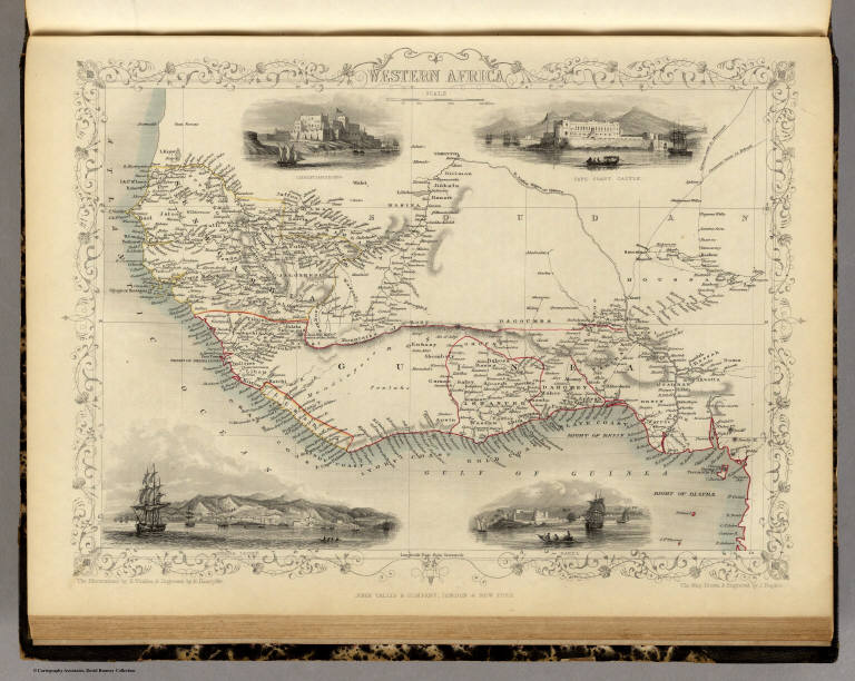
Full Title
Western Africa. The Illustrations by H. Winkles & Engraved by E. Radclyffe. The Map Drawn & Engraved by J. Rapkin.
Publisher
J. & F. Tallis
Author
[Martin, R.M., Tallis, J. & F.]
Full Title
Northern Africa. The Illustrations by H. Winkles & Engraved by G. Greatbach. The Map Drawn & Engraved by J. Rapkin.
Publisher
J. & F. Tallis
Author
[Martin, R.M., Tallis, J. & F.]
Full Title
Egypt, And Arabia Petraea. The Illustrations by J. Marchant & Engraved by J.B. Allen. The Map Drawn & Engraved by J. Rapkin.
Publisher
J. & F. Tallis
Author
[Martin, R.M., Tallis, J. & F.]
Full Title
North America. The Illustrations by J. Marchant & Engraved by J. Rogers. The Map Drawn & Engraved by J. Rapkin.
Publisher
J. & F. Tallis
Author
[Martin, R.M., Tallis, J. & F.]
Full Title
South America. The Illustrations by J. Marchant & Engraved by J. Rogers. The Map Drawn & Engraved by J. Rapkin.
Publisher
J. & F. Tallis
Author
[Martin, R.M., Tallis, J. & F.]
Full Title
British America. The Illustrations by H. Warren & Engraved by R. Wallis. The Map Drawn & Engraved by J. Rapkin.
Publisher
J. & F. Tallis
Author
[Martin, R.M., Tallis, J. & F.]
Full Title
West Canada. The Illustrations by H. Warren & Engraved by Robt. Wallis. The Map Drawn & Engraved by J. Rapkin.
Publisher
J. & F. Tallis
Author
[Martin, R.M., Tallis, J. & F.]
Full Title
East Canada And New Brunswick. The Illustrations by H. Warren & Engraved by J.B. Allen. The Map Drawn & Engraved by J. Rapkin.
Publisher
J. & F. Tallis
Author
[Martin, R.M., Tallis, J. & F.]
Full Title
Nova Scotia And Newfoundland. The Illustrations by A. Fussell & Engraved by J. Rogers. The Map Drawn & Engraved by J. Rapkin.
Publisher
J. & F. Tallis
Author
[Martin, R.M., Tallis, J. & F.]
Full Title
United States. The Illustrations by J. Marchant & Engraved by J. Rogers. The Map Drawn & Engraved by J. Rapkin.
Publisher
J. & F. Tallis
Author
[Martin, R.M., Tallis, J. & F.]
Full Title
Mexico, California and Texas. The Illustrations by H. Warren & Engraved by J. Rogers. The Map Drawn & Engraved by J. Rapkin.
Publisher
J. & F. Tallis
Author
[Martin, R.M., Tallis, J. & F.]
Full Title
Central America. The Illustrations by H. Winkles & Engraved by G.R. Manwaring. The Map Drawn & Engraved by J. Rapkin.
Publisher
J. & F. Tallis
Author
[Martin, R.M., Tallis, J. & F.]
Full Title
Isthmus of Panama. The Illustrations by H. Warren & Engraved by J. Wrightson. The Map Drawn & Engraved by J. Rapkin.
Publisher
J. & F. Tallis
Author
[Martin, R.M., Tallis, J. & F.]
Full Title
Venezuela, New Granada, Equador, and the Guayanas. The Illustrations by H. Winkles & Engraved by W. Lacey. The Map Drawn & Engraved by J. Rapkin.
Publisher
J. & F. Tallis
Author
[Martin, R.M., Tallis, J. & F.]
Full Title
Peru & Bolivia. The Illustrations by H. Winkles & Engraved by J.H. Kernot. The Map Drawn & Engraved by J. Rapkin.
Publisher
J. & F. Tallis
Author
[Martin, R.M., Tallis, J. & F.]
Full Title
Chili And La Plata. The Illustrations by H. Winkles & Engraved by W. Lacey. The Map Drawn & Engraved by J. Rapkin.
Publisher
J. & F. Tallis
Author
[Martin, R.M., Tallis, J. & F.]
Full Title
Falkland Islands And Patagonia. The Illustrations by H. Winkles & Engraved by W. Lacey. The Map Drawn & Engraved by J. Rapkin.
Publisher
J. & F. Tallis
Author
[Martin, R.M., Tallis, J. & F.]
Full Title
Brazil. The Illustrations by H. Winkles & Engraved by W. Lacey. The Map Drawn & Engraved by J. Rapkin.
Publisher
J. & F. Tallis
Author
[Martin, R.M., Tallis, J. & F.]
Full Title
British Guayana. The Illustrations Drawn & Engraved by H. Winkles. The Map Drawn & Engraved by J. Rapkin.
Publisher
J. & F. Tallis
Author
[Martin, R.M., Tallis, J. & F.]
Full Title
West India Islands. The Illustrations by H. Warren & Engraved by J. Rogers. The Map Drawn & Engraved by J. Rapkin.
Publisher
J. & F. Tallis
Author
[Martin, R.M., Tallis, J. & F.]
Full Title
Jamaica. The Illustrations by H. Winkles & Engraved by W. Lacey. The Map Drawn & Engraved by J. Rapkin.
Publisher
J. & F. Tallis
Author
Henn, Williams & Co.
Full Title
(Covers to) A Township Map Of The State Of Iowa. Compiled from the United States Surveys, official information and personal reconnaissance, showing the Streams, Roads, Towns, County Seats, Works of Internal Improvement, &c. &c. Published by Henn, Williams & Co. Fairfield, Iowa. and by R.L. Barnes, Philadelphia. No. 6 South 7th. Street 1855. Friend & Aub Lith. Phila. Entered ... 1854, by R.L Barnes ... Penna.
Publisher
Henn, Williams & Co.
Author
Henn, Williams & Co.
Full Title
A Township Map Of The State Of Iowa. Compiled from the United States Surveys, official information and personal reconnaissance, showing the Streams, Roads, Towns, County Seats, Works of Internal Improvement, &c. &c. Published by Henn, Williams & Co. Fairfield, Iowa. and by R.L. Barnes, Philadelphia. No. 6 South 7th. Street 1855. Friend & Aub Lith. Phila. Entered ... 1854, by R.L Barnes ... Penna.
Publisher
Henn, Williams & Co.
Author
[Ferry, Hypolite, Marzolla, Benedetto]
Full Title
Nuova California, Stati Uniti dell'America Settentrionale. (with) Carta particolare delle Baie di Monterey e di Francisco disegnata secondo i lavori idrografici piu recenti. La presente Carta e stata eseguita su quella, pubblicata nel 1850 dal Signr. Ipolito Ferry ... Atlante Geografico di B. Marzolla. Napoli, 1851.
Publisher
B. Marzolla
Author
Grassl, J. (Joseph)
Full Title
Herzogthum Nassau, Landgrafschaft Hessen Homburg und die Freie Stadt Frankfurt a/M, entw. u. gez. von J. Grassl. 1851. (with) Plan von Wiesbaden. (with) Frankfurt a/M. (with) Landgrafs. Hessen Homburg, Herrschaft Meisenheim. Stich, Druck und Verlag des Bibliographischen Instituts in Hildburghausen, (1860)
Publisher
Bibliographischen Instituts
Author
Radefeld, Carl Christian Franz, 1788-1874
Full Title
Hannover entw. u. gez. vom Major Radefeld. 1851. (with) Hannover mit Umgebung. (with) Gottingen mit Umgebung. Plane u. Schift gest. v. A. Madel. Stich, Druck u. Verlag des Bibliograph. Instituts in Hildburghausen, (1860)
Publisher
Bibliographischen Instituts
Author
Gotthard, A.
Full Title
Grossherzogthum Oldenburg und Gebiet der freien Stadt Bremen. Entworfen u. gezeichnet v. A. Gotthard, Ingen. Lieut., 1851. (with Bremerhaven). (with) Bremen. (with) Oldenburg. W. Feuerstein sc. Stahlstich, Druck u. Verlag des Bibliographischen Instituts in Hildburghausen, (1860)
Publisher
Bibliographischen Instituts
Author
Radefeld, Carl Christian Franz, 1788-1874
Full Title
Der Kaiserstaat Oesterreich. Nach den besten Quellen, entw. u. gez. vom Major Radefeld. 1851. Stich, Druck und Verlag des Bibliographischen Instituts in Hildburghausen, (1860)
Publisher
Bibliographischen Instituts
Author
[Brue, Adrien Hubert, 1786-1832, Marzolla, Benedetto, Picquet, C.]
Full Title
Gallia Transalpina e le sue successive divisioni sotto l'Impero Romano, dalla conquista da Guilio-Cesare, sino al dominio de' Goti, Borgognoni e Franchi. Per questa Carta si ha avuto presente quella di A. Brue, riveduta e aumentata di piccole Carte particolari da C. Picquet, e pubblicata in Parigi nel 1839. Essa fa parte dell'Atlante Geografico di B. Marzolla. Napoli 1851.
Publisher
B. Marzolla
Author
Bache, A. D.
Full Title
Richmond's Island Harbor (Harbor of Refuge no. ). From a trigonometrical survey under the direction of A.D. Bache, Superintendent of the Survey of the Coast of the United States. Triangulation by A.D. Bache & C.O. Boutelle, assistant. Topography by A.W. Longfellow, assistant. Hydrography by the party under the command of M. Woodhull, Lieutenant U.S. Navy. Published in 1851. Topography reduced by J. Lambert, draughtsman. Hydrography reduced by John R. Barker. Topography engraved by S. Siebert. Title by J.V.N. Throop, remaining lettering by W. Smith. Electrotype copy no. 2 by G. Mathiot, U.S.C.S. (with logo) U.S. Coast Survey Office.
Publisher
U.S.
Author
[Bache, A. D., Hassler, F. R.]
Full Title
Hart & City Island. From a trigonometrical survey under the direction of F.R. Hassler, Superintendent of the Survey of the Coast of the United States. Triangulation by E. Blunt, assistant. Topography by T.W. Werner and H.L. Whiting, assistants. Hydrography by the parties under the command of Lieut. G.S. Blake & Lieut. J.R. Goldsborough, U.S.N. ... Sachem's Head Harbor. From a trigonometrical survey under the direction of F.R. Hassler, Superintendent of the Survey of the Coast of the United States. Triangulation by E. Blunt, assistant. Topography by W.M. Boyce, assistant. Hydrography by the party under the command of Lieutenant G.S. Blake, U.S. Navy. Published in 1851. A.D. Bache, Superintendent. Reduction for engraving by M. McClery, J. Lambert & J. Robertson. Eng. principally by R.T. Knight & S.T. Pettit. Electrotype copy no. 2 by G. Mathiot, U.S.C.S. (with logo) U.S. Coast Survey Office.
Publisher
U.S.
Author
[Bache, A. D., Hassler, F. R.]
Full Title
Hell Gate and its approaches. From a trigonometrical survey under the direction of F.R. Hassler and A.D. Bache, Superintendents of the Survey of the Coast of the United States. Triangulation by Edmund Blunt, assistant. Topography by H.L. Whiting, assistant. Hydrography by the parties under the command of D.D. Porter & M. Woodhull, Lts., U.S. Navy. Published in 1851. A.D. Bache, Superintendent. Reduction of topography for engraving by C. Mahon, of hydrography by J.R.P. Mechlin. Topography engraved by A. Rolle, F. Dankworth & G. McCoy; lettering by J. Knight. Electrotype copy no. 1 by G. Mathiot, U.S.C.S. (with logo) U.S. Coast Survey Office.
Publisher
U.S.
Author
Bache, A. D.
Full Title
Savannah River. Reconnaissance of the approaches to the city of Savannah including Front & Back Rivers. U.S. Coast Survey. A.D. Bache, Superintendent. By the hydrographic party under the command of Lieut. J.N. Maffitt, U.S.N. & asst. U.S.C.S. 1851. (with logo) U.S. Coast Survey Office.
Publisher
U.S.
Author
Bache, A. D.
Full Title
Reconnoissance of vicinity of Cedar Keys, coast of Florida by F.H. Gerdes, assist. U.S. Coast Survey. U.S. Coast Survey. A.D. Bache, Superintendent. Sketch F. No. 4. 1851.
Publisher
U.S.
Author
Bache, A. D.
Full Title
Entrance to Mobile Bay. From a trigonometrical survey under the direction of A.D. Bache, Superintendent of the Survey of the Coast of the United States. Main triangulation by F.H. Gerdes, assistant. Secondary triangulation by R.H. Fauntleroy, assistant. Topography by W.E. Greenwell, assistant. Hydrography by the party under the command of C.P. Patterson, Lt. U.S. Navy and assist. Published in 1851. Final reduction for engraving by J.J. Ricketts, draughtsman. Topography engraved by R.T. Knight and S.T. Pettit. Lettering by W. Smith. Electrotype copy no. 3 by G. Mathiot, U.S.C.S. (with logo) U.S. Coast Survey Office.
Publisher
U.S.
Author
Bache, A. D.
Full Title
Mare Island Straits, California. U.S. Coast Survey, A.D. Bache, Superintendent. Triangulation by J.S. Williams and R.D. Cutts, assts., U.S.C.S. and Lt. S.F. Blunt, U.S.N., Joint Commn. Army & Navy officers. Topography by R.D. Cutts, asst., U.S.C.S. Hydrography by the party under the command of W.P. McArthur, Lieut U.S.N. and asst. U.S.C.S. 1851.
Publisher
U.S.
Author
Bache, A. D.
Full Title
Reconnaissance of Trinidad Bay, California. U.S. Coast Survey, A.D. Bache, Superintendent. By the hydrographic party under the command of Lieut. James Alden, U.S.N. and asst. U.S.C.S. 1851. (with) View of Trinidad Head and city. Topography & view by W.B. McMurtrie.
Publisher
U.S.
Author
Bache, A. D.
Full Title
Preliminary sketch of Beaufort Harbor, North Carolina. From a trigonometrical survey under the direction of A.D. Bache, Superintendent of the Survey of the Coast of the United States. Triangulation by C.P. Bolles, assistant. Topography by H.L. Whiting, asst. Hydrography by the party under the command of J.N. Maffitt, U.S.N. asst. 1851. (with logo) U.S. Coast Survey Office.
Publisher
U.S.
Author
Bache, A. D.
Full Title
Sketch of Frying-Pan Shoals and Cape Fear River. U.S. Coast Survey. A.D. Bache, Superintendt. By the parties under the command of Lieuts. T.A. Jenkins & J.N. Maffitt, U.S.N., assistants, U.S.C.S. (with logo) U.S. Coast Survey Office.
Publisher
U.S.
Author
[Geological Survey of Great Britain and Ireland, Great Britain, Ordnance Survey Office]
Full Title
75. Harlech, SW Quad.
Publisher
Ordnance Map Office
Author
[Barnard, J.G., Bruff, J.]
Full Title
Plan of that part of the Isthmus of Tehuantepec between the Jaltepec River and the Pacific Plains, embracing all of the engineering difficulties on the route of survey. J.G. Barnard. U.S.Engineers, Chief Engineer. J. J. Williamd 1st. Assistant. J. C. Avery 2nd. Lith. of Endicott & Co. N.Y. Entered ... by B. Fallon ... in the court of Southern District of New York. (inset) Profile of the lines as surveyed 1851. (to accompany) Maps Illustrating The Isthmus of Tehuantepec.
Publisher
D. Appleton & Co.
Author
[Barnard, J.G., Bruff, J.]
Full Title
1851 Tehuantepec Survey, Major J.G. Barnard. U.S.Engineers, Engineer in Chief. Map of the Coatzacoalcos River from Mina-titlan to the Isla del Suchil and of the Jaltepec River from its junction to the railroad crossing. Surveyed by the Hydrographic party under the command of Wm. G. Temple. Passd. Midn. U.S.N. and Chief Hydroge. Asst. Drawn by Louis R.O. Townsend. Lith. of Sarony & Major 117, Fulton St. New York. Entered ... 1852 by B. Fallon ... in the court of Sn. Desct. of New York. (to accompany) Maps Illustrating The Isthmus of Tehuantepec.
Publisher
D. Appleton & Co.
Author
[Barnard, J.G., Bruff, J.]
Full Title
Tehuantepec Survey, Maj. J.G. Barnard. U.S.Engineers, Engineer in Chief. Map of the River Uspanapa to the Playa del Tigre. Made in May 1851 by J.Mc.L. Murphy U.S.N. Hydrographic Assistnt. Lith. of Sarony & Major 117, Fulton St. N.Y. Entered ... 1852 by B. Fallon ... in the court of Sn. Dct. of New York. (insets) Map of the Tancochapa River, from the Hacienda of San Jose to la Isla de Xucuapa. 1851. Map of the Village of Mina-Titlan. Surveyed and drawn by Chas. C. Smith. 1851. (to accompany) Maps Illustrating The Isthmus of Tehuantepec.
Publisher
D. Appleton & Co.
Author
Stieler, Adolf
Full Title
No. VIII. Stieler's Hand-Atlas (No. 41b). Polar-Karte ....
Publisher
Justus Perthes
Author
Stieler, Adolf
Full Title
Stieler's Hand-Atlas (No. 41c). Der Atlantische Ocean.
Publisher
Justus Perthes
Author
Stieler, Adolf
Full Title
No. XLIV. Stieler's Hand-Atlas (No. 42a). Das Mittellaendische und Schwarze Meer. Auch als General Karte des Osmanischen Reichs. (insets) Die Canarischen Inseln Mit Madeira. Nil Delta.
Publisher
Justus Perthes
Author
Stieler, Adolf
Full Title
Stieler's Hand-Atlas (No. 43a). Das Osmanische Reich in Asien.
Publisher
Justus Perthes
Author
Stieler, Adolf
Full Title
No. XLVI. Stieler's Hand-Atlas (No. 43b). Iran und Turan, Persien, Afghanistan, Beludschistan, Turkestan.
Publisher
Justus Perthes
|