1852
Betts's New Portable Terrestrial Globe.
Globe
By The Queens Royal Letters Patent. Bett
…
|

1852
Map Of The Town Of Plymouth
Wall Map
Map Of The Town Of Plymouth, Litchfield
…
|

1852
A New Map of The States Of Texas & Calif
…
Wall Map
A New Map of The States Of Texas & Calif
…
|

1852
Map of North America.
Pocket Map
Map of North America by J. Calvin Smith.
…
|

1852
Mississippi.
World Atlas
Neueste Karte von Mississippi. Entworfen
…
|

1852
Iowa.
World Atlas
Karte von Iowa. Nach den neuesten Hulfsm
…
|

1852
Wisconsin.
World Atlas
Karte von Wisconsin. Nach den neuesten H
…
|

1852
California, Oregon, Utah.
World Atlas
A new map of the State of California, th
…
|

1852
Der Harz.
World Atlas
Der Harz. Gezeichnet v. Prem. Leutn. Got
…
|

1852
Sachsen.
World Atlas
Preussische Provinz Sachsen, 1852. (with
…
|

1852
Schleswig.
World Atlas
Herzogthum Schleswig. 1852. Entworfen u.
…
|

1852
Granducato di Toscana.
World Atlas
Granducato di Toscana. Benedetto Marzoll
…
|

1852
Confederazione Svizzera.
World Atlas
Confederazione Svizzera. Per questa Cart
…
|

1852
Gay Head to Cape Henlopen
Chart Atlas
General chart of the coast from Gay Head
…
|

1852
Coast of Delaware, Maryland, pt. of Virg
…
Chart Atlas
Sea Coast of Delaware, Maryland and part
…
|

1852
Key-West Harbor, approaches.
Chart Atlas
Preliminary chart of Key-West Harbor and
…
|

1852
Channel IV, Cedar-Keys, Fla.
Chart Atlas
Reconnaissance of Channel No. IV, Cedar-
…
|

1852
Mobile Bay.
Chart Atlas
Preliminary sketch of Mobile Bay. U.S. C
…
|

1852
Delta of the Mississippi.
Chart Atlas
Reconnoissance of the passes of the Delt
…
|

1852
Galveston Bay, Texas.
Chart Atlas
Preliminary sketch of Galveston Bay, Tex
…
|

1852
Catalina Harbor.
Chart Atlas
Reconnaissance of Catalina Harbor and th
…
|

1852
Santa Cruz, San Simeon, Coxo, San Luis O
…
Chart Atlas
Reconnaissance of the harbors of Santa C
…
|

1852
Monterey Harbor, Calif.
Chart Atlas
Monterey Harbor, California. From a trig
…
|

1852
San Pedro Harbor, Calif.
Chart Atlas
Reconnaissance of San Pedro Harbor, Cali
…
|

1852
Humboldt Bay, Calif.
Chart Atlas
Preliminary survey of Humboldt Bay, Cali
…
|

1852
Ocracoke Inlet, N.C.
Chart Atlas
Sketch of Ocracoke Inlet, North Carolina
…
|

1852
New River & Bar, N.C.
Chart Atlas
Reconnaissance of New River and Bar, Nor
…
|

1852
72. Burton on Trent, Stafford, SE Quad.
Geologic Atlas
72. Burton on Trent, Stafford, SE Quad.
|

1852
77. Holyhead, N Quad.
Geologic Atlas
77. Holyhead, N Quad.
|

1852
78. Bangor, NE Quad.
Geologic Atlas
78. Bangor, NE Quad.
|

1852
78. N. Anglesey, Bangor, NW Quad.
Geologic Atlas
78. N. Anglesey, Bangor, NW Quad.
|

1852
78. Bangor, SE Quad.
Geologic Atlas
78. Bangor, SE Quad.
|

1852
78. Bangor, SW Quad.
Geologic Atlas
78. Bangor, SW Quad.
|

1851
No.2. Plan of that part of the Isthmus o
…
Separate Map
Plan of that part of the Isthmus of Tehu
…
|

1848
No.3. Mouth of the Coatzacoalcos River s
…
Separate Map
Mouth of the Coatzacoalcos River surveye
…
|

1847
No.4. Sketch from the mouth of the Coatz
…
Separate Map
Sketch from the mouth of the Coatzacoalc
…
|

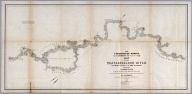
1851
No.5. Map of the Coatzacoalcos River fro
…
Separate Map
1851 Tehuantepec Survey, Major J.G. Barn
…
|

1851
No.6. Map of the River Uspanapa to the P
…
Separate Map
Tehuantepec Survey, Maj. J.G. Barnard. U
…
|

1852
Westliche Halbkugel. (Western Hemisphere
…
World Atlas
No. IV. Stieler's Hand-Atlas No. 6. West
…
|

1852
Oestliche Halbkugel. (Eastern Hemisphere
…
World Atlas
No. V. Stieler's Hand-Atlas No. 7. Oestl
…
|

1852
Planiglob der Antipoden. (Antipodes).
World Atlas
No. VI. Stieler's Hand-Atlas No. 8. Plan
…
|

1852
Die bekannteren Hohwn uber der Meeresfla
…
World Atlas
No.IX. Stieler's Hand-Atlas No. 10. Die
…
|

1852
Europa zur Uebersicht der Flussgebiete u
…
World Atlas
No. X. Stieler's Hand-Atlas No. 11. Euro
…
|

1852
Europa. (Europe}.
World Atlas
No. XI. Stieler's Hand-Atlas No. 12. Eur
…
|

1852
Spanien und Portugal. (Spain and Portuga
…
World Atlas
No. XII. Stieler's Hand-Atlas No. 13a. S
…
|

1852
Frankreich und Umgebungen von Paris. (Fr
…
World Atlas
No. XIII. Stieler's Hand-Atlas (No. 14a.
…
|

1852
Die Brittischen Inseln und Die Nord-See.
…
World Atlas
No. XVII. Stieler's Hand-Atlas (No. 15a.
…
|

1852
England und Wales. (England and Wales).
World Atlas
No. XVIII. Stieler's Hand-Atlas (No. 15b
…
|

1852
Schotland. (Scotland).
World Atlas
No. XIX. Stieler's Hand-Atlas (No. 15c.)
…
|

1852
Ireland.
World Atlas
No. XX. Stieler's Hand-Atlas (No. 15d.)
…
|