Browse All

1858 Bayern I. World Atlas Konigreich Bayern Ites Blatt. Entw. u. g … |

1858 Bayern III. World Atlas Konigreich Bayern IIItes Blatt. Entw. u. … |

1858 Bayern II. World Atlas Das Konigreich Bayern desseitz des Rhein … |

1857 Frontispiece: Geometrical projection of … Survey Book (Frontispiece to) Geometrical projection … |

1847 Plate II: Ordnance Survey: Base apparatu … Survey Book Ordnance Survey: Base apparatus. Plate I … |

1858 82. Chesterfield, SE Quad. Geologic Atlas 82. Chesterfield, SE Quad. |

1858 2. Sheerness. National Atlas 2. Sheerness. |

1858 4. Denge Ness. National Atlas 4. Denge Ness. |

1858 11. Winchester. National Atlas 11. Winchester. |

1858 16. Poole. National Atlas 16. Poole. |

1858 20. Bridgewater. National Atlas 20. Bridgewater. |

1858 25. Tavistock. National Atlas 25. Tavistock. |

1858 28. Lundy Island. National Atlas 28. Lundy Island. |

1858 33. Penzance. National Atlas 33. Penzance. |

1858 34. Cirencester. National Atlas 34. Cirencester. |

1858 38. Pembroke. National Atlas 38. Pembroke. |

1858 47. Dunmow. National Atlas 47. Dunmow. |

1858 56. Radnor. National Atlas 56. Radnor. |

1858 70. Sleaford. National Atlas 70. Sleaford. |

1858 83. Lincoln. National Atlas 83. Lincoln. |

1847 Plate III: Ordnance Survey: Base apparat … Survey Book Ordnance Survey: Base apparatus. Plate I … |

1858 Ft. Kearney South Pass & Honey Lake Wago … Exploration Book Preliminary Map of the Central Division … |

1858 Map No. 1 of the El Paso & Fort Yuma Wag … Exploration Book Map No. 1 of the El Paso & Fort Yuma Wag … |

1858 Map No. 2 of the El Paso & Fort Yuma Wag … Exploration Book Map No. 2 of the El Paso & Fort Yuma Wag … |
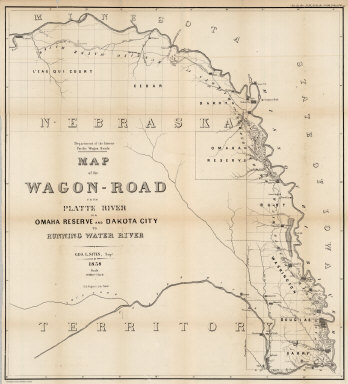
1858 Map of the Wagon-Road from Platte River … Exploration Book Map of the Wagon-Road from Platte River … |

1860 New National Map Exhibiting The United S … Wall Map Mitchell's New National Map Exhibiting T … |

1858 Western Hemisphere. Eastern Hemisphere. World Atlas Western Hemisphere. Eastern Hemisphere. |

1858 World Land and Co-Tidal Lands. World Oce … World Atlas The World Illustrating the Principal Fea … |

1858 World Animal Kingdom. World Productive I … World Atlas The World Showing the Geographical Distr … |

1858 North America (physical). World Atlas North America (physical). |

1858 North America (political). World Atlas North America (political). |

1858 British Provinces in Canada. World Atlas British Provinces Western Portion (Canad … |

1858 United States of America (physical). World Atlas United States of America (physical). (in … |

1858 United States of America (political). World Atlas United States of America (political). |

1858 Maine and New Hampshire. World Atlas Maine and New Hampshire. |

1858 Vermont, Massachusetts, Rhode Island, an … World Atlas Vermont, Massachusetts, Rhode Island, an … |

1858 New York, New Jersey, Pennsylvania, and … World Atlas New York, New Jersey, Pennsylvania, and … |

1858 Maryland, Virginia, North Carolina, and … World Atlas Maryland, Virginia, North Carolina, and … |

1858 Georgia, Alabama, and Florida. World Atlas Georgia, Alabama, and Florida. (inset) F … |

1858 Mississippi, Louisiana, and Arkansas. World Atlas Mississippi, Louisiana, and Arkansas. (i … |

1858 Texas. World Atlas Texas. |

1858 Ohio, Indiana, Kentucky, and Tennessee. World Atlas Ohio, Indiana, Kentucky, and Tennessee. … |

1858 Illinois, Iowa, and Missouri. World Atlas Illinois, Iowa, and Missouri. (inset) Vi … |

1858 Michigan and Wisconsin. World Atlas Michigan and Wisconsin. (inset) Vicinity … |

1858 Nebraska and Kansas. Minnesota. World Atlas Nebraska and Kansas. Minnesota. (inset) … |

1858 Oregon, Washington, California, Utah, an … World Atlas Oregon, Washington, California, Utah, an … |

1858 California. World Atlas California. |

1858 Mexico and Central America. World Atlas Mexico and Central America. |

1858 West Indies, Cuba, Hayti, and Jamaica. World Atlas West Indies. Cuba, Hayti, and Jamaica. |

1858 South America (physical). World Atlas South America (physical). |