Browse All

1870 Rock Island, Henry, Mercer counties. [State Atlas, World Atlas] Campbell's topographical & sectional map … |

1870 Bureau, Putnam, Stark, Marshall counties … [State Atlas, World Atlas] Campbell's topographical & sectional map … |

1870 La Salle, Grundy, Livingston counties. [State Atlas, World Atlas] Campbell's topographical & sectional map … |

1870 Kankakee, Iroquois, Ford counties. [State Atlas, World Atlas] Campbell's topographical & sectional map … |

1870 Peoria, Woodford, Tazewell counties. [State Atlas, World Atlas] Campbell's topographical & sectional map … |

1870 Henderson, Warren, Knox counties. [State Atlas, World Atlas] Campbell's topographical & sectional map … |

1870 Hancock, McDonough, Schuyler counties. [State Atlas, World Atlas] Campbell's topographical & sectional map … |

1870 Fulton, Mason, Cass, Menard counties. [State Atlas, World Atlas] Fulton, Mason, Cass, & Menard counties. … |

1870 McLean, De Witt, Piatt counties. [State Atlas, World Atlas] Campbell's topographical & sectional map … |

1870 Champaign, Vermillion counties. [State Atlas, World Atlas] Campbell's topographical & sectional map … |

1870 Logan, Sangamon, Christian counties. [State Atlas, World Atlas] Campbell's topographical & sectional map … |

1870 Adams, Brown, Pike counties. [State Atlas, World Atlas] Campbell's topographical & sectional map … |

1870 Morgan, Scott, Greene, Calhoun, Jersey c … [State Atlas, World Atlas] Campbell's topographical & sectional map … |

1870 Macoupin, Montgomery counties. [State Atlas, World Atlas] Campbell's topographical & sectional map … |

1870 Macon, Moultrie, Shelby counties. [State Atlas, World Atlas] Campbell's topographical & sectional map … |

1870 Douglas, Edgar, Coles, Cumberland, Clark … [State Atlas, World Atlas] Campbell's topographical & sectional map … |

1870 Jasper, Crawford, Clay, Lawrence, Richla … [State Atlas, World Atlas] Campbell's topographical & sectional map … |

1870 Fayette, Effingham, Marion, counties. [State Atlas, World Atlas] Campbell's topographical & sectional map … |

1870 Bond, Clinton, Washington counties. [State Atlas, World Atlas] Campbell's topographical & sectional map … |

1870 Madison, St. Clair, Monroe counties. [State Atlas, World Atlas] Campbell's topographical & sectional map … |

1870 Randolph, Perry, Jackson counties. [State Atlas, World Atlas] Campbell's topographical & sectional map … |

1870 Jefferson, Franklin, Williamson counties … [State Atlas, World Atlas] Campbell's topographical & sectional map … |

1870 Wayne, Edwards, Wabash, Hamilton, White … [State Atlas, World Atlas] Campbell's topographical & sectional map … |

1870 Saline, Gallatin, Hardin, Pope counties. [State Atlas, World Atlas] Campbell's topographical & sectional map … |

1870 Union, Johnson, Alexander, Pulaski, Mass … [State Atlas, World Atlas] Campbell's topographical & sectional map … |

1870 Climatological map, Illinois. [State Atlas, World Atlas] Climatological map of the state of Illin … |

1870 Geological map, Illinois. [State Atlas, World Atlas] Worthens new geological map of Illinois. … |

1870 Covers: Ordnance Survey of Great Britain … National Atlas (Covers to) Ordnance Survey of Great Bri … |

1870 Text: (Example of Map Cover showing the … National Atlas (Text Page) (Example of Map Cover showin … |
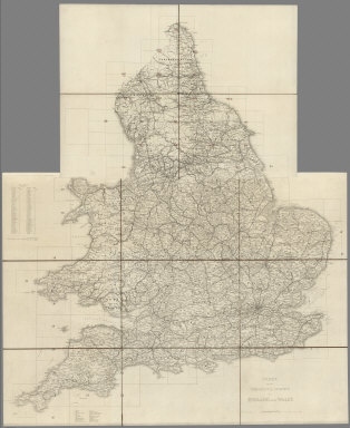
1870 Index Map: Index to the Ordnance Survey … National Atlas (Index Map) Index to the Ordnance Survey … |

1870 Index Map: Index to the Ordnance Survey … National Atlas (Index Map) Index to the Ordnance Survey … |

1870 Legend: Examples for the Size and Charac … National Atlas (Legend) Examples for the Size and Chara … |

1870 108. Wooler. National Atlas 108. Wooler. |

1870 Covers: Kriegsstrassen Karte eines Theil … Case Map (Covers to) Kriegsstrassen Karte eines T … |

1870 Index: Squelette der Kriegsstrassenkarte … Case Map (Index Map to) Squelette der Kriegsstras … |

1870 Covers: I. Uleaborg. Politische eintheil … Case Map (Covers to) I. Uleaborg. Politische eint … |

1870 Uleaborg. Politische eintheilung, I Case Map (Uleaborg. Politische eintheilung). (to … |

1870 Covers: II. Archangelsk Case Map (Covers to) II. Archangelsk. (to accompa … |

1870 Archangelsk, II Case Map (Archangelsk). (to accompany) Kriegsstra … |

1870 Covers: III. Mezen. Titel, - Maastabe, Z … Case Map (Covers to) III. Mezen. Titel, - Maastab … |

1870 Title Page: Titel, und Zeichenerklarung, … Case Map (Title Page to) Kriegsstrassen Karte ein … |

1870 Covers: IV. Stockholm Case Map (Covers to) IV. Stockhom. (to Accompany) … |

1870 Stockholm, IV Case Map (Stockhom). (to Accompany) Kriegsstrasse … |

1870 Covers: V. Saint Petersburg Case Map (Covers to) V. Petersburg. (to Accompany … |

1870 St. Petersburg, V Case Map (St. Petersburg). (to Accompany) Kriegss … |

1870 Covers: VI. Kostroma Case Map (Covers to) VI. Kostroma. (to Accompany) … |

1870 Kostroma, VI Case Map (Kostroma). (to Accompany) Kriegsstrasse … |

1870 Covers: VII. Konigsberg Case Map (Covers to) VII. Konigsberg. (to Accompa … |

1870 Konigsberg. VII Case Map (Konigsberg). (to Accompany) Kriegsstras … |

1870 Covers: Moskau. VIII Case Map (Covers to) VIII. Moskau. (to Accompany) … |