Browse All

1872 Atlas of Illinois, Counties of Jackson, … [National Atlas, State Atlas] Atlas of Illinois, Counties of Jackson, … |

1872 Map of the United States. [National Atlas, State Atlas] Map of the United States. Warner & Beers … |

1872 Atlas of the United States, New England, … [National Atlas, State Atlas] Atlas of the United States, New England, … |

1872 Atlas of the United States, Map of the C … [National Atlas, State Atlas] Atlas of the United States, Map of the C … |

1872 Atlas of the United States, Map of the W … [National Atlas, State Atlas] Atlas of the United States, Map of the W … |

1872 Atlas of the United States, Map of the S … [National Atlas, State Atlas] Atlas of the United States, Map of the S … |

1872 Texas. [National Atlas, State Atlas] Atlas of the United States, Map of Texas … |

1872 Territory of Dakota, Minnesota, and Nebr … [National Atlas, State Atlas] Atlas of the United States, Map of the T … |

1872 Montana, Idaho, and Wyoming. [National Atlas, State Atlas] Atlas of the United States, Map of the M … |

1872 Utah, Arizona, New Mexico, Kansas, Color … [National Atlas, State Atlas] Atlas of the United States, Map of Utah, … |

1872 Nevada and California. [National Atlas, State Atlas] Atlas of the United States, Map of Nevad … |

1872 Washington and Oregon. Territory of Alas … [National Atlas, State Atlas] Atlas of the United States, Map of the W … |

1872 West Indies. [National Atlas, State Atlas] Map of the West Indies. Warner & Beers, … |

1872 Western Hemisphere. Eastern Hemisphere [National Atlas, State Atlas] Western Hemisphere. Eastern Hemisphere. |

1872 Morrison, Whiteside County, Illinois. [National Atlas, State Atlas] Morrison. |

1872 Mt. Pleasant Township, Whiteside County, … [National Atlas, State Atlas] Mt. Pleasant. |

1872 Lyndon Township, Whiteside County, Illin … [National Atlas, State Atlas] Lyndon. (insets) Lyndon. Round Ground. |

1872 Prophetstown Township, Whiteside County, … [National Atlas, State Atlas] Prophetstown. |

1872 Newton Township, Whiteside County, Illin … [National Atlas, State Atlas] Newton. (inset) Mineral Springs. |

1872 Garden Plain Township, Whiteside County, … [National Atlas, State Atlas] Garden Plain. (inset) Unionville. |

1872 Fulton Township, Whiteside County, Illin … [National Atlas, State Atlas] Fulton. |

1872 Hopkins Township, Whiteside County, Illi … [National Atlas, State Atlas] Hopkins. (insets) Galt. Empire. |
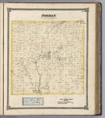
1872 Jordan Township, Whiteside County, Illin … [National Atlas, State Atlas] Jordan. (inset) Sanfordville. |

1872 Map Of Boston. Pocket Map Map Of Boston, 1872, After The Latest Su … |

1872 Cover: Map of Boston. Pocket Map (Covers to) Map Of Boston, 1872, After T … |

1872 Channel Islands, Scilly Islands, and Isl … World Atlas Channel Islands, Scilly Islands, and Isl … |

1872 England and Wales, Cities, Ports & Harbo … World Atlas England and Wales, Cities, Ports & Harbo … |

1872 Ports & Harbours on the East Coast of En … World Atlas Ports & Harbours on the East Coast of En … |

1872 Ports & Harbours on the South East Coast … World Atlas Ports & Harbours on the South East Coast … |

1872 Ports & Harbours on the North West Coast … World Atlas Ports & Harbours on the North West Coast … |

1872 Ports & Harbours on the South-West Coast … World Atlas Ports & Harbours on the South-West Coast … |

1872 Scotland. World Atlas Scotland by G.H. Swanston, Edinr. (with) … |

1872 Ports And Harbours On The West Coast of … World Atlas Ports And Harbours On The West Coast of … |

1872 Ports And Harbours On The East Coast of … World Atlas Ports And Harbours On The East Coast of … |

1872 Ireland. World Atlas Ireland According To The Government Surv … |

1872 Irish Ports & Harbours. World Atlas Irish Ports & Harbours. By J. Bartholome … |

1872 British North America. Sheet I, East. World Atlas British North America. Sheet I, East. Ne … |

1872 British North America. Sheet II, West. World Atlas British North America. Sheet II, West. C … |

1872 British North America. Sheet III. Pacifi … World Atlas British North America. Sheet III. Pacifi … |

1872 British West Indian Possessions, Norther … World Atlas British West Indian Possessions, Norther … |

1872 British Possessions on the North East Co … World Atlas British Possessions on the North East Co … |

1872 The British Possessions In The East Indi … World Atlas The British Possessions In The East Indi … |

1872 British Possessions In The Indian Seas. World Atlas British Possessions In The Indian Seas. … |

1872 Australia and New Zealand. World Atlas Australia and New Zealand By Augustus Pe … |

1872 France And Its Principal Foreign Possess … World Atlas France And Its Principal Foreign Possess … |

1872 French Ports & Harbours, and Plan of Par … World Atlas French Ports & Harbours, and Plan of Par … |

1872 Algeria. World Atlas Algeria (L'Algerie) Drawn by J. Hugh Joh … |

1872 Kingdom of Italy. World Atlas Kingdom of Italy. According to Keipert & … |

1872 (Staten Island North) Pocket Map (Map of Staten Island (Richmond Co.) N.Y … |

1872 Staten Island South. Pocket Map Map of Staten Island (Richmond Co.) N.Y. … |