Browse All

1873 Carte physique de la Confederation Argen … National Atlas Carte physique de la Confederation Argen … |

1873 Coupes geologiques diverses. National Atlas Coupes geologiques diverses. Grave par L … |

1873 Coupes geologiques diverses - altitudes. National Atlas Coupes geologiques diverses - altitudes. … |

1873 Coupes orographiques, territoire Argenti … National Atlas Coupes orographiques des parties central … |

1873 Coupes du continent Sud Americain. National Atlas No. 1. Coupes du continent Sud Americain … |

1873 Coupe de la route de Buenos-Ayres a Lima … National Atlas Coupe de la route de Buenos-Ayres a Lima … |

1873 Coupe de divers passages, Cordillere des … National Atlas Coupe de divers passages de la Cordiller … |

1873 Carte, cours du Haut Uruguay, 1. flle. C … National Atlas Carte du cours du Haut Uruguay depuis la … |

1873 Carte, cours du Haut Uruguay, 2. flle. U … National Atlas Carte du cours du Haut Uruguay depuis la … |

1873 Rio Paraguay; chutes, Rio Parana et Y-Gu … National Atlas Cours inferieur et bouches du Rio Paragu … |

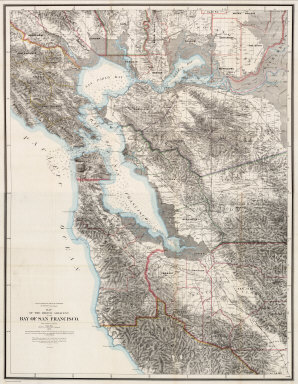
1873 North Sheet: Map Of The Region Adjacent … Pocket Map (North Sheet) State Geological Survey Of … |

1873 South Sheet: Map Of The Region Adjacent … Pocket Map (South Sheet) State Geological Survey Of … |

1873 Covers to: Map Of The Region Adjacent To … Pocket Map (Covers to) State Geological Survey Of C … |
1873 Composite: Map Of The Region Adjacent To … Pocket Map (Composite) State Geological Survey Of C … |

1873 Topographical map of the United States. State Atlas Topographical map of the United States. … |

1873 City of Burlington, Chittenden Co., Vt. State Atlas City of Burlington, Chittenden Co., Vt., … |

1873 59. Southwestern Utah. National Atlas Southwestern Utah. Atlas Sheet Number 59 … |

1873 59. Southwestern Utah. National Atlas Southwestern Utah. Atlas Sheet Number 59 … |

1873 59. Southern And Southwestern Utah. National Atlas Southern And Southwestern Utah. Atlas Sh … |

1873 58, 66. Parts Of E. California, S.E. Nev … National Atlas Atlas Sheet Number 58. Parts Of E. Calif … |

1873 50. Central & Western Utah. National Atlas Central & Western Utah Atlas Sheet Numbe … |

1873 50. Central & Western Utah. National Atlas Central & Western Utah Atlas Sheet Numbe … |

1873 50. Central & Western Utah. National Atlas Central & Western Utah Atlas Sheet Numbe … |

1873 90. Southport, SE Quad. Geologic Atlas 90. Southport, SE Quad. |

1873 Title Page: Topographical atlas ... West … National Atlas (Title Page to) Topographical Atlas Proj … |

1873 Title Page: Geological atlas ... West of … National Atlas (Title Page to) Geological Atlas Project … |

1873 Map Of The Areas Of Drainage To The Atla … National Atlas Map Of The Areas Of Drainage To The Atla … |

1873 Cover: Topographical atlas. National Atlas (Cover to) War Department Corps of Engin … |

1873 Cover: Geographical Explorations & Surve … National Atlas (Cover to) Geographical Explorations And … |

1873 Legend. West Of the One-Hundredth Meridi … National Atlas Legend. West Of the One-Hundredth Meridi … |

1873 Skeleton Map Of the Territory of the Uni … National Atlas Skeleton Map Of the Territory of the Uni … |

1873 Conventional Signs. West Of The One-Hund … National Atlas Conventional Signs. West Of The One-Hund … |

1873 Conventional Signs For Triangulation Out … National Atlas Conventional Signs For Triangulation Out … |

1873 Progress Map Of Lines And Areas Of Explo … National Atlas Progress Map Of Lines And Areas Of Explo … |

1873 Progress Map Of Lines And Areas Of Explo … National Atlas Progress Map Of Lines And Areas Of Explo … |

1865 Die Britischen Inseln und das Umliegende … World Atlas Stieler's Hand-Atlas ... No. 15a. Die Br … |

1866 Ireland. World Atlas Stieler's Hand-Atlas ... No. 15d. Irelan … |

1866 Grossbritannien. (Great Britain, Scotlan … World Atlas Stieler's Hand-Atlas ... No. 15c. Grossb … |

1863 Schweden und Norwegen, Daenemark, Island … World Atlas Stieler's Hand-Atlas ... No. 16a. Schwed … |
1864 Danemark mit Schleswig, Holstein, und La … World Atlas Stieler's Hand-Atlas ... No. 16b. Danema … |

1864 Danemark mit Schleswig, Holstein, und La … World Atlas Stieler's Hand-Atlas ... No. 16b. Daenem … |

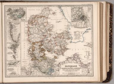
1867 Danemark mit Schleswig, Holstein, und La … World Atlas Stieler's Hand-Atlas ... No. 16/17. Daen … |

1857 Fluss u. Berg-Karte von Deutschland. (Ri … World Atlas Stieler's Hand-Atlas ... No. 18. Fluss u … |

1872 Nord-Ostliches Deutschland. (Northeast G … World Atlas Stieler's Hand-Atlas ... No. 20. Nord-Os … |

1872 Sud-westliches Deutschland und die Schwe … World Atlas Stieler's Hand-Atlas ... No. 24. Sud-wes … |

1872 Sud-Ostliches Deutschland ... Italien. ( … World Atlas Stieler's Hand-Atlas ... No. 25. Sud-Ost … |

1867 No. I. Deutschland, Niederlande, Belgien … World Atlas No. I. Karte von Deutschland den Konigr. … |

1867 No. II. Deutschland, Niederlande, Belgie … World Atlas No. II. Karte von Deutschland den Konigr … |

1867 No. III. Deutschland, Niederlande, Belgi … World Atlas No. III. Karte von Deutschland den Konig … |

1867 No. IV. Deutschland, Niederlande, Belgie … World Atlas No. IV. Karte von Deutschland den Konigr … |