Browse All
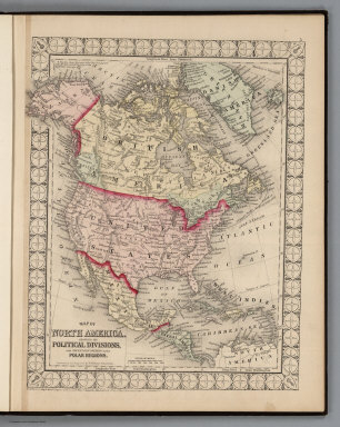
1874 North America. National Atlas Map of North America Showing its Politic … |

1874 United States, and Territories together … National Atlas Map of the United States, and Territorie … |

1874 Residences of W. Murphy and others, hote … State Atlas Residence of Wm. Murphy, Esqr. ... Rosem … |

1874 City of Washington, the Capitol of the U … National Atlas Plan of the City of Washington, the Capi … |

1874 County Map of Maine. National Atlas County Map of the State of Maine. (inset … |

1874 County and Township Map of the States of … National Atlas County and Township Map of the States of … |

1874 New Hampshire and Vermont. National Atlas New Hampshire and Vermont. Entered ... 1 … |

1874 Union Presbyterian and Blessed Trinity C … State Atlas Union Presbyterian Church ... St. Peter, … |

1874 County Map of Virginia and West Virginia … National Atlas County Map of Virginia and West Virginia … |

1874 Plan of Boston. National Atlas Plan of Boston. Entered ... 1874 by S. A … |

1874 Plan of Baltimore. National Atlas Plan of Baltimore. Entered ... 1874 by S … |

1874 Counties of Cottonwood, Murray, Pipeston … State Atlas Counties of Cottonwood, Murray, Pipeston … |

1874 County Map of Maryland and Delaware. Cou … National Atlas County Map of Maryland and Delaware. Cou … |

1874 County Map of the State of New York. National Atlas County Map of the State of New York. (in … |

1874 Chicago. National Atlas Chicago. Entered ... 1874 by S. Augustus … |

1874 County Map of the State of Illinois. National Atlas County Map of the State of Illinois. (in … |

1874 Montevideo, Granite Falls, and H. Hill r … State Atlas Montevideo, Chippewa County, Minn., situ … |

1874 New York City and Brooklyn. National Atlas New York and Brooklyn. (inset) Northern … |

1874 North and South Carolina. National Atlas North and South Carolina. (inset) Plan o … |

1874 County Map of the State of Pennsylvania. National Atlas County Map of the State of Pennsylvania. … |

1874 Plan of the City of Philadelphia and Cam … National Atlas Plan of the City of Philadelphia and Cam … |

1874 Plan of Cincinnati. National Atlas Plan of Cincinnati. Entered ... 1874 by … |

1874 Map of Rice County, Minn. State Atlas Map of Rice County, Minn. (Published by … |

1874 County Map of Ohio and Indiana. National Atlas County Map of Ohio and Indiana. |

1874 County Map of the States of Georgia and … National Atlas County Map of the States of Georgia and … |

1874 St. Louis. National Atlas St. Louis. Entered ... 1874 by S. August … |

1874 Map of Faribault, Rice County, Minn. State Atlas Map of Faribault, laid out in 1855 by Al … |

1874 County and Township Map of the States of … National Atlas County and Township Map of the States of … |

1874 County Map of the States of Arkansas, Mi … National Atlas County Map of the States of Arkansas, Mi … |

1874 Plan of New Orleans. National Atlas Plan of New Orleans. Entered ... 1874 by … |

1874 County Map of Florida. Mobile. National Atlas County Map of Florida. (inset) Mobile. |

1874 Shattuck School, Faribault; Willis Hall, … State Atlas The Shattuck School, Faribault, Minn. (w … |

1874 County Map of the State of Texas. Plan o … National Atlas County Map of the State of Texas, Showin … |

1874 County Map of Minnesota. National Atlas County Map of Minnesota. Entered ... 187 … |

1874 County Map of Kentucky and Tennessee. National Atlas County Map of Kentucky and Tennessee. En … |

1874 County and Township Map of the States of … National Atlas County and Township Map of the States of … |

1874 Deaf and Dumb Inst. of the State of Minn … State Atlas The Deaf and Dumb Institute of the State … |

1874 Plan of Detroit. National Atlas Plan of Detroit. |

1874 Plan of Milwaukee. National Atlas Plan of Milwaukee. Entered ... 1874 by S … |

1874 County & Township Map of the States of K … National Atlas County & Township Map of the States of K … |

1874 County Map of Utah and Nevada. National Atlas County Map of Utah and Nevada. |

1874 Maps of New Auburn and New Ulm, Minn. State Atlas Map of New Auburn, New Auburn Township . … |

1874 County Map of Arizona and New Mexico. National Atlas County Map of Arizona and New Mexico. En … |

1874 County Map of Colorado, Wyoming, Dakota, … National Atlas County Map of Colorado, Wyoming, Dakota, … |

1874 Map of Le Sueur, Map of Cleveland, Le Su … State Atlas Map of Le Sueur ... Le Sueur Co., Minn. … |

1874 Map of Oregon, Washington, Idaho & Monta … National Atlas Map of Oregon, Washington, Idaho & Monta … |

1874 County Map of the State of California. S … National Atlas County Map of the State of California. ( … |

1874 Map of Goodhue County, Minn. State Atlas Map of Goodhue County, Minn. (Published … |

1874 Map of Red Wing, Goodhue Co., Minn. State Atlas Map of Red Wing, Goodhue Co., Minn. ... … |

1874 Red Wing Inst. and residences in Nininge … State Atlas Red Wing Institute, Prof. W.P. Hood, Pri … |