Who What Where WhenREMOVEWHAT
WHEREShow More |
Author
Edwards, John P.
Full Title
Mulvane.
Publisher
John P. Edwards
Author
Edwards, John P.
Full Title
Township 25 South Range 1 West.
Publisher
John P. Edwards
Author
Edwards, John P.
Full Title
Township 28 South Range 2 West.
Publisher
John P. Edwards
Author
Edwards, John P.
Full Title
Edwards' Township, Railway and Postal Map of Kansas Published by Jno. P. Edwards, No. 31 5th, 6th St. Philadelphia.
Publisher
John P. Edwards
Author
Edwards, John P.
Full Title
(Text Page) History of Sedgwick County, Kansas (continued). Business References.
Publisher
John P. Edwards
Author
Edwards, John P.
Full Title
(Text Page) Business References (continued).
Publisher
John P. Edwards
Author
Edwards, John P.
Full Title
(Text Page) List of Patrons (continued).
Publisher
John P. Edwards
Author
Edwards, John P.
Full Title
Township 26 South Range 1 East.
Publisher
John P. Edwards
Author
Edwards, John P.
Full Title
Township 27 South Range 1 East.
Publisher
John P. Edwards
Author
Edwards, John P.
Full Title
Township 29 South Range 1 East.
Publisher
John P. Edwards
Author
Edwards, John P.
Full Title
Township 25 South Range 2 East.
Publisher
John P. Edwards
Author
Edwards, John P.
Full Title
Township 26 South Range 2 East.
Publisher
John P. Edwards
Author
Edwards, John P.
Full Title
Township 27 South Range 2 East.
Publisher
John P. Edwards
Author
Edwards, John P.
Full Title
Township 28 South Range 2 East.
Publisher
John P. Edwards
Author
Edwards, John P.
Full Title
Township 29 South Range 2 East.
Publisher
John P. Edwards
Author
Edwards, John P.
Full Title
Township 26 South Range 1 West.
Publisher
John P. Edwards
Author
Edwards, John P.
Full Title
Township 27 South Range 1 West.
Publisher
John P. Edwards
Author
Edwards, John P.
Full Title
Township 28 South Range 1 West.
Publisher
John P. Edwards
Author
Edwards, John P.
Full Title
Township 29 South Range 1 West.
Publisher
John P. Edwards
Author
Edwards, John P.
Full Title
Township 25 South Range 2 West.
Publisher
John P. Edwards
Author
Edwards, John P.
Full Title
Township 26 South Range 2 West.
Publisher
John P. Edwards
Author
Edwards, John P.
Full Title
Township 27 South Range 2 West.
Publisher
John P. Edwards
Author
Edwards, John P.
Full Title
Saint Mark. Mount Hope. Derby. Marshall. Germania. Valley Center.
Publisher
John P. Edwards
Author
Edwards, John P.
Full Title
Township 29 South Range 2 West.
Publisher
John P. Edwards
Author
Edwards, John P.
Full Title
Township 25 South Range 3 West.
Publisher
John P. Edwards
Author
Edwards, John P.
Full Title
Township 26 South Range 3 West.
Publisher
John P. Edwards
Author
Edwards, John P.
Full Title
Township 27 South Range 3 West.
Publisher
John P. Edwards
Author
Edwards, John P.
Full Title
Township 28 South Range 3 West.
Publisher
John P. Edwards
Author
Edwards, John P.
Full Title
Township 27 South Range 4 West.
Publisher
John P. Edwards
Author
Edwards, John P.
Full Title
Township 28 South Range 4 West.
Publisher
John P. Edwards
Author
Edwards, John P.
Full Title
Township 29 South Range 4 West.
Publisher
John P. Edwards
Author
Edwards, John P.
Full Title
Township 29 South Range 3 West.
Publisher
John P. Edwards
Author
Bevan, G. Phillips
Full Title
(Covers to) The Statistical Atlas of England, Scotland and Ireland. By G. Phillips Bevan, F.S.S., F.G.S., Etc. Containing 45 Maps with Text. W. & A.K. Johnston, Edinburgh and London, MDCCCLXXXII.
Publisher
W. &. A.K. Johnston
Author
Bevan, G. Phillips
Full Title
(Half Title Page) The Statistical Atlas of England, Scotland and Ireland. By G. Phillips Bevan, F.S.S., F.G.S., Etc. Containing 45 Maps with Text. W. & A.K. Johnston, Edinburgh and London, MDCCCLXXXII.
Publisher
W. &. A.K. Johnston
Author
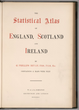
Bevan, G. Phillips
Full Title
(Title Page) The Statistical Atlas of England, Scotland and Ireland. By G. Phillips Bevan, F.S.S., F.G.S., Etc. Containing 45 Maps with Text. W. & A.K. Johnston, Edinburgh and London, MDCCCLXXXII.
Publisher
W. &. A.K. Johnston
Author
Bevan, G. Phillips
Full Title
(Text Page) Preface.
Publisher
W. &. A.K. Johnston
Author
British Admiralty
Full Title
America East Coast: Charleston Harbour, from the United States Coast Survey 1866. The notations in fine line are from U.S. Governt. Report of 1882. Engraved by J. & C. Walker. London. Published at the Admiralty April 1st. 1869 under the Superintendence of Captn. G.H. Richards, R.N., F.R.S. Hydrographer. Corrections and additions to Nov. 1881. (on lower margin) I 83 XII.84. 2806. (inset profile view) City of Charleston.
Publisher
British Admiralty
Author
Atlantic & Pacific Railroad
Full Title
Map of the First Operating Division of the Western Division, Atlantic & Pacific R.R., From Albuquerque to Coolidge. Drawing No. J2-902. Lewis Kingman, Chief Engineer.
Publisher
Atlantic & Pacific Railroad
Author
Atlantic & Pacific Railroad
Full Title
Map of the 2nd Operating Division of the Western Division, Atlantic & Pacific R.R., From Coolidge to Winslow. Drawing No. J-2-902.
Publisher
Atlantic & Pacific Railroad
Author
Atlantic & Pacific Railroad
Full Title
Map of the Third Operating Division of the Western Division, Atlantic & Pacific R.R., From From Winslow to Williams. Drawing No. J-2-902.
Publisher
Atlantic & Pacific Railroad
Author
Atlantic & Pacific Railroad
Full Title
Map of the 4th Operating Division of the Western Division, Atlantic & Pacific R.R., From Williams to Peach Springs. Drawing No. J-2-902.
Publisher
Atlantic & Pacific Railroad
Author
Atlantic & Pacific Railroad
Full Title
Map of the 5th Operating Division of the Western Division, Atlantic & Pacific R.R., From Peach Springs to Needles. W.A. Drake, Acting Chief Engineer. Drawing No. J-2-902.
Publisher
Atlantic & Pacific Railroad
Author
Atlantic & Pacific Railroad
Full Title
Map of the 6th Operating Division of the Western Division, Atlantic & Pacific R.R., From Needles to Mojave. Saml. M. Rowe, Resident Engineer. Drawing No. J-2-902.
Publisher
Atlantic & Pacific Railroad
Author
Atlantic & Pacific Railroad
Full Title
(Composite of) Maps of the First through Sixth Operating Divisions of the Western Division, Atlantic & Pacific Railroad, Albuquerque, New Mexico, to Mojave (Mohave), California.
Publisher
Atlantic & Pacific Railroad
Author
Bancroft, A.L.
Full Title
Bancroft's new map of California and Nevada : compiled from the latest and most reliable official sources and special surveys.
Publisher
A.L. Bancroft & Co.
Author
Bancroft, A.L.
Full Title
Bancroft's new map of California and Nevada : compiled from the latest and most reliable official sources and special surveys.
Publisher
A.L. Bancroft & Co.
Author
[Conder, C.R. (Claude Reignier), Kitchener, H.R. (Horatio Herbert)]
Full Title
(Sheet 2). Map of Western Palestine from Surveys Conducted for The Committee of the Palestine Exploration Fund ... Reduced from the One-Inch Map ... Special Edition Illustrating the Divisions of the Natural Drainage and the Mountain Ranges According to "An Introduction to the Survey of Western Palestine by Trelawney Saunders.
Publisher
Committee of the Palestine Exploration Fund
Author
[Conder, C.R. (Claude Reignier), Kitchener, H.R. (Horatio Herbert)]
Full Title
(Sheet 3). Western Palestine from Surveys Conducted for The Committee of the Palestine Exploration Fund ... Reduced from the One-Inch Map ... Special Edition Illustrating the Divisions of the Natural Drainage and the Mountain Ranges According to "An Introduction to the Survey of Western Palestine by Trelawney Saunders.
Publisher
Committee of the Palestine Exploration Fund
Author
[Conder, C.R. (Claude Reignier), Kitchener, H.R. (Horatio Herbert)]
Full Title
(Sheet 4). Map of Western Palestine from Surveys Conducted for The Committee of the Palestine Exploration Fund ... Reduced from the One-Inch Map ... Special Edition Illustrating the Divisions of the Natural Drainage and the Mountain Ranges According to "An Introduction to the Survey of Western Palestine by Trelawney Saunders.
Publisher
Committee of the Palestine Exploration Fund
Author
[Conder, C.R. (Claude Reignier), Kitchener, H.R. (Horatio Herbert)]
Full Title
(Sheet 5). Map of Western Palestine from Surveys Conducted for The Committee of the Palestine Exploration Fund ... Reduced from the One-Inch Map ... Special Edition Illustrating the Divisions of the Natural Drainage and the Mountain Ranges According to "An Introduction to the Survey of Western Palestine by Trelawney Saunders.
Publisher
Committee of the Palestine Exploration Fund
|