Who What Where WhenREMOVEWHEREShow MoreWHO
|
Author
United States. War Department
Full Title
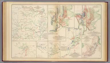
Rough sketch of reconnaissance, May 24th, 1862 (by) R.H. Rush, Col. Lancers. Map illustrating the Battle of Hanover, Va., May 27, 1862. Accompanying report of Brig. Gen. John H. Martindale ... Engagement near Hanover Court-House, Va., May 27, 1862. Accompanying report of Col. S.W. Stryker ... Reconnaissance made on the afternoon of May the 23d, 1862 (by) Alexander Doull ... Map of march from Mount Airey to Old Church, Va., May 23rd 1862 ... accompanying report of Col. R.O. Tyler ... Skirmish between two rebel batteries and Battery B, 1st Md. Arty., June 5th, 1862 at New Bridge, Va. Accompanying report of Captain A. Snow ... Battle of Mechanicsville, Va., June 26 and 27, 1862. Accompanying report of Brig. Gen. T. Seymour ... Sketch of the Battle of New Market, Va., June 30, 1862 ... Map to accompany the report of Brig. Gen. J.E.B. Stuart ... commanding Pamunkey Expedition to the enemy's rear, June 13, 14 and 15, 1862 ... Malvern Hill, Va., Morrell's Division, July 1st, 1862. Engagement near Hanover Court-House, Va., May 27, 1862. Accompanying report of Brig. Gen. D. Butterfield ... Topography of the battle-field of Cross Keys, Va. by Lieut. Col. John Pilsen ... Accompanying report of Maj. Gen. J.C. Fremont ... Map of route and positions, First Corps, Army of Virginia, Major General Sigel, commanding from July 7th to Sept. 10th 1862 (by) Franz Kappner, Maj. and Chf. Engr. Julius Bien & Co., Lith., N.Y. (1891-1895)
Publisher
U.S. Government Printing Office
Author
United States. War Department
Full Title
Map of the operations of the Cavalry Brigade commanded by Brig. Gen. J.E.B. Stuart from 25th June to 10th July 1862. Prepared by Capt. Wm. W. Blackford ... Map no. 2, operations of the Army of Virginia under Maj. Gen. John Pope. Battle-field of Cedar Mountain, August 9th 1862. W. Hoelcke ... Map no. 5, operations of the Army of Virginia ... Battle-field of Manassas, Va., close of the action August 29th, 1862. W. Hoelcke ... Map of the battle-field of Bull Run, August 29th and 30th 1862. Surveyed by order of Maj. Gen. Sigel under direction of Maj. Kappner by G. Stengel and U. de Fonvielle, November 1862. Map of the field operations of the Army of Virginia during the months of July and August 1862. Map no. 4, operations of the Army of Virginia under Maj. Gen. John Pope. Position of troops at sunset August 28th 1862. W. Hoelcke. Map no. 3, operations of the Army of Virginia under Maj. Gen. John Pope. Position of troops on the night of August 27th 1862. W. Hoelcke. Julius Bien & Co., Lith., N.Y. (1891-1895)
Publisher
U.S. Government Printing Office
Author
[Abbot, Henry L., Sigel, Franz, United States. War Department]
Full Title
Map of route and positions, First Corps, Army of Virginia. Major General Sigel, commanding, from August 27th to Sept. 1st 1862. Map of the engagement at Secessionville, James Island, S.C., June 16, 1862. Department of the Gulf, map no. 7. Grand Lake Region. Prepared by order of Maj. Gen. N.P. Banks. Henry L. Abbot ... Feb. 3rd, 1863. (with) Operations of Stuart's cavalry division around Groveton, Aug. 1862. (with) Map of route taken by scouting party under Maj. Gen. J.E.B. Stuart August 1862. Drawn by Wm. W. Blackford ... (with) Map to accompany the report of Maj. Gen. J.E.B. Stuart of the operations of the Cavalry Division during the advance of the Army of Northern Virginia toward the Rappahannock in August 1862. Drawn by Capt. W.W. Blackford ... (with) Map of cavalry expedition to Catlett's Sta., Major General Stuart, commd'g., Aug. 22d. 1862. Drawn by Wm. W. Blackford ... (with) Diagram showing the position of the 3d. Brigade on the battle field, October 3, 1862. (with) Diagram showing the field of battle, October 3rd and 4th, 1862. Julius Bien & Co., Lith., N.Y. (1891-1895)
Publisher
U.S. Government Printing Office
Author
United States. War Department
Full Title
Section of map prepared to exhibit the campaigns in which the Army of the Cumberland took part during the War of the Rebellion by order of Maj. Gen. Geo. H. Thomas, U.S.A. Compiled under the direction of Brevt. Maj. Gen. Z.B. Tower ... by Ed. Ruger ... assistants Capt. A. Kilp and Lieut. R. Flach, U.S. Colored Artillery (Heavy) and Asst. Top. Engrs. ... (with) Topographical plan of the city and battle-field of Baton Rouge, La. fought on the 5th of August 1862 drawn by Joseph Gorlinski ... (with) Map of the battle-field of Perryville, Ky ... October 8th 1862. Surveyed and compiled by order of Major General George H. Thomas, U.S.A. (with) Map of the battle-field of Perryville, Ky ... prepared by Walter J. Morris. (with) E. Sketch showing the position of the attacking and defending forces at the Siege of Washington, N.C., March 29 to April 16, 1863. Report of Maj. Gen. J.G. Foster ... Julius Bien & Co., Lith., N.Y. (1891-1895)
Publisher
U.S. Government Printing Office
Author
[Rosecrans, William S., United States. War Department]
Full Title
Plan of the battle of Corinth fought on the 3d and 4th of October,1862, between the Confederate forces under Major Generals Van Dorn, Price and Lovell and the United States forces under Major General Rosecrans. Accompanying official report respectfully forwarded (by) W.S. Rosecrans. (with) Map of the ground on which was fought the battle of Iuka, Miss. on the 19th of September 1862. (with) Sketch of engagement at Bayou Fourche, Ark. September 10, 1863 ... report of Col. John M. Glover ... (with) Sketch showing positions of pontoon bridges and guns covering them at Fredericksburg, Va., December 11-15, 1862 ... report of Lieut C.B. Comstock ... (with) Map showing the intrenchments around Wilmington. Surveyed and mapped under the direction of Capt. W.H. James ... by L.C. Turner, C.E., 1863 ... (with) Map of route followed by the Cavalry Division through Maryland into Pennsylvania under command of Maj. Gen. J.E.B. Stuart October 1862. Prepared by Wm. W. Blackford ... Julius Bien & Co., Lith., N.Y. (1891-1895)
Publisher
U.S. Government Printing Office
Author
[Soederquist, Oscar, United States. War Department]
Full Title
Military map of Suffolk and vicinity for Brig. Gen. E.L. Viele. Surveyed and drawn by Oscar Soederquist ... (with) Plan of Fort Esperanza, Tex. (with) Map of Morris Island and the adjacent creeks. From U.S. Coast Survey 1823-4. Sand hills from a survey 6th June 1862 ... indorsement (sic) of Gen. G.T. Beauregard ... (with) Proposed secondary line of defense on the peninsula between Ashepoo and Combahee Rivers, S.C., November 4, 1863 ... letter from Brig. Gen. W.S. Walker ... ... Julius Bien & Co., Lith., N.Y. (1891-1895)
Publisher
U.S. Government Printing Office
Author
U.S. War Department, Topographical Engineers
Full Title
Part of map of portions of the military departments of Washington, Pennsylvania, Annapolis and Northeastern Virginia. Compiled in the Bureau of Topographical Engrs., War Department &c., July 1861 ... report of Maj. Gen. Geo. B. McClellan ... and Maj. A.J. Myer ... Battle-fields of South Mountain showing the positions of the forces of the United States and of the enemy during the battle fought by the Army of the Potomac under the command of Maj. Gen. Geo. B. McClellan, Sept. 14, 1862. Prepared in the Bureau of Topographical Engineers. (with) Map accompanying Lieutenant General Pemberton's report of operations near Vicksburg, Miss., December 21, 1862, January 2, 1863. Surveyed and drawn by H.A. Pattison, Civil Engr. Julius Bien & Co., Lith., N.Y. (1891-1895)
Publisher
U.S. Government Printing Office
Author
[Bowen, Nicolas, United States. War Department]
Full Title
Map of the battle of the Antietam fought on the 16th and 17th September 1862 between the United States forces under the command of Maj. Gen. Geo. B. McClellan and the Confederates under Gen. Robert E. Lee. Prepared ... under the direction of 1st Lt. Nicholas Bowen ..., 1st Lt. A.H. Cushing ..., Chas. Shoemacker, E.F. Bowke, Jos. McMakin, C.A. Mallory, assts. ... October 1862. (with) Map of the battle of the Antietam ... sketched under the direction of Capt. J.C. Duane ... by Maj. D.C. Houston ..., Lt. N. Bowen, Lt. Js. H. Wilson, Lt. Jno. M. Wilson ..., Lt. W.A. Roebling ..., W.S. Long ..., Jos. McMackin ... (with) Engagement at deserted house or Kelly's Store near Suffolk, Va., January 30th 1863 (with) Battle-field of Gettysburg, July 1-4, 1863. Drawn by Thomas Peters ... (with) Map of the position of the cavalry during the engagement of April 4th 1863 ... (with) Map of that portion of the battle-field of Antietam occupied by the troops under Maj. Gen. Burnside ... from surveys made under the supervision of Capt. R.S. Williamson ... by H.C. Fillebrown, E.S. Waters, Civ. Eng'rs. Julius Bien & Co., Lith., N.Y. (1891-1895)
Publisher
U.S. Government Printing Office
Author
[Michler, Nathaniel, United States. War Department]
Full Title
Antietam. Prepared by Bvt. Brig. Gen. N. Michler, Major of Engineers from surveys under his direction ... 1867. Compiled and drawn by Maj. J.E. Weyss, assisted by F. Theilkuhl, J. Strasser and G. Thompson. ... Map of the battle-fields of Harper's Ferry and Sharpsburg with position of troops, routes of Army &c., Sept. 13 to 17, 1862 ... by S. Howell Brown, 1st. Lieut. Engr. Troops ... Jan. 27, 1864. To accompany report of General Robert E. Lee, C.S. Army. Julius Bien & Co., Lith., N.Y. (1891-1895)
Publisher
U.S. Government Printing Office
Author
[Michler, Nathaniel, United States. War Department]
Full Title
10. New map of Tennessee by Capt. Michler, Topl. Engineers, U.S.A. (with) 9. Topographical sketch of the battle-field of Stone's River near Murphreesborough, Tenn., December 31st 1862 to January 3d. 1863. Maj. Gen. W.S. Rosecrans ... Forces of the United States. General Braxton Bragg commanding enemy's forces. (with) Position of 1st Division 3rd Corps at noon December 13, 1862. Drawn by direction of Brig. Gen. D.B. Birney ... (by) J.C. Briscoe ... (with) Position held by the 1st Division 3rd Corps after having repulsed the enemy December 13, 1862. Drawn by direction of Brig. Gen. D.B. Birney ... (by) J.C. Briscoe ... (with) Map of Huntersville line commanded by Col. Wm. L. Jackson. (with) Sketch showing the positions of Liddell's division consisting of Walthall's and Govan's brigades in the Battle of Chickamauga, September 18, 19 and 20, 1863. Accompanying report of Brig. Gen. St. John R. Liddell, C.S. Army. Julius Bien & Co., Lith., N.Y. (1891-1895)
Publisher
U.S. Government Printing Office
Author
United States. War Department
Full Title
Map of the battle of Murfreesborough fought Dec. 30th, 1862 to Jan. 3d., 1863, between the Confederate forces under General Bragg and Federal forces under Major General Rosecrans. (with) "1" Map of the Stone's River Campaign. C. Meister, draughtsman ... (with) Map showing the movements of Johnson's brigade and Darden's attached battery in the battle before Murfreesborough, Tenn., Dec. 31, 1862. ... accompanying report of Brig. Gen R.B. Johnson ... (with) Sketch of the Battle of Fredericksburg, Saturday Dec. 13th 1862, Right Wing, C.S.A., Lieutenant General Jackson's Corps by Jed. Hotchkiss. (with) Survey of fortifications and environs of Tullahoma between the Shelbyville and Lynchburg roads. Drawn by J.H. Haney. (with) Map of the battle-field of Thompson's Hill, Port Gibson showing the positions of the 9th Div., 13th Army Corps commanded by Brig. Gen. P.J. Osterhaus, May 1, 1863. Sketched by F. Tunica, engineer. Julius Bien & Co., Lith., N.Y. (1891-1895)
Publisher
U.S. Government Printing Office
Author
[Morris, Walter J., United States. War Department]
Full Title
Bb. Plan of the battles on Stone's River before Murfreesborough. Gen. Bragg, commdg. Confederate Army, Maj. Gen. Rosecrans, commdg. Federal Army, Dec. 31, 1862, Jan. 1, 2, 3, 1863. ... by Walter J. Morris ... (with) Position of the divisions of Humphreys, Whipple, Griffin and Sykes at the battle of Fredericksburg on Dec. 13th, 1862. (with) V. Plan of Sabine Pass, of its defenses and means of communication. J. Kellersberg(er) ... October 15th, 1863. (with) Rebel fortifications, Grand Gulf, Miss. Surveyed May, 1863, drawn October, 1863 by H.A. Ulffers, Asst. Engr. (with) Skirmishes near Liberty Gap, Tenn., June 24-26, 1863 ... report of Brig. Gen St. John R. Liddell, C.S. Army. (with) Map of the approaches to Little Rock, Ark., made under directions from Maj. Gen. Sterling Price ... by Capt. T.J. Mackey, C.S. Engrs., August, 1863 ... Julius Bien & Co., Lith., N.Y. (1891-1895)
Publisher
U.S. Government Printing Office
Author
[Michler, Nathaniel, United States. War Department]
Full Title
Fredericksburg. Prepared by Bvt. Brig. Gen. N. Michler ... by order of ... A.A. Humphreys. 1867. (with) Map exhibiting the route of the Sioux Expedition under the command of Brig. Gen. H.H. Sibley, 1863. Compiled and projected by John H. Wagner ... (with) Map of the fight of the 14th A.C. at Buzzard Roost, Ga., February 24th, 25th and 26th, 1864 by Theo. Wiseman, A.A. ... (with) Sketch of battle of Big Mound, fought July 24th, 1863 by the expeditionary forces commanded by Brigadier General H.H. Sibley. Sketched and drawn by Joseph McCloud. (with) Sketch of the battle at Dead Buffalo Lake, July 26th, 1863, commanded by Brig. Gen. H.H. Sibley. (with) Map accompanying report of the battle of Dry Fork Creek, Mo., on the 5th of July, 1861 ... report of Capt. T.W. Sweeny ... Julius Bien & Co., Lith., N.Y. (1891-1895)
Publisher
U.S. Government Printing Office
Author
[Merrill, William E., United States. War Department]
Full Title
Vicinity of Readyville, Bradyville and Woodbury. Compiled ... under the direction of Capt. W.E. Merrill. Printed in the field by Capt. W.C. Margedant's new method for field map printing. June 28th, 1863. Capt. W.C. Margedant's new method for quick field maps ... (Manchester, Jackborough, McMinnville) (with) No. 1. Shelbyville and vicinity from general information by Capt. W.E. Merrill ... June 10th, 1863. (with) Quick map July 4th, 1863. Compiled under the direction of Capt. W.E. Merrill ... (with) Quick map, July 5th, 1863. Compiled under the direction of Capt. W.E. Merrill ... Julius Bien & Co., Lith., N.Y. (1891-1895)
Publisher
U.S. Government Printing Office
Author
[Merrill, William E., United States. War Department]
Full Title
Vicinity of Decherd. Compiled in the field ... under the direction of Capt. W.E. Merrill ... printed ... by Capt. Margedant's new method for field map printing, July 20th, 1863. Manchester and vicinity ... July 24, 1863. Sketch of Tullahoma, Tenn. and vicinity ... July 6th, 1863. Proposed road along south bank of new canal from Duckport to Walnut Bayou, thence barges towed by Victor to Richmond. Accompanying letter of ... W.T. Sherman ... Jasper and vicinity ... July 24, 1863. Chattanooga and vicinity ... July 20th, 1863. Shelbyville and vicinity. From a survey by Capt. C. Dunham ... July 17th, 1863. Julius Bien & Co., Lith., N.Y. (1891-1895)
Publisher
U.S. Government Printing Office
Author
[Matz, Otto H., United States. War Department]
Full Title
Map of the country between Milliken's Bend, La. and Jackson, Miss. showing the routes followed by the Army of the Tennessee under the command of Maj. Gen. U.S. Grant, U.S. Vls. in its march from Milliken's Bend to rear of Vicksburg in April and May 1863. Compiled, surveyed and drawn under the direction of Lt. Col. J.H. Wilson ... Drawn by Maj. Otto H. Matz ... and 1st Lieut. L. Helmle ... Map of the siege of Vicksburg, Miss. by the U.S. forces under the command of Maj. Gen. U.S. Grant ... Maj. F.E. Prime, Chief Engr. Surveyed and constructed under direction of Capt. C.B. Comstock ... by Major Otto H. Matz ..., Chs. Spangenberg ..., Lieuts. Patton, Karnasch and Helmle ..., L. Zwanziger, S.R. Tresilian, B. Barth, S. Hartwell, asst. engrs. Drawn by Chs. Spangenberg ... Julius Bien & Co., Lith., N.Y. (1891-1895)
Publisher
U.S. Government Printing Office
Author
United States. War Department
Full Title
Map of the approaches to Petersburg and their defenses, 1863. By order of the Engineer Bureau, Col. J.F. Gilmer ... Col. W.H. Stevens ... Capt. Chas. H. Dimmock, C.S.E., in charge of defenses, Petersburg, Va. Map of the battle-field of Gettysburg, Pa. July 1, 2 and 3, 1863. (with) B. Sketch showing route of the Burnside Expedition. Accompanying report of Maj. Gen. J.G. Foster, C.S. Army ... (with) C. Sketch showing the route to New Berne pursued by the Burnside Expedition, March 13 and 14, 1862. (with) Map showing the positions of Maj. Gen. S.G. French's forces at Lovejoy's Station, Ga. from Sept. 3d. to Sept. 8th, 1864. Julius Bien & Co., Lith., N.Y. (1891-1895)
Publisher
U.S. Government Printing Office
Author
[Confederate States of America. Army of Northern Virginia, Confederate States of America. Army, Hotchkiss, Jed.]
Full Title
Sketch of the battles of Chancellorsville, Salem Church and Fredericksburg, May 2, 3 and 4, 1863. Prepared by order of General R.E. Lee, by Jed. Hotchkiss, Topogl. Engr., 2d. Corps, A.N.V. (with) Map of the action at Dranesville, Va., December 20th, 1861. U.S. forces commanded by Brig. Gen. E.O.C. Ord. Drawn by H.H. Strickler ... 1875. Julius Bien & Co., Lith., N.Y. (1891-1895)
Publisher
U.S. Government Printing Office
Author
United States. War Department
Full Title
Military map showing the topographical features of the country adjacent to Harper's Ferry, Va. including Maryland, Loudoun and Bolivar heights and portions of South and Short mountains with the positions of the defensive works, also the junction of the Potomac and Shenandoah rivers and their passage through the Blue Ridge. Surveyed from August 3d to Sept. 30th 1863 under the direction of Capt. N. Michler, Corps of Engrs., U.S. Army, by Major John E. Weyss ... Army of the Potomac. Map of the vicinity of Hagerstown, Funkstown, Williamsport and Falling Waters, Md. Accompanying the report of Major General G.G. Meade on the Battle of Gettysburg dated October 1st 1863. (with) Battle of Slaughter's Mountain, sketch of field August 9, 1862. (with) Sketch of that part of field at Cold Harbor where Ewell's Division operated, particularly where Trimble's Brigade fought, June 27, 1862. (with) Sketch of the battle-field of Cross Keys, Va., June 8, 1862. ... Julius Bien & Co., Lith., N.Y. (1891-1895)
Publisher
U.S. Government Printing Office
Author
[Brown, S. Howell, Confederate States of America. Army of Northern Virginia, Confederate States of America. Army]
Full Title
Map of the battle-field of Gettysburg with positions of troops, July 2nd, 1863. Topl. Office, A.N.V., by L. Howell Brown ... copied by Hoffmann. Accompanying report of Gen. R.E. Lee, C.S. Army. (with) Sketch of the battle of Gettysburg, July 1st, 2nd and 3rd, 1863 to accompany report of Lieut. Gen. R.S. Ewell ... by Jed. Hotchkiss. (with) Sketch of the second battle of Winchester, June 13th, 14th and 15th, 1863 ... by Jed. Hotchkiss. (with. Marietta Region) Accompanying report of Brig. Gen. K. Garrard. (with Dallas Region) Marked "McPherson" by Gen. Sherman. (with Dallas Region) Marked "McPherson" by Gen. Sherman. (with) Sketch of routes, 2nd Corps A.N.V. from Fredericksburg, Va. to Gettysburg, Pa. and return to Orange C.H., Va. from June 4th 1863 to August 1st, 1863. To accompany report of Lieut. Gen. R.S. Ewell ... by Jed. Hotchkiss. (with) Texas Coast showing points of occupation of expedition under Maj. Gen. N.P. Banks, November 1863. (with Dallas Region). Marked "McPherson" by Gen. Sherman. Julius Bien & Co., Lith., N.Y. (1891-1895)
Publisher
U.S. Government Printing Office
Author
United States. War Department
Full Title
Plan of a portion of the siege operations against the defenses of Charleston Harbor showing the left batteries. Executed by order of Maj. General Q.A. Gillmore under the direction of Maj. T.B. Brooks, A.D.C., Lieut. C.R. Suter, U.S.E., Lieut. P.S. Michie, U.S.E., assistant engineers. Plate IV. ... Plan of a portion of the siege operations against the defenses of Charleston Harbor prior to the capture of Fort Wagner, Sept. 7, 1863. Executed by order of Major-General Q.A. Gillmore ... Plate III. Sketch showing the operations of the Army of the Potomac from Nov. 26 to Dec. 3, 1863. Julius Bien & Co., Lith., N.Y. (1891-1895)
Publisher
U.S. Government Printing Office
Author
[Confederate States of America. Army of Northern Virginia, Confederate States of America. Army, Hoffman, J. Paul, Hoffman, United States. War Department]
Full Title
Map of Orange County &c., Va. embracing the details and plan of operations of Confederate and Federal forces at Mine Run and Rapidan River by order of ... W.P. Smith, Lt., Col. of Engrs., Topl. Office, A.N.V. Prepared by J. Paul Hoffman. Accompanying report of General R.E. Lee, C.S. Army. (with) Part of map of portions of the military departments of Washington, Pennsylvania, Annapolis and Northeastern Virginia. Compiled in the Bureau of Topographical Engrs., War Department &c., 1861. Accompanying report of Capt. L.B. Norton ... (with Decatur, Howard's Plantation). From original in possession of Gen. W.T. Sherman. (with Brownings C.H.-Stone Mountain) C.B. Reese, Capt. Engrs. From original in possession of Gen W.T. Sherman. (with Campbellton Region) Accompanying letter of Maj. Gen. George Stoneman. (with) Map to show lines of march of Second Army Corps and the enemy, Oct. 14, 1863 ... report of ... G.K. Warren. (with) Map of battle-field at Bristoe fought by 2d Army Corps commanded by Maj. Gen. G.K. Warren, October 14, 1863. (with) Map of Missionary Ridge, Tenn. showing the positions attacked by the forces under the command of Maj. Gen. W.T. Sherman, Nov. 24th and 25th, 1863. Julius Bien & Co., Lith., N.Y. (1891-1895)
Publisher
U.S. Government Printing Office
Author
[Ruger, Edward, United States. War Department]
Full Title
Sheet no. 1. Map of the battle-field of Chickamauga, September 19th, 1863 between the United States forces commanded by Maj. Gen. W.S. Rosecrans and the rebel army under Gen. Braxton Bragg. Compiled under the direction of Col. W.E. Merrell ... by Edward Ruger ... Sheet no. 2. Map of the battle-field of Chickamauga, September 20th, 1863 ... (with) Map showing the expedition of the 15th Army Corps, Maj. Gen. P.J. Osterhaus, commanding, Turkeytown Valley, Ala., October 24-26, 1864. (with) Battle of Chickamauga, Walker Co., Georgia, Sept. 19 and 20, 1863. From original in the possession of General Braxton Bragg, C.S. Army. Julius Bien & Co., Lith., N.Y. (1891-1895)
Publisher
U.S. Government Printing Office
Author
[Morris, Walter J., United States. War Department]
Full Title
Map of the fall campaigns of the Army of Missouri, Maj. Gen. Sterling Price, commanding in Sept., Oct., Nov. 1864. Capt. T.J. Mackey, Chf. Engr. (with) No. 2. Map of the battle of Chickamauga showing the positions of the Confederate and Federal armies on the 19th September, 1863 ... by Walter J. Morris ... (with) No. 3. Map of the battle of Chickamauga ... 19th September 1863 ... by Walter J. Morris ... (with Marietta Region, Georgia). Accompanying letter of Maj. Gen. J.M. Scholfield ... (with Peach Tree Creek Region, Georgia) Marked "Thomas" by Gen. Sherman. (with) Mine Run, Va. and vicinity, 1863. (with) No. 1. Map showing the positions of the Confederate Army and that of the Federal Army at midnight on the 18th of September, 1863, the night previous to the general engagements of the 19th and 20th Sept., or the Battle of Chickamauga ... by Walter J. Morris ... (with) Map of the engagement at Wauhatchie, Tenn., October 28th and 29th, 1863 and of the operations of the 11th and 12th Army Corps preliminary thereto. Accompanying report of Maj. Gen. Joseph Hooker. Julius Bien & Co., Lith., N.Y. (1891-1895)
Publisher
U.S. Government Printing Office
Author
[Anstey, E. G., Confederate States of America. Army, Rockwell, Cleveland, United States. War Department]
Full Title
Map no. 1. The Chickamauga Campaign, August 16-September 22, 1863. E.G. Anstey, draughtsman. Accompanying report of Gen. Braxton Bragg, C.S. Army. Topographical map of the approaches and defenses of Knoxville, E. Tennessee, showing the positions occupied by the United States and Confederate forces during the siege. Surveyed by direction of Capt. O.M. Poe ... during Dec., Jan. and Feb., 1863-4 by Cleveland Rockwell, Sub. Asst., U.S. Coast Survey, R.H. Talcott, aide. (with Dallas Line, Georgia). Accompanying letter of Maj. Gen. Jas. B. McPherson ... (with Dallas Line, Georgia). Original marked "McPherson May 27." From original in possession of Gen. W.T. Sherman. (with) Sketch of roads from Gen. McCook's hdqrs. near junction of Acworth and Dallas and Marietta roads to Acworth and Big Shanty and R.R. ... 1864. From original in possession of Gen. W.T. Sherman. Julius Bien & Co., Lith., N.Y. (1891-1895)
Publisher
U.S. Government Printing Office
Author
[Howard, Oliver O., Mergell, C. S., United States. War Department]
Full Title
Map of the battle-field of Chattanooga. Prepared to accompany report of Maj. Gen. U.S. Grant. By direction of Brig. Gen. W.F. Smith ... 1864. Compiled and drawn by C.S. Mergell. Position of troops, etc. drawn by E. Hergesheimer. Map accompanying report of Maj. Gen. O.O. Howard. (with) McPherson's crossing at Roswell. From original in possession of Gen. W.T. Sherman. (with Marietta Region by) C.W. Skinner. Accompanying letter of Brig. Gen. Garrard. (with Chattahoochee River) marked "Schofield" in Gen. Sherman's handwriting. Julius Bien & Co., Lith., N.Y. (1891-1895)
Publisher
U.S. Government Printing Office
Author
[Stevenson, Carter L., United States. War Department]
Full Title
Battle of Lookout Mountain, Tenn., November 24, 1863. Map of the line west of Chattanooga Creek. Accompanying report of Maj. Gen. Carter L. Stevenson, C.S. Army ... (with) Map of country in vicinity of Brown's Ferry. Made to accompany report of Brig. Gen. Wm. F. Smith ... Drawn ... Nov. 5, 1863 by C.S. Mergell. (with) Map of the battle-field of Missionary Ridge showing the positions of Maj. Gen. Sheridan's and Brig. Gen. T.J. Wood's divisions ... Novbr. 23, 24 and 25, 1863 under command of Maj. Gen. Gordon Granger. (with) Map illustrating the positions of the Second Division, Fourth Army Corps, under the command of Maj. Gen. P.H. Sheridan, U.S. Army in front of Chattanooga, Tenn., November 23 to 25, 1863. (with) Chattanooga and vicinity. Accompanying report of Maj. Gen. C.L. Stevenson, C.S. Army. (with) Red River Expedition, 1864. 12th April, 1864, C. Fendall. Accompanying letter of Rear-Admiral D.D. Porter, U.S. Navy. Julius Bien & Co., Lith., N.Y. (1891-1895)
Publisher
U.S. Government Printing Office
Author
[Bush, H. M., United States. War Department]
Full Title
Map of the country between Vicksburg and Meridian, Miss. showing the route followed by the Seventeenth Army Corps under the command of Maj. Gen. J.B. McPherson in February, 1864. Surveyed by Lt. H.M. Bush and assistants S. Davis and S.W. Dunning under the direction of Capt. A. Hickenlooper, Chf. Engr. (with) Sketch of the city of Atlanta and line of defenses. L.P. Grant, Capt. Engs. (with) Sketch of battery. L.P. Grant, Capt. Engs. (with) Map of Smith's Island, N.C. Prepared under the direction of Capt. Wm. H. James, Chf. Engr. by Lieut. B.L. Blackford, Top. Engr., Nov., 1863. Accompanying letter of Maj. Gen. W.H.C. Whiting, C.S. Army. Julius Bien & Co., Lith., N.Y. (1891-1895)
Publisher
U.S. Government Printing Office
Author
United States. War Department
Full Title
Valley of the Red River, La., Mississippi River to Shreveport illustrating the campaign under Major-General N.P. Banks in the spring of 1864, prepared to accompany his report from information furnished by Col. John S. Clark, A.D.C., in the Engineer Bureau, War Department, Jan. 1865, drawn by Theo. von Kamecke. ... Julius Bien & Co., Lith., N.Y. (1891-1895)
Publisher
U.S. Government Printing Office
Author
Confederate States of America. Army
Full Title
Parts of Arkansas and Louisiana. Respectfully forwarded, Richd. M. Venable ... Accompanying the report of Gen. E. Kirby Smith, C.S. Army. Section including falls and dam in Red River. Prepared by order of B'v't. Brig. Gen. J. Bailey by Lieut. W.S. Trask ... (with) Sketch of the battle-field of Ocean Pond, Fla., February 20th, 1864. M.B. Grant, Lieut., Corps Engrs., C.S.A., del. (with) Part of Louisiana. Sketch of General Liddell's plan, January, 1864. Accompanying letter of Maj. Gen. R. Taylor, C.S. Army. Julius Bien & Co., Lith., N.Y. (1891-1895)
Publisher
U.S. Government Printing Office
Author
United States. War Department
Full Title
Map of Texas and part of New Mexico, compiled in the Bureau of Topographl. Engrs. chiefly for military purposes. Information on this map furnished by Wm. E. Young, C.E. and compiled under the direction of Maj. D.C. Houston, Chief Engr., Dept. of the Gulf. Accompanying letter of Gen. N.P. Banks ... (with) Plan of the battle-field at New Creek, W. Va., August 4th, 1864. (with) Plan of the battle-field at Pleasant Mills near Cumberland, Md., August 1st, 1864. Made by F.M. Knight. ... Julius Bien & Co., Lith., N.Y. (1891-1895)
Publisher
U.S. Government Printing Office
Author
United States. War Department
Full Title
Map of the battle-field of the Wilderness, Va., May 5th, 6th and 7th., 1864 showing the field of operations of the Army of the Potomac commanded by Gen. George G. Meade, U.S.A. Surveyed under the orders of Bvt. Col. J.C. Duane ... by Bvt. Maj. C.W. Howell ... Assisted by Messrs. L. C. Oswell, L. Bell and R.B. Talfor. Map of the battle-field of Spotsylvania C.H., Va. ... From May 8th to 21st, 1864. Surveyed under the orders of Bvt. Col. J.C. Duane ... by Bvt. Maj. C. W. Howell ... Assisted by Messrs L.C. Oswell, L. Bell and R.B. Talfor. Map of the country in the vicinity of Todd's Tavern, Va. with the position of the 2nd Corps, Army of the Potomac, May 8th, 1864 ... Map of the battle-fields of North Anna ... from May 3d to 27th, 1864 .. Map of the battle-fields of the Totopotomoy and Bethesda Church, Va. ... from May 28th to June 2d 1864 ... Positions of the Army of the Ohio in front of Dalton, Ga., May 8 and 9, 1864. Accompanying letter of Maj. Gen. J.M. Schofield, U.S. Army. Julius Bien & Co., Lith., N.Y. (1891-1895)
Publisher
U.S. Government Printing Office
Author
United States. War Department
Full Title
Map of the vicinity of Petersburg, Va., 1862. "Copy of map furnished General Gillmore ... June 9, 1864." Accompanying letter of Maj. Gen. B.F. Butler ... (with) No. 15. The Atlanta Campaign, operations of the 4th Army Corps from June 15th to July 3d 1864. Accompanying report of Maj. Gen. O.O. Howard ... (with) No. 16. The Atlanta Campaign, operations of the 4th Army Corps from July 3d to 5th 1864. (with) No. 17. The Atlanta Campaign, operations of the 4th Army Corps from July 5th to 18th 1864. (with) Position of the Army of the Tennessee from May 27th to June 4th 1864. (with) Battle ground of the Army of the Tennessee under command of the late Maj. Gen. James B. McPherson before Atlanta, Ga., July 22d 1864. (with) Battle-ground of the Army of the Tennessee under the command of Maj. Gen. O.O. Howard before Atlanta, Ga., July 28th 1864 ... C.B. Reese, Capt. of Engineers ... (with) No. 18. The Atlanta Campaign, operations of the 4th Army Corps from July 18th to 27th 1864. Julius Bien & Co., Lith., N.Y. (1891-1895)
Publisher
U.S. Government Printing Office
Author
United States. War Department
Full Title
Map illustrating the operations of the Army under command of General W.T. Sherman in Georgia From May the 5th to September the 4th 1864. Compiled and drawn under the direction of Bvt. Brig. Gen. O.M. Poe ... by J. v. Glumer. Map illustrating the first epoch of the Atlanta Campaign. Embracing the region from the Tennessee River to the Oostanaula River ... Commanding United States forces Major-General W.T. Sherman, commanding rebel forces Lieut. General J.E. Johnston. Compiled by Edward Ruger. Map showing the roads followed by the Army of the Tennessee in its march from Chattanooga, Tenn. to Atlanta, Ga. ... Made under the direction of Capt. C.B. Reese ... Drawn and compiled by Capt. I. Helmle ... Accompanying report of Maj. Gen. O.O. Howard ... Julius Bien & Co., Lith., N.Y. (1891-1895)
Publisher
U.S. Government Printing Office
Author
[Ruger, Edward, United States. War Department]
Full Title
Map illustrating the second epoch of the Atlanta Campaign. Embracing the region from Resaca to the Etowah River ... Commanding United States forces, Major-General W.T. Sherman. Commanding rebel forces, Lieut. General J.E. Johnston. Compiled by Edward Ruger. (with) Map showing the march of the 15th Army Corps, Maj. Gen. John A. Logan, com'd'g., through Northern Georgia in the campaign of 1864. (with) Plate 1. Position of the 15th Army Corps, Army of the Tennessee, before and during the siege of Resaca, Ga., May 10th till May 16th 1864. (with) Plate II. Position of the 15th Army Corps from the 27th to the 31st of May, 1864. (with) Plate III. Position of the 15th Army Corps, Army of the Tennessee near New Hope Church, Ga., on June the 4th, 1864. (with) Plate IV. Showing the different positions of 15th Army Corps, Maj. Gen. John A. Logan, commanding, during the siege of Kenesaw Mountain, Ga. from June 10th till July 3d 1864. Julius Bien & Co., Lith., N.Y. (1891-1895)
Publisher
U.S. Government Printing Office
Author
[Ruger, Edward, United States. War Department]
Full Title
Map illustrating the third epoch of the Atlanta Campaign. Embracing the region from the Etowah River south to include Marietta and Dallas ... Commanding United States forces, Major-General W.T. Sherman, commanding rebel forces, Lieutenant-General J.E. Johnston. Compiled by Edward Ruger. (with) Positions, 4th Division, 16th Army Corps June 11th to 22nd 1864. Accompanying report of Brig. Gen. John W. Fuller. (with) Position, 4th Division, 16th Army Corps, July 4, 1864. (with) Positions, Fourth Division, 16th Army Corps, May 13 to 16, 1864 at Resaca, Ga. (with) Position, 4th Division, 16th Army Corps, May 27, 1864. (with) Plate VII. Position of the 15th Army Corps before Jonesborough, Ga. from August 30th to September 2d, 1864. Accompanying report of Maj. Gen. John A. Logan. (with) Plate VI. Position of the 15th Army Corps before Atlanta, Ga. from July 28th to August 26th 1864. (with) Plate V. Position of the 15th Army Corps, Maj. Gen. John A. Logan, com'd'g. at Nickajack Creek, Ga. from July 7th to 10th 1864. (with) Position of the 1st Division, 15th Army Corps near Jonesborough, Ga. Maj. Gen. P.J. Osterhaus, comm'd'g. Julius Bien & Co., Lith., N.Y. (1891-1895)
Publisher
U.S. Government Printing Office
Author
[Ruger, Edward, United States. War Department]
Full Title
Map illustrating the fourth epoch of the Atlanta Campaign. Embracing the region from Pine, Lost and Kenesaw mountains south to include Atlanta and its environs ... Commanding United States forces, Major-General W.T. Sherman, commanding rebel forces, Lieutenant-General J.E. Johnston, relieved by Lieutenant-General J.B. Hood. Compiled by Edward Ruger. Map illustrating the fifth epoch of the Atlanta Campaign. Embracing the region from the Chattahoochee River south to include Jonesborough and Lovejoy's Station ... Julius Bien & Co., Lith., N.Y. (1891-1895)
Publisher
U.S. Government Printing Office
Author
United States. War Department
Full Title
Topographical sketch of the battle of Bethel, Va., June 10th, 1861. (with) Position, Left Wing, 16th Army Corps, September 3d to 5th, 1864 near Lovejoy's Station, Ga. (with) July 22, 1864. To accompany official report of Maj. Gen. Frank P. Blair ... by Lieut Levi Coffman. (with) Position of the 17th Army Corps before Atlanta, Ga., July 22d 1864 ... (with) Position near Jonesborough, Ga. occupied by 2nd Division, 15th Army Corps from August 30th to September 2, 1864. (with) Sketch of the siege of Blakely, Ala. invested April 2d. by the forces under Maj. Gen. F. Steele. Assault April 9th 1865. Drawn by Gen. C.C. Andrews, May 1866. (with) Position of the Left Wing, 16th Army Corps near Jonesborough, Ga. (with) Position of the Left Wing, 16th Army Corps, September 10, 1864. (with) Line of march of Left Wing, 16th Army Corps from April 29 to May 4, 1864. (with) Position, Left Wing, 16th Army Corps, Resaca, Ga., May 14th, 15th and 16th, 1864. (with) Position, Left Wing, 16th Army Corps ... July 4, 1864. (with) Position, 16th Army Corps, May 16, 1864. (with) Position, Left Wing, 16th Army Corps ... May 26 to June 1st 1864. (with) Position, Left Wing, 16th A.C. near Owen's Mill, Ga., June 1st to 5th 1864. (with) Position of 16th Army Corps from July 26th to August 26th 1864. Julius Bien & Co., Lith., N.Y. (1891-1895)
Publisher
U.S. Government Printing Office
Author
United States. War Department
Full Title
Line of march of the Left Wing, 16th Army Corps from May 5th to Sept. 8th, 1864. (with) Position of the Left Wing, 16th A.C. ... July 11, 1864. (with) Map showing the position of Left Wing, 16th Army Corps during the engagement near Atlanta July 22, 1864. (with Atlanta Campaign). (with) Diagram of the battle-field occupied by Gen. Blair, 17th Army Corps ... July 5th to 11th 1864 on the Chattahoochee. (with) Position of Left Wing ... in front of Kenesaw Mountain. (with) Map showing position of the Confederate armies of Mississippi and Tennessee under command of Gen. J.E. Johnston May 19th 1864. (with) Position of 4th Div., 17th Army Corps, July 22d, 1864. (with) Diagram of the general situation during the siege of Atlanta. (with Marietta Ga. June 10-July 3, 1864). (with) Diagram showing the advance of the 3d. Brig., 4th Div., 17th Corps on the Sandtown Road to Widow Mitchell's farm and from there east to the Nickajack. July 3, 4 and 5th 1864. (with) Diagram showing the flank movement of the 17th Army Corps from Turner's Ferry, July 16, 1864, by way of Marietta and Roswell to south of Decatur and east of Atlanta to the extreme left of the Army. (with Marietta, Ga. June 10-July 3, 1864). (with Marietta Ga. June 10-July 3, 1864). Julius Bien & Co., Lith., N.Y. (1891-1895)
Publisher
U.S. Government Printing Office
Author
[Palfrey, John C., United States. War Department]
Full Title
"A." Plan of siege operations against Fort Morgan, Ala., by the U.S. forces under Maj. Gen. Gordon Granger, August, 1864. Capt. John C. Palfrey, Corps of Engr's.. Lieut. A.H. Burnham, Lieut. Chas. J. Allen ... in charge of works. Surveyed and drawn by Capt. W.H. Wheeler, Lt. S.E. McGregory ... (with) Diagram of battle-field at Harrisburg, Miss. Battle fought July 14th, 1864. Drawn by Capt. D.W. Wellman. (with) Map of the roads and adjacent country between Stubb's Plantation and Brice's Cross-roads, Miss. (with) Snake Creek Gap, Ga. (with) Sketch of vicinity of 2d. Cav. Div. camp. K. Garrard ... (with) Defense of Fort Morgan by Brig. Gen. R.L. Page, P.A.C.S., August 1864. A true copy of the engineers' record, J. Gallimard ... (with) Defense of Fort Morgan, entrance of Mobile Bay ... (with) Map of the battle of Fredericksburg, Va., December 13, 1862. (with) Map of battle-field of Mechanicsville and Cold Harbor, Va. Julius Bien & Co., Lith., N.Y. (1891-1895)
Publisher
U.S. Government Printing Office
Author
United States. War Department
Full Title
Appendix 65. Engineer Department, Hdqrs. Army of the Potomac, July 28th, 1864 (Petersburg, Virginia Region). Submitted by Maj. J.C. Duane ... (with) Appendix 66. Plan showing part of the line of the U.S. forces on July 29th, 1864. (with) Sketch explanatory of the positions and operations of the Artillery, Army of the Potomac, July 30th, 1864. To accompany the report of Brig. Gen. H.J. Hunt, Chf. of Art'y. (with) Reconnaissance beyond the Chickahominy at bottom's and railroad bridges, May 21st, 1862. Made by Lieuts. Comstock and McAlester. Julius Bien & Co., Lith., N.Y. (1891-1895)
Publisher
U.S. Government Printing Office
Author
[United States. War Department, Walker, Tipton]
Full Title
Coast of Texas and its defenses, Capt. Tipton Walker, Chief of Topographical Bureau of Texas, New Mexico and Arizona, drawn by P. Helferich, Asst. Engr. 1864. (with) Engineer Office, 10th Army Corps, sketch no. 8 of road between Bermuda Hundred and enemy's first line of intrenchments on the north and Petersburg on the south. T.B. Brooks, Maj. A.D.C. and Directing Engineer. (with Marietta, Ga., June 10-July 3, 1864). Original marked "Thomas and Schofield." (with Marietta, Ga., June 10-July 3, 1864). Original marked "Garrard." (with) Schofield crossing the Chattahoochee. (with Marietta, Ga., June 10-July 3, 1864). (with) No. 3. Sketch of defensive works at Deep Bottom, Va. (with) Section through Dutch Gap, James River, Va. (with) Plan of Dutch Gap Canal and fortifications, James River, Va., Sept. 10, 1864. P.S. Michie. (with) No. 2. Sketch of road from pontoon-bridge at Point of Rocks to Petersburg, showing line of works captured by 18th Army Corps. Julius Bien & Co., Lith., N.Y. (1891-1895)
Publisher
U.S. Government Printing Office
Author
United States. War Department
Full Title
Campaign against Sterling Price, 1864, Maj. Gen. S.R. Curtis, commanding. Executed under the direction of Lieut. G.T. Robinson, Chief Engineer, by Jacob Miller ... Westport and Big Blue, Mo. Westport and Big Blue, Oct. 22 and 23, 1864, by L.G. Bennett, Topogr. Engineer. Battle-ground of Westport, Oct. 23, 1864 by L.G. Bennett. Battle-ground of Charlot, Oct. 25, 1864. Battle-ground of Newtonia, Mo., October 28, 1864. (Harrison's Landing, Va., July 4, 1862) Osage or Mine Creek, Kans. Map of battle-field of Five Forks, Va., April 1st 1865 and of field of operation preliminary to it, showing the operations of the Fifth Army Corps, commanded by Maj. Gen. G.K. Warren. A sketch of the military prison on Johnson's Island, Ohio. Map of the battle-field of Five Forks, Va., April 1st, 1865 showing the positions of movements of the Fifth Army Corps, commanded by ... G.K. Warren. ... Julius Bien & Co., Lith., N.Y. (1891-1895)
Publisher
U.S. Government Printing Office
Author
United States. War Department
Full Title
Federal Point, N.C. Fort Pemberton near Greenwood, Miss. Topographical map of the country and vicinity of New Berne, N.C. Compiled under the direction of Lieut. W.R. King ... Made by Solon M. Allis ... May 1864. Plan of defensive works at Harrisons Landing, Sept. 21st, 1864. Powder vessel exploded off Fort Fisher, N.C. Sheet no. 1. Plan, section and elevation of board loop-hole on our picket line. Official: Peter S. Michie ... February 20th 1865. No. 3. Union defensive lines, Deep Bottom, Va. ... October 26th 1864. Hdqr. Army of the Potomac, Engineer Department. Sketch showing the position west of the Weldon Railroad ... N. Michler ... October 8th 1864. Sketch showing the positions of the redoubts and batteries of the lines of the U.S. forces in front of Petersburg, Va. ... Sept. 13th, 1864. Official: N. Michler ... Lookout and signal tower at Crow's Nest near Bermuda Hundred, Va. Julius Bien & Co., Lith., N.Y. (1891-1895)
Publisher
U.S. Government Printing Office
Author
United States. War Department
Full Title
No. 1. Defensive lines, 18th Army Corps from Fort Brady to Fort Burnham, Battery Harrison ... October, 1864. Engineer's Office, Military Division of the Gulf. Map no. 4. Battle-field of Five Forks, Va. fought Saturday April 1st 1865. Union forces commanded by Maj. Gen. P. H. Sheridan, U.S.A. Surveyed, drawn and lithographed under direction of ... G.L. Gillespie ... July 1865. Surveyed and drawn by Henry C. Koch. Drawn for stone by F. D'Avignon. (with) Defensive lines, 10th Army Corps from Fort Burnham, Battery Harrison, to right of New Market Road ... October 1864. Official: Peter S. Michie. (with) Redoubt and signal station on Cobb's Hill, Va. No. 4. (with) Battle of Bentonville, N.C., fought March 19th, 1865. (with) No. 4. Map showing position of pontoon bridge on which the Army of the Potomac crossed the James River, June 14th and 15th 1864. Approved G. Weitzel. (with) Chart of the obstructions in the Cape Fear and Brunswick rivers and the batteries commanding them. (with) Plan, section and elevation of casemate in Fort Burnham, January 1865. Official: W.R. King. (with) Plan of the cantonment of the 1st Brigade, 7th Division, Cavalry Corps, Military Division of the Mississippi at Gravelly Springs, Ala., in January and February 1865. Julius Bien & Co., Lith., N.Y. (1891-1895)
Publisher
U.S. Government Printing Office
Author
[Gillespie, George L., United States. War Department]
Full Title
Engineer Office, Military Division of the Gulf. Map no. 5. Upper Potomac from McCoy's Ferry to Conrad's Ferry and adjacent portions of Maryland and Virginia showing the operations of the Army of the Shenandoah. Commanded by Maj. Gen. P.H. Sheridan, U.S.A. Drawn and lithographed under the direction of Bvt. Maj. G.L. Gillespie ... October 1865. (with) Sheet no. 2. Map of the battle-field of Cedar Creek, Va. fought Oct. 19th, 1864 and cavalry fight of Tom's Brook fought Oct. 9th 1864. Union forces commanded by Maj. Gen. P.H. Sheridan, U.S.A. Confederate forces commanded by Lieut. Gen. J.A. Early, C.S.A. Drawn and lithographed under the direction of ... Col. G. Gillespie ... (with) Map showing the march routes of the Army of the Tennessee from Atlanta to Savannah during the campaign in Georgia, under the command of Maj. Gen. O.O. Howard. Compiled and drawn under the direction of Capt. C.B. Reese ... by L. Helmle ... (with) Plate showing positions of the 15th Army Corps, Maj. Gen. P.J. Osterhaus, commanding in front of Savannah, Ga., Dec. 1864. Drawn by C. v. Seutter. Julius Bien & Co., Lith., N.Y. (1891-1895)
Publisher
U.S. Government Printing Office
Author
[Poe, Orlando M., United States. War Department]
Full Title
Map of Savannah, Ga. and vicinity. Illustrating the operations of the army under command of Maj. Gen. W.T. Sherman resulting in the fall of that city December 21, 1864. Compiled under the direction of ... O.M. Poe ... from captured maps, Coast Survey maps and surveys made during the progress of the siege. Drawn by Maj. E.F. Hoffman, A.D.C. and Capt. H.A. Ulffers, A.A.G. ... Sept. 17, 1881. (with) Map showing the route of march of the 2d Division, 15th Army Corps from November 12th to December 21st 1864. (with) Rebel defenses in front of the 14th and 20th Army Corps before the evacuation of Savannah, Ga. John Rziha, Capt. 19th U.S. Infty. (with) Map of the city of Selma, Ala. and its defenses. Captured by assault by the Cavalry Corps, M.D.M., April 2d. 1865. Bvt. Maj. Gen. J.H. Wilson, com'd'g. Surveyed and drawn by Capt. H.E. Noyes ... Julius Bien & Co., Lith., N.Y. (1891-1895)
Publisher
U.S. Government Printing Office
Author
United States. War Department
Full Title
No. 10. Map of the defenses of the city of Mobile. Rebel line of works at Blakely, Ala., captured by the Army of West Mississippi, April 9, 1865. Position and approaches by the Union forces. Expedition from Messinger's Ferry toward Canton, Miss., October 14-20, 1863. (with) Campaign maps, numbers 1 to 11 inclusive, showing position of 20th Army Corps on march from Atlanta, Ga. to Savannah, Ga., with dates and Union and rebel defenses, from surveys of Topographical Engineers 20th Army Corps. Position of troops by Lieut. Col. C.W. Asmussen ... December 1864. (with) Position occupied by troops from French's division at the crossing of the Chattahoochee River. S.G. French, Major-General, C.S. Army. Julius Bien & Co., Lith., N.Y. (1891-1895)
Publisher
U.S. Government Printing Office
Author
[Peseux, M., United States. War Department]
Full Title
Battle-fields in front of Nashville, Tenn., where the United States forces commanded by Major-General Geo. H. Thomas, defeated and routed the rebel army under General Hood, December 15th and 16th 1864. Surveyed and drawn under the direction of Gen. Tower by M. Peseux, C.S. Mergell, auth. (with) Battle-field in front of Franklin, Tenn., where the United States forces ... under the command of Maj. Gen. J.M. Schofield, severely repulsed the rebel army commanded by Lieutenant-General Hood, November 30th 1864. (with) Map of the battle-field of Waynesborough, Va., fought March 2d. 1865. Union cavalry commanded by Maj. Gen. P.H. Sheridan ... Confederate forces commanded by Lieut. Gen. J.A. Early. Surveyed and drawn under the direction of ... G.L. Gillespie ... by H.C. Koch. (with) Sketch of West Point, Ga. and line of defenses. Under supervision of Lieut. Heywood ... (with) Sketch of Saunders' Ford, Ala., on Mulberry Fork of the Black Warrior River. Surveyed and drawn by H.S. Heywood ... (with) Sketch of the camp of the Cav. Corps, M.D.M., extending from Eastport, Miss. to Gravelly Springs, Ala. from field notes of H.S. Heywood ... (with) Battle-field of Waynesborough, Va., 2d March 1865. Prepared by ... G.L. Gillespie ... 1873. Surveyed by John B. McMaster ... drawn by George B. Strauch. Julius Bien & Co., Lith., N.Y. (1891-1895)
Publisher
U.S. Government Printing Office
Author
[Peseux, Charles, United States. War Department, Willett, John H.]
Full Title
Topographical map of the battle-field of Nashville, Tenn. 15th and 16th Dec. 1864. Prepared under the direction of Col. Wm. E. Merrill, 1st U.S.V.V. Engineers ... by Major James R. Willett ... Surveyed by Chs. Peseux and John H. Willett, 1864-1865. Drawn by Charles Peseux. (with) Map of a portion of the battle-field of Nashville, Tenn., showing the position of Stewart's Corps, Dec. 15th and 16th, 1864. W.F. Foster, Maj. & Chf. Engr. (with) Map of a portion of the battle-field of Franklin, Tenn., showing the position of Stewart's Corps. Compiled from surveys by Topographical Corps, Army of Tenn. W.F. Foster, Maj. & Senr. Engr. (with) Sketch of first, second and third positions of the 2d Brig., 2d Division, 4th A.C., at the battle of Franklin, Tenn. Drawn by G.A. Lemert ... (with Franklin, Tenn., Nov. 30, 1864) (with Gettysburg, Pa., July 1-3, 1864) Capt. V. E. von Koerber, Top. Eng. Julius Bien & Co., Lith., N.Y. (1891-1895)
Publisher
U.S. Government Printing Office
|