|
Title
Head of a Woman (Frauenkopf)
Description
Also signed by Felsing
Date
1906
Author
Peterson, E. Frank
Full Title
(Covers to) South Dakota by E. Frank Peterson, Lake Andes, S.D. Publisher Of The Illustrated Historical Atlas Of South Dakota ... Copyright 1906 By E. Frank Peterson. Huronite Printing Co., Huron, S.D. The Great State of South Dakota; the Land of Corn and Gold ... Riley's Land Agency Large List of Western Farm Lands For Sale ... Doland, South Dakota.
Publisher
E. Frank Peterson
Author
Peterson, E. Frank
Full Title
(Text Page) South Dakota by E. Frank Peterson, Lake Andes, S.D. Publisher Of The Illustrated Historical Atlas Of South Dakota ... Copyright 1906 By E. Frank Peterson. Huronite Printing Co., Huron, S.D. The Great State of South Dakota; the Land of Corn and Gold ... Riley's Land Agency Large List of Western Farm Lands For Sale ... Doland, South Dakota.
Publisher
E. Frank Peterson
Author
Peterson, E. Frank
Full Title
South Dakota by E. Frank Peterson, Lake Andes, S.D. Publisher Of The Illustrated Historical Atlas Of South Dakota ... Copyright 1906 By E. Frank Peterson. Huronite Printing Co., Huron, S.D. The Great State of South Dakota; the Land of Corn and Gold ... Riley's Land Agency Large List of Western Farm Lands For Sale ... Doland, South Dakota.
Publisher
E. Frank Peterson
Author
Rand McNally and Company
Full Title
(Covers to) Rand, McNally & Co.'s South Dakota. Rand, McNally & Co., Map Publishers and Engravers, Chicago, 1906. Copyright, 1906, ... 1898, ... 1895 ...
Publisher
Rand McNally & Co.
Author
Rand McNally and Company
Full Title
Rand, McNally & Co.'s South Dakota. Rand, McNally & Co., Map Publishers and Engravers, Chicago, 1906. Copyright, 1906, ... 1898, ... 1895 ...
Publisher
Rand McNally & Co.
Author
Nell, Louis
Full Title
(Covers to) Nell's Topographical Map Of The State Of Colorado. The Kendrick Book & Stationery Co. Denver, 1906. C.A. Kendrick, Pres. H.E. Bellamy, Vice Pres. Copyright by Louis Nell, Denver, Colo. 1903. The Friedenwald Co. Photo-Lith. Balto.
Publisher
Kendrick Book & Stationery Co.
Author
Nell, Louis
Full Title
(Index Page to) Nell's Topographical Map Of The State Of Colorado. The Kendrick Book & Stationery Co. Denver, 1906. C.A. Kendrick, Pres. H.E. Bellamy, Vice Pres. Copyright by Louis Nell, Denver, Colo. 1903. The Friedenwald Co. Photo-Lith. Balto.
Publisher
Kendrick Book & Stationery Co.
Author
Nell, Louis
Full Title
Nell's Topographical Map Of The State Of Colorado. The Kendrick Book & Stationery Co. Denver, 1906. C.A. Kendrick, Pres. H.E. Bellamy, Vice Pres. Copyright by Louis Nell, Denver, Colo. 1903. The Friedenwald Co. Photo-Lith. Balto.
Publisher
Kendrick Book & Stationery Co.
Author
Rand McNally and Company
Full Title
(Covers to) Rand, McNally & Co.'s Oklahoma and Indian Territory. Rand, McNally & Co., Map Publishers and Engravers, Chicago, 1906. Rand, McNally & Co.'s New Business Atlas Map of Indian Territory and Oklahoma. Copyright, 1906, ... 1902 ... (inset) Western Portion of Oklahoma. (with 17 page index) Rand, McNally & Co.'s Indexed County And Railroad Pocket Map And Shippers' Guide Of Indian Territory ... Chicago And New York: Rand, McNally & Co. ... (on verso) Copyright, 1906, by Rand, McNally & Co., Chicago.
Publisher
Rand McNally & Co.
Author
Rand McNally and Company
Full Title
(Title Page to) Rand, McNally & Co.'s Oklahoma and Indian Territory. Rand, McNally & Co., Map Publishers and Engravers, Chicago, 1906. Rand, McNally & Co.'s New Business Atlas Map of Indian Territory and Oklahoma. Copyright, 1906, ... 1902 ... (inset) Western Portion of Oklahoma. (with 17 page index) Rand, McNally & Co.'s Indexed County And Railroad Pocket Map And Shippers' Guide Of Indian Territory ... Chicago And New York: Rand, McNally & Co. ... (on verso) Copyright, 1906, by Rand, McNally & Co., Chicago.
Publisher
Rand McNally & Co.
Author
Rand McNally and Company
Full Title
Rand, McNally & Co.'s Oklahoma and Indian Territory. Rand, McNally & Co., Map Publishers and Engravers, Chicago, 1906. Rand, McNally & Co.'s New Business Atlas Map of Indian Territory and Oklahoma. Copyright, 1906, ... 1902 ... (inset) Western Portion of Oklahoma. (with 17 page index) Rand, McNally & Co.'s Indexed County And Railroad Pocket Map And Shippers' Guide Of Indian Territory ... Chicago And New York: Rand, McNally & Co. ... (on verso) Copyright, 1906, by Rand, McNally & Co., Chicago.
Publisher
Rand McNally & Co.
Author
U.S. General Land Office
Full Title
Department Of The Interior General Land Office William A. Richards, Commissioner. Alaska. Compiled from the official Records of the General Land Office U.S. Coast and Geodetic Survey; Geological Survey; Canadian and other sources under the direction of Frank Bond, Chief of Drafting Division G.L.O. 1906. (with 4 inset maps).
Publisher
Andrew B. Graham Co., Lithographers
Author
Carlton, D.C.
Full Title
Official Map Of The County Of Stanislaus, California 1906 Compiled From Official Records And Surveys And Published By Stanislaus Land & Abstract. Co. Modesto, Cal. Drawn By D.C. Carlton. (with 5 inset maps).
Publisher
Stanislaus Land & Abstract Co.
Author
The Norris Peters Co.
Full Title
Yosemite National Park, showing boundaries established by act of Congress : approved June 11, 1906, and lands eliminated therefrom and placed in the Sierra Forest Reservation. The Norris Peters Co., Washington D.C.
Publisher
The Norris Peters Co.
Author
[Clason, George, S., Patrick Investment Co.]
Full Title
Sketch Map Of Nevada And The Southeastern Portion Of California. Compliments of The Patrick Investment Co. 402-403-404-405 Empire Bldg. Phone Main 4245. Denver, Colorado. Published By The Clason Map Company, Denver, Colorado. Copyrighted, 1906 By George S. Clason, Denver, Colorado.
Publisher
Clason Map Company
Author
Blanchard, Rufus
Full Title
Blanchard's map of Chicago with the new street names. 1906.
Publisher
Rufus Blanchard
Author
Blanchard, Rufus
Full Title
(Covers to) Blanchard's map of Chicago with the new street names. 1906.
Publisher
Rufus Blanchard
Author
[Donn, John M., Wall, Walter E.]
Full Title
Hawaii, Hawaiian Islands. Primary triangulation by W.D. Alexander, C.J. Lyons, J.S. Emerson, J.M. Lydgate and E.D. Baldwin. Boundaries and topography by W.D. Alexander, C.J. Lyons, J.S. Emerson, J.M. Lydgate, J.F. Brown, E.D. Baldwin, F.S. Lyman, J.M. Alexander, S.M. Kanakanui and A.B. Loebenstein. Map by John M. Donn. 1901. (At head of title:) Hawaii Territory Survey, W.D. Alexander, Walter E. Wall, Surveyor. Andrew B. Graham Co., Lithographers, Washington, D.C. (1906)
Publisher
Government Printing Office
Author
Wall, Walter E.
Full Title
Kahoolawe. Traced from Gov't Survey reg. map no. 1271. H.E. Newton. October, 1906. (At head of title:) Hawaii Territory Survey, Walter E. Wall, Surveyor. Andrew B. Graham Co., Photo-Lithographers, Washington, D.C.
Publisher
Government Printing Office
Author
[Donn, John M., Wall, Walter E.]
Full Title
Kauai, Hawaiian Islands. 1903. Compiled by John M. Donn from all available data in the office and from private surveys. (At head of title:) Hawaii Territory Survey, Walter E. Wall, Surveyor. Andrew B. Graham Co., Lithographers, Washington, D.C. (1906)
Publisher
Government Printing Office
Author
[Monsarrat, M.D., Wall, Walter E.]
Full Title
Lanai. Government Survey. 1878. Walter E. Wall, Surveyor. Triangulation, topography, boundaries and map by J.F. Brown and M.D. Monsarrat. Traced from Gov't. Survey reg. map no. 1394. H.E. Newton. September, 1906. Andrew B. Graham Co., Photo-Lithographers, Washington, D.C.
Publisher
Government Printing Office
Author
Wall, Walter E.
Full Title
Maui County, Hawaiian Islands. (At head of title:) Hawaii Territory Survey, Walter E. Wall, Surveyor. Andrew B. Graham Co., Photo-Lithographers, Washington, D.C. (1906)
Publisher
Government Printing Office
Author
[Dodge, F. S., Donn, John M.]
Full Title
Maui, Hawaiian Islands. Primary triangulation by W.D. Alexander and S.E. Bishop. Boundaries and topography by W.D. Alexander, C.J. Lyons, M.D. Monsarrat, F.S. Dodge, S.E. Bishop, E.D. Baldwin and W.R. Lawrence. Map by F.S. Dodge. 1885. Brought up to date in 1903 by John M. Donn. (At head of title:) Hawaiian Government Survey. W.D. Alexander, Surveyor-General. Andrew B. Graham Co., Lithographers, Washington, D.C. (1906)
Publisher
Government Printing Office
Author
[Dodge, F. S., Kanakanui, S. M., Willis, C. J.]
Full Title
Molokai. Triangulation by W.D. Alexander and M.D. Monsarrat. Topography and boundaries by M.D. Monsarrat. Map by F.S. Dodge, C.J. Willis and S.M. Kanakanui. 1897. (At head of title:) Hawaiian Government Survey. W.D. Alexander, Surveyor-General. Andrew B. Graham Co., Lithographers, Washington, D.C. (1906)
Publisher
Government Printing Office
Author
[Kerns, S. M., Wall, Walter E.]
Full Title
Niihau, Hawaiian Islands. 1904. Survey and map by S.M. Kerns. Traced from Gov't. Survey reg. map no. 2248. H.E. Newton. October, 1906. Latitude and longitude by W.D. Alexander, LL.D., Assistant U.S. Coast and Geodetic Survey, Dec. 1903. (At head of title:) Hawaii Territory Survey, Walter E. Wall, Surveyor. Andrew B. Graham Co., Photo-Lithographers, Washington, D.C.
Publisher
Government Printing Office
Author
[Donn, John M., Wall, Walter E.]
Full Title
Oahu, Hawaiian Islands. Compiled, from all available data in the office and also from private surveys, by John M. Donn. 1902. (At head of title:) Hawaiian Territory Survey. Walter E. Wall, Surveyor. Andrew B. Graham Co., Lithographers, Washington, D.C. (1906)
Publisher
Government Printing Office
Author
Hawaii. Governor
Full Title
(Title Page to) Report of the Governor of the Territory of Hawaii to the Secretary of the Interior. 1906.
Publisher
Government Printing Office
Author
Hawaii. Governor
Full Title
(Contents to) Report of the Governor of the Territory of Hawaii to the Secretary of the Interior. 1906.
Publisher
Government Printing Office
Author
USGS (U.S. Geological Survey)
Full Title
Yosemite, Calif.
Publisher
USGS (U.S. Geological Survey)
Author
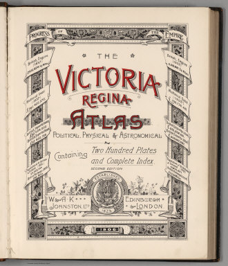
W. & A.K. Johnston Limited
Full Title
(Covers to) The Victoria Regina Atlas, Political, Physical & Astronomical. Containing Two Hundred Plates and Complete Index. Second Edition. W. & A.K. Johnston, Ltd. Established 1825. Edinburgh & London. 1906.
Publisher
W. & A.K. Johnston Limited
Author
W. & A.K. Johnston Limited
Full Title
(Title Page) The Victoria Regina Atlas, Political, Physical & Astronomical. Containing Two Hundred Plates and Complete Index. Second Edition. W. & A.K. Johnston, Ltd. Established 1825. Edinburgh & London. 1906.
Publisher
W. & A.K. Johnston Limited
Author
W. & A.K. Johnston Limited
Full Title
(Text Page (Dedication)) To Her Most Gracious Majesty, Queen Victoria, This Atlas was by Her Majesty's Special Permission Respectfully Dedicated.
Publisher
W. & A.K. Johnston Limited
Author
W. & A.K. Johnston Limited
Full Title
(Table of Contents) Contents.
Publisher
W. & A.K. Johnston Limited
Author
W. & A.K. Johnston Limited
Full Title
(Table of Contents - Continued) Contents.
Publisher
W. & A.K. Johnston Limited
Author
W. & A.K. Johnston Limited
Full Title
Time of All Nations.
Publisher
W. & A.K. Johnston Limited
Author
W. & A.K. Johnston Limited
Full Title
(Flags) Arms or Badges of Great Britain and Her Colonies. National Arms.
Publisher
W. & A.K. Johnston Limited
Author
W. & A.K. Johnston Limited
Full Title
(Flags) Flags of All Nations.
Publisher
W. & A.K. Johnston Limited
Author
W. & A.K. Johnston Limited
Full Title
Map of the Stars. The North Pole.
Publisher
W. & A.K. Johnston Limited
Author
W. & A.K. Johnston Limited
Full Title
Map of the Stars. The South Pole. Map of the Stars.
Publisher
W. & A.K. Johnston Limited
Author
W. & A.K. Johnston Limited
Full Title
Map of the Stars. Map of the Stars.
Publisher
W. & A.K. Johnston Limited
Author
W. & A.K. Johnston Limited
Full Title
Map of the Stars. The Solar System.
Publisher
W. & A.K. Johnston Limited
Author
W. & A.K. Johnston Limited
Full Title
Fig. 1. Day and Night.
Publisher
W. & A.K. Johnston Limited
|