Browse All

1920 Elector Frederick the Wise (Kurfürst Fri … |

1920 Elector Joachim I, Brandenburg (Joachim … |

1920 Elisabeth |

1920 Emperor Charles V (Kaiser Karl V) |

1920 Emperor Maximilian I (Kaiser Maximilian … |

1920 Erasmus of Rotterdam (Erasmus von Rotter … |

1920 [A Clown Standing On A Stool In Front Of Dudley Hardy |

1920 Covers: Roads Of California And Nevada. Pocket Map (Covers to) Midget Map Of The Best Roads … |
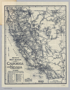
1920 Roads Of California And Nevada. Pocket Map Midget Map Of The Best Roads Of Californ … |

1920 Covers: New Mexico Pocket Map (Covers to) The Rand McNally New Commerc … |

1920 Title Page: New Mexico Pocket Map (Title Page to) The Rand McNally New Com … |

1920 New Mexico Pocket Map The Rand McNally New Commercial Atlas Ma … |

1920 New Mexico Automobile Road Map Pocket Map The Rand McNally New Commercial Atlas Ma … |

1920 Covers: San Francisco Pocket Map (Covers to) Free Map of San Francisco. F … |

1920 Map Of San Francisco Pocket Map (untitled view map of San Francisco). (o … |

1920 Text page: San Francisco Pocket Map (Text page to) Free Map of San Francisco … |

1920 Western Hemisphere -- Physical Wall Map Schulwandkarte der Westlichen Erdhalfte. |

1920 Covers: Denver Green Guide Guide Book (Covers to) Clason's Denver Green Guide. … |

1920 View: Denver Green Guide Guide Book (View to) Clason's Denver Green Guide. T … |

1920 Title Page: Denver Green Guide Guide Book (Title Page to) Clason's Denver Green Gu … |

1920 Denver Green Guide Guide Book Clason's Guide Map Of Denver Colorado. P … |

1920 Covers: New England Pocket Map (Covers to) Map of New England ... Copyr … |

1920 Text Page: New England States With Offic … Pocket Map (Text page to) Map of New England ... Co … |
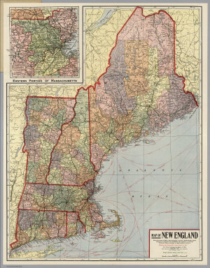
1920 New England Pocket Map Map of New England ... Copyright 1920 Th … |

1920 Denny's pocket map of San Benito County, … Separate Map Denny's pocket map of San Benito County, … |

1920 Greater Kansas City. Pocket Map Gallup's map of greater Kansas City and … |

1920 Cover: Greater Kansas City. Pocket Map (Covers to) Gallup's map of greater Kans … |

1920 (California) Wall Map (California) Eureka. Native Sons of the … |

1920 Nebraska highway map. Pocket Map Highway map and guide of Nebraska. Copyr … |

1920 Cover: Nebraska highway map. Pocket Map (Covers to) Highway map and guide of Neb … |

1920 Text Page: Nebraska highway map. Pocket Map (Text Page to) Highway map and guide of … |

1920 Sheet 16. Whitby & Saltburn. National Atlas Sheet 16. Whitby & Saltburn. |

1920 Sheet 20. Kirby Lonsdale & Hawes. National Atlas Sheet 20. Kirby Lonsdale & Hawes. |

1920 Sheet 25. Ribblesdale. National Atlas Sheet 25. Ribblesdale. |

1920 Sheet 28. Great Driffield & Bridlington. National Atlas Sheet 28. Great Driffield & Bridlington. |

1920 Sheet 29. Preston, Southport & Blackpool … National Atlas Sheet 29. Preston, Southport & Blackpool … |

1920 Sheet 30. Blackburn. National Atlas Sheet 30. Blackburn. |

1920 Sheet 32. Goole & Pontefract. National Atlas Sheet 32. Goole & Pontefract. |

1920 Sheet 35. Liverpool & Birkenhead. National Atlas Sheet 35. Liverpool & Birkenhead. |

1920 Sheet 38. Doncaster. National Atlas Sheet 38. Doncaster. |

1920 Sheet 39. Scunthorpe & Market Rasen. National Atlas Sheet 39. Scunthorpe & Market Rasen. |

1920 Sheet 40. Grimsby & Louth. National Atlas Sheet 40. Grimsby & Louth. |

1920 Sheet 43. Chester. National Atlas Sheet 43. Chester. |

1920 Sheet 44. Northwich & Macclesfield. National Atlas Sheet 44. Northwich & Macclesfield. |

1920 Sheet 45. Buxton & Matlock. National Atlas Sheet 45. Buxton & Matlock. |

1920 Sheet 46. The Dukeries. National Atlas Sheet 46. The Dukeries. |

1920 Sheet 47. Lincoln. National Atlas Sheet 47. Lincoln. |

1920 Sheet 48. Horncastle & Skegness. National Atlas Sheet 48. Horncastle & Skegness. |

1920 Sheet 55. Grantham. National Atlas Sheet 55. Grantham. |

1920 Sheet 56. Boston. National Atlas Sheet 56. Boston. |