Who What Where WhenREMOVEWHATShow MoreWHO
WHEN
|
Author
[McAlester, Miles D., United States. War Department]
Full Title
Rebel lines. Mobile defenses. Fort Jeb Stuart, K, on Lieut. Col. V. Sheliha's line of works. M.D. McAlester ... Rebel lines. Mobile defenses. Lunette D ... C.A. Czartoryski, 1st. La. Cav., del. Rebel lines. Redoubt B. Lieut. Col. V. Sheliha's line of fortifications. Fort Mouton. Prepared by order of Maj. McAlester ... June 1865. Rebel lines. Mobile defenses. Fort G, H and I ... Julius Bien & Co., Lith., N.Y. (1891-1895)
Publisher
U.S. Government Printing Office
Author
[McAlester, Miles D., United States. War Department]
Full Title
Rebel lines. Mobile defenses. Forts E and F. on Lieut. Col. V. Sheliha's line of works. M.D. McAlester, Bvt. Maj. Cp. En. Rebel lines. Mobile defenses. Redan no. 1 ... 2 ... 3 ... 4 ... 5 ... 6 ... M.D. McAlester, Bvt. Maj. Cp. En. C.A. Czartoryski, Private 1st La. Cav., del. Julius Bien & Co., Lith., N.Y. (1891-1895)
Publisher
U.S. Government Printing Office
Author
[McGregory, Samuel E., United States. War Department]
Full Title
Campaign of the Army of West Mississippi, Maj. Gen. E.R.S. Canby, Com'dg., in southern Alabama, March and April 1865. Drawn under direction of Lieut. S.E. McGregory, comdg. topographical party, by order of Bvt. Maj. McAlester, Chief Engineer, A.D.W.M. Accompanying report of Maj. Gen. E.R.S. Canby ... June 1, 1865. Julius Bien & Co., Lith., N.Y. (1891-1895)
Publisher
U.S. Government Printing Office
Author
[Rziha, John, United States. War Department]
Full Title
Topographical sketch of Fortress Rosecrans near Murfreesborough, Tenn. Surveyed under the supervision of Brig. Gen. J. St. Clair Morton, U.S.A. by John Rziha, Capt. 19th U.S. Infty. Office Inst. Gen. of Fortifications, Mil. Div. Miss. ... April 1865, traced by W. Claypoole, del. (with) Map of Bridgeport, Ala. From a survey made under the direction of Col. W.E. Merrill ... (with) Map of Stevenson, Ala. From a survey made under the direction of Col. W.E. Merrill ... (with) Defenses of Nashville, Tenn. ... Traced from the original map in possession of Major James R. Willett ... W.E. Merrill. (with) Defenses of Chattanooga, Tenn. Fort Lytle. (with) Defenses of Chattanooga, Tenn. Fort Crutchfield. (with) Defenses of Chattanooga, Tenn. Fort Mihalotzy. (with) Defenses of Chattanooga, Tenn. Redoubt Carpenter. Julius Bien & Co., Lith., N.Y. (1891-1895)
Publisher
U.S. Government Printing Office
Author
United States. War Department
Full Title
Topographical map of Clarksville, Tenn. Copied from the original plan prepared under the direction of Col. W.E. Merrill ... by Maj. James R. Willett ... From a survey by John H. Willett, Dec., 1864 ... 1865. Traced by W. Claypoole. Dalton, Ga. Copied from the original plan by Maj. Willett from a survey by R.M. Radford ... (with) Topographical map of Johnsonville, Tenn ... 1865. (with) Franklin, Tenn .... survey by Charles Peseux ... (with) Topographical map of Columbia, Tenn and vicinity ... (with) Gallatin, Tenn ... (with) Decatur, Ala. ... (with) Topographical sketch of Athens, Ala ... (with) Huntsville, Ala ... Surveyed by Jno. Willett and Chas. Peseux ... Julius Bien & Co., Lith., N.Y. (1891-1895)
Publisher
U.S. Government Printing Office
Author
Johnson, A.J.
Full Title
Johnson's Georgia and Alabama. Published by A. J. Johnson, New York. 53. 54. Entered according to the Act of Congress, in the year 1863, by A.J. Johnson in the Clerk's Office of the District Court of the United States for the Southern District of New York.
Publisher
A.J. Johnson.
Author
Asher & Adams
Full Title
Asher & Adams' Georgia & Alabama. Entered according to Act of Congress 1874 by Asher & Adams in the Office of the Librarian of Congress at Washington.
Publisher
Asher & Adams.
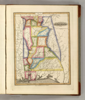
Author
Tanner, Henry S.
Full Title
Louisiana and Mississippi. By H.S. Tanner. American Atlas. Engraved & Published by H.S. Tanner, Philadelphia. Entered according to Act of Congress, 20th Day of December, 1820, by H.S. Tanner, of the State of Pennsylvania.
Publisher
Henry Tanner
Author
Tanner, Henry S.
Full Title
Georgia and Alabama. By H.S. Tanner. 1825. American Atlas. Published by H.S. Tanner, Philadelphia. Entered according to Act of Congress, 20th Day of August, 1823, by H.S. Tanner, of the State of Pennsylvania. Engraved by H.S. Tanner & Assistants.
Publisher
Henry Tanner
Author
[Bourquin, Frederick, Mitchell, Samuel Augustus, Tanner, Henry S.]
Full Title
A New Map of Alabama with its Roads & Distances from place to place along Stage and Steam Boat Routes. By H.S. Tanner. Entered according to Act of Congress in the 1841 by H.S. Tanner - in the Clerk's Office of the Eastern District of Pennsylvania. 22.
Publisher
S. Augustus Mitchell.
Full Title
Carte geographique, statistique et historique d'Alabama. Alabama. Fonderie et Imprimerie de J. Carez. (1825)
Publisher
J. Carez
Author
Fullarton, A. & Co.
Full Title
United States North America According to Calvin, Smith & Tanner. By G.H. Swanston Edinr. The South Eastern States Comprising Mississippi, Alabama, Tennessee, Georgia, Nth. & Sth. Carolina, and part of Florida, Virginia & Kentucky. LVIII. Engd. by G.H. Swanston Edinburgh. A. Fullarton & Co. Edinburgh, London & Dublin.
Publisher
A. Fullarton & Co.
Full Title
Alabama. (Published by George F. Cram, Chicago, Ill. 1909)
Publisher
E.A. Davis
Author
Bache, A. D.
Full Title
Entrance to Mobile Bay. From a trigonometrical survey under the direction of A.D. Bache, Superintendent of the Survey of the Coast of the United States. Main triangulation by F.H. Gerdes, assistant. Secondary triangulation by R.H. Fauntleroy, assistant. Topography by W.E. Greenwell, assistant. Hydrography by the party under the command of C.P. Patterson, Lt. U.S. Navy and assist. Published in 1851. Final reduction for engraving by J.J. Ricketts, draughtsman. Topography engraved by R.T. Knight and S.T. Pettit. Lettering by W. Smith. Electrotype copy no. 3 by G. Mathiot, U.S.C.S. (with logo) U.S. Coast Survey Office.
Publisher
U.S.
Author
Bache, A. D.
Full Title
Preliminary sketch of Mobile Bay. U.S. Coast Survey. A.D. Bache, Superintendent. Published in 1852. Second edition. Reduction for engraving--topography by J. Lambert and J.J. Ricketts; hydrography by M.C. Gritzner. Outlines engraved by H. Evens; topography by H.M. Knight; lettering by Saml. E. Stull. Electrotype copy no. 1 by G. Mathiot, U.S.C.S. (with logo) U.S. Coast Survey Office.
Publisher
U.S.
Author
Cram, George Franklin
Full Title
Cram's Rail Road & Township Map of Miss. & Alabama. Published by Geo. F. Cram. Proprietor of the Western Map Depot. 66, Lake St. Chicago Ills. 1875.
Publisher
Cram Atlas Company
Full Title
Alabama. (Written and engraved by Jos. Perkins. 1845)
Publisher
Tanner's Geographical Establishment
Author
[Kellogg, Sanford Cobb, 1842-, Mergell, C. S., United States. Army. Corps of Engineers]
Full Title
The Chattanooga Campaign of August and September 1863, enlarged from a map compiled in 1865, by C.S. Mergell, under the direction of Col. W.E. Merrill, 1st U.S. V.V. Eng'rs, and published by the Chief of Engineers of the Army in 1874. Drawn by J. von Glumer. Positions of troops located in 1891 by Captain S.C. Kellogg, 5th Cavalry. Julius Bien & Co. lith. (Washington, D.C.: U.S. Government Printing Office, 1891)
Publisher
U.S. Government Printing Office
Author
Rand McNally and Company
Full Title
Rand McNally junior auto road map Alabama. Copyright by Rand McNally & Co., Chicago, Ill. (1927)
Publisher
Rand McNally
Author
Greenleaf, Jeremiah
Full Title
Map of the State of Alabama.
Publisher
J. Greenleaf.
Author
Lucas, Fielding Jr.
Full Title
Alabama. Drawn and Published by F. Lucas Jr. J. Cone, Sc. (1822)
Publisher
Fielding Lucas
Author
Melish, John
Full Title
Map of the Country belonging to the Cherokee and Creek Indians From the Original Drawing in the War Department. J. Melish del. (1824)
Publisher
No publisher.
Author
Colton, G.W.
Full Title
Alabama. No. 31. Published by J.H. Colton & Co., No 172 William St., New York. Entered according to the Act of Congress in the year 1855 by J.H. Colton & Co. in the Clerk's Office of the District Court of the United States for the Southern District of New York.
Publisher
J.H. Colton
Author
Burr, David H., 1803-1875
Full Title
Map of the State of Alabama. By David H. Burr. Entered ... 1834 by Illman & Pilbrow ... New York.
Publisher
D.S. Stone
Author
Leahy, J.F.
Full Title
(Index Page to) Leahy's Hotel Guide and railway Distance Maps. Alabama.
Publisher
American Hotel register Co.
Author
Leahy, J.F.
Full Title
Leahy's Hotel Guide and Railway Distance Map of the State of Alabama. Published by American Hotel Register Company. Leahy Build., 228-234 W. Ontario St., Chicago, Ill. Copyrighted by J.F. Leahy, Jan., 1934.
Publisher
American Hotel register Co.
Author
Finley, Anthony
Full Title
Map of Louisiana Mississippi And Alabama Constructed from the Latest Authorities. D.H. Vance Del. J.H. Young Sc. Philadelphia Published by A. Finley 1826.
Publisher
Anthony Finley
Author
[Gray, Ormando Willis, Lloyd, H.H., Walling, H. F.]
Full Title
Atlas of the United States. Alabama, Arkansas, Louisiana, and Mississippi. (Published by Stedman, Brown & Lyon, Cincinnati. 1872. Entered ... 1872, by H.F. Walling, and O.W. Gray, and H.H. Lloyd & Co. ... Washington)
Publisher
Stedman, Brown & Lyon
Author
Bradford, Thomas G.
Full Title
Alabama. Entered ... 1838, by T.G. Bradford ... Massachusetts. Engraved by G.W. Boynton.
Publisher
[Weeks, Jordan & Co., Wiley and Putnam.]
Author
Bellin, Jacques Nicolas, 1703-1772
Full Title
Carte De La Coste De La Floride depuis la Baye de la Mobile jusqu'aux Cayes de St. Martin.
Publisher
J.N. Bellin
Author
U.S. General Land Office
Full Title
(Map 5 - Texas, Lousiana).
Publisher
Julius Bien
Author
U.S. General Land Office
Full Title
(Map 6 - Indian Territory, Arkansas, Mississippi, Alabama, Tennessee, Missouri, Kentucky, Louisiana).
Publisher
Julius Bien
Author
Mitchell, Samuel Augustus
Full Title
A New Map of Alabama with its Roads & Distances from Place to Place along the Stage & Steam Boat Routes. Published By S. Augustus Mitchell. N.E. corner of Market & 7th. Streets. Philadelphia.
Publisher
S.A. Mitchell
Author
Mitchell, Samuel Augustus Jr.
Full Title
County map of Georgia, and Alabama. Entered ... 1860 by S. Augustus Mitchell, Jr. ... Pennsylvania.
Publisher
S.A. Mitchell Jr.
Author
Mitchell, Samuel Augustus Jr.
Full Title
County map of North Carolina. (Scale: 1:2,800,000). Map of South Carolina. (Scale: 1:2,550,000). (inset) 31. Map of Charleston Harbor. County map of Florida. (Scale:1:3,700,000). Entered ... 1860 by S. Augustus Mitchell, Jr. ... Pennsylvania.
Publisher
S.A. Mitchell Jr.
Author
Mitchell, Samuel Augustus Jr.
Full Title
County map of the States of Georgia and Alabama. Entered ... 1874, by S. Augustus Mitchell ... Washington. (with inset maps) Savannah, Georgia. City of Atlanta, the capital of Georgia.
Publisher
S.A. Mitchell Jr.
Author
Mitchell, Samuel Augustus Jr.
Full Title
County map of the States of Georgia and Alabama. Entered ... 1876 by S. Augustus Mitchell, . ... Washington. (inset maps): Savannah Georgia. (with reference to squares), and City of Atlanta, the capital of Georgia.
Publisher
S.A. Mitchell Jr.
Author
Johnson, A.J.
Full Title
Johnson's Georgia And Alabama By Johnson & Browning. No. 28-29.
Publisher
Johnson and Browning
Author
Mitchell, Samuel Augustus
Full Title
A New Map of Alabama.
Publisher
Thomas, Cowperthwait & Co.
Author
Mitchell, Samuel Augustus
Full Title
A New Map of Alabama. With its Roads & Distances from place to place, along the Stage & Steam Boat Routes. Published by Charles Desilver, No. 251 Market St. Philadelphia. Entered ... 1856 by Charles Desilver ... Pennsylvania.
Publisher
Charles DeSilver
Author
[Blunt, Edmund M. (Edmund March), 1770-1862, Gauld, George.]
Full Title
The coasts of West Florida, Alabama, Mississippi & Louisiana; drawn from the surveys of Gauld, and improved from other authorities. By Edmund Blunt. New-York, published by E. & G.W. Blunt. No. 154 Water Street, corner of Maiden Lane, 1828. Engraved & printed at W. Hooker's office, New York.
Publisher
E. & G.W. Blunt.
Author
National Map Company
Full Title
Alabama. (Copyrighted by) National Map Company, Indianapolis. (to accompany) Official Paved Road and Commercial Survey of the United States.
Publisher
National Map Company
Author
Mitchell, Samuel Augustus Jr.
Full Title
County map of Georgia and Alabama. Entered ... 1867 by S. Augustus Mitchell, Jr. ... Pennsylvania.
Publisher
S.A. Mitchell Jr.
Author
[Julius Bien & Co., United States. War Department]
Full Title
General topographical map. Sheet XII. Julius Bien & Co., Lith., N.Y. (1891-1895)
Publisher
U.S. Government Printing Office
Author
[Julius Bien & Co., United States. War Department]
Full Title
General topographical map. Sheet XIII. Julius Bien & Co., Lith., N.Y. (1891-1895)
Publisher
U.S. Government Printing Office
Author
[Julius Bien & Co., United States. War Department]
Full Title
General topographical map. Sheet XIV. Julius Bien & Co., Lith., N.Y. (1891-1895)
Publisher
U.S. Government Printing Office
Author
[Bradford, Thomas G., Goodrich, S.G.]
Full Title
Alabama. Engraved by G.W. Boynton. Entered ... 1838, by T.G. Bradford ... Massachusetts.
Publisher
C.D. Strong
Author
[Hinton, Isaac Taylor, 1799-1847, Simpkin & Marshall]
Full Title
Map of the states of Alabama and Georgia. (with) Plan of Savannah. London, published Oct. 15, 1831 by I.T. Hinton & Simpkin & Marshall. Engraved & printed by Fenner Sears & Co. (1832)
Publisher
[Simpkin & Marshall, Thomas Wardle]
|