1799
Dress of the Inhabitants of Port des Fra
…
Exploration Book
Dress of the Inhabitants of Port des Fra
…
|

1799
Woman of Port des Francais.
Exploration Book
A Woman of Port des Francais. Published
…
|

1799
Wreck of the Two Boats at Port des Franc
…
Exploration Book
Wreck of the Two Boats at Port des Franc
…
|

1799
Entrance to the Port of Bucarelli.
Exploration Book
Plan of the Entrance of the Port of Buca
…
|

1799
Views of the North West Coast of America
…
Exploration Book
Views of the North West Coast of America
…
|

1901
Alaska.
Pocket Map
Alaska. Published by Geo. F. Cram, Chica
…
|

1901
Cover: Alaska, Hawaii.
Pocket Map
(Covers to) Alaska. Published by Geo. F.
…
|

1901
Title Page: Alaska, Hawaii.
Pocket Map
(Title Page to) Alaska. Published by Geo
…
|

1825
Possessions russes.
National Atlas
Carte geographique, statistique et histo
…
|

1837
Amerique Boreale.
World Atlas
Amerique Boreale pour servir a l'Histoir
…
|

1909
Alaska.
State Atlas
Alaska: the land of gold, copper and coa
…
|

1909
Alaska.
State Atlas
Alaska. (Published by George F. Cram, Ch
…
|

1837
Amerique Russe, Nouvelle Bretagne et Can
…
World Atlas
Amerique Russe, Nouvelle Bretagne et Can
…
|

1894
United States.
State Atlas
Gray's new map of the United States. (wi
…
|

1885
United States.
State Atlas
Gray's new map of the United States. (wi
…
|

1892
Gletscherkarte.
Geologic Atlas
Gletscherkarte. Entw. v. Herm. Berghaus
…
|

1922
Cover: White Pass & Yukon Route, connect
…
Pocket Map
(Covers to) Map Of White Pass & Yukon Ro
…
|

1922
Map Of White Pass & Yukon Route And Conn
…
Pocket Map
Map Of White Pass & Yukon Route And Conn
…
|

1934
Index: Saskatchewan, Manitoba, Alaska U.
…
Guide Book
(Index to) Leahy's Hotel Guide and Railw
…
|

1934
British Columbia, Alberta, Saskatchewan.
…
Guide Book
British Columbia. Alberta. Saskatchewan.
…
|

1872
North western America showing the territ
…
State Atlas
North western America showing the territ
…
|

1878
(Map 13 - Alaska).
Case Map
(Map 13 - Alaska).
|

1868
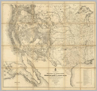
Territory Of The United States From The
…
Case Map
Territory Of The United States From The
…
|

1798
The Coast of N.W. America.
Chart Atlas
A Chart shewing part of the Coast of N.W
…
|

1798
The Coast of N.W. America.
Chart Atlas
A Chart shewing part of the Coast of N.W
…
|

1798
The Coast of N.W. America.
Chart Atlas
A Chart Shewing part of the Coast of N.W
…
|

1798
The Coast of N.W. America.
Chart Atlas
A Chart Shewing part of the Coast of N.W
…
|

1798
Views of Headlands and Islands.
Chart Atlas
Views of Headlands and Islands on the Co
…
|

1874
Northwestern America
World Atlas
Northwestern America showing the territo
…
|

1906
No. 29, Aborigines of Canada, Alaska and
…
National Atlas
Department of Interior : Atlas of Canada
…
|

1827
Partie, Russie d'Asie. Asie 20.
World Atlas
Partie de la Russie d'Asie. Asie no. 20.
…
|

1827
Partie, Iles Aleutiennes. Asie 38.
World Atlas
Partie des Iles Aleutiennes. Asie no. 38
…
|

1827
Iles Aleutiennes. Asie 39.
World Atlas
Iles Aleutiennes. Asie no. 39. (Dresse p
…
|

1877
Northwestern America
World Atlas
North Western America; showing the terri
…
|

1868
North Western America
World Atlas
North Western America, Showing the Terri
…
|

1915
Aborigines of Canada, Alaska and Greenla
…
National Atlas
Aborigines of Canada, Alaska and Greenla
…
|

1915
British Columbia & Yukon - Alaska bounda
…
National Atlas
British Columbia & Yukon - Alaska bounda
…
|

1816
Northern Passage.
World Atlas
Chart of the Northern Passage between As
…
|

1804
British possessions in America.
World Atlas
British possessions in America. Jones sc
…
|

1812
British possessions in America.
World Atlas
British Possessions in America. Jones sc
…
|

1873
North western America showing the territ
…
State Atlas
North western America showing the territ
…
|

1929
Legend: 125-26. Canada, Alasca, Groenlan
…
World Atlas
(Legend to) Canada, Alasca, Groenlandia,
…
|

1929
125-26. Canada, Alasca, Groenlandia.
World Atlas
Canada, Alasca, Groenlandia, Canada, Ala
…
|

1880
NW America.
World Atlas
Northwestern America showing the territo
…
|

1890
NW America.
World Atlas
Northwestern America showing the territo
…
|

1870
NW America.
[State Atlas, World Atlas]
Northwestern America showing the territo
…
|

1896
Pacific Coast Steamship Company.
Timetable Map
Map showing routes of the Pacific Coast
…
|

1896
Cover: Pacific Coast Steamship Co.
Timetable Map
(Covers to) Pacific Coast Steamship Co.
…
|

1896
Text Page: Pacific Coast Steamship Co.
Timetable Map
(Text Page to) Pacific Coast Steamship C
…
|

1905
Britisch Nordamerika und Alaska
World Atlas
Britisch Nordamerika und Alaska. Okt. 19
…
|