Browse All

1865 Hindoostan (India). World Atlas Hindoostan. |

1831 India VIII. Bengal Presidency. World Atlas India. Bengal Presidency. (India VIII). … |

1886 India. World Atlas Colton's Hindostan or British India. Pub … |

1874 Hindostan. World Atlas Colton's Hindostan or British India. Pub … |

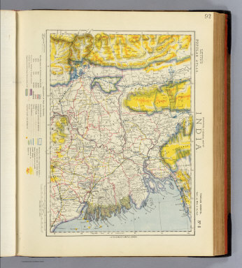
1901 India. World Atlas India. (inset) South Eastern Provinces o … |

1827 Hindoostan. World Atlas Hindoostan. By Sidney Hall. London, publ … |

1880 Text: Indian Empire. World Atlas (Text Page) Indian Empire. |

1880 Physical Map of the Indian Empire. World Atlas Physical Map of the Indian Empire. W. Sw … |

1880 Physical Map of the Indian Empire. World Atlas Physical Map of the Indian Empire. W. Sw … |

1880 Text: The Indian Empire. Political. World Atlas (Text Page) The Indian Empire. Political … |

1880 Political Map of the Indian Empire. World Atlas Political Map of the Indian Empire. W. S … |

1870 Hindoostan and Farther India. World Atlas Johnson's Hindoostan and Farther India. … |

1824 Hindustan. Berlin 1824. R.v.L. [School Atlas, World Atlas] Hindustan. Berlin 1824. R.v.L. |

1901 India South. World Atlas India and the adjacent parts of Beluchis … |

1901 Burma, adjacent countries. World Atlas Burma and adjacent countries. London atl … |

1855 Vorderindien. World Atlas Vorderindien. Lithographie, Druck u. Ver … |

1832 India. World Atlas India, by J. Arrowsmith. London, pubd. 1 … |

1835 Hindostan. World Atlas Hindostan. Entered ... 1835 by Thomas Il … |

1990 South Asia -- Physical-Political Wall Map South Asia. |

1764 Carte du port de Goa et ses environs Chart Atlas Carte du port de Goa et ses environs. |

1764 Carte du Golphe de Bengale Chart Atlas Carte du Golphe de Bengale. (engraved by … |

1764 Nouvelle carte du royaume de Bengale Chart Atlas Nouvelle carte du royaume de Bengale. |

1764 Carte de l'entree du Gange et son cours … Chart Atlas Carte de l'entree du Gange et son cours … |

1906 India. East India Is. World Atlas India. East India Is. |

1850 Hindoostan. World Atlas Hindoostan. (inset) Delta of the Ganges. |

1865 India. World Atlas India. |

1863 Prequ'ile de L'Inde. World Atlas Prequ'ile de L'Inde. |

1827 Bengale. Asie 95. World Atlas Bengale. Asie no. 95. (Dresse par Ph. Va … |

1832 India. World Atlas India. |

1742 Malabar, Coromandel, cotes. World Atlas Carte des Cotes de Malabar et de Coroman … |

1883 India. World Atlas General map of India. Letts's popular at … |
1883 India 8. World Atlas Statistical & general map of India. No. … |

1794 N. Hindostan. World Atlas A map of the north part of Hindostan or … |

1794 (Bengal, Bahar &c north) World Atlas (An actual survey, of the provinces of B … |

1794 Bengal, Bahar &c. (south) World Atlas An actual survey, of the provinces of Be … |

1794 Composite: Bengal, Bahar &c. World Atlas (Composite of) An actual survey, of the … |

1922 India - north-eastern section. World Atlas India - north-eastern section. (with Cal … |

1922 Provinces of the Lower Ganges. World Atlas Provinces of the Lower Ganges. The Edinb … |

1723 Malabar, Coromandel, costes. World Atlas Carte des Cotes de Malabar et de Coroman … |

1810 Hindostan. Manuscript Map Hindostan. (By Frances Bowen. 1810) |

1752 Carte de l'Inde. (Northern section). World Atlas Carte de l'Inde. (Northern section). Dre … |

1752 (Carte de l'Inde. Southern section). World Atlas (Carte de l'Inde. Southern section. Dres … |

1752 Composite: l'Inde. World Atlas (Composite of) Carte de l'Inde. Dressee … |

1850 Vorder-Indien oder das Indo-Britische Re … World Atlas No. XLIX. Stieler's Hand-Atlas (No. 44b) … |

1853 Vorder-Indien oder das Indo-Britische Re … World Atlas No. XLIX. Stieler's Hand-Atlas (No. 44b) … |

1879 Indien & Inner-Asien in 2 Blattern (Indi … World Atlas Stieler's Hand-Atlas No. 63. Indien & In … |

1786 Bengal, Bahar, Oude, Allahabad. World Atlas A map of Bengal, Bahar, Oude & Allahabad … |

1808 Hindoostan. World Atlas Hindoostan. |

1817 Hindoostan. World Atlas Hindoostan. |

1806 Hindoostan Divided into Soubahs accordin … World Atlas Hindoostan Divided into Soubahs accordin … |