Browse All

1856 Map Of Boston And Adjacent Cities. World Atlas Map Of Boston And Adjacent Cities. Publi … |

1776 The Provinces of Massachusetts Bay and N … National Atlas A Map of the most Inhabited part of New … |

1956 Shell Metropolitan Boston and Vicinity. National Atlas Shell Map of Metropolitan Boston and Cap … |

1956 Boston. National Atlas Downtown Boston. Sightseeing Guide to Bo … |

1867 Covers: New Haven, Middletown And Boston … Pocket Map (Covers to) Map showing the Line of The … |

1867 New Haven, Middletown And Boston Railroa … Pocket Map Map showing the Line of The New Haven, M … |

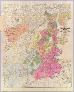
1889 Boston World Atlas Boston, Engraved Expressly for the Stand … |

1886 Boston and Adjacent Cities. World Atlas Colton's Boston and Adjacent Cities. Pub … |

1874 Boston and Adjacent Cities. World Atlas Colton's Boston and Adjacent Cities. Pub … |

1842 Boston, Charlestown, Roxbury. World Atlas Boston with Charlestown and Roxbury. Pub … |

1866 Massachusetts, Connecticut, and Rhode Is … World Atlas Colton's Massachusetts, Connecticut, and … |

1866 Boston and Adjacent Cities. World Atlas Colton's Map of Boston and Adjacent Citi … |

1846 Covers: Massachusetts And Rhode Island Pocket Map (Covers to) Massachusetts And Rhode Isla … |

1846 Massachusetts And Rhode Island Pocket Map Massachusetts And Rhode Island: By H.S. … |

1901 Boston. World Atlas Map of Boston. |

1874 Plan of Boston. National Atlas Plan of Boston. Entered ... 1874 by S. A … |

1855 Map of Massachusetts and Rhode Island World Atlas Map of Massachusetts and Rhode Island: P … |

1846 Cover: Boston, Charlestown, Cambridge. Pocket Map (Covers to) Plan Of Boston Comprising a … |

1846 Plan Of Boston Comprising a Part of Char … Pocket Map Plan Of Boston Comprising a Part of Char … |

1857 Boston Harbor, Massachusetts. Chart Map Boston Harbor, Massachusetts. From a Tri … |

1874 Map Of The City Of Boston and its Enviro … Pocket Map Map Of The City Of Boston and its Enviro … |

1874 Cover: Boston and its environs. Pocket Map (Covers to) Map Of The City Of Boston an … |

1884 Boston. Pocket Map New map of Boston giving all points of i … |

1884 Boston Harbor. Pocket Map Bird's eye view of Boston Harbor engrave … |

1884 Cover: Boston. Pocket Map (Covers to) New map of Boston giving all … |

1835 Boston, pt. of Charlestown, Cambridge. Wall Map Plan of Boston comprising a part of Char … |

1870 Boston and Vicinity. World Atlas Johnson's Boston and Vicinity. Entered . … |

1846 Mass., R.I. World Atlas Neueste Karte von Massachusetts und Rhod … |
1888 Boston. Pocket Map Map of Boston, for 1888. Published expre … |

1888 Cover: Boston. Pocket Map (Covers to) Map of Boston, for 1888. Pub … |

1872 Map Of Boston. Pocket Map Map Of Boston, 1872, After The Latest Su … |

1872 Cover: Map of Boston. Pocket Map (Covers to) Map Of Boston, 1872, After T … |

1852 Boston and vicinity. Case Map Map of the City and vicinity of Boston, … |

1890 31. Boston sheet. State Atlas Massachusetts. Boston sheet. Preliminary … |

1841 Boston. World Atlas Boston. Engraved by G.W. Boynton. |

1874 Boston and vicinity. World Atlas Johnson's Boston and Vicinity. Published … |

1848 Massachusetts And Rhode Island. World Atlas Massachusetts and Rhode Island: Publishe … |

1890 Boston Harbor. Pocket Map Correct map of Boston Harbor giving rout … |

1890 Cover: Boston Harbor. Pocket Map (Covers to) Correct map of Boston Harbor … |

1890 Verso: Boston Harbor. Pocket Map (Verso of) Correct map of Boston Harbor … |

1807 Boston et Ses Environs. Historical Atlas Boston et Ses Environs. (1807) |

1807 Boston and Its Environs. Historical Atlas Boston and Its Environs. Engraved for Wa … |

1824 Sketch of the Action on the Heights of C … World Atlas Sketch of the Action on the Heights of C … |

1857 Boston and Adjacent Cities. National Atlas Map of Boston and Adjacent Cities. No. 1 … |

1883 136. Industries by cities. Statistical Atlas Selected industries in twenty principal … |

1846 Mass., R.I. State Atlas Massachusetts and Rhode Island: by H.S. … |

1846 Boston Guide Book Boston (to accompany) The American Trave … |

1844 Boston Guide Book Boston (to accompany) The American Trave … |

1852 Covers: City And Vicinity Of Boston Mass … Case Map (Covers to) Map Of The City And Vicinity … |

1838 Boston. National Atlas Boston. Engraved by G.W. Boynton. |