Who What Where WhenREMOVE |
Author
Klett Perthes
Full Title
America Central y Las Antillas, Politico.
Publisher
Klett Perthes
Author
Arrowsmith, Aaron
Full Title
Chart Of The West Indies And Spanish Dominions In North America. By A. Arrowsmith, 1803. Jones Smith & Co. sc. Beaufort Buildgs. Strand. London Published June 1st 1803 by A. Arrowsmith No. 24 Rathbone Place. To Admiral John Willett Payne, A distinguished Native of the West Indies ... This Chart is respectfully Dedicated by his most obedient Servt. A. Arrowsmith.
Publisher
A. Arrowsmith
Author
Jefferys, Thomas
Full Title
An Accurate Map Of North America. Describing and distinguishing the British and Spanish Dominions on the great Continent; According to the Definitive Treaty Concluded at Paris 10th Feby. 1763. Also all the West India Islands Belonging to, and possessed by the Several European Princes and States. The whole laid down according to the latest and Most authentick Improvements, By Eman Bowen Gegr: to His Majesty and John Gibson Engraver. (with) inset map of The Passage by Land To California, Discovered by Father Eusebius Francis Kino a Jesuit. London. Printed for Robert Sayer No. 53 Fleet Street as the Act Directs 2d. July 1775.
Publisher
Sayer and Bennett
Author
Instituto Geographico di Agostini
Full Title
America Centrale. Indie Occidentali.
Publisher
Instituto Geographico di Agostini
Author
Instituto Geographico di Agostini
Full Title
America Centrale. (insets) Bermuda; Zona del Canale di Panama; Ie. Bermuda.
Publisher
Instituto Geographico di Agostini
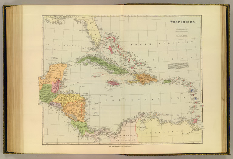
Author
Johnston, Alexander Keith, 1804-1871
Full Title
West India Islands and Central America by Keith Johnston, F.R.S.E. Engraved & printed by W. & A.K. Johnston, Edinburgh. William Blackwood & Sons, Edinburgh & London, (1861)
Publisher
William Blackwood & Sons
Author
Florida East Coast Railway
Full Title
Map of the Peninsula of Florida and Adjacent Islands. Published by the Land Department, Florida East Coast Railway. This map is absolutely correct in all the Geographical details, and every Railroad is shown in its proper location. The Matthews Northrup Co., Complete Engraving And Printing Works, Buffalo, N.Y. (inset) West Indies, Central America And South America. (inset) Bahama Islands
Publisher
Matthews-Northrup Co.
Author
Radefeld, Carl Christian Franz, 1788-1874
Full Title
Neueste Karte von Centralamerica und West Indien, 1843. Entworf. u. gezeichn. v. Hauptm. Radefeld. (with) Der Isthmus von Panama. Loyds Aufnahme v. J. 1829. Stahlstich, Direction v. Kleinknecht, aus der Schweinfurter Geographischen Graviranstalt des Bibliographischen Instituts zu Hildburghausen, Amsterdam, Paris und Philadelphia, (1860)
Publisher
Bibliographischen Instituts
Author
Garnier, F. A., 1803-1863
Full Title
Etats-Unis du Mexique, Amerique Centrale, comprenant les Republiques de Guatemala, Honduras, St. Salvador, Nicaragua, Costa-Rica, et les Grandes et Petites Antilles. (with) Isthmes de Panama et de Nicaragua. (with) Isthme de Tehuantepec. (with) Iles Guadeloupe et Marie Galante. (with) Ile Martinique. Atlas spheroidal & universel de geographie dresse par F.A. Garnier, geographe. Paris, Vve. Jules Renouard, Editeur, Rue de Tournon, no. 6. 1860. Sarazin, Imp. r. Git-le-Coeur, 8, Paris.
Publisher
Veuve Jules Renouard, Libraire
Author
Magnus, Charles
Full Title
Map Of The United States of America, The British Provinces, Mexico, the West Indies and Central America. Published by Charles Magnus. New York. 1854. (inset map) Central America.
Publisher
Charles Magnus
Author
[Thomson, John, Wyld, James, 1790-1836]
Full Title
West Indies. Drawn by Wyld. Engraved by Hewitt. Published by John Thomson & Co. Edinburgh. (to accompany) A General Atlas, Containing Maps illustrating some important periods in Ancient History; and distinct Maps of the several Empires, Kingdoms and States In The World, From Original Drawings according to the latest Treaties by J. Wyld and Engraved by N.R. Hewitt. Edinburgh, Printed for John Thomson & Co for Baldwin, Cradock & Joy, London & John Cumming, Dublin.
Publisher
John Thomson
Author
[Bayer, Herbert, Container Corporation of America]
Full Title
Central America and West Indies. (inset) Canal Zone.
Publisher
Container Corporation of America
Author
Brue, Adrien Hubert
Full Title
Carte Generale des Iles Antilles, Des Iles et Bancs De Bahama, Des Etats-Unis de L'Amerique-Centrale, de la Mer Du Mexique &a. Dediee a l'Academie Royale des Sciences de l'Institut de France. par A.H. Brue Geographe de Roi ... Paris, 1832. Chez Chles. Picquet proprietaire des Cartes et Atlas de Brue, Quai Conti No. 17, pres due Pont des Arts. (within stamp) AB Propriete Acquise en 1835. (with) three inset maps: Details des Iles Vierges, La Martinique d'apres les Cartes de M.M. Monnier et Bourgon. Duperre, and La Guadeloupe et Iles adjacentes.
Publisher
Charles Picquet
Author
Ruhle von Lilienstern, August
Full Title
Westindien. Berlin 1824 von R.v.L.
Publisher
C.G. Luderitz
Author
Bartholomew, John
Full Title
(Composite of) Plates 113, 114, Mexico, Central America, West Indies, Vol. 5.
Publisher
[Houghton Mifflin Co., John Bartholomew & Son LTD.]
Author
Tanner, Henry S.
Full Title
North America, S.E. Sheet. American Atlas. Engraved & Published By H.S. Tanner & Co., Philadelphia. 1822.
Publisher
Henry Tanner
Author
[Edward Stanford Ltd., Stanford, Edward]
Full Title
West Indies. London atlas series. Stanford's Geographical Establishment. London : Edward Stanford, 26 & 27 Cockspur St., Charing Cross, S.W. (1901)
Publisher
Edward Stanford
Author
[Edward Stanford Ltd., Stanford, Edward]
Full Title
Jamaica. (with) The West Indies and Central America. London atlas series. Stanford's Geographical Establishment. London : Edward Stanford, 26 & 27 Cockspur St., Charing Cross, S.W. (1901)
Publisher
Edward Stanford
Author
[Brue, Adrien Hubert, 1786-1832, Picquet, C.]
Full Title
Carte des Iles Antilles, des Etats-Unis de l'Amerique Centrale, et de la Mer du Mexique. Seconde edition, par A. Brue, Geographe du Roi. Revue et augmentee par Chles. Picquet, Geographe du Roi et du Duc d'Orleans. Quai Conti No. 17, pres du Pont des Arts. Paris, 1837.
Publisher
C. Picquet
Full Title
Central American and West Indian ports. (with) The Pacific Coast from San Diego to Vancouver. (with) The Pacific Coast from Seattle to Dutch Harbor. George Philip & Son, Ltd. The London Geographical Institute. (1922)
Publisher
[C.S. Hammond & Company. London: George Philip & Son, Ltd. The London Geographical Institute, Philip, Son & Nephew, Ltd.]
Author
Arrowsmith, John
Full Title
West Indies, by J. Arrowsmith. London, pubd. 15 Feby. 1832 by J. Arrowsmith, 35 Essex Street, Strand.
Publisher
John Arrowsmith
Author
Brue, Adrien Hubert, 1786-1832
Full Title
Carte des Iles-Antilles ou Indes Occidentales, du Golfe du Mexique et d'une partie des pays adjacents; par A. Brue, Geographe du Roi. Paris, 1825. Chez l'Auteur, rue des Macons Sorbonne, no. 9, et chez les principaux marchands de geographie. Revue en 1827.
Publisher
A. Brue
Author
[Desbuissons, L.E., Migeon, J.]
Full Title
Mexique, Amerique Centrale et Antilles. Grave par L. Smith. Dresse Sous La Direction De J. Migeon Par Ch. Lacoste. Migeon, editeur, imp, r. du Moulin Vert, Paris. Ecrit par A. Bizet. (1892). Fillatreau del. and Barbier sc. (for vignette).
Publisher
Direction & Administration.
Author
[Gerold, Friedrich Karl Joseph von, 1798-1879, Heller, Karl Bartholomaus, 1824-1880, Humboldt, Alexander von, 1769-1859, Kiepert, Heinrich, 1818-1899, Smith, Martin Luther, 1819-1866, Sociedad Mexicana de Geografia y Estadistica]
Full Title
(Covers to) H. Kiepert's Karte des nordlichen tropischen America. A new map of Tropical-America north of the equator comprising the West-Indies, Central-America, Mexico, New Granada and Venezuela. Composed with the help of all cartographic and litterary (sic) materials hitherto published and dedicated by permission to His Excellency Baron Alexander von Humboldt By H. Kiepert, Ph. Dr. M.R., Acad. Berlin, F. Geogr. Soc. of. Berlin, Paris and Vienna. 1858. Published by Dietrich Reimer, Berlin. Lithogr. and printed by C. Monecke, Berlin. Lith. Inst. von C. Monecke in Berlin. (with) Central part of the Mexican Republic ... based on the surveys published by A.v. Humboldt, v. Gerolt, Heller, Smith and the Sociedad Mejicana de Geografia t Estadistica.
Publisher
Deitrich Reimer
Author
[Gerold, Friedrich Karl Joseph von, 1798-1879, Heller, Karl Bartholomaus, 1824-1880, Humboldt, Alexander von, 1769-1859, Kiepert, Heinrich, 1818-1899, Smith, Martin Luther, 1819-1866, Sociedad Mexicana de Geografia y Estadistica]
Full Title
H. Kiepert's Karte des nordlichen tropischen America. A new map of Tropical-America north of the equator comprising the West-Indies, Central-America, Mexico, New Granada and Venezuela. Composed with the help of all cartographic and litterary (sic) materials hitherto published and dedicated by permission to His Excellency Baron Alexander von Humboldt By H. Kiepert, Ph. Dr. M.R., Acad. Berlin, F. Geogr. Soc. of. Berlin, Paris and Vienna. 1858. Published by Dietrich Reimer, Berlin. Lithogr. and printed by C. Monecke, Berlin. Lith. Inst. von C. Monecke in Berlin. (with) Central part of the Mexican Republic ... based on the surveys published by A.v. Humboldt, v. Gerolt, Heller, Smith and the Sociedad Mejicana de Geografia t Estadistica.
Publisher
Deitrich Reimer
Author
Reichard, C. G.
Full Title
Mittel America oder Westindien von C.G. Reichard. Nurnberg, bei Friedrich Campe. (1822)
Publisher
Friedrich Campe.
Author
Klett Perthes
Full Title
America Central y Las Antillas -- Fisico.
Publisher
Klett Perthes
Author
Jones, Clarence F.
Full Title
Caribbean Area.
Publisher
Denoyer-Geppert Company
Author
edigol ediciones, s.a.
Full Title
America Central y El Caribe -- Fisico.
Publisher
edigol ediciones, s.a.
Author
edigol ediciones, s.a.
Full Title
America Central y El Caribe -- Politico.
Publisher
edigol ediciones, s.a.
Author
Bellin, Jacques Nicolas, 1703-1772
Full Title
Carte reduite du golphe Mexique et des isles de I'Amerique.
Publisher
J.N. Bellin
Author
Magnus, Charles
Full Title
(Covers to) Map Of The United States of America, The British Provinces, Mexico, the West Indies and Central America. Published by Charles Magnus. New York. 1854. (inset map) Central America.
Publisher
Charles Magnus
Author
Mitchell, Samuel Augustus Jr.
Full Title
Map of Mexico, Central America, and the West Indies. (with four insets) 49. Map of the Island of Cuba. 50. Map of the Island of Jamaica. 51. Map of the Bermuda Islands. 52. Map of the Panama Railroad. Constructed & Engraved by W. Williams Philadelphia. Entered ... 1860 by S. Augustus Mitchell, Jr. ... Pennsylvania.
Publisher
S.A. Mitchell Jr.
Author
Goldthwait, J.H.
Full Title
(Covers to) Goldthwait's Map Of The United States, British Provinces, Mexico, Central America, W. India Is. &c. Exhibiting The Railroads ... by J.H. Goldthwait. Published by D. Chester, 119 & 121 Nassau St. New York. Entered ... 1861 by J.H. Goldthwait ... New York. (inset) Great Rail Road Routes from the Middle Atlantic Ports To The Mississippi River by J.H. Goldthwait. (inset) Of The Railroads Of New England And Eastern N . York by J.H. Goldthwait.
Publisher
D. Chester
Author
Goldthwait, J.H.
Full Title
Goldthwait's Map Of The United States, British Provinces, Mexico, Central America, W. India Is. &c. Exhibiting The Railroads ... by J.H. Goldthwait. Published by D. Chester, 119 & 121 Nassau St. New York. Entered ... 1861 by J.H. Goldthwait ... New York. (inset) Great Rail Road Routes from the Middle Atlantic Ports To The Mississippi River by J.H. Goldthwait. (inset) Of The Railroads Of New England And Eastern N . York by J.H. Goldthwait.
Publisher
D. Chester
Author
[Andree, Richard, Times (London, England)]
Full Title
Central America and West Indies. (Published at the office of "The Times," London, 1900). (insets) The Lesser Antilles (Leeward Islands, Windward Islands) ; Jamaica ; Nicaragua Canal ; Panama Canal ; Wales.
Publisher
The Office of The Times
Author
Mitchell, Samuel Augustus Jr.
Full Title
Map of Mexico, Central America and the West Indies. Entered ... 1874, by S. Augustus Mitchell ... Washington. (with 4 insets) Map of the Island of Jamaica; Map of the Sandwich Islands. Discovered by Captn. Cook in 1778; Map of the Bermuda Islands; Map of the Panama railroad.
Publisher
S.A. Mitchell Jr.
Author
Mitchell, Samuel Augustus Jr.
Full Title
Map of Mexico, Central America, and the West Indies. Entered ... 1877 by S. Augustus Mitchell, . ... Washington. (with four insets: Map of the Island of Jamaica; Map of the Sandwich Island. Discovered by Captn. Cook in 1778; Map of the Bermuda Islands; Map of the Panama Railrod.
Publisher
S.A. Mitchell Jr.
Author
Mitchell, Samuel Augustus Jr.
Full Title
Map of Mexico, Central America, and the West Indies. Constructed & Engraved by W. Williams Philadelphia. (inset maps) 55. Map of the Island of Cuba. 56. Map of the Island of Jamaica. 57. Map of Bermuda Islands. Map of the Panama Railroad. 58. Entered ... 1867 by S. Augustus Mitchell, Jr. ... Pennsylvania.
Publisher
S.A. Mitchell Jr.
Author
Arrowsmith, John
Full Title
West Indies, By J. Arrowsmith. (with) inset map of the northern section of Guatimala (sic) (Map) 45. London, Pubd. 15 Feby. 1842, by J. Arrowsmith, 10 Soho Square.
Publisher
John Arrowsmith
Author
Delamarche, Charles Francois
Full Title
Golfe du Mexique avec les Isles Antilles. A Paris, chez Delamarche, Geog., avec privil., 1783. (ca. 1800)
Publisher
C.F. Delamarche
Full Title
Spanish dominions in North America. From various authorities. (Published by John Conrad & Co., Philadelphia. 1804)
Publisher
J. Conrad
Full Title
Spanish Dominions in North America. From various authorities. (Boston: Published by Thomas & Andrews. 1812)
Publisher
Thomas & Andrews
Author
Mitchell, Samuel Augustus
Full Title
Map of Mexico, Central America, and the West Indies. (with) Map of the Sandwich Islands. Discovered by Captn. Cook in 1778. (with) Map of the island of Jamaica. (with) Map of the Bermuda Islands. (with) Map of the Panama Railroad. Entered ... 1879 by S. Augustus Mitchell ... Washington. (1880)
Publisher
S.A. Mitchell
Full Title
Map of Mexico, Central America, and the West Indies. (with) Map of the Bermuda Islands. (with) Map of the island of Jamaica. (with) Map of the proposed ship rail road route across the isthmus of Tehuantepec. (with) Map of the Panama Railroad and proposed canal. (with) Map of the proposed Nicaragua Canal route. Copyright 1887 by Wm. M. Bradley & Bro. (1890)
Publisher
John Y. Huber & Co.
Full Title
Central America and West Indies. (with) Isthmus of Panama. (Published at the office of "The Times," London, 1895)
Publisher
The Times
Full Title
Centralamerika und Westindien. (with) Istmus von Panama. (Richard Andree. Herausgegeben von der Geographischen Anstalt von Velhagen & Klasing in Leipzig. 1881)
Publisher
Velhagen & Klasing
Author
[Mitchell, Samuel Augustus, Williams, W. (Wellington)]
Full Title
Map of Mexico, Central America, and the West Indies. (with) Map of the island of Cuba. (with) Map of the island of Jamaica. (with) Map of the Bermuda Islands. (with) Map of the Panama Railroad. Constructed & engraved by W. Williams, Philadelphia. Entered ... 1870 by S. Augustus Mitchell, Jr. ... Pennsylvania.
Publisher
[R.A. Campbell, S.A. Mitchell, Jr.]
Author
Debenham, Frank
Full Title
Central America and the Caribbean. (Copyright) G.P. Ltd. (with inset views)
Publisher
Simon and Schuster
|