Browse All

1868 Map of Mexico, Central America, and the … World Atlas Map of Mexico, Central America, and the … |

1866 No.I. General map of the American Isthmu … Survey Book No.I. General map of the American Isthmu … |

1866 No.II. Profiles of the Isthmus of Tehuan … Survey Book No.II. Profiles of the Isthmus of Tehnan … |

1866 No.III. Map of vertical section of the p … Survey Book No.III. Map of vertical section of the p … |

1866 No.IV. Map and profile of the route from … Survey Book No.IV. Map and profile of the route from … |

1866 No.V. Map of the Isthmus between Chagres … Survey Book No.V. Map of the Isthmus between Chagres … |

1866 No.VI. Central america. Panama rail road Survey Book No.VI. Panama rail road : Central Americ … |

1866 No.VII. Map and profile of the route for … Survey Book No.VII. Map and profile of the route for … |

1866 No.VIII. Isthmus of Darien Survey Book No.VIII. Isthmus of Darien. Map showing … |

1866 No.IX. Map of part of the Isthmus of Dar … Survey Book No.IX. Map of part of the Isthmus of Dar … |

1866 No.XII. Interoceanic ship canal via Atra … Survey Book No.XII. Interoceanic ship canal via Atra … |

1866 No.XIII. Isthmus of Darien from 77(degre … Survey Book No.XIII. Isthmus of Darien from 77(degre … |

1857 Index Map. Explanation of Signs Used In … National Atlas Index Map. Explanation of Signs Used In … |

1860 Central America. World Atlas Johnson's Central America By Johnson & B … |

1860 North America. World Atlas Johnson's North America By Johnson & Bro … |

1858 Covers: Carte D'Etude Pour Le Trace Et L … Survey Book (Covers to) Carte D'Etude Pour Le Trace … |

1858 Title Page: Carte D'Etude Pour Le Trace … Survey Book (Title Page to) Carte D'Etude Pour Le Tr … |

1858 TextPage: Trace et profils du canal de N … Survey Book (Text Page to) Trace et profils du canal … |
1858 Carte D'Etude Pour Le Trace Et Le Profil … Survey Book Carte d'etude dressee par Mr. Thome de G … |

1857 Central America. National Atlas Central America. States Of Yucatan Guate … |

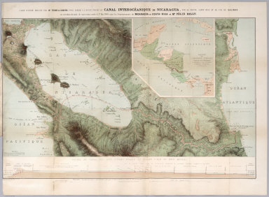
1857 Central America. National Atlas Central America. States Of Nicaragua, & … |

1844 West Indies. World Atlas West Indies, By J. Arrowsmith. (with) in … |

1775 The Bay of Honduras. Regional Atlas The Bay of Honduras. By Thos. Jeffreys, … |

1864 Mexico, Central America. School Atlas Mexico, Yucatan, Balize & Central Americ … |

1850 Mexico, Guatimala. School Atlas Mexico and Guatimala. Drawn by (to be fi … |

1830 Mexico, Guatimala. School Atlas Mexico and Guatimala. J.H. Young Sc. (Ph … |

1800 Golfe du Mexique, Isles Antilles. School Atlas Golfe du Mexique avec les Isles Antilles … |

1816 Spanish N. America, S. pt. World Atlas Spanish North America, southern part. Dr … |

1829 Mexique. World Atlas Carte des Etats-Unis du Mexique. (with) … |

1831 Mexico, Guatimala. World Atlas Mexico & Guatimala. Published by D. Liza … |

1922 Mexico & Central America. World Atlas Mexico & Central America. The Edinburgh … |

1883 Mexico South, Central America. World Atlas Mexico, South; and Central America. Lett … |

1804 Spanish dominions in North America. World Atlas Spanish dominions in North America. From … |

1812 Spanish dominions in North America. World Atlas Spanish Dominions in North America. From … |

1831 Mexico, Guatemala, W.I., North America. World Atlas Mexico, Guatemala & West Indies. North A … |

1847 United States, Mexico. School Atlas Map of the United States. Engraved to il … |

1929 Legend: 148-50. Messico Centrale, Americ … World Atlas (Legend to) Messico Centrale, Mexico cen … |

1929 Legend: 153-54. America Centrale, Colomb … World Atlas (Legend to) America Centrale, Colombia, … |

1929 153-54. America Centrale, Colombia, Ecua … World Atlas America Centrale, Colombia, Ecuador, Per … |

1880 Mexico, Central America, West Indies. World Atlas Map of Mexico, Central America, and the … |

1890 Mexico, Central America, West Indies. World Atlas Map of Mexico, Central America, and the … |

1895 Central America. World Atlas Central America and West Indies. (with) … |

1881 Centralamerika und Westindien. World Atlas Centralamerika und Westindien. (with) Is … |

1787 Du Mexique. School Atlas Du Mexique. (with) La Terre Ferme. (1787 … |

1840 North America. World Atlas North America. |

1870 Mexico, Central America, West Indies. [State Atlas, World Atlas] Map of Mexico, Central America, and the … |

1840 United States Of Mexico. World Atlas The United States Of Mexico. (with) Guat … |

1835 Mexico, Guatamala. World Atlas Mexico & Guatamala (sic). Fenner Sc., Pa … |

1905 Mittleamerika und Westindien World Atlas Mittelamerika und Westindien. Juli 1905. … |

1857 Cover: Atlas of the United States of Nor … National Atlas (Covers to) Atlas Of The United States O … |