|
|
REFINE
Browse All : National Atlas of Oregon from 1966
1-4 of 4
Author
[Macomb, J.N, Warner, W.H.]
Full Title
Chart Of Detroit River, From Lake Erie To Lake St. Slair. Surveyed In 1840, '41, & '42, By Lieutenants J.N. Macomb And W.H. Warner, Corps Of Topl. Engineers; Under The Direction Of Captain W.G. Williams,. Corps T. Engs.
Publisher
Secretary of War
Author
Bellin, Jacques Nicolas, 1703-1772
Full Title
La Riviere Du Detroit Depuis Le Lac Sainte Claire Jusqu'Au Lac Erie. (inset) Plan Du Fort Du Detroit.
Publisher
J.N. Bellin
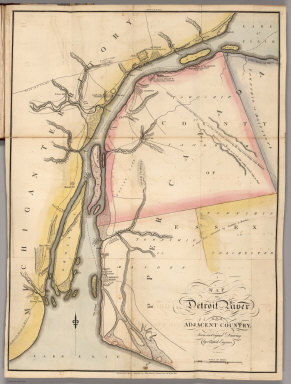
Author
Melish, John
Full Title
Map of Detroit River and Adjacent Country, From an Original Drawing, by a British Engineer.
Publisher
John Melish
1-4 of 4
|