Browse All

1838 Karte von dem Deutschen Meere und den An … World Atlas Karte von dem Deutschen Meere und den An … |

1847 Die Britischen Inseln: Volker und Sprach … World Atlas Die Britischen Inseln: Volker und Sprach … |

1856 England and Wales. World Atlas England And Wales. (with) Scilly Isles. … |

1823 England and Wales. World Atlas England and Wales. |

1807 British Isles. World Atlas A new map of the British Isles, from the … |

1807 England. World Atlas A new map of England, from the latest au … |

1865 British Islands. World Atlas British Islands. |

1861 England, Wales N. World Atlas England and Wales, northern sheet, by Ke … |

1861 England, Wales S. World Atlas England and Wales, southern sheet, by Ke … |

1861 Composite: England, Wales. World Atlas (Composite of) England and Wales by Keit … |

1889 England and Wales. Ireland. World Atlas England & Wales Engraved Expressly for t … |

1832 London environs. World Atlas The environs of London. Drawn & engraved … |

1886 England and Wales. World Atlas Colton's England and Wales. (inset) Scil … |

1839 Birmingham. World Atlas Birmingham. Engraved & printed by J. Hen … |

1874 England and wales. World Atlas Colton's England and Wales. (inset) Scil … |
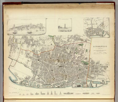
1836 Liverpool. World Atlas Liverpool. Published under the superinte … |

1836 London. World Atlas London. Published under the superintende … |

1843 London. 1843. World Atlas London. 1843. Drawn & engraved from auth … |

1866 England and Wales. World Atlas Colton's England and Wales. (inset) Scil … |

1901 England and Wales. World Atlas England and Wales. |

1853 Map of England World Atlas Map of England. Published by Thomas, Cow … |

1862 Iles Britanniques, chemins de fer, canau … World Atlas Roy(au)me Uni de la Grande Bretagne et d … |

1862 Iles Britanniques. World Atlas Roy(au)me Uni de la Grande Bretagne et d … |

1864 England and Wales World Atlas Johnson's England And Wales By Johnson A … |

1855 Map of England World Atlas Map of England. Published by Cowperthwai … |

1817 England World Atlas England. Drawn by A. Arrowsmith. Engrave … |

1955 Index: The British Isles, Plate 54, V. I … World Atlas (Index to) The British Isles. Secant Con … |

1955 The British Isles, Plate 54, V. III World Atlas The British Isles. The Geographical Inst … |

1955 Index: London and Environs, Plate 55, V. … World Atlas (Index to) London and environs. 1;100,00 … |

1955 London and Environs, Plate 55, V. III World Atlas London and Environs. The Geographical In … |

1955 Index: England South and Wales, Plate 56 … World Atlas (Index to) England South and Wales. Simp … |

1955 England South and Wales, Plate 56, V. II … World Atlas England South and Wales. The Geographica … |

1955 Index: Midlands and Scottish Borders, Pl … World Atlas (Index to) Midlands and Scottish Borders … |

1955 Midlands and Scottish Borders, Plate 57, … World Atlas Midlands and Scottish Borders. The Geogr … |

1824 England and Wales World Atlas England and Wales. Drawn by Wyld. (Engra … |

1873 The British Isles. World Atlas The British Isles. |

1829 British Isles. World Atlas British Isles by Sidney Hall. London, pu … |

1828 England, Wales. World Atlas England and Wales. By Sidney Hall. Londo … |

1953 Europe Economic. United Kingdom. Ireland … World Atlas Europe Economic. United Kingdom. Ireland … |

1953 British Isles. World Atlas British Isles. (insets) Shetland Is. (in … |

1844 Grossbritannien, Ireland. World Atlas Neueste Karte von Grossbritannien und Ir … |

1844 England. World Atlas Neueste Karte von England. Nach den bess … |

1845 London. World Atlas London, 1845, nach den besten Materialie … |

1816 England And Wales From The Best Authorit … World Atlas England And Wales From The Best Authorit … |

1880 Text: British Isles. World Atlas (Text Page) British Isles. |

1880 British Isles. World Atlas British Isles. W. Swan Sonnenschein & Al … |

1880 British Isles. World Atlas British Isles. W. Swan Sonnenschein & Al … |

1880 Text: England and Wales. Physical. World Atlas (Text Page) England and Wales. Physical. |

1880 Physical Map of England. World Atlas Physical Map of England. W. Swan Sonnens … |

1880 Physical Map of England. World Atlas Physical Map of England. W. Swan Sonnens … |