Browse All

1747 SE pt. of Germany. Geography Book A new & accurate map of the South East p … |

1830 Germanie Ancienne. World Atlas Carte de la Germanie Ancienne. Dressee p … |

1742 L'Allemagne. World Atlas L'Allemagne, dressee sur les observation … |

1742 Carte exacte des postes et routes de l'E … World Atlas Carte exacte des postes et routes de l'E … |

1794 Germany. World Atlas A new map of Germany, divided into its c … |

1794 Germany (north) World Atlas Map of the Empire of Germany, including … |

1794 Germany (south) World Atlas (Map of the Empire of Germany, including … |

1794 Composite: Germany. World Atlas (Composite of) Map of the Empire of Germ … |

1802 Post roads Germany, Hungary. World Atlas A new map of the post roads of Germany a … |

1701 L'Allemagne. World Atlas L'Allemagne, dressee sur les observation … |

1821 France, Germany, Netherlands, Switzerlan … School Atlas France, Germany, Netherlands, Switzerlan … |

1831 France, Switzerland, Germany. World Atlas France, Switzerland. Germany. G. Boynton … |

1881 Deutschland physikalisch. World Atlas Deutschland physikalisch. (Richard Andre … |

1881 Sprachenkarte, Religionskarte v. Deutsch … World Atlas Sprachenkarte von Deutschland. Religions … |

1852 Deutschland, Niederlande, Belgien, Schwe … School Atlas Deutschland, Niederlande, Kgr. Belgien u … |

1835 Germania, Dacia. World Atlas Germania, Dacia. Fenner Sc., Paternoster … |

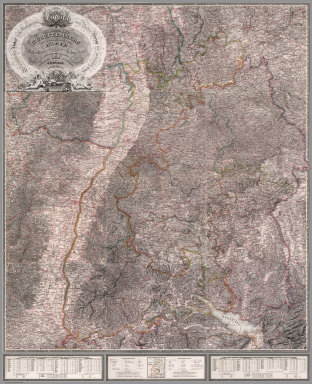
1838 Composite: Karte von Sudwest-Deutschland … National Atlas Composite: Karte von Sudwest-Deutschland … |

1838 Covers: Woerl Atlas der Wuerttemberg National Atlas (Covers to) Das Koenigreich Wuerttemberg … |

1838 Title page: Das Koenigreich Wuerttemberg … National Atlas (Title Page to) Das Koenigreich Wuerttem … |

1838 Index page: Das Koenigreich Wuerttemberg … National Atlas (Index Page to) Das Koenigreich Wuerttem … |

1836 Text Page: Vergleichungs- Tabelle der Me … National Atlas (Text Page to) Vergleichungs- Tabelle de … |

1831 Darmstadt National Atlas Darmstadt. Entworfen und bearbeitet von … |

1834 Wurzburg National Atlas Wurzburg. Entworfen und bearbeitet von W … |

1833 Zweybrucken National Atlas Zweybrucken. Entworfen und bearbeitet vo … |

1834 Carlsruhe - Stuttgart National Atlas Carlsruhe - Stuttgart. Entworfen und bea … |

1834 Ellwangen National Atlas Ellwangen. Entworfen und bearbeitet von … |

1833 Strasburg National Atlas Strasburg. Entworfen und bearbeitet von … |

1831 Tubingen National Atlas Tubingen. Entworfen und bearbeitet von W … |

1831 Ulm National Atlas Ulm. Entworfen und bearbeitet von Woerl … |

1831 Freiburg National Atlas Freiburg. Entworfen und bearbeitet von W … |
1831 Composite: Sheets 1 - 12 Das Koenigreich … National Atlas (Composite of) Sheets 1 - 12 Das Koenigr … |

1838 Nurnberg National Atlas Nurnberg. Entworfen und bearbeitet von W … |

1837 Amberg National Atlas Amberg. Entworfen und bearbeitet von Woe … |

1837 Klattau National Atlas Klattau. Entworfen und bearbeitet von Wo … |

1837 Ingolstadt National Atlas Ingolstadt. Entworfen und bearbeitet von … |

1837 Regensburg National Atlas Regensburg. Entworfen und bearbeitet von … |

1838 Passau National Atlas Passau. Entworfen und bearbeitet von Woe … |

1838 Augsburg National Atlas Augsburg. Entworfen und bearbeitet von W … |

1837 Munchen National Atlas Munchen. Entworfen und bearbeitet von Wo … |

1837 Salzburg National Atlas Salzburg. Entworfen und bearbeitet von W … |

1838 Hallein National Atlas Hallein. Entworfen und bearbeitet von Wo … |

1838 Lienz National Atlas Lienz. Entworfen und bearbeitet von Woer … |

1838 Padua National Atlas Padua. Entworfen und bearbeitet von Woer … |

1831 Assemblage zur karte von Sudwest-Deutsch … National Atlas Assemblage zur karte von Sudwest-Deutsch … |

1788 German Empire. World Atlas A new map of the German Empire, and the … |

1788 German Empire. World Atlas A new map of the German Empire, and the … |

1822 Germany School Atlas Germany. (to accompany) The Juvenile Atl … |

1875 Composite: Sud-West Deutschland, Schweiz … World Atlas (Composite of) Sud-West Deutschland Und … |

1886 Europe : Inde, Antilles , Etats - Unis e … World Atlas Europe : Inde, Antilles , Etats - Unis e … |

1917 Map Western Front. Pocket Map Hammond's large scale war map of the Wes … |