Browse All

1845 Florida. World Atlas Florida. (with) Plan of Tallahassee. (wi … |
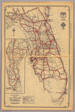
1927 Florida. National Atlas Rand McNally junior auto road map Florid … |

1927 Atlanta, Jacksonville, Memphis, Clevelan … National Atlas Atlanta and vicinity. Jacksonville and v … |

1848 Map of the State of Florida. World Atlas Map of the State of Florida. |

1817 Florida. World Atlas Florida. Drawn and Published by F. Lucas … |

1857 Florida. National Atlas Florida. No. 30. Published by J.H. Colto … |

1835 Map of the Territory of Florida. World Atlas Map of the Territory of Florida. W.F.H. … |

1826 Map of Florida. National Atlas Map of Florida according to the Latest A … |

1834 Florida Pocket Map Map Of Florida according to the Latest A … |

1934 Index: Florida, Railway Distance Maps Guide Book (Index Page to) Leahy's Hotel Guide and … |

1934 Railway Distance Map of the State of Flo … Guide Book Leahy's Hotel Guide and Railway Distance … |

1934 Index: (Continued) Florida, Railway Dist … Guide Book (Index Page to) Leahy's Hotel Guide and … |

1934 (Continuation) Railway Distance Map of t … Guide Book Leahy's Hotel Guide and Railway Distance … |

1872 Florida, Georgia, and South Carolina. State Atlas Atlas of the United States. Florida, Geo … |

1838 Florida. National Atlas Florida. Entered ... 1838, by T.G. Bradf … |

1764 Carte De La Coste De La Floride depuis l … Chart Atlas Carte De La Coste De La Floride depuis l … |

1764 Carte des isles Lucayes. Chart Atlas Carte des isles Lucayes. |

1764 Isle de Cube. Chart Atlas Isle de Cube. |

1878 Moncrief House, Jacksonville, Florida, S … State Atlas Moncrief House, Jacksonville, Florida. ( … |

1906 Florida. Wisconsin, Michigan. World Atlas Florida. Wisconsin, Michigan. |

1878 (Map 1 - Florida). Case Map (Map 1 - Florida) (portion of title bloc … |

1878 (Map 5 - Texas, Lousiana). Case Map (Map 5 - Texas, Lousiana). |

1849 Floriada World Atlas Florida. Published By S. Augustus Mitche … |

1874 County map of Florida World Atlas County map of Florida. Entered ... 1874, … |

1877 County map of Florida World Atlas County map of Florida. Entered ... 1876 … |

1860 Florida. World Atlas Johnson's Florida By Johnson & Browning. … |

1850 Florida. World Atlas Florida. (insets) Pensacola. Tallahassee … |

1857 A New Map of Florida World Atlas A New Map of Florida. Published by Charl … |

1780 Carte de la Louisiane, et de la Floride World Atlas Carte de la Louisiane, et de la Floride. … |

1840 Profile of the Florida Canal ; Morris Ca … Guide Book Florida Canal ; Morris Canal N. J. ; Uni … |

1827 (The Bahama Banks and Gulf of Florida. E … Chart Atlas (The Bahama Banks and Gulf of Florida by … |

1827 The Bahama Banks and Gulf of Florida (We … Chart Atlas The Bahama Banks and Gulf of Florida by … |

1827 Composite: Bahama Banks, Gulf of Florida … Chart Atlas (Composite of) The Bahama Banks and Gulf … |

1828 The coasts of West Florida, Alabama, Mis … Chart Atlas The coasts of West Florida, Alabama, Mis … |

1927 Florida National Atlas Florida. (Copyrighted by) National Map C … |

1868 County map of Florida World Atlas County map of Florida. (inset map) 36. M … |

1895 Gen. map X. Military Atlas General topographical map. Sheet X. Juli … |

1895 Gen. map XI. Military Atlas General topographical map. Sheet XI. Jul … |

1895 Gen. map XII. Military Atlas General topographical map. Sheet XII. Ju … |

1832 Florida. National Atlas Map of the state of Florida. London, pub … |

1775 The Coast of West Florida and Louisiana. Regional Atlas The Coast of West Florida and Louisiana. … |

1775 The Peninsula and Gulf of Florida or Cha … Regional Atlas The Peninsula and Gulf of Florida or Cha … |

1775 The Island of Cuba with part of the Baha … Regional Atlas The Island of Cuba with part of the Baha … |

1830 N. & S. Carolina. School Atlas N. & S. Carolina, Georgia & Florida. J.H … |

1883 E. United States 10. World Atlas Eastern United States. No. 10. Letts's p … |

1794 Southern dominions U.S. World Atlas A new and general map of the southern do … |

1873 Florida, Georgia, and South Carolina. State Atlas Atlas of the United States. Florida, Geo … |

1834 Floride, Delta du Mississippi canal. National Atlas Carte generale de la Floride et du Delta … |

1834 Baies, Florides, Golfe du Mexique. National Atlas Plans hydrographiques des baies, rades, … |

1863 (Alabama, Georgia, Florida) School Atlas (Map of Alabama, Georgia and part of Flo … |