Browse All

1863 77. Holyhead. National Atlas 77. Holyhead. |

1861 78. Bangor. National Atlas 78. Bangor. |

1860 79. Denbigh. National Atlas 79. Denbigh. |

1860 80. Northwich. National Atlas 80. Northwich. |

1860 81. Buxton. National Atlas 81. Buxton. |

1859 82. Chesterfield. National Atlas 82. Chesterfield. |

1858 83. Lincoln. National Atlas 83. Lincoln. |

1848 84. Louth. National Atlas 84. Louth. |

1854 85. Patrington. National Atlas 85. Patrington. |

1854 86. Hull. National Atlas 86. Hull. |

1863 87. Doncaster. National Atlas 87. Doncaster. |

1861 88. Huddersfield. National Atlas 88. Huddersfield. |

1859 89. Bolton. National Atlas 89. Bolton. |

1859 90. Southport. National Atlas 90. Southport. |

1863 91. Lancaster. National Atlas 91. Lancaster. |

1863 92. Skipton. National Atlas 92. Skipton. |

1862 93. York. National Atlas 93. York. |

1862 94. Beverley. National Atlas 94. Beverley. |

1863 95. Scarborough. National Atlas 95. Scarborough. |

1863 96. Helmsley. National Atlas 96. Helmsley. |

1863 97. Richmond. National Atlas 97. Richmond. |

1865 98. Kendal. National Atlas 98. Kendal. |

1865 99. Ravenglass. National Atlas 99. Ravenglass. |

1874 100. Isle of Man. National Atlas 100. Isle of Man. |

1869 101. Cockermouth. National Atlas 101. Cockermouth. |

1868 102. Appleby. National Atlas 102. Appleby. |

1868 103. Durham. National Atlas 103. Durham. |

1869 104. Whitby. National Atlas 104. Whitby. |

1867 105. Newcastle. National Atlas 105. Newcastle. |

1869 106. Haltwhistle. National Atlas 106. Haltwhistle. |

1869 107. Carlisle. National Atlas 107. Carlisle. |

1870 108. Wooler. National Atlas 108. Wooler. |

1869 109. Alnwick. National Atlas 109. Alnwick. |

1868 110. Berwick. National Atlas 110. Berwick. |

1758 Great Britain And Ireland World Atlas Great Britain And Ireland. (to accompany … |

1905 Ubersichtskarte von Groszbritannien und … World Atlas Ubersichtskarte von Groszbritannien und … |

1944 Western Front. 3. Battle of Britain World Atlas Western Front. 3. Battle of Britain. |

1865 Die Britischen Inseln und das Umliegende … World Atlas Stieler's Hand-Atlas ... No. 15a. Die Br … |

1879 Grossbritannien. (Great Britain, Souther … World Atlas Stieler's Hand-Atlas No. 46. Grossbritan … |

1880 Grossbritannien. (Great Britain, Norther … World Atlas Stieler's Hand-Atlas No. 47. Grossbritan … |

1875 Composite: Grossbritannien. World Atlas (Composite of) Grossbritannien Im Maasss … |

1817 United Kingdoms of Great Britain and Ire … World Atlas United Kingdoms of Great Britain and Ire … |

1800 Britannicae Insulae en Aevi Romani Monum … World Atlas Britannicae Insulae ex Aevi Romani Monum … |

1823 Die Brittischen Inseln. (British Isles). World Atlas No. XVII. Stielers Hand-Atlas (No. 15). … |
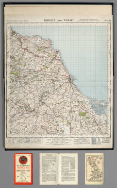
1947 Sheet 64. Berwick-upon-Tweed. National Atlas Sheet 64. Berwick-upon-Tweed. |

1947 Sheet 71. Alnwick. National Atlas Sheet 71. Alnwick. |

1947 Sheet 75. Dumfries. National Atlas Sheet 75. Dumfries. |

1947 Sheet 76. Carlisle. National Atlas Sheet 76. Carlisle. |

1947 Sheet 77. Hexham. National Atlas Sheet 77. Hexham. |
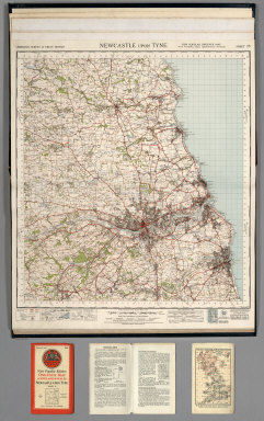
1947 Sheet 78. Newcastle upon Tyne. National Atlas Sheet 78. Newcastle upon Tyne. |