Browse All

1844 Vorder Indien, Hindostan. World Atlas Neueste Karte von Vorder Indien oder Hin … |

1870 Hindoostan and Farther India. World Atlas Johnson's Hindoostan and Farther India. … |

1824 Hindustan. Berlin 1824. R.v.L. [School Atlas, World Atlas] Hindustan. Berlin 1824. R.v.L. |

1959 Composite: India South, North-East, Nort … World Atlas (Composite of) Plates 28, 29, 30, 31, 32 … |

1848 Northern India World Atlas Northern India. (to accompany) The Cerog … |

1848 Western India World Atlas Western India. (to accompany) The Cerogr … |

1848 Southern India World Atlas Southern India. (to accompany) The Cerog … |

1848 Bengal World Atlas Bengal. (to accompany) The Cerographic M … |

1820 India. Historical Atlas Geographical, Historical, and Statistica … |

1874 Hindoostan and Farther India. World Atlas Johnson's Hindoostan and Farther India. … |

1848 Hindoostan. World Atlas Hindoostan. 66. (1848) |

1812 Hindoostan. World Atlas Hindoostan. London, Published April 3d 1 … |

1901 North Western Frontier of India, Pamir R … World Atlas Map of the North Western Frontier of Ind … |

1872 The British Possessions In The East Indi … World Atlas The British Possessions In The East Indi … |

1901 India North. World Atlas (India and the adjacent parts of Beluchi … |

1901 India South. World Atlas India and the adjacent parts of Beluchis … |

1901 Composite: India. World Atlas (Composite of) India and the adjacent pa … |

1855 Vorderindien. World Atlas Vorderindien. Lithographie, Druck u. Ver … |

1845 Hindoostan. World Atlas Hindoostan. (Written and engraved by Jos … |

1922 Arabian Sea. World Atlas The Arabian Sea. George Philip & Son, Lt … |

1836 Carte generale des Indes. World Atlas Carte generale des Indes en-deca et au-d … |

1844 India. World Atlas India from Authorities Principally for U … |

1814 Indostan. World Atlas Indostan. Drawn & Engraved for Dr. Playf … |

1832 India. World Atlas India, by J. Arrowsmith. London, pubd. 1 … |

1821 Carte generale des Indes. World Atlas Carte generale des Indes en-deca et au-d … |

1848 Hindostan. World Atlas Hindostan. |

1822 Hindoostan. World Atlas Hindoostan. S. Harrison, Scl. Phia. (182 … |

1892 Inde. Asie Centrale. World Atlas Inde. Asie Centrale. Grave par L. Smith. … |
1837 Geographiques de Ptolemee, de Strabon & … World Atlas Systemes Geographiques de Ptolemee, de S … |

1837 Empire d'Alexandre. World Atlas Empire d'Alexandre. No. 5. Longitude du … |

1837 Monde connu des anciens. World Atlas Monde Connu des Anciens, au IIe Siecle d … |

1837 l'Indie. World Atlas Carte de l'Inde, 1835. No. 50. Grave par … |

1864 Ost Indien. World Atlas Ost Indien mit besonderer Berucksichtigu … |

1837 Asie Meridionale. World Atlas Asie Meridionale Comprenant L'Inde en De … |

1854 Grossbritannien's saemmtliche Besitzunge … Historical Atlas Grossbritannien's saemmtliche Besitzunge … |

1835 Hindostan. World Atlas Hindostan. Entered ... 1835 by Thomas Il … |

1855 Der Sikh-Staat. World Atlas Der Sikh-Staat. Druck u. Verlag von C. F … |

1980 India and Southwest Asia -- Political. Wall Map India, Pakistan, Burma, Bangladesh, & Sr … |

1863 Vorderindien. World Atlas Vorderindien. |

1878 Corrugated iron steam yacht for the Nawa … State Atlas Corrugated iron steam yacht, Francis' pa … |

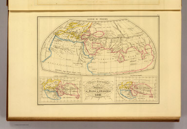
1864 Map of India to Illustrate the Progress … World Atlas Map of India to Illustrate the Progress … |

1865 Map of Hindoostan, Farther India, China, … World Atlas Map of Hindoostan, Farther India, China, … |

1804 Lower Sheet: Map of India. Case Map (Lower Sheet to) To Mark Wood Esqr. M.P. … |

1804 Middle Sheet: Map of India. Case Map (Middle Sheet to) To Mark Wood Esqr. M.P … |

1804 Upper Sheet: Map of India. Case Map (Upper Sheet to) To Mark Wood Esqr. M.P. … |

1804 Covers: Map of India. Case Map (Covers to) To Mark Wood Esqr. M.P. colo … |

1804 Composite: Map of India. Case Map (Composite Map of) To Mark Wood Esqr. M. … |

1825 Punjab World Atlas Punjab. London, Published Jany. 4.1825 b … |

1825 India World Atlas India. London, Published Jany. 4.1825 by … |

1990 South Asia -- Physical-Political Wall Map South Asia. |