Who What Where WhenREMOVEWHO
WHEN
|
Author
Mitchell, Samuel Augustus
Full Title
Map of the States Of Ohio, Indiana & Illinois And Part Of Michigan Territory Compiled from the Latest Authorities. Published by S. Augustus Mitchell Philadelphia. 1831. J.H. Young Sc.
Publisher
S.A. Mitchell
Author
Burr, David H., 1803-1875
Full Title
Map of Ohio And Indiana Exhibiting the Post Offices, Post Roads, Canals, Rail Roads, &c. By David H. Burr. (Late Topographer to the Post Office.) Geographer to the House of Representatives of the U.S. John Arrowsmith. Entered ... July 10th, 1839, by David H. Burr ... District of Columbia.
Publisher
John Arrowsmith
Author
Colton, G.W.
Full Title
Indiana. Published By J.H. Colton & Co. No. 172 William St. New York. Entered ... 1855 by J.H. Colton & Co. ... New York. No. 41.
Publisher
J.H. Colton
Author
G.W. & C.B. Colton & Co.
Full Title
Maps showing the Indiana & Illinois Central Railway. And Its Connections. Prepared By G.W. & C.B. Colton & Co. 172 William Street New York. Entered ... 1872 by G.W. & C.B. Colton & Co. ... Washington. (with) Untitled inset map of railway connections from the Eastern Seaboard to Colorado and Wyoming.
Publisher
G.W. & C.B. Colton
Author
Henshaw, Frances A.
Full Title
Indiana.
Publisher
Manuscript
Author
Henshaw, Frances A.
Full Title
(Description of) Indiana.
Publisher
Manuscript
Author
Asher & Adams
Full Title
Asher & Adams' Ohio & Indiana. Entered according to Act of Congress in the year 1874 by Asher & Adams ... at Washington. (New York, 1874)
Publisher
Asher and Adams
Author
Schonberg & Co.
Full Title
Ohio and Indiana. entered ... 1864 ... New York.
Publisher
Schonberg & Co.
Author
Shell Oil Company
Full Title
Shell Map of Indiana (cover title). Shell Highway Map of Indiana. 8-DD-1956-3.
Publisher
Shell Oil Company
Author
Shell Oil Company
Full Title
Hammond, Gary, Michigan City Region. Indianapolis. (Verso to) Shell Highway Map of Indiana.
Publisher
Shell Oil Company
Author
Colton, J. H.
Full Title
(Covers to) Colton's New Map Of Indiana. Reduced from his Large Map Exhibiting the Boundaries of Counties, Township Surveys, Location of Cities, Towns, Villages, Post Offices, Canals, Rail Roads & other Internal Improvements. New-York, Published by J.H. Colton. 1853.
Publisher
J. H. Colton.
Author
Colton, J. H.
Full Title
Colton's New Map Of Indiana. Reduced from his Large Map Exhibiting the Boundaries of Counties, Township Surveys, Location of Cities, Towns, Villages, Post Offices, Canals, Rail Roads & other Internal Improvements. New-York, Published by J.H. Colton. 1853.
Publisher
J. H. Colton.
Author
Colton, J. H.
Full Title
(Covers to) Colton's New Map Of Indiana. Reduced from his Large Map Exhibiting the Boundaries of Counties, Township Surveys, Location of Cities, Towns, Villages, Post Offices, Canals, Rail Roads & other Internal Improvements. New-York, Published by J.H. Colton & Co. 1854. Entered ... 1854, by J.H. Colton ... New York.
Publisher
J.H. Colton & Co.
Author
Colton, J. H.
Full Title
Colton's New Map Of Indiana. Reduced from his Large Map Exhibiting the Boundaries of Counties, Township Surveys, Location of Cities, Towns, Villages, Post Offices, Canals, Rail Roads & other Internal Improvements. New-York, Published by J.H. Colton & Co. 1854. Entered ... 1854, by J.H. Colton ... New York.
Publisher
J.H. Colton & Co.
Author
Mitchell, Samuel Augustus
Full Title
(Covers to) Map of the States Of Ohio, Indiana And Illinois with the settled part of Michigan. Published by S. Augustus Mitchell Philadelphia: 1834. Sold by Mitchell & Hinman No. 6 North 5th St. Entered ... 1834 by S. Augustus Mitchell ... Pennsylvania. Engraved by J.H. Young. (inset) Lead Region East of the Mississippi River. (inset) Falls Of Ohio. (inset) Vicinity Of Cincinnati. (inset) Vicinity Of Detroit.
Publisher
S. Augustus Mitchell
Author
Mitchell, Samuel Augustus
Full Title
Map of the States Of Ohio, Indiana And Illinois with the settled part of Michigan. Published by S. Augustus Mitchell Philadelphia: 1834. Sold by Mitchell & Hinman No. 6 North 5th St. Entered ... 1834 by S. Augustus Mitchell ... Pennsylvania. Engraved by J.H. Young. (inset) Lead Region East of the Mississippi River. (inset) Falls Of Ohio. (inset) Vicinity Of Cincinnati. (inset) Vicinity Of Detroit.
Publisher
S. Augustus Mitchell
Author
[Mitchell, Samuel Augustus, Young, James H.]
Full Title
(Covers to) The Tourist's Pocket Map Of The State Of Indiana Exhibiting Its Internal Improvements Roads Distances &c. By J.H. Young. Philadelphia: Published by S. Augustus Mitchell. 1834. Entered ... 1834 ... Pennsylvania. Engraved by J.H. Young & F. Dankworth. (inset) Population of the State of Indiana...1930.
Publisher
S. Augustus Mitchell
Author
[Mitchell, Samuel Augustus, Young, James H.]
Full Title
The Tourist's Pocket Map Of The State Of Indiana Exhibiting Its Internal Improvements Roads Distances &c. By J.H. Young. Philadelphia: Published by S. Augustus Mitchell. 1834. Entered ... 1834 ... Pennsylvania. Engraved by J.H. Young & F. Dankworth. (inset) Population of the State of Indiana...1930.
Publisher
S. Augustus Mitchell
Author
Vandermaelen, Philippe, 1795-1869
Full Title
Partie des Etats-Unis. Amer. Sep. no. 50. Dressee et dessinee par Ph. Vandermaelen. La lettre par Ph. Lippens. Desinee sur pierre et Lith. par H. Ode, Mai 1825. (Quatrieme partie. - Amer. sept. Bruxelles. 1827)
Publisher
Ph. Vandermaelen
Author
Mitchell, Samuel Augustus
Full Title
(Covers to) Map of the States Of Ohio, Indiana And Illinois with the settled part of Michigan. Published by S. Augustus Mitchell Philadelphia: 1837. Sold by Mitchell & Hinman No. 6 North 5th St. Entered ... 1834 by S. Augustus Mitchell ... Pennsylvania. Engraved by J.H. Young. (inset) Lead Region East of the Mississippi River. (inset) Falls Of Ohio. (inset) Vicinity Of Cincinnati. (inset) Vicinity Of Detroit.
Publisher
S. Augustus Mitchell
Author
Mitchell, Samuel Augustus
Full Title
Map of the States Of Ohio, Indiana And Illinois with the settled part of Michigan. Published by S. Augustus Mitchell Philadelphia: 1837. Sold by Mitchell & Hinman No. 6 North 5th St. Entered ... 1834 by S. Augustus Mitchell ... Pennsylvania. Engraved by J.H. Young. (inset) Lead Region East of the Mississippi River. (inset) Falls Of Ohio. (inset) Vicinity Of Cincinnati. (inset) Vicinity Of Detroit.
Publisher
S. Augustus Mitchell
Author
[Mitchell, Samuel Augustus, Young, James H.]
Full Title
(Covers to) The Tourist's Pocket Map Of The State Of Indiana Exhibiting Its Internal Improvements Roads Distances &c. By J.H. Young. Philadelphia: Published by S. Augustus Mitchell. 1839. Entered ... 1835, by S. Augustus Mitchell ... Pennsylvania. Sold by Thomas, Cowperthwait & Co. No 253 Market Street. Engraved by J.H. Young & F. Dankworth.
Publisher
S. Augustus Mitchell
Author
[Mitchell, Samuel Augustus, Young, James H.]
Full Title
The Tourist's Pocket Map Of The State Of Indiana Exhibiting Its Internal Improvements Roads Distances &c. By J.H. Young. Philadelphia: Published by S. Augustus Mitchell. 1839. Entered ... 1835, by S. Augustus Mitchell ... Pennsylvania. Sold by Thomas, Cowperthwait & Co. No 253 Market Street. Engraved by J.H. Young & F. Dankworth.
Publisher
S. Augustus Mitchell
Author
Cram, George Franklin
Full Title
Indiana.
Publisher
George F. Cram
Author
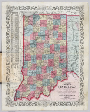
Colton, G.W.
Full Title
Colton's Indiana. Published By G. W & C. B. Colton & Co., No. 182 William St. New York.
Publisher
G. W & C. B. Colton & Co.
Author
Society for the Diffusion of Useful Knowledge (Great Britain)
Full Title
North America sheet VIII. Ohio, with parts of Kentucky and Virginia. Published under the superintendence of the Society for the Diffusion of Useful Knowledge. Engraved by J. & C. Walker. Published May 1st. 1833 by Baldwin & Cradock, 47 Paternoster Row, London. Printed by J. & C. Walker. (London: Chapman & Hall, 1844)
Publisher
Chapman and Hall
Author
Society for the Diffusion of Useful Knowledge (Great Britain)
Full Title
North America sheet IX. Parts of Missouri, Illinois and Indiana. Published under the superintendence of the Society for the Diffusion of Useful Knowledge. Engraved by J. & C. Walker. Published July 1st. 1833 by Baldwin & Cradock, 47 Paternoster Row, London. Printed by Russell, Penge. (London: Chapman & Hall, 1844)
Publisher
Chapman and Hall
Author
Colton, G.W.
Full Title
Colton's Indiana. Published By G. W & C. B. Colton & Co., No. 182 William St. New York.
Publisher
G. W & C. B. Colton & Co.
Author
Colton, G.W.
Full Title
Colton's New Map of Indiana. Reduced from his Large Map Exhibiting the Boundaries of Counties, Township Surveys, Location of Cities, Towns, Villages, Post Offices, Rail Roads & Other Internal Improvements. New York. Published by G.W. & C.B. Colton & Co., No. 172 William St. New York.
Publisher
G.W. & C.B. Colton
Author
Schonberg & Co.
Full Title
Maryland and Delaware. Ohio and Indiana.
Publisher
Schonberg & Co.
Author
Rand McNally and Company
Full Title
(Covers to) Rand McNally & Co.'s Indiana. Copyright, 1880, by Rand, McNally & Co., Chicago, Ill. (inset) City Of Indianapolis.
Publisher
Rand McNally & Co.
Author
Rand McNally and Company
Full Title
Rand McNally & Co.'s Indiana. Copyright, 1880, by Rand, McNally & Co., Chicago, Ill. (inset) City Of Indianapolis.
Publisher
Rand McNally & Co.
Author
Cram, George Franklin
Full Title
Indiana.
Publisher
George F. Cram
Author
Geographical Publishing Company
Full Title
Wayne Co. Indiana. Copyrighted 1915 by The Geographical Publ. Co. Chicago.
Publisher
The Geographical Publishing Company
Author
Strong, Ezra
Full Title
The States Of Ohio Indiana & Illinois And Michigan Territory From the Latest Authorities. Published by Ezra Strong New York, 1835.
Publisher
Ezra Strong
Author
Mitchell, Samuel Augustus
Full Title
A New Map of Indiana, with its Roads & Distances. Published by Thomas, Cowperthwait & Co. No. 253 Market Street, Philadelphia. Entered ... 1850, by Thomas, Cowperthwait & Co. ... Pennsylvania. (inset) Profile of the Wabash and Erie Canal.
Publisher
Thomas, Cowperthwait & Co.
Author
Mitchell, Samuel Augustus Jr.
Full Title
County Map of Ohio and Indiana.
Publisher
Ziegler & McCurdy
Author
Johnson, A.J.
Full Title
Johnson's Indiana, Published By Johnson and Ward. Entered ... 1864, by A.J. Johnson ... New York.
Publisher
Johnson and Ward
Author
Mitchell, Samuel Augustus
Full Title
A new map of Indiana, with its Roads & Distances. Published by Thomas, Cowperthwait & Co. No. 253 Market Street, Philadelphia. Entered ... 1850 by Thomas, Cowperthwait & Co. ... Pennsylvania.
Publisher
Cowperthwait, Desilver & Butler
Author
U.S. General Land Office
Full Title
Department Of The Interior General Land Office J.A. Williamson, Commissioner. State of Indiana. 1878. Compiled from the official Records of the General Land Office and other sources by C. Roeser, Principal Draughtsman G.L.O. Photo lith & print by Julius Bien 16 & 18 Park Place N.Y.
Publisher
Julius Bien
Author
[Bayer, Herbert, Container Corporation of America]
Full Title
Indiana. U.S. State. (inset) (Vicinity of Indianapolis).
Publisher
Container Corporation of America
Author
[Breese, Samuel, 1802-1873, Morse, Sidney E. (Sidney Edwards), 1794-1871]
Full Title
Indiana. Entered ... 1843 by Sidney E. Morse and Samuel Breese. (New York: Published by Harper & Brothers, 1845)
Publisher
Harper & Brothers
Author
[Howe, Samuel Gridley, Ruggles, Samuel P.]
Full Title
Map of Indiana.
Publisher
New England Institution for the Education of the Blind
Author
Page, H.R. & Co.
Full Title
(Index Pages) Guide to Illinois (continued). Guide to Indiana.
Publisher
H.R. Page & Co.
Author
[Page, H.R. & Co., Barker, J.T.]
Full Title
J.T. Barker's Map of Indiana, Compiled & Engraved by H.R. Page & Co. Chicago. 1885.
Publisher
H.R. Page & Co.
Author
Page, H.R. & Co.
Full Title
(Index Pages) Guide to Indiana (continued). Guide to Iowa.
Publisher
H.R. Page & Co.
Author
Johnson, A.J.
Full Title
Johnson's Indiana. Entered ... 1864.
Publisher
A.J. Johnson
Author
Lake, D.J.
Full Title
New Sectional and Township Map of Indiana, 1874. D.L. Bourquin Eng. Chicago. Entered ... 1874 by Higgins Belden & Co. ... Washington D.C.
Publisher
Griffing, Stevenson & Co.
|