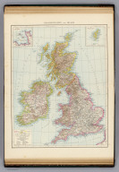
Who What Where WhenWHERE
|
Author
Lothian, John
Full Title
Great Britain and Ireland.
Publisher
James MacLeod and Francis Orr & Sons
Author
[Raynal, G.T., Bonne, R.]
Full Title
Carte des Isles Britanniques : contenant les Royaumes d'Angleterre, d'Ecosse et d'Irlande. Par M. Bonne, Ingenieur, Hdrographe de la Marine. (on upper margin) Liv. III IV X XIV XVI et XVII : No. 17 bis. &18. (to accompany) Histoire Philosophique et Politique Des Establissements et Du Commerce Des Europeens Dans Les Deux Indes.
Publisher
Jean-Leonard Pellet
Author
[Tardieu, Ambroise, Vuillemin, A., Duvotenay, Erhard, Testarode, E.]
Full Title
Iles Britanniques.
Publisher
Furne Et Cie
Author
Bowen, Emanuel
Full Title
A new and accurate map of Great Britain & Ireland, together with their respective islands &c. Drawn from surveys and the most approved maps and charts. The whole being regulated by astronomical observations, by Emanl. Bowen. (London: Printed for William Innys, Richard Ware, Aaron Ward, J. and P. Knapton, John Clarke, T. Longman and T. Shewell, Thomas Osborne, Henry Whitridge ... M.DCC.XLVII)
Publisher
William Innys [et al.]
Author
Delamarche, Felix.
Full Title
Carte des Iles Britanniques ... 1838.
Publisher
F. Delamarche
Author
Arrowsmith, Aaron Jr.
Full Title
Great Britain and Ireland. Insulae Britannicae. London, Published Jany. 2, 1828 by A. Arrowsmith Hydrographer to His Majesty, No. 10, Soho Square.
Publisher
A. Arrowsmith
Author
[Dower, John, Higgins, W.M.]
Full Title
British Isles.
Publisher
[W.S. Orr, Chambers, W. & R.]
Author
Stein, C.G.D.
Full Title
(Text Page to) Tableau de l'Angleterre : Historique, statistique, politique et militaire. Tabelle von England. Historisch, statistische, politische und militarische. (to accompany) Neuer Atlas Der Ganzen Welt.
Publisher
J.C. Hinrichs
Full Title
British Isles. (with) Shetland Isles. Withington sculp. (Published by Lincoln & Edmands, 1819)
Publisher
Lincoln & Edmands
Full Title
British Isles. Asia. H. Morse Sc. Published by Lincoln & Edmands, Boston. (1832)
Publisher
Lincoln & Edmands
Author
Cornell, S. S. (Sarah S.)
Full Title
British Isles. Designed to accompany Cornell's High school geography. Entered ... 1855, by S.S. Cornell ... Southern District of New York. New York: D. Appleton & Co., 443 & 445 Broadway. (1864)
Publisher
Appleton & Co.
Author
[Fairchild, Lucy, Fitch, George W.]
Full Title
British Islands. Drawn by (to be filled in. By George W. Fitch. New York: Sheldon, Blakeman and Company, 115 Nassau Street. Entered ... 1850, by Huntington and Savage ... New York)
Publisher
Blakeman, Sheldon & Co.
Author
[Gaultier, abbe (Aloisius Edouard Camille), 1746?-1818, Wauthier, J. M.]
Full Title
A plain map or emblematic chart for the geographical game of the British Islands, according to the method of the Abbe Gaultier. By Mr. Wauthier, his pupil. 1797. Hewitt Sc.
Publisher
Harris and Son
Author
[Gaultier, abbe (Aloisius Edouard Camille), 1746?-1818, Wauthier, J. M.]
Full Title
A map of the British Isles, according to the method of the Abbe Gaultier, by Mr. Wauthier, his pupil. 1799.
Publisher
Harris and Son
Full Title
British Islands. J.H. Young Sc. (Philadelphia: John Grigg, No. 9 North Fourth Street. 1830)
Publisher
John Grigg
Full Title
Les royaumes d'Angleterre, d'Ecosse et d'Irelande. Avec privil. (A Paris, chez Delamarche, Geogr., ca. 1800)
Publisher
C.F. Delamarche
Full Title
South America. J.W. Barber sc. (with) British Isles. (Published by Richardson & Lord. Sold also by Collins & Hannay, New-York, 1828)
Publisher
Richardson & Lord
Full Title
Great Britain and Ireland. Entered ... 1836, by Eleazer Huntington ... Connecticut.
Publisher
Reed & Barber
Author
[Lapie, Alexandre Emile, Lapie, M. (Pierre), 1779-1850]
Full Title
Carte des Iles Britanniques comprenant l'Angleterre, l'Ecosse et l'Irlande. Dressee par M. Lapie, 1er. Geographe du Roi et M. Lapie Fils, Lieut. Ingr. Geoge. Paris, 1829. Chez Eymery Fruger et Cie., Rue Mazarine No. 30. La gravure dirigee et gravee par Lallemand.
Publisher
Eymery Fruger et Cie
Author
[Bartholomew, J. G. (John George), 1860-1920, John Bartholomew & Co.]
Full Title
British Isles - railways & industrial. (with) Distribution of land under cultivation. (with) Distribution of land under pasture. The Edinburgh Geographical Institute, John Bartholomew & Co. "The Times" atlas. (London: The Times, 1922)
Publisher
The Times
Author
[Bartholomew, J. G. (John George), 1860-1920, John Bartholomew & Co.]
Full Title
British Isles - political. (with) Industrial sketch map. (with) Density of population. The Edinburgh Geographical Institute, John Bartholomew & Co. "The Times" atlas. (London: The Times, 1922)
Publisher
The Times
Author
[Bartholomew, J. G. (John George), 1860-1920, John Bartholomew & Co.]
Full Title
(Composite of) Section maps of the British Isles on a scale of 1:633,600. The Edinburgh Geographical Institute, John Bartholomew & Co. "The Times" atlas. (London: The Times, 1922)
Publisher
The Times
Author
[Covens et Mortier, Lisle, Guillaume de, 1675-1726]
Full Title
Les Isles Britanniques ou sont le Royaumes d'Angleterre tire de Speed, celuy d'Ecosse tire de de Th. Pont et celuy d'Irlande tire de Petti. Le tout rectifie par diverses observations. Par G. de l'Isle, Geographe de l'Academie Royale des Sciences. A Amsterdam, Chez J. Covens & C. Mortier, avec privil. (Title in upper margin): Magnae Britanniae tabula, comprehendens Angliae, Scotiae, ac Hiberniae Regna, ad usum serenissimi Burgundiae Ducis. (1742?)
Publisher
Covens & Mortier
Author
[Enouy, Joseph Christopher, Robert Laurie & James Whittle]
Full Title
The invasions of England and Ireland with all their civil wars since the conquest. Compiled & drawn by J. Enouy, Geographer. London, Published by Laurie & Whittle, Fleet Street, 15th Septr. 1797. 2d edition, Augt. 12th, 1801. S. Neele sculpt.
Publisher
Laurie & Whittle
Author
Arrowsmith, Aaron
Full Title
United Kingdoms of Great Britain and Ireland. From Arrowsmith's map of the British Isles. Hooker sc. (Published by John Conrad & Co., Philadelphia. 1804)
Publisher
J. Conrad
Author
Arrowsmith, Aaron
Full Title
United Kingdoms of Great Britain and Ireland. From Arrowsmith's map of the British Isles. Hooker sc. (Boston: Published by Thomas & Andrews. 1812)
Publisher
Thomas & Andrews
Author
Touring club italiano
Full Title
Gran Bretagna, Great Britain. Propr. Artistico-letteraria del T.C.I. Ufficio cartografico del T.C.I. (1929)
Publisher
Touring club italiano
Author
Patteson, Edward
Full Title
Insulae Britannicae. The British Isles. E.P. delint. S.I. Neele sculp, 352 Strand. Published June 15th 1804 by the Revd. E. Patteson, M.A., Richmond, Surrey.
Publisher
Patteson
Author
Patteson, Edward
Full Title
Insulae Britannicae. The British Isles. E.P. delin. Neele sc., 352 Strand. Published June 15th 1804 by the Revd. E. Patteson, M.A., Richmond, Surrey.
Publisher
Patteson
Author
[Morse, H., Worcester, J. E.]
Full Title
Britain of the United Kingdom of England, Scotland and Ireland. H. Morse Sc. Published by Cummings & Hilliard, No. 1 Cornhill, Boston. (ca. 1821)
Publisher
Cummings & Hilliard
Author
Goodrich, S.G.
Full Title
Pacific Ocean. British Islands. G. Boynton Sc. Entered ... by S.G. Goodrich of Massachusetts. (Boston: Gray & Bowen ... 1831)
Publisher
Gray & Bowen
Author
Cummings, J. A. (Jacob Abbot)
Full Title
Britain or the United Kingdom of England, Scotland and Ireland. Published by Cummings & Hilliard, No. 1, Cornhill, Boston. H. Morse Sc. (1821?)
Publisher
Cummings and Hilliard
Author
Horsley, John, 1675-1732
Full Title
Britannia Antiqua. Auctore Horsley. W. Sim, Sc. (1814?)
Publisher
R. M'Dermut
Author
Mitchell, Samuel Augustus
Full Title
Map of Great Britain and Ireland. Engraved to illustrate Mitchell's school and family geography. J.H. Young Sc. Entered ... 1840 by S. Augustus Mitchell ... Eastern District of Pennsylvania.
Publisher
Thomas, Cowperthwait & Co.
Full Title
British Isles. (with) The Channel Islands. (with) The Shetland Islands. (Published at the office of "The Times," London, 1895)
Publisher
The Times
Author
[Bartholomew, J. G. (John George), 1860-1920, John Bartholomew & Co.]
Full Title
British Isles -- bathy-orographical. The Edinburgh Geographical Institute, John Bartholomew & Co. "The Times" atlas. (London: The Times, 1922)
Publisher
The Times
Author
[Bartholomew, J. G. (John George), 1860-1920, John Bartholomew & Co.]
Full Title
British Isles - vegetation & climate. The Edinburgh Geographical Institute, John Bartholomew & Co. "The Times" atlas. (London: The Times, 1922)
Publisher
The Times
Full Title
Grossbritannien und Irland. (with) Die Canal Inseln. (with) Die Shetland Inseln. (Richard Andree. Herausgegeben von der Geographischen Anstalt von Velhagen & Klasing in Leipzig. 1881)
Publisher
Velhagen & Klasing
Author
Moll, Herman, d. 1732
Full Title
A general map of Great Britain and Ireland, with part of Germany, Holland, Flanders, France &c. Agreeable to modern history. By H. Moll Geographer. (with Farro, Schetland and Orkney islands). (Printed for Tho: Bowles next ye Chapter House in St. Pauls Church Yard, & John Bowles at the Black Horse in Cornhill, London 1736?)
Publisher
Thos. Bowles and John Bowles
Full Title
British Islands. N. & S.S. Jocelyn Sc. (Boston: Published by Richardson & Lord. 1820)
Publisher
Richardson & Lord
Author
Greenleaf, Jeremiah
Full Title
British Islands.
Publisher
G.R. French
Author
Clouet, J. B. L. (Jean-Baptiste Louis), b. 1730
Full Title
Des Isles Britanniques. (1787)
Publisher
Mondhare et Jean
Full Title
British Isles. (with) Shetland Isles. (Boston: Hilliard, Gray, Little and Wilkins, 1826)
Publisher
Hilliard, Gray, Little and Wilkins
Full Title
Die Brittischen Inseln. England, Schottland, Ireland. (Efter Stielers Hand-Atlas. Stockholm, J.L. Brudin, 1852)
Publisher
J.L. Brudin
Full Title
(La Grande-Bretagne. A Lyon, Chez Jean-Marie Bruyset, Pere & Fils. M.DCC.LXXXIV)
Publisher
Jean-Marie Bruyset
Author
Fenner, Rest.
Full Title
Britannicae Insulae. Fenner Sc., Paternoster Row. (London, Joseph Thomas, 1835)
Publisher
Joseph Thomas
Author
Fenner, Rest.
Full Title
British Isles. Fenner Sc., Paternoster Row. (London, Joseph Thomas, 1835)
Publisher
Joseph Thomas
Author
[Stieler, Adolf, Stulpnagel, F.v.]
Full Title
(Composite of) No. XVII, XIX, XX. Stieler's Hand-Atlas (No. 15b, 15c, 15d.) England und Wales, Schotland, Ireland.
Publisher
Justus Perthes
Author
[Stieler, Adolf, Stulpnagel, F.v.]
Full Title
No. XVII. Stieler's Hand-Atlas (No. 15a.) Die Brittischen Inseln und Die Nord-See.
Publisher
Justus Perthes
Author
[Andree, Richard, Scobel, Albert]
Full Title
Ubersichtskarte von Groszbritannien und Irland. Mai.1905. Bearb. v. G. Jungk. Lithogr. v. P. Franke, H. Anschutz u. A.Soeder. Flachentreue Azmut-Projektion. (insets : nebenkarten) Shetland und Orkney-Inseln ; Umgebung von London ; Britische Kolonien.
Publisher
Velhagen & Klasing
|