Browse All

1900 Title Page: Map Of Maine Pocket Map (Title Page to) Farrington's Map Of Main … |
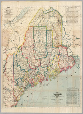
1900 Map Of Maine Pocket Map Farrington's Map Of Maine, Together with … |

1886 Covers: Maine Pocket Map (Covers to) Colton's Maine. Published By … |

1886 Maine Pocket Map Colton's Maine. Published By G.W. And C. … |

1879 Covers: Maine Pocket Map (Covers to) Colton's Maine. Published By … |

1879 Maine Pocket Map Colton's Maine. Published By G.W. And C. … |

1874 County map of the State of Maine World Atlas County map of the State of Maine. (with … |

1877 County map of the State of Maine World Atlas County map of the State of Maine. (with … |

1850 Maine. World Atlas A New Map of Maine. |

1865 North America Sheet II. World Atlas North America Sheet II. East Canada and … |

1857 A New Map of Maine World Atlas A New Map of Maine. Published by Charles … |

1860 Maine. World Atlas Johnson's Maine By Johnson & Browning. N … |

1828 The north eastern coast, North America, … Chart Atlas The north eastern coast of North America … |

1927 Maine National Atlas Maine. (Copyrighted by) National Map Com … |

1868 County map of the State of Maine World Atlas County map of the State of Maine. (inset … |

1832 Maine, N.H., Vt. National Atlas Map of Maine, New Hampshire and Vermont. … |

1836 Maine. School Atlas Maine. Entered ... 1836, by Eleazer Hunt … |

1804 Maine. World Atlas Maine. Drawn by S. Lewis. Engd. by Hooke … |

1812 Maine. World Atlas Maine. (Boston: Published by Thomas & An … |

1834 Canal de la Chesapeake a l'Ohio. National Atlas Canal de la Chesapeake a l'Ohio. Plan ge … |

1831 Maine; Costumes. World Atlas Maine. G. Boynton Sc. Entered ... by S.G … |

1929 129. Maine, Nova Scotia, New Brunswick, … World Atlas Stati Uniti, United States of America. M … |

1929 Legend: 129-31. Maine, Ohio, Penn., N.Y. … World Atlas (Legend to) Stati Uniti, United States o … |

1890 Maine. World Atlas County and township map of the state of … |

1823 Maine, N.H., Vermont. National Atlas Maine, New Hampshire and Vermont. N. & S … |

1755 Nova Scotia, Cape Britain. Geography Book A new map of Nova Scotia and Cape Britai … |

1840 Maine. World Atlas Maine. |

1870 Maine. [State Atlas, World Atlas] County map of the state of Maine. (with) … |

1880 Maine. World Atlas County map of the state of Maine. (with) … |

1796 Province of Maine. National Atlas Province of Maine. Engraved by A. Doolit … |

1794 Province of Maine. World Atlas The Province of Maine, From the best Aut … |

1796 Province of Maine. World Atlas The Province of Maine, From the best Aut … |

1966 Alpine Glaciation. Youthful Glaciation. … Physical Atlas Alpine Glaciation. Youthful Glaciation. … |

1966 Continental Glaciation. Eskers-Drumlins. … Physical Atlas Continental Glaciation. Eskers-Drumlins. … |

1966 Shorelines. Embayed-Resistant. Boothbay, … Physical Atlas Shorelines. Embayed-Resistant. Boothbay, … |

1860 Maine. World Atlas A New Map of Maine. Philadelphia, Publis … |

1940 Road map of Maine, New Hampshire, Vermon … National Atlas Rand McNally Road map, Maine, New Hampsh … |

1829 Maine. State Atlas Map of the principal rivers, mountains a … |

1829 Upper & Lower Canada, Gaspe. State Atlas Sketch from Bouchette's maps of Upper & … |

1829 Maine highlands. State Atlas Sketch of the imaginary ranges of highla … |

1829 Maine vertical sections. State Atlas Vertical sections, exhibiting the compar … |

1829 Maine grants & land sales. State Atlas Map exhibiting the principal original gr … |

1829 Maine, inhabited part. State Atlas Map of the inhabited part of the State o … |

1829 Meteorological diagrams. State Atlas Meteorological diagrams. Monthly means o … |

1829 Cover: Atlas, Maine. State Atlas (Covers to) Atlas accompanying Greenleaf … |

1811 Maine. World Atlas The Province of Maine, From the best Aut … |

1885 Maine National Atlas Maine. (to accompany) Bradstreet's Pocke … |

1828 Maine National Atlas Part Of Maine &c. with The Boundary Clai … |

1883 Maine. World Atlas Maine. |

1838 Maine World Atlas Maine. (to accompany) A Comprehensive At … |