Browse All

1842 Maine National Atlas Maine. (to accompany) Supplement To The … |

1873 Maine. World Atlas Gray's Atlas Map of Maine. |

1827 Maine, New Hampshire, and Vermont. National Atlas Map of Maine, New Hampshire, and Vermont … |

1855 Maine. National Atlas Maine. Entered ... 1855 by J.H. Colton & … |

1878 New England. National Atlas Cram's Rail Road & County Map of New Eng … |

1891 Map of Maine. 68 World Atlas Map of Maine. Copyright 1891 by Matthews … |

1939 Rand McNally Road map: Maine, New Hampsh … National Atlas Rand McNally Road map: Maine, New Hampsh … |

1935 Maine. National Atlas Maine. |

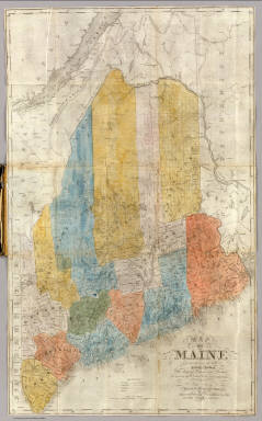
1845 Maine National Atlas Maine. (By Sidney E. Morse and Samuel Br … |

1846 New Map of Maine. World Atlas A New Map of Maine. Published By S. Augu … |

1846 State Of Maine With The Province Of New … Wall Map Map Of The State Of Maine With The Provi … |

1862 State of Maine. Case Map Map Of The State Of Maine. From Surveys … |

1844 State Of Maine With The Province Of New … Wall Map Map Of The State Of Maine With The Provi … |

1866 Chart From Cape Cod To Belle Isle. Wall Map Eldridge's Chart From Cape Cod To Belle … |

1891 (Quebec, New England) Railroad Map of th … Case Map Rand, McNally & Co.'s New Shippers' Rail … |

1891 Covers: (Quebec, New England) Railroad M … Case Map (Covers to) Rand, McNally & Co.'s New Sh … |

1853 Maine. Pocket Map Maine. 1853. Published By J.H. Colton. N … |

1853 Covers: Maine. Pocket Map (Covers to) Maine. 1853. Published By J. … |

1857 Covers: New Map of Maine. Pocket Map (Covers to) A New Map of Maine. Publishe … |

1857 New Map of Maine. Pocket Map A New Map of Maine. Published By Charles … |

1795 Province of Maine. National Atlas The Province of Maine, From the best Aut … |

1898 Cover: Lines, metallic circuit connectio … Pocket Map (Covers to) Lines And Metallic Circuit C … |

1898 Lines And Metallic Circuit Connections. Pocket Map Lines And Metallic Circuit Connections. … |

1843 Cover: Maine. Pocket Map (Covers to) Map Of Maine Constructed fro … |
1843 Map Of Maine. Pocket Map Map Of Maine Constructed from the most C … |

1889 South Carolina, Wisconsin, Maine, Michig … National Atlas South Carolina, Wisconsin, Maine, Michig … |

1831 Map of Maine, New Hampshire,and Vermont. National Atlas Map of Maine, New Hampshire And Vermont, … |

1860 County Map Of The State Of Maine. World Atlas County Map Of The State Of Maine. 11. (w … |

1967 199. New England. The World Atlas. World Atlas 199. New England. The World Atlas. |

1865 Maine. World Atlas Colton's Maine. Published By J. H. Colto … |

1869 Maine. World Atlas Colton's Maine. Published by G. W & C. B … |

1852 Quebec, New Brunswick, Maine, Vermont, N … National Atlas (Quebec, New Brunswick, Maine, Vermont, … |

1827 Maine, New Hampshire, Vermont. National Atlas Map of Maine, New Hampshire, and Vermont … |

1948 Maine. World Atlas Maine. 4366. |

1865 Maine. World Atlas Johnson's Maine By Johnson and Ward. |

1874 Maine. New Hampshire. World Atlas Gray's Atlas Map of Maine. New Hampshire … |

1886 Maine. World Atlas Johnson's Maine. Published by Alvin J. J … |

1924 Text Page: Industrial Statistics of the … National Atlas (Text Page) Industrial Statistics of the … |

1924 Text Page: Industrial Statistics of the … National Atlas (Text Page) Industrial Statistics of the … |

1924 Maine. National Atlas Commercial Atlas of America. Rand McNall … |

1924 Text Page: Maine - Geographical Features … National Atlas (Text Page) Maine - Counties, Islands, L … |

1924 New England, Eastern New York. National Atlas Commercial Atlas of America. Rand McNall … |

1924 Maine. National Atlas Commercial Atlas of America. Rand McNall … |

1831 Maine. [Classical Atlas, World Atlas] Maine. Published by A. Finley Philada. Y … |

1823 Maine. World Atlas Maine. B.T. Welch & Co. Sc. Drawn & Publ … |

1836 New Map of Maine. World Atlas A New Map of Maine By H.S. Tanner. Enter … |

1814 District of Maine. World Atlas The District of Maine. Engrd. by John G. … |

1856 Maine. National Atlas Maine. Published by A. & C. Black. Edinb … |

1882 Maine. World Atlas County and township map of the state of … |

1889 Text Page: Maine. National Atlas (Text Page) Maine. |