Browse All

1847 Covers: Massachusetts, Connecticut And R … Pocket Map (Covers to) Map Of Massachusetts, Connec … |

1847 Massachusetts, Connecticut And Rhode Isl … Pocket Map Map Of Massachusetts, Connecticut And Rh … |

1920 Covers: New England Pocket Map (Covers to) Map of New England ... Copyr … |

1920 Text Page: New England States With Offic … Pocket Map (Text page to) Map of New England ... Co … |
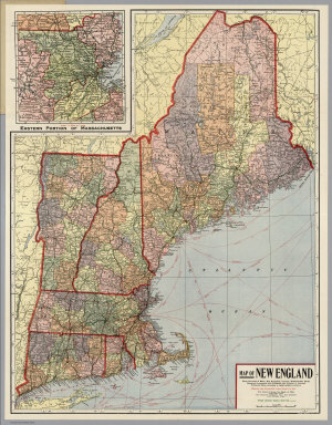
1920 New England Pocket Map Map of New England ... Copyright 1920 Th … |

1874 County and township map of the states of … World Atlas County and township map of the states of … |

1877 County and township map of the States of … World Atlas County and township map of the States of … |

1850 Massachusetts and Rhode Island. World Atlas Massachusetts and Rhode Island. |

1857 Map of Massachusetts and Rhode Island World Atlas Map of Massachusetts and Rhode Island: P … |

1828 Plan of a survey for the proposed Boston … Gov't Report Book Plan of a survey for the proposed Boston … |

1860 Massachusetts Connecticut And Rhode Isla … World Atlas Johnson's Massachusetts Connecticut And … |

1927 Massachusetts and Rhode Island National Atlas Massachusetts and Rhode Island. (Copyrig … |

1868 County map of Massachusetts, Connecticut … World Atlas County map of Massachusetts, Connecticut … |

1832 Mass., Conn., R.I. National Atlas Map of the states of Massachusetts and C … |

1836 Mass., R.I. School Atlas Massachusetts and Rhode Island. Entered … |

1831 Massachusetts, Rhode Island. World Atlas Massachusetts. Rhode Island. G. Boynton … |

1929 Legend: 132-33. Mass., Conn., R.I., N.J. … World Atlas (Legend to) Stati Uniti, United States o … |

1890 Mass., Conn., R.I. World Atlas County and township map of the states of … |

1823 Mass., R.I., Conn. National Atlas Massachusetts, Rhode-Island and Connecti … |

1840 Massachusetts. Rhode Island. And Connect … World Atlas Massachusetts. Rhode Island. And Connect … |

1870 Mass., Conn., R.I. [State Atlas, World Atlas] County map of Massachusetts, Connecticut … |

1880 Mass., Conn., R.I. World Atlas County and township map of the states of … |

1758 New England World Atlas New England. (to accompany) Atlas Minimu … |

1859 Massachusetts and Rhode Island. World Atlas Map of Massachusetts and Rhode Island. P … |

1905 Complete Road Atlas, Massachusetts And R … Regional Atlas Complete Road Atlas Massachusetts and Rh … |

1905 Composite: Sheets 1 - 5. Scarborough's C … Regional Atlas (Composite of) Sheets 1 - 5. Scarborough … |

1940 Road map of Connecticut, Massachusetts, … National Atlas Rand McNally Road map, Connecticut, Mass … |

1883 Massachusetts, Rhode Island, and Connect … World Atlas Massachusetts, Rhode Island, & Connectic … |

1845 Massachusetts and Rhode Island National Atlas Massachusetts and Rhode Island. (to acco … |

1873 Massachusetts and Rhode Island. World Atlas Gray's Atlas Map of Massachusetts and Rh … |

1827 Massachusetts, Connecticut, and Rhode Is … National Atlas Map of Massachusetts, Connecticut, and R … |

1876 Massachusetts, Rhode Island, and Connect … National Atlas Gray's New Map of Massachusetts, Rhode I … |

1890 24. Blackstone sheet. State Atlas Massachusetts-Rhode Island. Blackstone s … |

1890 27. Franklin sheet. State Atlas Massachusetts-Rhode Island. Franklin she … |

1939 Rand McNally Road map: Connecticut, Mass … National Atlas Rand McNally Road map: Connecticut, Mass … |

1845 Massachusetts and Rhode Island National Atlas Massachusetts and Rhode Island. (By Sidn … |

1846 Massachusetts And Rhode Island. World Atlas Massachusetts And Rhode Island: (with) B … |

1831 Map of Massachusetts, Connecticut, and R … National Atlas Map Of Massachusetts, Connecticut And Rh … |

1865 Massachusetts and Rhode Island, Vicinity … World Atlas Colton's Massachusetts and Rhode Island. … |

1869 Massachusetts, Connecticut and Rhode Isl … World Atlas Colton's Massachusetts, Connecticut and … |

1852 New York, New Jersey, Massachusetts, Con … National Atlas (New York, New Jersey, Massachusetts, Co … |

1827 Massachusetts, Connecticut, Rhode Island … National Atlas Map of Massachusetts, Connecticut, and R … |

1948 Massachusetts, Connecticut, and Rhode Is … World Atlas Southern New England. Massachusetts, Con … |

1864 Vermont, New Hampshire, Massachusetts, R … World Atlas Johnson's Vermont, New Hampshire, Massac … |

1864 Massachusetts, Connecticut, And Rhode Is … World Atlas Johnson's Massachusetts, Connecticut, An … |

1874 Massachusetts. Rhode Island. World Atlas Gray's Atlas Map of Massachusetts and Rh … |

1924 Connecticut, Massachusetts, and Rhode Is … National Atlas Commercial Atlas of America. Rand McNall … |

1836 Massachusetts And Rhode Island. World Atlas Massachusetts And Rhode Island: By H.S. … |

1856 New York, Vermont, New Hampshire, Rhode … National Atlas New York, Vermont, New Hampshire, Rhode … |

1884 Mass., Conn., R.I. World Atlas County and township map of the states of … |