Who What Where WhenWHEREShow More |
REFINE
Browse All : Images of Orinoco-Essequibo Region and Democratic Republic of CongoAuthor
Duflot de Mofras, Eugene
Full Title
Carte De La Cote De L'Amerique Sur L'Ocean Pacifique Septentrional Le Territoire De L'Oregon, Les Californies, La Mer Vermeille, Partie des Territoires de la Compagnie de la Baie d'Hudson, Et De L'Amerique Russe. Dressee par Mr. Duflot de Mofras, Attache a la Legation de France a Mexico; Pour servir a l'intelligence de son Voyage d'exploration Publie Par Ordre Du Roi, sous les Auspices De Mr. Le Marechal Duc De Dalmatie, Mr. Le Ministre Des Affaires Etrangeres. Paris, 1844. Le plan grave par Jacobs. L'ecriture gravee par Hacq. Publie par Arthus Bertrand.
Publisher
Arthus Bertrand
Author
Hutawa, Julius
Full Title
(Covers to) Map Of Mexico & California. Compiled from the latest authorities. By Juls. Hutawa. Lithr. Second St. 45 St. Louis, Mo. 2nd Edition. 1863. (inset) Vicinity of Mexico.
Publisher
J. Hutawa
Author
Hutawa, Julius
Full Title
Map Of Mexico & California. Compiled from the latest authorities. By Juls. Hutawa. Lithr. Second St. 45 St. Louis, Mo. 2nd Edition. 1863. (inset) Vicinity of Mexico.
Publisher
J. Hutawa
Author
Farnham, Thomas Jefferson, 1804-1848
Full Title
Map of the Californias by T.J. Farnham. Entered ... 1845 by Thomas J. Farnham ... New York. (New York: Published by Harper & Brothers, 1845)
Publisher
Harper & Brothers
Author
[Breese, Samuel, 1802-1873, Morse, Sidney E. (Sidney Edwards), 1794-1871]
Full Title
Mexico. (with) Central America and Yucatan. (By Sidney E. Morse and Samuel Breese. New York: Published by Harper & Brothers, 1845)
Publisher
Harper & Brothers
Author
Society for the Diffusion of Useful Knowledge (Great Britain)
Full Title
Central America II. Texas, California and the northern states of Mexico. Published under the superintendence of the Society for the Diffusion of Useful Knowledge. J. & C. Walker sculpt. Published by Chapman & Hall, 186 Strand, 15th. Oct. 1842. (1844)
Publisher
Chapman and Hall
Author
U.S. War Department, Topographical Engineers
Full Title
Map Of The United States And Their Territories Between The Mississippi and the Pacific Ocean And Of Part of Mexico. Compiled in the Bureau of the Corps of Topogl. Engs. under a Resolution of the U.S. Senate. From the best authorities which could be obtained. 1850. Engraved by Sherman and Smith, New-York.
Publisher
Sherman and Smith
Author
Radefeld, Carl Christian Franz, 1788-1874
Full Title
Texas. Nach den besten Quellen entw. u. gez. vom Hauptm. Radefeld. 1846. Stich, Druck und Verlag des Bibliographischen Instituts zu Hildburghausen, (1860)
Publisher
Bibliographischen Instituts
Author
Radefeld, Carl Christian Franz, 1788-1874
Full Title
Neueste Karte von Mexico. Nach den besten Quellen entw. u. gezeichn. von Hauptm. Radefeld. 1845. Stich, Druk, und Verlag des Bibliographischen Instituts zu Hildburghausen, (1860)
Publisher
Bibliographischen Instituts
Author
Southern Pacific Company
Full Title
(Covers to:) California, Texas, Mexico And Arizona Southern Pacific Co. "Sunset route" from New Orleans to the Pacific Coast ... January, 1892. American Bank Note Co., N.Y.
Publisher
Poole Brothers.
Author
Southern Pacific Company
Full Title
California, Texas, Mexico And Arizona Southern Pacific Co. "Sunset route" from New Orleans to the Pacific Coast ... January, 1892. American Bank Note Co., N.Y.
Publisher
Poole Brothers.
Author
Southern Pacific Company
Full Title
Correct map of the railway & steamship lines operated by the Southern Pacific Company [United States and Mexico]. Poole Bros., Map Engravers, Chicago. (inset) County map of Texas showing the Atlantic System of the Southern Pacific Company. (inset) San Francisco, California. (inset) Los Angeles, California. (inset) New Orleans. (inset) San Antonio, Texas.
Publisher
Poole Brothers.
Author
Disturnell, John
Full Title
(Covers to) Mapa de los Estados Unidos de Mejico, segun lo organizado y definido por las varias actas del Congreso de dicha Republica ... Lo Publican J. Disturnell, 102 Broadway. Nueva York. 1846.
Publisher
J. Disturnell
Author
Disturnell, John
Full Title
(Text Page to) Mapa de los Estados Unidos de Mejico, segun lo organizado y definido por las varias actas del Congreso de dicha Republica ... Lo Publican J. Disturnell, 102 Broadway. Nueva York. 1846.
Publisher
J. Disturnell
Author
Disturnell, John
Full Title
Mapa de los Estados Unidos de Mejico, segun lo organizado y definido por las varias actas del Congreso de dicha Republica ... Lo Publican J. Disturnell, 102 Broadway. Nueva York. 1846. (inset) Carto de los caminos &c. desde Vera Cruz y Alvarado a Mejico.
Publisher
J. Disturnell
Full Title
Carte geographique, statistique et historique du Mexique. Mexique. Grave par B. de Beaupre, Rue de Vaugirard, No. 81, a Paris. Fonderie et Imprimerie de J. Carez. (1825)
Publisher
J. Carez
Author
Flemming, Carl
Full Title
Mexico, Mittel-America, Texas. Lithographie, Druck u. Verlag von C. Flemming in Glogau. (1855)
Publisher
C. Flemming
Full Title
Mexico. (with) Texas. (Written and engraved by Jos. Perkins. 1845)
Publisher
Tanner's Geographical Establishment
Author
[Brue, Adrien Hubert, 1786-1832, Picquet, C.]
Full Title
Carte generale des Etats-Unis Mexicains, de la Republique du Texas et des etats de l'Amerique Centrale. (with) Guatemala ou Provinces-Unies de l'Amerique Centrale. Par A. Brue, Geographe du Roi (1825). Revue et augmentee par Ch. Picquet, Geographe du Roi et de Mgr. le Duc d'Orleans. Paris, 1840. Chez Ch. Picquet, Quai Conti No. 17, pres du Pont des Arts.
Publisher
C. Picquet
Author
Arrowsmith, John
Full Title
Mexico, by J. Arrowsmith. (with) Mexico, shewing the connection with the ports of Acapulco, Vera Cruz & Tampico. London, pubd. 15 Feby. 1832 by J. Arrowsmith, 35 Essex Street, Strand.
Publisher
John Arrowsmith
Author
[Pacific Railroad Survey, Warren, Gouverneur Kemble, 1830-1882, Winterbotham, W.]
Full Title
Reduced section of a general map of North America. Drawn from the best surveys. 1795. To accompany Winterbotham's History. Published by John Reid, New York. Lith of J. Bien, 60 Fulton St., N.Y. U.S. Pacific R.R. Exp. & Surveys. Lt. Warren's Memoir Plate I. (1861)
Publisher
[A.O.P. Nicholson I-XI, T. Ford XII.]
Author
[Pacific Railroad Survey, Warren, Gouverneur Kemble, 1830-1882]
Full Title
Reduced section of map of North America including all the recent geographical discoveries. 1826. Lith of J. Bien, 60 Fulton St., N.Y. U.S. Pacific R.R. Exp. & Surveys. Lt. Warren's Memoir Plate III. (1861)
Publisher
[A.O.P. Nicholson I-XI, T. Ford XII.]
Author
[Bonneville, Benjamin Louis Eulalie de, Pacific Railroad Survey, Warren, Gouverneur Kemble, 1830-1882]
Full Title
Reduced map of the territory west of the Rocky Mountains. By Capt. B.L.E. Bonneville, U.S.A. 1837. Lith of J. Bien, 60 Fulton St., N.Y. U.S. Pacific R.R. Exp. & Surveys. Lt. Warren's Memoir Plate IV. (1861)
Publisher
[A.O.P. Nicholson I-XI, T. Ford XII.]
Author
Watson, Gaylord
Full Title
Watson's New Map Of The Western States, Territories, Mexico, And Central America. Published by Gaylord Watson, 16 Beekman Street, New York. Chicago: W.W. Wadsworth, 135 So. Water St. Entered ... 1869, by Gaylord Watson ... New York. (inset) Central America.
Publisher
W.W. Wadsworth
Author
Watson, Gaylord
Full Title
(Covers to) Watson's New Map Of The Western States, Territories, Mexico, And Central America. Published by Gaylord Watson, 16 Beekman Street, New York. Chicago: W.W. Wadsworth, 135 So. Water St. Entered ... 1869, by Gaylord Watson ... New York. (inset) Central America.
Publisher
W.W. Wadsworth
Author
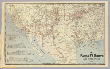
Atchison, Topeka, and Santa Fe Railroad Company
Full Title
Santa Fe Route. Official guide, main lines, branches and connections. Traffic Department, Topeka, Kansas. August, 1888. Rand, McNally & Co., Printers, Chicago.
Publisher
Rand McNally
Author
Atchison, Topeka, and Santa Fe Railroad Company
Full Title
(Covers to) Santa Fe Route. Official guide, main lines, branches and connections. Traffic Department, Topeka, Kansas. August, 1888. Rand, McNally & Co., Printers, Chicago.
Publisher
Rand McNally
Author
Brue, Adrien Hubert, 1786-1832
Full Title
Carte encyprotype de l'Amerique Septentrionale, dediee et presentee a Monsieur. Par H. Brue, Ingenieur-Geographe de S.A. Royale. 1ere feuille. Dirige par H. Brue. A Paris, Chez Desray ... (et) J. Goujon ..., 1815.
Publisher
Desray, Libraire-Editeur
Full Title
Mexico and Guatimala. J.H. Young Sc. (Philadelphia: John Grigg, No. 9 North Fourth Street. 1830)
Publisher
John Grigg
Author
Thomson, John
Full Title
Spanish North America. Drawn and engraved for Thomson's New general atlas, 1814.
Publisher
[Baldwin, Cradock, and Joy, John Cumming, John Thomson]
Author
[Lapie, Alexandre Emile, Lapie, M. (Pierre), 1779-1850]
Full Title
Carte des Etats-Unis du Mexique. (with) Carte du Guatemala ou Provinces-Unies de l'Amerique Centrale. Dressee par M. Lapie, 1er. Geographe du Roi et M. Lapie fils, Geographe de S.A.R.M. le Dauphin. Paris, 1829. Chez Eymery Fruger et Cie., Rue Mazarine No. 30. La gravure dirigee et executee par Lallemand.
Publisher
Eymery Fruger et Cie
Author
Lizars, Daniel
Full Title
Mexico & Guatimala. Published by D. Lizars, Edinburgh. (1831?)
Publisher
[John Hamilton, W. Curry, Jun. & Co., Whittaker, Treacher & Co.]
Author
Letts, Son & Co.
Full Title
United States, West & Mexico, North. Letts's popular atlas. Letts, Son & Co. Limited, London. (1883)
Publisher
Letts, Son & Co.
Author
Kino, Eusebio Francisco
Full Title
(A new map of North America, with the West India Islands. South half). (with) The passage by land to California discover'd by Father Eusebius Francis Kino a Jesuit, between the years 1692 and 1701 before which and for a considerable time since California has always been described in all charts & maps as an island. (Divided according to the Preliminary Articles of Peace, signed at Versailles, 20 Jan. 1783, wherein are particularly distinguished the United States and the several provinces, governments &c. which compose the British Dominions, laid down according to the latest surveys, and corrected from the original materials of Goverr. Pownall, Membr. of Parliamt. London, Published by Laurie & Whittle, No. 53, Fleet Street, 12th May, 1794)
Publisher
Laurie & Whittle
Author
[Kino, Eusebio Francisco, Pownall, Thomas, Robert Laurie & James Whittle]
Full Title
(Composite of) A new map of North America, with the West India Islands. (with) A particular map of Baffin and Hudson's Bay. (with) The passage by land to California discover'd by Father Eusebius Francis Kino a Jesuit, between the years 1692 and 1701 before which and for a considerable time since California has always been described in all charts & maps as an island. Divided according to the Preliminary Articles of Peace, signed at Versailles, 20 Jan. 1783, wherein are particularly distinguished the United States and the several provinces, governments &c. which compose the British Dominions, laid down according to the latest surveys, and corrected from the original materials of Goverr. Pownall, Membr. of Parliamt. London, Published by Laurie & Whittle, No. 53, Fleet Street, 12th May, 1794.
Publisher
Laurie & Whittle
Full Title
Spanish dominions in North America. From various authorities. (Published by John Conrad & Co., Philadelphia. 1804)
Publisher
J. Conrad
Full Title
Spanish Dominions in North America. From various authorities. (Boston: Published by Thomas & Andrews. 1812)
Publisher
Thomas & Andrews
Author
[Geographisches Institut (Weimar, Germany), Kiepert, Heinrich, 1818-1899]
Full Title
Mexico, Texas und Californien. (with) Die Republiken von Central-America im Maasstab der Hauptkarte. (with) Haupt-Gold-District in Californien im doppelten maastab der Hauptkarte... (with) Plateau von Mexico ... Bearbeitet und gezeichnet von H. Kiepert. Situation und Schrift gestochen von K. Madel, Terrain von C. Jungmann. Weimar, Verlag des Geographischen Instituts, 1855.
Publisher
Weimar Geo Inst.
Author
Atchison, Topeka, and Santa Fe Railroad Company
Full Title
Santa Fe. Poole Bros., Chicago.
Publisher
Poole Bros.
Author
Atchison, Topeka, and Santa Fe Railroad Company
Full Title
(Covers to) Santa Fe. The Atchison, Topeka & Santa Fe Railway and connecting lines. Oct. 10, 1904.
Publisher
Poole Bros.
Author
[Arrowsmith, Aaron, Humboldt, Alexander von, 1769-1859]
Full Title
(A new map of Mexico and adjacent provinces compiled from original documents by A. Arrowsmith, 1810. Sheet 3). London, Published 5th October 1810 by A. Arrowsmith, 10 Soho Square. (Engraved by E. Jones)
Publisher
A. Arrowsmith
Author
[Arrowsmith, Aaron, Humboldt, Alexander von, 1769-1859]
Full Title
(A new map of Mexico and adjacent provinces compiled from original documents by A. Arrowsmith, 1810. Sheet 4). London, Published 5th October 1810 by A. Arrowsmith, 10 Soho Square. (Engraved by E. Jones)
Publisher
A. Arrowsmith
Author
[Arrowsmith, Aaron, Humboldt, Alexander von, 1769-1859]
Full Title
(Composite of) A new map of Mexico and adjacent provinces compiled from original documents by A. Arrowsmith, 1810. (with) Valley of Mexico, from Mr. Humboldt's map. (with) Veracruz. (with) Acapulco. London, Published 5th October 1810 by A. Arrowsmith, 10 Soho Square, Hydrographer to H.R.H. the Prince of Wales. Engraved by E. Jones.
Publisher
A. Arrowsmith
Author
Rand McNally and Company
Full Title
(Composite Map of) (Western section of Rand, McNally & Co.'s New Shippers' Railroad Map of the United States. Scale: 18 miles to one inch).
Publisher
Rand McNally & Co.
Author
Freyhold, Edward; Warren, Gouverneur Kemble, 1830-1882; United States. Army. Corps of Engineers
Full Title
Map of the Territory of the U.S. West of the Miss. Riv. Sheet no. 4. (Prepared by authority of the Hon. the Secretary of War in the Office of the Chief of Engineers under the direction of Brig. General A.A. Humphreys Chief of Engineers and Brevet Maj. Gen. U.S. Army. By Edward Freyhold 1879) (with) Territory of Alaska.
Publisher
U.S. Topographical Engineers
Author
Freyhold, Edward; Warren, Gouverneur Kemble, 1830-1882; United States. Army. Corps of Engineers
Full Title
Map of the Territory of the U.S. West of the Miss. Riv. Sheet no. 5. (Prepared by authority of the Hon. the Secretary of War in the Office of the Chief of Engineers under the direction of Brig. General A.A. Humphreys Chief of Engineers and Brevet Maj. Gen. U.S. Army. By Edward Freyhold 1879)
Publisher
U.S. Topographical Engineers
Author
Freyhold, Edward; Warren, Gouverneur Kemble, 1830-1882; United States. Army. Corps of Engineers
Full Title
Map of the Territory of the U.S. West of the Miss. Riv. Sheet no. 6. Prepared by authority of the Hon. the Secretary of War in the Office of the Chief of Engineers under the direction of Brig. General A.A. Humphreys Chief of Engineers and Brevet Maj. Gen. U.S. Army. By Edward Freyhold 1879.
Publisher
U.S. Topographical Engineers
Author
[Martin, R.M., Tallis, J. & F.]
Full Title
Mexico, California and Texas. The Illustrations by H. Warren & Engraved by J. Rogers. The Map Drawn & Engraved by J. Rapkin.
Publisher
J. & F. Tallis
Author
Pike, Zebulon Montgomery
Full Title
(Title Page to) An Account of Expeditions to the Sources of the Mississippi, and Through the Western Parts of Louisiana, to the Sources of the Arkansaw, Kans, La Platte, and Pierre Jaun, Rivers; ... During the Years 1805, 1806, and 1807. And a Tour Through the Interior Parts of New Spain, When Conducted Through These Provinces, by order of The Captain-General, in the year 1807. By Major Z.M. Pike. Illustrated by Maps and Charts. Philadelphia: Published by C. & A. Conrad & Co. No. 30, Chesnut Street. Somervell & Conrad, Petersburgh. Bonsal, Conrad, & Co. Norfolk, and Fielding Lucas, Jr. Baltimore. John Binns, Printer....1810.
Publisher
C. & A. Conrad
|