Browse All

1859 Republics Of North America Wall Map Johnson's New Illustrated & Embellished … |

1839 Map of the United States Of North Americ … National Atlas Map of the United States Of North Americ … |

1849 Cover: United States, British Provinces, … Pocket Map (Covers to) Map Of The United States The … |

1849 Map Of The United States The British Pro … Pocket Map Map Of The United States The British Pro … |

1851 Ornamental Map Of The United States & Me … Wall Map Ornamental Map Of The United States & Me … |

1811 Carte Du Mexique et des Pays Limitrophes … National Atlas Carte Du Mexique et des Pays Limitrophes … |

1865 Covers: Colton's Railroad and Military M … Pocket Map (Covers to) Colton's Railroad And Milita … |

1865 Colton's Railroad And Military Map Of Th … Pocket Map Colton's Railroad And Military Map Of Th … |

1862 Covers: Colton's Railroad and Military M … Pocket Map (Covers to) Colton's Railroad And Milita … |
1862 Colton's Railroad and Military Map, Unit … Pocket Map Colton's Railroad And Military Map Of Th … |

1956 Covers: Shell Atlas. National Atlas (Covers to) Shell Atlas. |

1861 Covers: United States, Mexico, The West … Pocket Map (Covers to) Colton's Map Of The United S … |

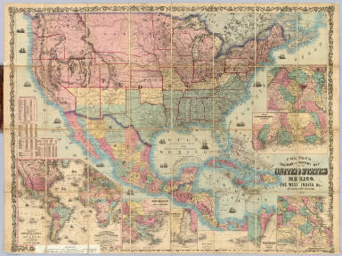
1861 United States, Mexico, The West Indies Pocket Map Colton's Map Of The United States, Mexic … |

1952 United States. Mexico. World Atlas U.S.A. (insets) Chicago; Buffalo; New Yo … |

1842 Texas, Calif., N. Mexico. World Atlas Central America II. Texas, California an … |

1873 Topographical map of the United States. State Atlas Topographical map of the United States. … |

1850 Map of the United States. Separate Map Map Of The United States And Their Terri … |

1892 Cover: California, Texas, Mexico and Ari … Timetable Map (Covers to:) California, Texas, Mexico A … |

1892 California, Texas, Mexico and Arizona So … Timetable Map California, Texas, Mexico And Arizona So … |

1892 Railway, steamship lines, Southern Pacif … Timetable Map Correct map of the railway & steamship l … |

1847 Ornamental Map Of The United States & Me … Separate Map Ornamental Map Of The United States & Me … |

1846 Ornamental Map Of The United States and … Separate Map Ornamental Map Of The United States & Me … |

1855 Ornamental Map Of The United States & Me … Separate Map Ornamental Map Of The United States & Me … |

1848 Map Of The United States And Mexico Separate Map Ornamental Map Of The United States & Me … |

1854 Map Of The United States of America, The … Pocket Map Map Of The United States of America, The … |

1849 Map Of The United States The British Pro … Separate Map Map Of The United States The British Pro … |

1870 Carte Generale Des Etats - Unis Et Du Me … Separate Map Carte Generale Des Etats - Unis Et Du Me … |

1876 Carte Generale Des Etats - Unis Et Du Me … Separate Map Carte Generale Des Etats - Unis Et Du Me … |

1849 Political Map Of The United States, Mexi … School Atlas Political Map Of The United States, Mexi … |

1885 Texas and Mexico, Houston and Texas Cent … Timetable Map Texas and Mexico showing Houston and Tex … |

1845 Political Map Of The United States, Mexi … School Atlas Political Map Of The United States, Mexi … |

1824 Nordliches America. Berlin 1824 von R.v. … [School Atlas, World Atlas] Nordliches America. Berlin 1824 von R.v. … |

1799 Port of San Diego; Port of San Blas. Exploration Book (Two charts) Plan of the Port of S. Dieg … |

1867 The American Republic and rail-road map … Pocket Map The American Republic and rail-road map … |

1867 Cover: The American Republic and rail-ro … Pocket Map (Covers to) The American Republic and ra … |

1867 Cover: The American Republic and rail-ro … Pocket Map (Inside Covers to) The American Republic … |

1825 Etats-Unis d'Amerique. National Atlas Etats-Unis d'Amerique. La lettre gravee … |

1855 Mexico, Mittel-America, Texas. World Atlas Mexico, Mittel-America, Texas. Lithograp … |

1844 Mexico and Guatimala. World Atlas Mexico and Guatimala. London: Published … |

1865 Vereinigte Staaten von NordAmer(ika, neb … World Atlas Vereinigte Staaten von NordAmer(ika, neb … |

1865 Composite: Vereinigte Staaten von NordAm … World Atlas (Composite of) Vereinigte Staaten von No … |

1832 Mexico. World Atlas Mexico, by J. Arrowsmith. (with) Mexico, … |

1825 Etats-Unis Mexicains, Amerique Centrale. World Atlas Carte generale des Etats-Unis Mexicains … |

1822 United States. World Atlas United States. Drawn & Published by F. L … |

1837 Etats-Unis d'Amerique, 1835. World Atlas Carte des Etats-Unis d'Amerique, 1835. N … |

1837 Mexique et L'Amerique Centrale. World Atlas Republique des Etats Unis Du Mexique. Gu … |

1861 Reduced section, general map, North Amer … Exploration Book Reduced section of a general map of Nort … |

1861 Reduced section, map of North America, 1 … Exploration Book Reduced section of map of North America … |

1861 Reduced section, territory west of Rocky … Exploration Book Reduced map of the territory west of the … |

1833 Fredonia Or The United States of North A … Case Map Fredonia Or The United States of North A … |