Browse All

1952 Asia. Medio Oriente. Turchia Siria Pales … World Atlas Asia. Medio Oriente. Turchia Siria Pales … |

1861 Palestine. World Atlas Palestine or the Holy Land by Keith John … |

1855 Palestine and Adjacent Countries World Atlas Palestine & Adjacent Countires. Publishe … |

1959 Index: Israel, Jordan. Plate 35, V. II World Atlas (Index to) Israel, Jordan. Conic Project … |

1959 Israel, Jordan. Plate 35, V. II World Atlas Israel, Jordan. 1:500,000. The Geographi … |

1845 Palestine. World Atlas Palestine. (Written and engraved by Jos. … |

1828 Palestine sous la domination romaine. World Atlas Carte de la Palestine sous la domination … |

1865 Canaan. Classical Atlas Canaan. (with) Sinai, Canaan, Aram, Assu … |

1844 Syrie et de la Palestine, 624 ans apres … World Atlas Carte de la Syrie et de la Palestine, lo … |

1844 Terre Sainte, pendant la premiere croisa … World Atlas Carte de la Terre Sainte, pendant la pre … |

1844 Terre Sainte depuis la deuxieme croisade … World Atlas Carte de la Terre Sainte depuis la deuxi … |

1844 Terre Sainte en 1839. World Atlas Carte de la Terre Sainte en 1839. Dresse … |

1855 Syrien und die angraenzenden Laender zur … Historical Atlas Syrien und die angraenzenden Laender zur … |

1838 Palestine sous la domination romaine. World Atlas Carte de la Palestine sous la domination … |

1980 Israel & Its Arab Neighbors -- Physical Wall Map Israel und Seine Arabischen Nachbarn. |

1900 Palestine World Atlas Palestine. (Published at the office of " … |

1874 A new map of Palestine or the Holy Land. World Atlas A new map of Palestine or the Holy Land. … |

1827 Syrie et Palestine. Asie 63. World Atlas Syrie et Palestine. Asie no. 63. Dressee … |

1814 Palaestina. Classical Atlas Palaestina. (with) The Tribes. (with) Je … |

1800 12 tribus d'Israel. School Atlas Carte des 12 tribus d'Israel. A Paris, c … |

1833 Palestine ou Terre Sainte. World Atlas Carte de la Palestine ou Terre Sainte. D … |

1880 Palestine, Jerusalem. World Atlas A new map of Palestine or the Holy Land. … |

1881 Palastina. World Atlas Palastina. (Richard Andree. Herausgegebe … |

1826 Roman Empire, Palestine. School Atlas The Roman Empire at its greatest extent. … |

1870 Palestine, Jerusalem. [State Atlas, World Atlas] A new map of Palestine or the Holy Land. … |

1835 Palaestina. World Atlas Palaestina. Fenner Sc., Paternoster Row. … |

1846 Das Osmanische Reich in Asien, (Ottoman … World Atlas Stieler's Hand-Atlas (No. 43a). Das Osma … |

1852 Das Osmanische Reich in Asien, (Ottoman … World Atlas Stieler's Hand-Atlas (No. 43a). Das Osma … |

1905 Palastina World Atlas Palastina. Sept. 1905. (inset: nebenkart … |
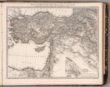
1865 Das Osmanische Reich in Asien, (Ottoman … World Atlas Stieler's Hand-Atlas ... No. 43a. Das Os … |

1822 Syria and Assyria School Atlas Syria and Assyria. (to accompany) The Ju … |

1819 Places Recorded in the Five Books of Mos … World Atlas Places Recorded in the Five Books of Mos … |

1844 No. 4: Plan of Jerusalem Religious Atlas No. 4: Plan of Jerusalem : from the map … |

1967 Map Title Page: 149-150. East Mediterran … World Atlas (Map Title Page) 149-150. East Mediterra … |

1838 Egypte, Syrie, Asie Mineure. World Atlas Egypte, Syrie, Asie Mineure. (inset) Pal … |

1897 Palestine. World Atlas Rand, McNally & Co.'s new 14 x 21 map of … |