Who What Where WhenREMOVE |
Author
Mitchell, Samuel Augustus
Full Title
Map of the State of Missouri And Territory Of Arkansas Compiled From The Latest Authorities. Published by S. Augustus Mitchell Philadelphia. 1831. J.H. Young Sc.
Publisher
S.A. Mitchell
Author
Burr, David H., 1803-1875
Full Title
Map of Illinois & Missouri Exhibiting the Post Offices, Post Roads, Canals, Rail Roads, &c. By David H. Burr. (Late Topographer to the Post Office.) Geographer to the House of Representatives of the U.S. John Arrowsmith. Entered ... July 10th, 1839, by David H. Burr ... District of Columbia.
Publisher
John Arrowsmith
Author
Colton, G.W.
Full Title
The City Of St. Louis Missouri. (with) The City Of Chicago Illinois. Published By J.H. Colton & Co. No. 172 William St. New York. Entered ... 1855 by J.H. Colton & Co. ... New York. No. 45.
Publisher
J.H. Colton
Author
Colton, G.W.
Full Title
Missouri. (with) Vicinity Of St. Louis. Published By J.H. Colton & Co. No. 172 William St. New York. Entered ... 1855 by J.H. Colton & Co. ... New York. No. 46.
Publisher
J.H. Colton
Author
Schonberg & Co.
Full Title
Missouri. Texas.
Publisher
Schonberg & Co.
Author
Asher & Adams
Full Title
Asher & Adams' Missouri. Entered according to Act of Congress in the year 1874 by Asher & Adams ... at Washington. (New York, 1874)
Publisher
Asher and Adams
Author
Schonberg & Co.
Full Title
Schonberg's Map of Missouri. Entered ... 1866 ... New York.
Publisher
Schonberg & Co.
Author
Shell Oil Company
Full Title
Shell Map of Missouri (cover title). Shell Highway Map of Missouri. 514-J-7-DD. (insets) Enlarged Map of the Kansas City District; Enlarged Map of the St. Louis District.
Publisher
Shell Oil Company
Author
Shell Oil Company
Full Title
Central Ozarks. 555-S-7-00. (Verso to) Shell Highway Map of Missouri.
Publisher
Shell Oil Company
Author
Kenyon Company
Full Title
(Covers to) Map Of Missouri Showing Towns with their Location and Population. Railroads, County Seats, Counties and Congressional Districts. Copyright Applied For Kenyon Printing & Mfg. Co. Maps, Blank Books And Printers, Des Moines, Iowa ... Compliments of Winters & Tucker, Perry, Missouri.
Publisher
The Kenyon Company
Author
Kenyon Company
Full Title
(Text Page to) Map Of Missouri Showing Towns with their Location and Population. Railroads, County Seats, Counties and Congressional Districts. Copyright Applied For Kenyon Printing & Mfg. Co. Maps, Blank Books And Printers, Des Moines, Iowa ... Compliments of Winters & Tucker, Perry, Missouri.
Publisher
The Kenyon Company
Author
Kenyon Company
Full Title
Map Of Missouri Showing Towns with their Location and Population. Railroads, County Seats, Counties and Congressional Districts. Copyright Applied For Kenyon Printing & Mfg. Co. Maps, Blank Books And Printers, Des Moines, Iowa ... Compliments of Winters & Tucker, Perry, Missouri.
Publisher
The Kenyon Company
Author
Buxton & Skinner Stationery Company
Full Title
(Covers to) Ground Plan Of The Louisiana Purchase Exposition St. Louis, Mo. 1904. Buxton & Skinner Stationery Co. Publishers, Fourth & Olive St. St. Louis, Mo. Copyright, 1904 By Parker Eng. Co.
Publisher
Buxton & Skinner
Author
Buxton & Skinner Stationery Company
Full Title
Ground Plan Of The Louisiana Purchase Exposition St. Louis, Mo. 1904. Buxton & Skinner Stationery Co. Publishers, Fourth & Olive St. St. Louis, Mo. Copyright, 1904 By Parker Eng. Co.
Publisher
Buxton & Skinner
Author
Buxton & Skinner Stationery Company
Full Title
(Text Page to) Ground Plan Of The Louisiana Purchase Exposition St. Louis, Mo. 1904. Buxton & Skinner Stationery Co. Publishers, Fourth & Olive St. St. Louis, Mo. Copyright, 1904 By Parker Eng. Co.
Publisher
Buxton & Skinner
Author
Tracy, J.L.
Full Title
(Covers to) Tracy's Guide To Missouri And St. Louis: Containing ... A Colored Township Map of Missouri... A Colored Map of the City of St. Louis ... A Colored Outline Map, Showing the Railroad Connections of St. Louis and the West ... By J.L. Tracey. St. Louis: R.P. Studley Co's Steam Print, 221 North Main Street. 1871. (with) Map Of The State Of Missouri ... To illustrate Tracy's "Missouri Guide" and "Missouri Gazetteer" ... Published by The R.P. Studley Co. ... St. Louis 1871. Lith. by R.P. Studley & Co. St. Louis. (with) Map Of The City Of St. Louis For Tracy's Guide To Missouri. Drawn & Lithd. By Juls. Hutawa 313 Chestnut St. (with) Map Of The Missouri Pacific And Atlantic & Pacific Railroads, And Connections. National Railway Publication Co. Philadelphia.
Publisher
St. Louis:
Author
Tracy, J.L.
Full Title
Map Of The State Of Missouri ... To illustrate Tracy's "Missouri Guide" and "Missouri Gazetteer" ... Published by The R.P. Studley Co. ... St. Louis 1871. Lith. by R.P. Studley & Co. St. Louis. (with) Map Of The City Of St. Louis For Tracy's Guide To Missouri. Drawn & Lithd. By Juls. Hutawa 313 Chestnut St. (with) Map Of The Missouri Pacific And Atlantic & Pacific Railroads, And Connections. National Railway Publication Co. Philadelphia.
Publisher
St. Louis:
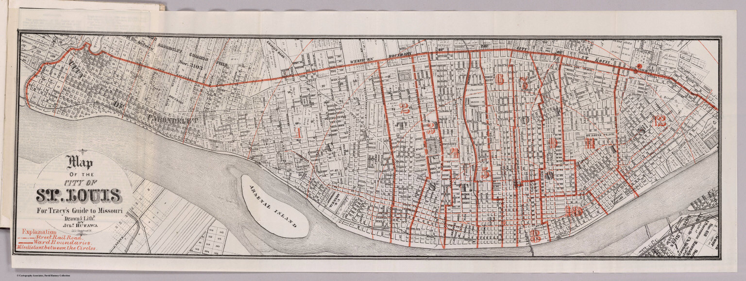
Author
Tracy, J.L.
Full Title
Map Of The City Of St. Louis For Tracy's Guide To Missouri. Drawn & Lithd. By Juls. Hutawa 313 Chestnut St. (with) Map Of The State Of Missouri ... To illustrate Tracy's "Missouri Guide" and "Missouri Gazetteer" ... Published by The R.P. Studley Co. ... St. Louis 1871. Lith. by R.P. Studley & Co. St. Louis. (with) Map Of The Missouri Pacific And Atlantic & Pacific Railroads, And Connections. National Railway Publication Co. Philadelphia.
Publisher
St. Louis:
Author
Tracy, J.L.
Full Title
Map Of The Missouri Pacific And Atlantic & Pacific Railroads, And Connections. National Railway Publication Co. Philadelphia. (with) Map Of The City Of St. Louis For Tracy's Guide To Missouri. Drawn & Lithd. By Juls. Hutawa 313 Chestnut St. (with) Map Of The State Of Missouri ... To illustrate Tracy's "Missouri Guide" and "Missouri Gazetteer" ... Published by The R.P. Studley Co. ... St. Louis 1871. Lith. by R.P. Studley & Co. St. Louis.
Publisher
St. Louis:
Author
Ensign, Bridgman & Fanning
Full Title
(Covers to) Map of Missouri. Published By Ensign, Bridgman & Fanning, 156 William St. New York 1857. Entered ... 1856, by Ensign, Bridgman & Fanning ... New York.
Publisher
Ensign, Bridgman & Fanning
Author
Ensign, Bridgman & Fanning
Full Title
Map of Missouri. Published By Ensign, Bridgman & Fanning, 156 William St. New York 1857. Entered ... 1856, by Ensign, Bridgman & Fanning ... New York.
Publisher
Ensign, Bridgman & Fanning
Author
Cram, George Franklin
Full Title
(Cover to) New Sectional Map Of The State Of Missouri. Engraved from Official Draughts of each County. Published by George F. Cram & Co. Proprietor Of The Western Map Depot. 148. Lake Street, Chicago, Ill. 1871. Entered ... 1869, by George F. Cram ... Illinois.
Publisher
George F. Cram
Author
Cram, George Franklin
Full Title
New Sectional Map Of The State Of Missouri. Engraved from Official Draughts of each County. Published by George F. Cram & Co. Proprietor Of The Western Map Depot. 148. Lake Street, Chicago, Ill. 1871. Entered ... 1869, by George F. Cram ... Illinois.
Publisher
George F. Cram
Author
Matthews-Northrup
Full Title
(Covers to) The Matthews-Northrup Up-To-Date Map of Missouri. Published Indexed Vest-Pocket Style ... Copyright, 1895, by The Matthews-Northrup Co., Complete Engraving and Printing Works, Buffalo, N.Y.
Publisher
Matthews-Northrup
Author
Matthews-Northrup
Full Title
(Index page to) The Matthews-Northrup Up-To-Date Map of Missouri. Published Indexed Vest-Pocket Style ... Copyright, 1895, by The Matthews-Northrup Co., Complete Engraving and Printing Works, Buffalo, N.Y.
Publisher
Matthews-Northrup
Author
Matthews-Northrup
Full Title
The Matthews-Northrup Up-To-Date Map of Missouri. Published Indexed Vest-Pocket Style ... Copyright, 1895, by The Matthews-Northrup Co., Complete Engraving and Printing Works, Buffalo, N.Y.
Publisher
Matthews-Northrup
Author
Matthews-Northrup
Full Title
(Covers to) The Matthews-Northrup Up-To-Date Map of St. Louis Mo. Copyright, 1895, by The Matthews-Northrup Co., Complete Engraving and Printing Works, Buffalo and New York.
Publisher
Matthews-Northrup
Author
Matthews-Northrup
Full Title
(Index page to) The Matthews-Northrup Up-To-Date Map of St. Louis Mo. Copyright, 1895, by The Matthews-Northrup Co., Complete Engraving and Printing Works, Buffalo and New York.
Publisher
Matthews-Northrup
Author
Matthews-Northrup
Full Title
The Matthews-Northrup Up-To-Date Map of St. Louis Mo. Copyright, 1895, by The Matthews-Northrup Co., Complete Engraving and Printing Works, Buffalo and New York.
Publisher
Matthews-Northrup
Author
Chapman, Silas
Full Title
(Covers to) Chapman's New Township Map Of The North West. Published By Silas Chapman, Milwaukee, Wis. Entered ... 1862 by S. Chapman ... Wisconsin. Engraved & Printed by L. Lipman, Practical Lithographer, Milwaukee, Wis.
Publisher
Silas Chapman
Author
Chapman, Silas
Full Title
Chapman's New Township Map Of The North West. Published By Silas Chapman, Milwaukee, Wis. Entered ... 1862 by S. Chapman ... Wisconsin. Engraved & Printed by L. Lipman, Practical Lithographer, Milwaukee, Wis.
Publisher
Silas Chapman
Author
[Finley, Anthony, Vance, David H.]
Full Title
(Covers to) Map of the State of Missouri And Territory Of Arkansas Compiled From the Latest Authorities. Published by A. Finley Philadelphia. 1826. Drawn by D.H. Vance. Engraved by J.H. Young. (inset) Statistical Table. The State of Missouri Population...1920.
Publisher
Anthony Finley
Author
[Finley, Anthony, Vance, David H.]
Full Title
Map of the State of Missouri And Territory Of Arkansas Compiled From the Latest Authorities. Published by A. Finley Philadelphia. 1826. Drawn by D.H. Vance. Engraved by J.H. Young. (inset) Statistical Table. The State of Missouri Population...1920.
Publisher
Anthony Finley
Author
Vandermaelen, Philippe, 1795-1869
Full Title
Partie des Etats-Unis. Amer. Sep. no. 49. Dressee et dessie. par Ph. Vandermaelen. La lettre par Fois. Charles. Desinee sur pierre et Litie. par H. Ode, Avril 1825. (Quatrieme partie. - Amer. sept. Bruxelles. 1827)
Publisher
Ph. Vandermaelen
Author
Cram, George Franklin
Full Title
(Covers to) Cram's Rail Road & Township Map Of Missouri. Published By Geo. F. Cram. Proprietor Of The Western Map Depot. 66. Lake St. Chicago Ills. 1878. Entered ... 1877 by G.F. Cram ... Washington D.C.
Publisher
George F. Cram
Author
Cram, George Franklin
Full Title
Cram's Rail Road & Township Map Of Missouri. Published By Geo. F. Cram. Proprietor Of The Western Map Depot. 66. Lake St. Chicago Ills. 1878. Entered ... 1877 by G.F. Cram ... Washington D.C.
Publisher
George F. Cram
Author
Cram, George Franklin
Full Title
Railroad and Township Map of Missouri. (inset) (St. Louis and Vicinity).
Publisher
George F. Cram
Author
Colton, G.W.
Full Title
Colton's Missouri. (insets) Vicinity of St. Louis; Plan of the South Eastern portion of Missouri on the same scale as the main map. Published By G. W & C. B. Colton & Co., No. 182 William St. New York.
Publisher
G. W & C. B. Colton & Co.
Author
Society for the Diffusion of Useful Knowledge (Great Britain)
Full Title
North America sheet IX. Parts of Missouri, Illinois and Indiana. Published under the superintendence of the Society for the Diffusion of Useful Knowledge. Engraved by J. & C. Walker. Published July 1st. 1833 by Baldwin & Cradock, 47 Paternoster Row, London. Printed by Russell, Penge. (London: Chapman & Hall, 1844)
Publisher
Chapman and Hall
Author
Colton, G.W.
Full Title
Colton's Missouri. (inset) Plan of the South Eastern Portion of Missouri on the same scale as the main map. Published By G. W & C. B. Colton & Co., No. 172 William St. New York.
Publisher
G. W & C. B. Colton & Co.
Author
Colton, G.W.
Full Title
Colton's Missouri. (inset) Vicinity of St. Louis. Published by G.W. & C.B. Colton & Co., No. 172 William St. New York.
Publisher
G.W. & C.B. Colton
Author
Colton, G.W.
Full Title
The City of St. Louis, Missouri. The City of Chicago, Illinois. Published by G.W. & C.B. Colton & Co., No. 172 William St. New York.
Publisher
G.W. & C.B. Colton
Author
Tanner, Henry S.
Full Title
(Covers to) Illinois And Missouri. By H.S. Tanner. 1836. Published by H.S. Tanner, Philadelphia. Entered ... 1836, by H.S. Tanner ... Pennsylvania. Engraved by H.S. Tanner & Assistants.
Publisher
H.S. Tanner
Author
Tanner, Henry S.
Full Title
Illinois And Missouri. By H.S. Tanner. 1836. Published by H.S. Tanner, Philadelphia. Entered ... 1836, by H.S. Tanner ... Pennsylvania. Engraved by H.S. Tanner & Assistants.
Publisher
H.S. Tanner
Author
Cram, George Franklin
Full Title
Missouri. (inset) Vicinity of St. Louis.
Publisher
George F. Cram
Author
Mitchell, Samuel Augustus
Full Title
A New Map of the State of Missouri. Published by Thomas, Cowperthwait & Co. No. 253 Market Street, Philadelphia. Entered ... 1850, by Thomas, Cowperthwait & Co. ... Pennsylvania.
Publisher
Thomas, Cowperthwait & Co.
Author
Mitchell, Samuel Augustus Jr.
Full Title
County and Township Map of the States of Iowa and Missouri. Entered ... 1874 by S. Augustus Mitchell ... Washington.
Publisher
Ziegler & McCurdy
Author
Meyer, Joseph, 1796-1856
Full Title
Neueste Karte von Missouri. Nach den bessten Quellen verbessert, 1845. Aus der Geographischen Graviranstalt des Bibliographischen Instituts zu Hildburghausen, Amsterdam, Paris u. Philadelphia, (1860)
Publisher
Bibliographischen Instituts
Author
Johnson, A.J.
Full Title
Johnson's Missouri And Kansas By Johnson And Ward.
Publisher
Johnson and Ward
Author
Mitchell, Samuel Augustus
Full Title
A new map of the State of Missouri. Published by Thomas, Cowperthwait & Co. No. 253 Market Street, Philadelphia. Entered ... 1850 by Thomas, Cowperthwait & Co. ... Pennsylvania.
Publisher
Cowperthwait, Desilver & Butler
|