Who What Where WhenREMOVEWHERE
|
Author
[Compton, Richard J., Dry, Camille N.]
Full Title
(Pictorial St. Louis) plate 85, plate 86. (By C.N. Dry, 1876)
Publisher
Compton & Company
Author
[Compton, Richard J., Dry, Camille N.]
Full Title
(Pictorial St. Louis) plate 87, plate 88. (By C.N. Dry, 1876)
Publisher
Compton & Company
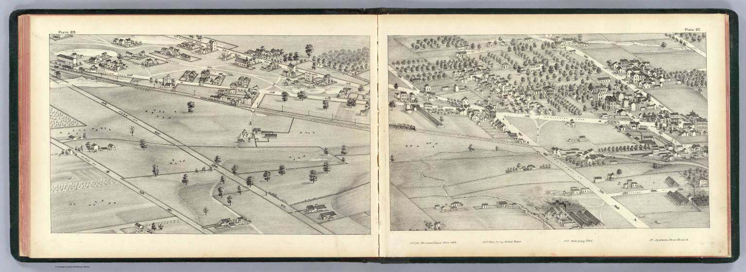
Author
[Compton, Richard J., Dry, Camille N.]
Full Title
(Pictorial St. Louis) plate 89, plate 90. (By C.N. Dry, 1876)
Publisher
Compton & Company
Author
[Compton, Richard J., Dry, Camille N.]
Full Title
(Pictorial St. Louis) plate 91 Shaw's Garden, plate 92. (By C.N. Dry, 1876)
Publisher
Compton & Company
Author
[Compton, Richard J., Dry, Camille N.]
Full Title
(Pictorial St. Louis) plate 93, plate 94. (By C.N. Dry, 1876)
Publisher
Compton & Company
Author
[Compton, Richard J., Dry, Camille N.]
Full Title
(Pictorial St. Louis) plate 95, plate 96. (By C.N. Dry, 1876)
Publisher
Compton & Company
Author
[Compton, Richard J., Dry, Camille N.]
Full Title
(Pictorial St. Louis) plate 97, plate 98. (By C.N. Dry, 1876)
Publisher
Compton & Company
Author
[Compton, Richard J., Dry, Camille N.]
Full Title
(Pictorial St. Louis) plate 99, plate 100. (By C.N. Dry, 1876)
Publisher
Compton & Company
Author
[Compton, Richard J., Dry, Camille N.]
Full Title
(Pictorial St. Louis) plate 101, plate 102. (By C.N. Dry, 1876)
Publisher
Compton & Company
Author
[Compton, Richard J., Dry, Camille N.]
Full Title
(Pictorial St. Louis) plate 103, plate 104. (By C.N. Dry, 1876)
Publisher
Compton & Company
Author
[Compton, Richard J., Dry, Camille N.]
Full Title
(Pictorial St. Louis) plate 105, plate 106. (By C.N. Dry, 1876)
Publisher
Compton & Company
Author
[Compton, Richard J., Dry, Camille N.]
Full Title
(Pictorial St. Louis) plate 107, plate 108. (By C.N. Dry, 1876)
Publisher
Compton & Company
Author
[Compton, Richard J., Dry, Camille N.]
Full Title
(Pictorial St. Louis) plate 109, plate 110. (By C.N. Dry, 1876)
Publisher
Compton & Company
Author
[Compton, Richard J., Dry, Camille N.]
Full Title
(Pictorial St. Louis) Composite (By C.N. Dry, 1876)
Publisher
Compton & Company
Author
[Compton, Richard J., Dry, Camille N.]
Full Title
(Covers to) Pictorial St. Louis, the great metropolis of the Mississippi Valley; a topographical survey drawn in perspective A.D. 1875, by Camille N. Dry, designed & edited by Rich. J. Compton. St. Louis. Compton & Company, 1876. Western Engraving Co. St. Louis.
Publisher
Compton & Company
Author
[Compton, Richard J., Dry, Camille N.]
Full Title
(Title Page to) Pictorial St. Louis, the great metropolis of the Mississippi Valley; a topographical survey drawn in perspective A.D. 1875, by Camille N. Dry, designed & edited by Rich. J. Compton. St. Louis. Compton & Company, 1876. Western Engraving Co. St. Louis.
Publisher
Compton & Company
Author
[Compton, Richard J., Dry, Camille N.]
Full Title
(Text Page to) Pictorial St. Louis, the great metropolis of the Mississippi Valley; a topographical survey drawn in perspective A.D. 1875, by Camille N. Dry, designed & edited by Rich. J. Compton. St. Louis. Compton & Company, 1876. Western Engraving Co. St. Louis.
Publisher
Compton & Company
Author
[Carey, Henry Charles, Lea, Isaac]
Full Title
Illinois and Missouri. J.G. Melish, del. J. Yeager, Sc. (to accompany) The Juvenile Atlas or a Series Of Maps, To Illustrate the Old and New Worlds ...1822.
Publisher
H.C. Carey & I. Lea
Author
[Compton, Richard J., Dry, Camille N.]
Full Title
(Pictorial St. Louis) plate 51, plate 52. (By C.N. Dry, 1876)
Publisher
Compton & Company
Author
Hillebrands, A.J.
Full Title
Atlas de Vereenigde Staten No. 9. Iowa, Illinois, Nebraska, Missouri, Western Territory en Arkansas.
Publisher
[J. Oomkens, J. Zoon]
Author
Bradstreet Company
Full Title
Missouri. (to accompany) Bradstreet's Pocket Atlas Of The United States. Published Exclusively for Macullar, Parker & Company, Boston, Massachusetts ... New York: The Bradstreet Company, 1885. (on verso) Entered ... 1879, by The Bradstreet Company ... Washington.
Publisher
Bradstreet Co.
Author
Tanner, Henry S.
Full Title
Illinois And Missouri. (engraved by) J. Knight. Sc. (inset) Missouri River, West Part. (to accompany) A New Pocket Atlas of the United States With The Roads and Distances, Designed For the Use of Travelers. By H.S. Tanner. Philadelphia: Published by the Author. 1828. (on verso) ...on the seventeenth day of November ... 1828, Henry S. Tanner ... hath deposited ... a book ... Pennsylvania.
Publisher
H.S.Tanner
Author
[Compton, Richard J., Dry, Camille N.]
Full Title
(Pictorial St. Louis) plate 41, plate 42. (By C.N. Dry, 1876)
Publisher
Compton & Company
Author
[Compton, Richard J., Dry, Camille N.]
Full Title
(Pictorial St. Louis) plate 43, plate 44. (By C.N. Dry, 1876)
Publisher
Compton & Company
Author
[Compton, Richard J., Dry, Camille N.]
Full Title
(Pictorial St. Louis) plate 45, plate 46. (By C.N. Dry, 1876)
Publisher
Compton & Company
Author
[Compton, Richard J., Dry, Camille N.]
Full Title
(Pictorial St. Louis) plate 47, plate 48. (By C.N. Dry, 1876)
Publisher
Compton & Company
Author
[Compton, Richard J., Dry, Camille N.]
Full Title
(Pictorial St. Louis) plate 49, plate 50. (By C.N. Dry, 1876)
Publisher
Compton & Company
Author
Cram, George Franklin
Full Title
New Rail Road and County Map of Missouri.
Publisher
A.C. Shewey and Co.
Author
[Johnston, Alexander Keith, 1804-1871, Rogers, Henry Darwin]
Full Title
States Of Illinois, Missouri, And Arkansas. By Prof. H.D. Rogers & A. Keith Johnston, F.R.S.E. Entered in Sta. Hall. London ... & according to an act of Congress ... 1857, by H.D. Rogers ... Massachusetts. London, John Murray, Albemarle Street, Edinburgh, W. & A.K. Johnston. Engraved by W. & A.K. Johnston, Edinburgh.
Publisher
Edward Stanford
Author
Tanner, Henry S.
Full Title
Illinois And Missouri By H.S. Tanner. Improved To 1825. American Atlas. Entered ... 20th day of August 1823, by H.S. Tanner ... Pennsylvania. Published by H.S. Tanner Philadelphia. Engraved by H.S. Tanner & Assistants.
Publisher
Henry Tanner
Author
Bradford, Thomas G.
Full Title
Illinois & Missouri. (to accompany) A Comprehensive Atlas, Geographical, Historical & Commercial. By T.G. Bradford. William D. Ticknor, Boston. Wiley & Long, New-York. Entered ... 1835, by Thos. G. Bradford ... Massachusetts.
Publisher
[William D. Ticknor, Wiley & Long]
Author
[Morse, Sidney E., Breese, S.]
Full Title
Missouri. (to accompany) Supplement To The New-York Observer. The Cerographic Atlas Of The United States. No.3. 1845. Entered ... 1845, by Sidney E. Morse and Samuel Breese ... New-York.
Publisher
Sidney E. Morse & Co.
Author
[Morse, Sidney E., Breese, Samuel]
Full Title
Missouri. Entered ... 1844 by Sidney E. Morse and Samuel Breese ... New York. (New York: Published by Harper & Brothers, 1845). (to accompany) Morse's Cerographic Maps. No. II.
Publisher
Harper and Brothers
Author
Gray, O.W.
Full Title
Gray's Atlas Map of Missouri.
Publisher
Stedman, Brown & Lyon
Author
Finley, Anthony
Full Title
Map of the State of Missouri and the Territory of Arkansas, Compiled from the Latest Authorities.
Publisher
Anthony Finley
Author
[Colton, G.W., Colton, C.B., Gray, O.W.]
Full Title
Missouri. Entered ... 1869 by G.W. & C.B. Colton & Co.
Publisher
Stedman & Brown
Author
Cram, George Franklin
Full Title
Cram's Rail Road & Township Map of Missouri.
Publisher
George F. Cram
Author
United States. War Department
Full Title
Map showing the system of rebel fortifications on the Mississippi River at Island No. 10 and New Madrid, also the operations of the U.S. forces under General John Pope against these positions. (with) Route from Keetsville to Fayetteville, Ark. (with) Plan of the battle-field of Pea Ridge, Ark. Surveyed by H.A. Ulffers ... and A. Hoeppner ... (with) Route followed by the command of Maj. Joseph Conrad ... from near Bentonville, Ark. to Cassville, Mo., March 4-7, 1862. (with) Sketch A. Battle-field of Pea Ridge, Ark, March 7th, 1862 accompanying Report of Capt. Louis Hoffmann ... (with) Sketch B. Battle-field of Pea Ridge, Ark, March 8th, 1862 ... (with) Rebel position at Centreville, reconnaissance of March 14th, 1862 by M.D. McAlester ... (with) Battle at Leetown, March 7th, 1862. (with) Manassas Junction and vicinity surveyed by party of U.S. Coast Survey ... to act under orders of Lt. Col. J.N. Macomb ... Field work under direction of H.L. Whiting ... April 1862. (with) Sketch of battle-field at Shiloh near Pittsburg Landing, Tenn., April 6 and 7, 1862. Julius Bien & Co., Lith., N.Y. (1891-1895)
Publisher
U.S. Government Printing Office
Author
Appleton, D. & Co.
Full Title
Map of Missouri. Copyright 1891 by Matthews-Northrup Co. ... Buffalo, New York. (inset) City of St. Louis. (to accompany) The Library Atlas Of Modern Geography ... New York, D. Appleton And Company 1892. (on upper margin) Missouri. 79.
Publisher
D. Appleton & Co.
Author
[Rand McNally and Company, State Farm Insurance Companies Travel Bureau]
Full Title
Rand McNally Road map: Missouri. Copyright by Rand McNally & Company, Chicago, Ill. Lithorgaphed in the U.S.A. U.3606. (to accompany) State Farm road atlas : United States, Canada, Mexico. (inset) Southeastern Missouri.
Publisher
State Farm Insurance Companies Travel Bureau
Author
Cram, George Franklin
Full Title
(Covers to) New Rail Road & township map of Missouri and Kansas : Published by Geo. F. Cram & Co. Western Map Depot. 148 Lake Street, Chicago Ills.
Publisher
Geo. F. Cram & Co.
Author
Cram, George Franklin
Full Title
New Rail Road & township map of Missouri and Kansas : Published by Geo. F. Cram & Co. Western Map Depot. 148 Lake Street, Chicago Ills.
Publisher
Geo. F. Cram & Co.
Author
[U.S. Army Corps of Engineers, Moser, C.]
Full Title
No. 51-52: Map Of The Ohio River, Reduced from the following surveys ... 1837-8, Lieut. Sanders ... 1844, C.A. Fuller ... 1867-8, W.M. Roberts ... Made under the direction of Major W.E. Merrill, Corps of Engineers, By C. Moser.
Publisher
Corps of Engineers
Author
[Taylor, Frank J., White, Ruth Taylor]
Full Title
Missouri.
Publisher
Little, Brown, and Company
Author
North West Publishing Co.
Full Title
Missouri. (inset) (Vicinity of St. Louis).
Publisher
North West Publishing Co.
Author
Mitchell, Samuel Augustus
Full Title
A New Map Of Missouri With Its Roads And Distances. Published By S. Augustus Mitchell, N.E. corner of Market & 7th Street Philada., 1846. Entered ... 1846 by H.N. Burroughs ... Pennsylvania.
Publisher
S.A. Mitchell
Author
Rand McNally and Company
Full Title
Rand, McNally & Co.'s New Shippers' Railroad Map of the United States. Scale: 8 miles to one inch. Showing all railroads, each in a separate color, and all railroad stations in large, plain type. This is the St. Louis section only, of the above named map. (Below the neatline) Rand, McNally & Co.'s New Shippers' Railroad Map of the United States, Copyright, 1888 by Rand, McNally & Co. Copyright, 1891 by Rand, McNally & Co.
Publisher
Rand McNally & Co.
Author
Rand McNally and Company
Full Title
Rand, McNally & Co.'s New Shippers' Railroad Map of the United States. Scale: 8 miles to one inch. Showing all railroads, each in a separate color, and all railroad stations in large, plain type. (Below the neatline) Rand, McNally & Co.'s New Shippers' Railroad Map of the United States, Copyright, 1888 by Rand, McNally & Co. Copyright, 1891 by Rand, McNally & Co.
Publisher
Rand McNally & Co.
Author
Rand McNally and Company
Full Title
(Covers to) Rand, McNally & Co.'s New Shippers' Railroad Map of the United States. Scale: 8 miles to one inch. Showing all railroads, each in a separate color, and all railroad stations in large, plain type. This is the St. Louis section only, of the above named map. (Below the neatline) Rand, McNally & Co.'s New Shippers' Railroad Map of the United States, Copyright, 1888 by Rand, McNally & Co. Copyright, 1891 by Rand, McNally & Co.
Publisher
Rand McNally & Co.
Author
Rand McNally and Company
Full Title
(Covers to) Rand, McNally & Co.'s New Shippers' Railroad Map of the United States. Scale: 8 miles to one inch. Showing all railroads, each in a separate color, and all railroad stations in large, plain type. (Below the neatline) Rand, McNally & Co.'s New Shippers' Railroad Map of the United States, Copyright, 1888 by Rand, McNally & Co. Copyright, 1891 by Rand, McNally & Co.
Publisher
Rand McNally & Co.
|