Browse All

1872 Cover: Territory of Montana. Pocket Map (Covers to) Map Of The Territory Of Mont … |

1872 Map Of The Territory Of Montana. Pocket Map Map Of The Territory Of Montana with por … |

1869 Title Page: Geological report of the Exp … Exploration Book (Title Page to) Geological Report of the … |

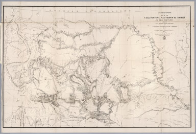
1869 Map Of The Yellowstone And Missouri Rive … Exploration Book U.S. War Department Map Of The Yellowsto … |

1827 Partie des Etats-Unis. Amer. Sep. 39. World Atlas Partie des Etats-Unis. Amer. Sep. no. 39 … |

1827 Partie des Etats Unis. Amer. Sep. 40. World Atlas Partie des Etats Unis. Amer. Sep. no. 40 … |

1886 Montana, Idaho and Wyoming. World Atlas Colton's Montana, Idaho & Wyoming. Publi … |

1925 Covers: Auto Trails Map Idaho-Montana Wy … Pocket Map (Covers to) Rand McNally Official 1925 A … |

1925 Title Page: Auto Trails Map Idaho-Montan … Pocket Map (Title Page to) Rand McNally Official 19 … |

1925 Auto Trails Map Idaho-Montana Wyoming Pocket Map Rand McNally Official 1925 Auto Trails M … |

1925 Auto Trails Map Idaho-Montana Wyoming Pocket Map Map Of Yellowstone National Park Copyrig … |

1874 County Map of Colorado, Wyoming, Dakota, … National Atlas County Map of Colorado, Wyoming, Dakota, … |

1976 Montana And Wyoming Territories Separate Map Montana And Wyoming Territories. Embraci … |

1878 Preliminary geological map of the Yellow … Separate Map Preliminary Geological Map of the Yellow … |

1873 Nebraska, Dakota, Montana, and Wyoming World Atlas Map of Nebraska, Dakota, Montana, and Wy … |

1872 Montana, Idaho, and Wyoming. [National Atlas, State Atlas] Atlas of the United States, Map of the M … |

1874 Nebraska, Dakota, Idaho, Montana, and Wy … World Atlas Johnson's Nebraska, Dakota, Idaho, Monta … |

1877 Covers: Map Of The Yellowstone And Misso … Pocket Map (Covers to) Western Sheet. Map Of The Ye … |

1877 Map Of The Yellowstone And Missouri Rive … Pocket Map Western Sheet. Map Of The Yellowstone An … |

1937 Road map Idaho, Mont., Wyo. Pocket Map Texaco road map Idaho, Montana, Wyoming. … |

1937 Cover: Road map Idaho, Mont., Wyo. Pocket Map (Covers to) Texaco road map Idaho, Monta … |

1906 Montana, Wyoming (North). Utah, Colorado … World Atlas Montana, Wyoming (North). Utah, Colorado … |

1876 Map Of The Yellowstone And Missouri Rive … Separate Map War Department Map Of The Yellowstone An … |

1874 County map of Colorado, Wyoming, Dakota, … World Atlas County map of Colorado, Wyoming, Dakota, … |
1868 Map of the Yellowstone and Missouri Rive … Exploration Book U.S. War Department : Map of the Yellows … |

1877 County map of Colorado, Wyoming, Dakota, … World Atlas County map of Colorado, Wyoming, Dakota, … |

1890 Mont., Ida., Wyo. World Atlas County and township map, Montana, Idaho … |

1966 Alpine Glaciation. The Cycle of Glacial … Physical Atlas Alpine Glaciation. The Cycle of Glacial … |

1869 Map Of The Yellowstone And Missouri Rive … Case Map U.S. War Department Map Of The Yellowsto … |

1869 Covers: Map Of The Yellowstone And Misso … Case Map (Covers to) U.S. War Department Map Of T … |

1873 Idaho, Montana and Wyoming. World Atlas Gray's Atlas Map of Idaho, Montana and W … |

1884 Idaho, Montana and Wyoming. National Atlas Gray's Idaho, Montana and Wyoming. |

1891 Montana, Idaho and Wyoming. 80 World Atlas Map of Montana, Idaho and Wyoming. Copyr … |

1931 Soil Map of the United States, Section 3 … National Atlas Soil Map of the United States by Curtis … |

1874 Colorado. Idaho, Montana, and Wyoming. World Atlas Colorado. Idaho, Montana, and Wyoming. D … |

1924 AutoTrails Map, North Dakota, South Dako … National Atlas Commercial Atlas of America. Rand McNall … |

1924 Text Page: Wyoming, Montana - Geographic … National Atlas (Text Page) Wyoming - Counties, Creeks, … |

1884 Montana, Idaho, and Wyoming. World Atlas County & township map Montana, Idaho, an … |

1886 Nebraska, Dakota, Idaho, Montana, and Wy … World Atlas Johnson's Nebraska, Dakota, Idaho, Monta … |

1878 Colorado, Idaho, Montana, and Wyoming. World Atlas Colorado. Gray's Idaho, Montana, and Wyo … |